
Skip to the Interactive Map!
When I first saw this on Google Maps, I had a feeling that it might be pretty good. It went through an area with some remaining old growth forests, went deep into the mountains, and it had some ethnic villages on the far end of it. What I didn't expect to find was a real treasure of a road, in great shape and capable of good speeds, cutting through the jungle. What I expected to be a 20 kmh dirt road ended up being a beautiful ribbon of high speed asphalt twisting in and around the jungle-clad foothills. This road is destined to become a great addition to the Da Nang area road network, and for anyone travelling to Prao or the Ho Chi Minh Road, you should consider this as an alternate approach, or one leg of an area loop.

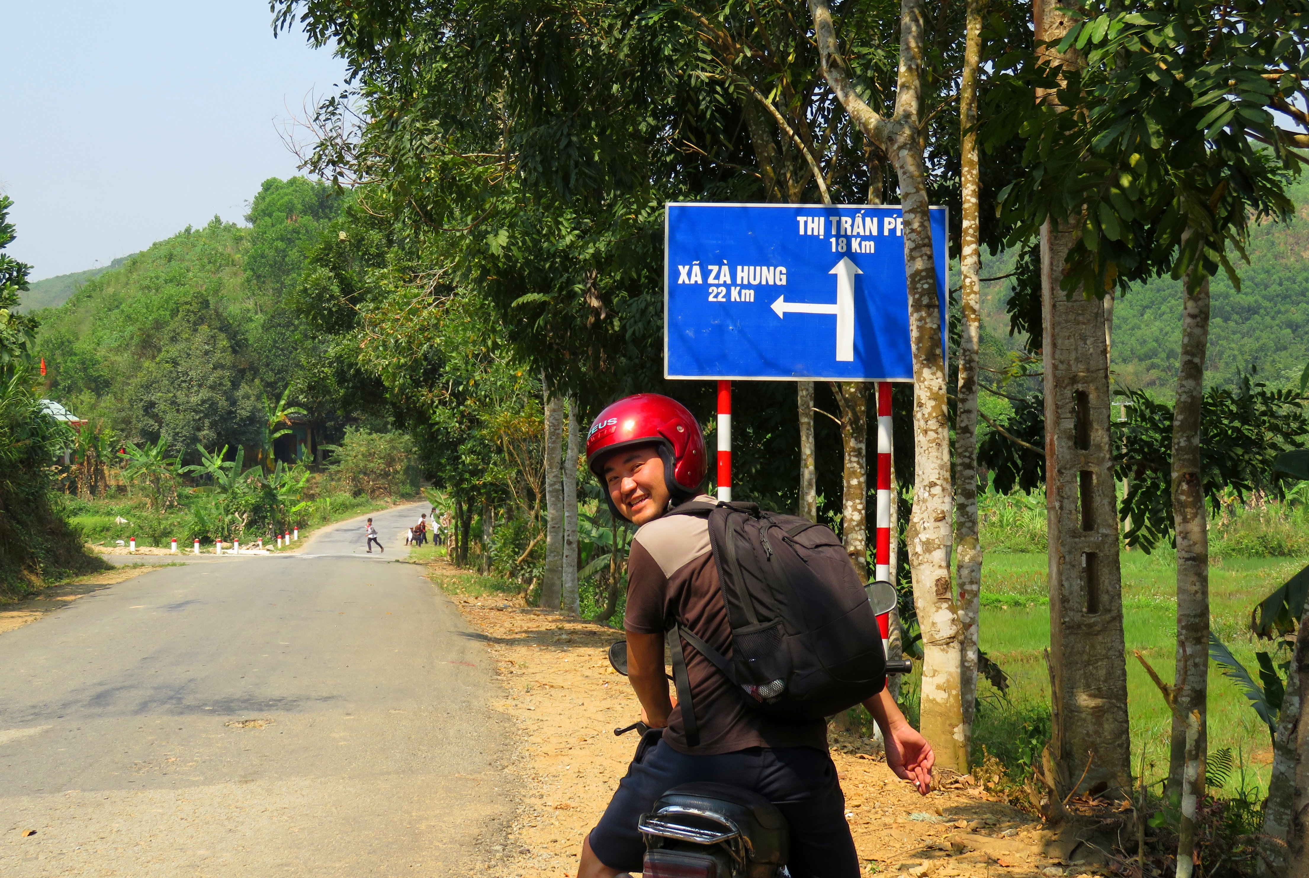
Kong at the turn on the Prao Road.
|
I first became aware of this road while driving to Prao one day in early 2016. A new road sign had been installed where there wasn't one before, with a big fork labeled "Za Hung 22 km" on a road that took off perpendicular to the main road. I was curious but didn't have time to explore it then so I filed it away for future trips. Later, I had it on my sights as a detour while coming back from the Prao area, but I ended up not finding a room in Prao and had to high tail back to Da Nang on the main road and missed out on it. However, on a nice clear day in March 2016, the crew and I got together and set out to finally explore it.
|
|
Unfortunately, this road is quite a ways from Da Nang, so we had to drive almost two hours just to arrive at our turn. However, this is not a bad thing, as our route took us along the 14-G, the road to Prao. This route goes through plenty of ethnic villages along it's course and is a great road in it's own right.
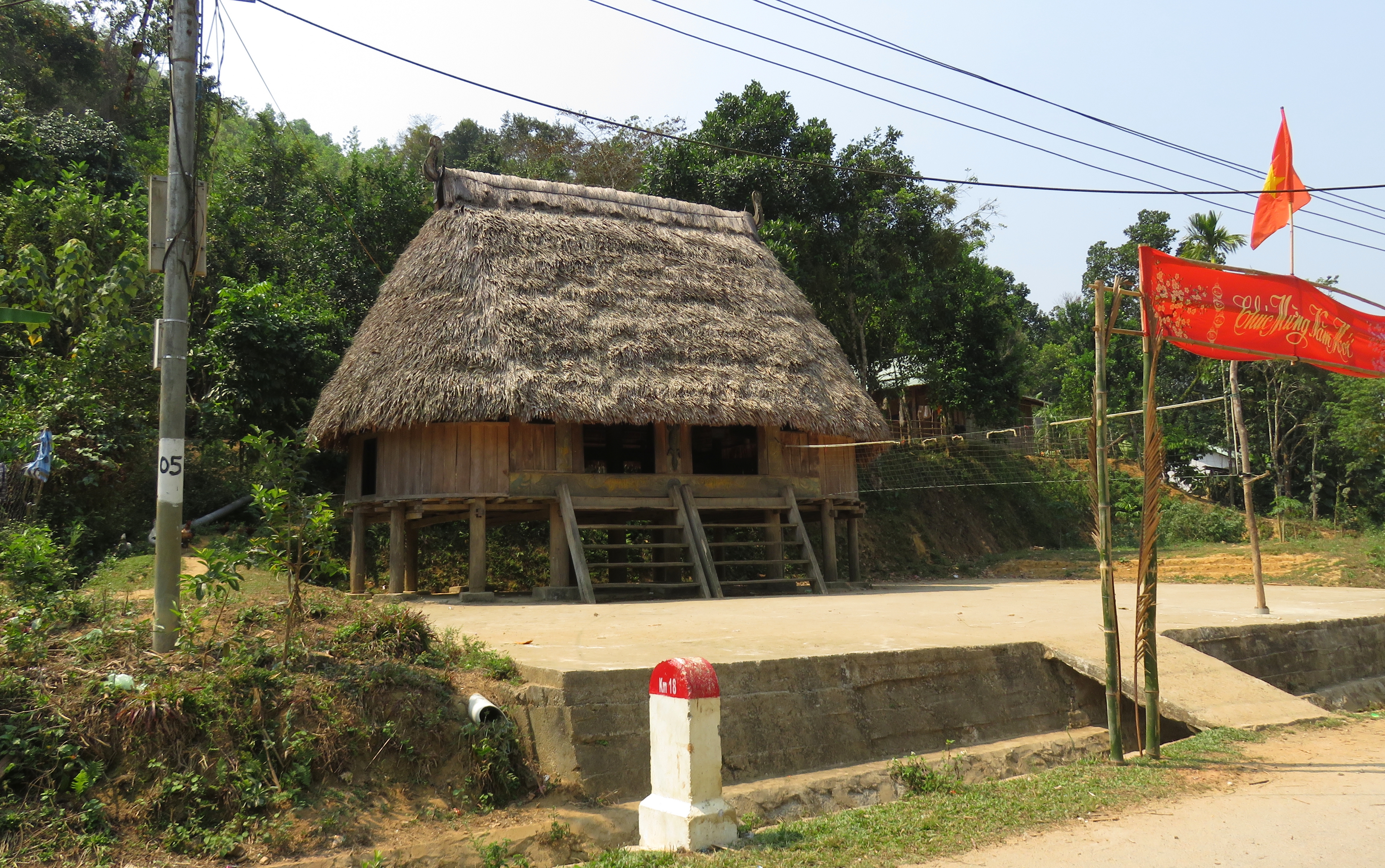
The turn to the Za Hung Road is right across the road from a massive goul that has recently been built to service the surrounding community of Jo Ngay. This goul has been built using modern materials and is quite large, compared to many other typical gouls. |
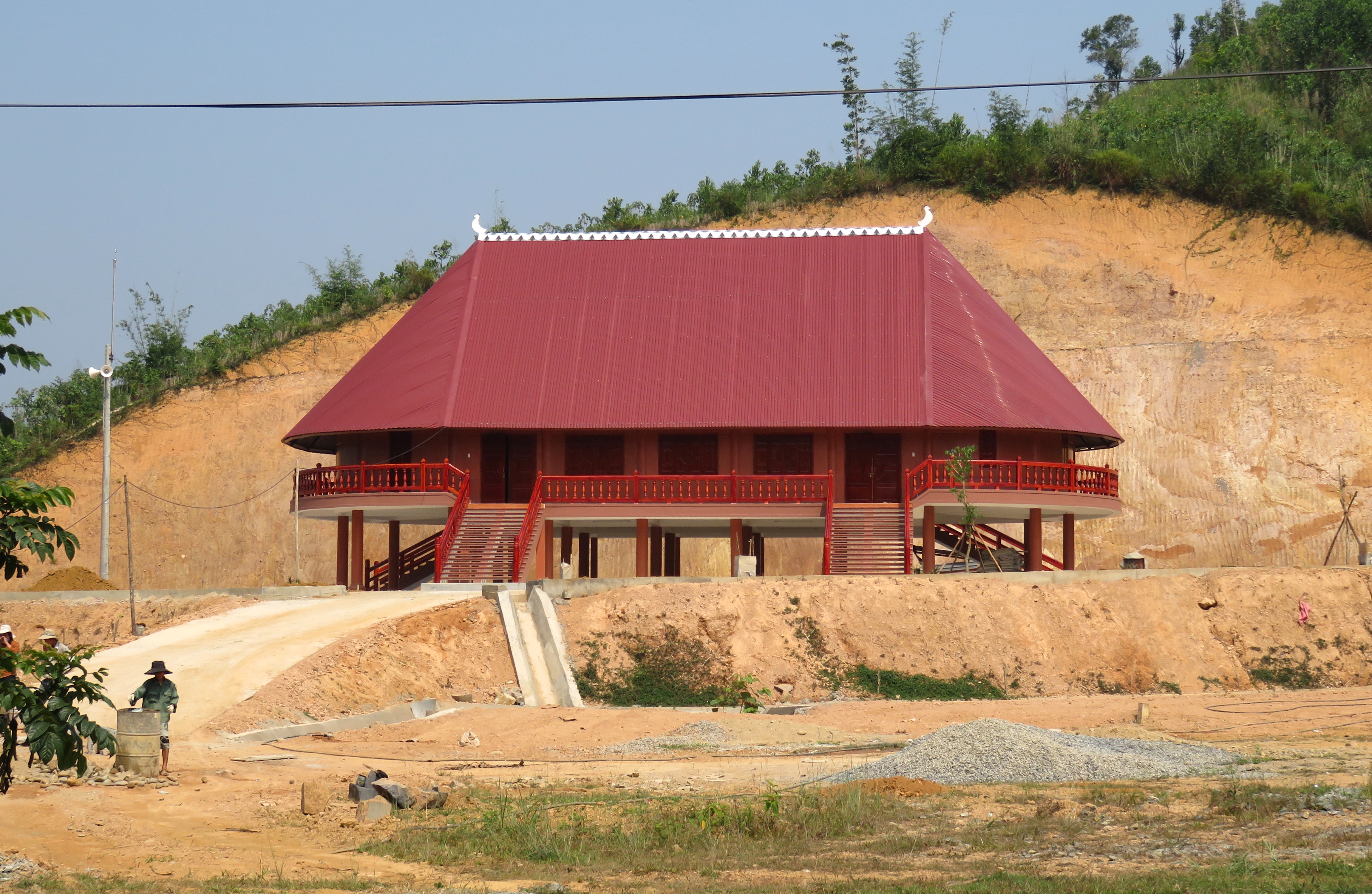
Large new goul in Jo Ngay.
|
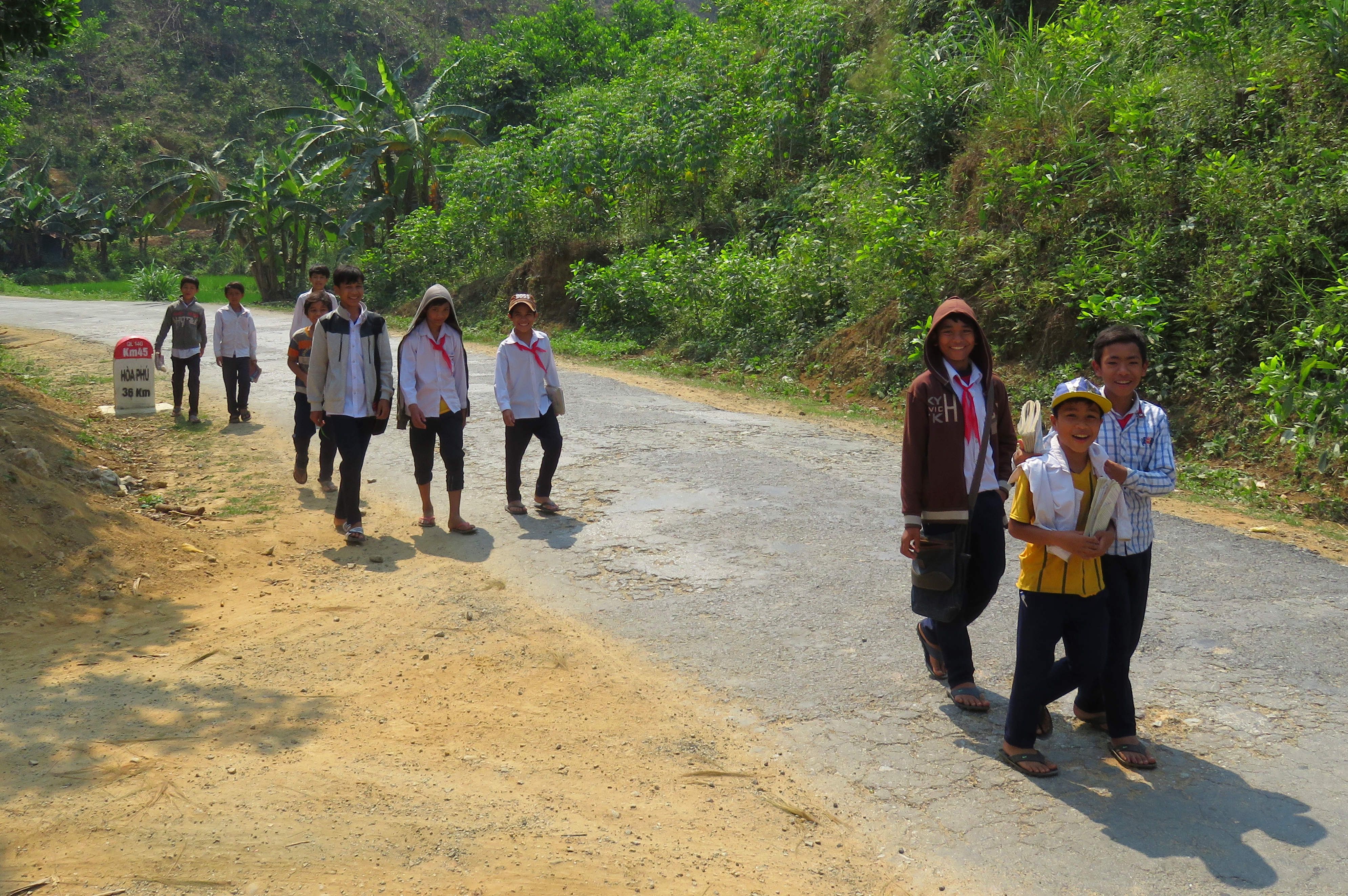
Local boys in Jo Ngay.
|
It was about this time that a pack of boys showed up, on their way to or from school, and they were a lot of fun and had some great attitudes.
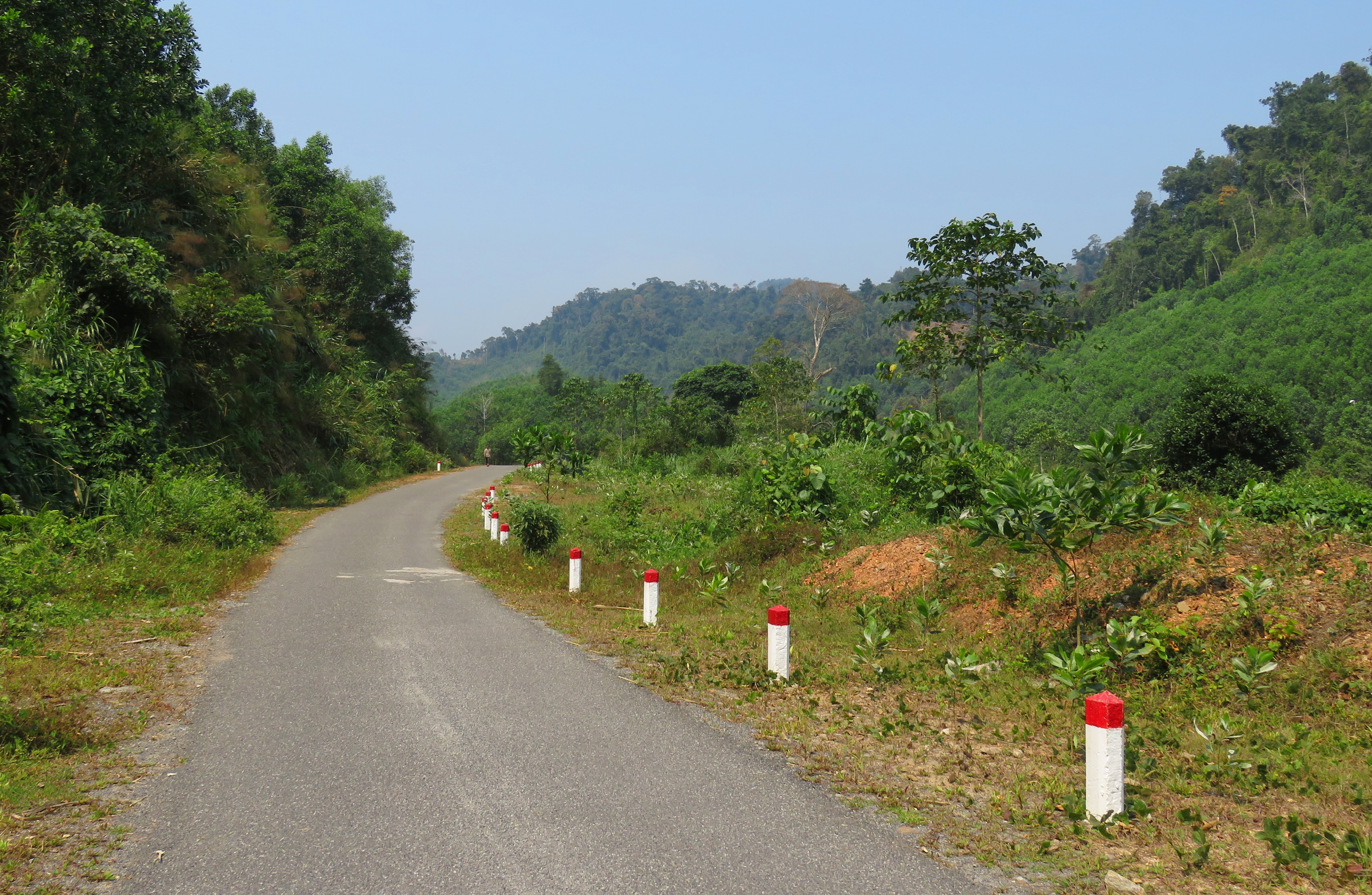
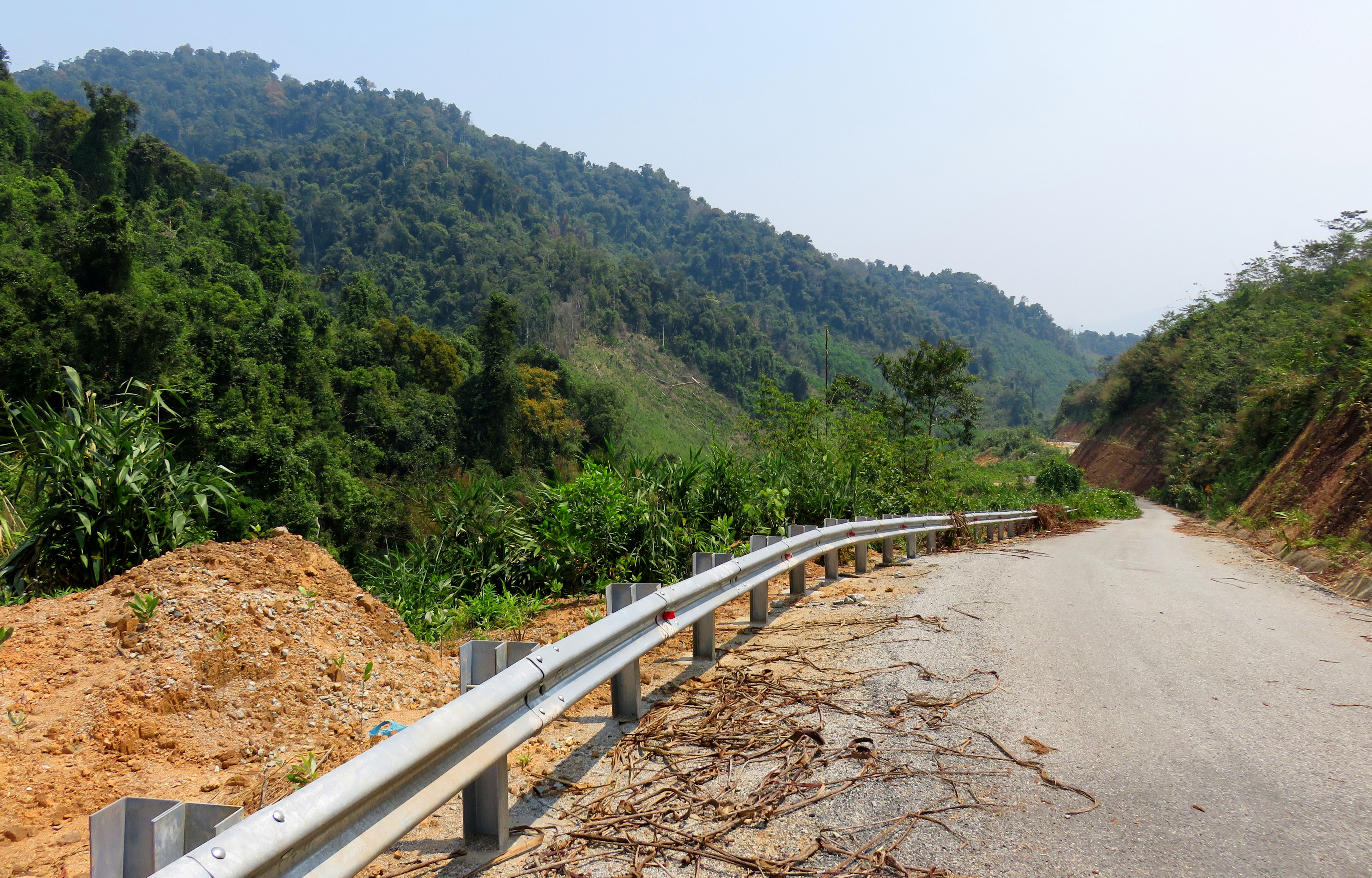
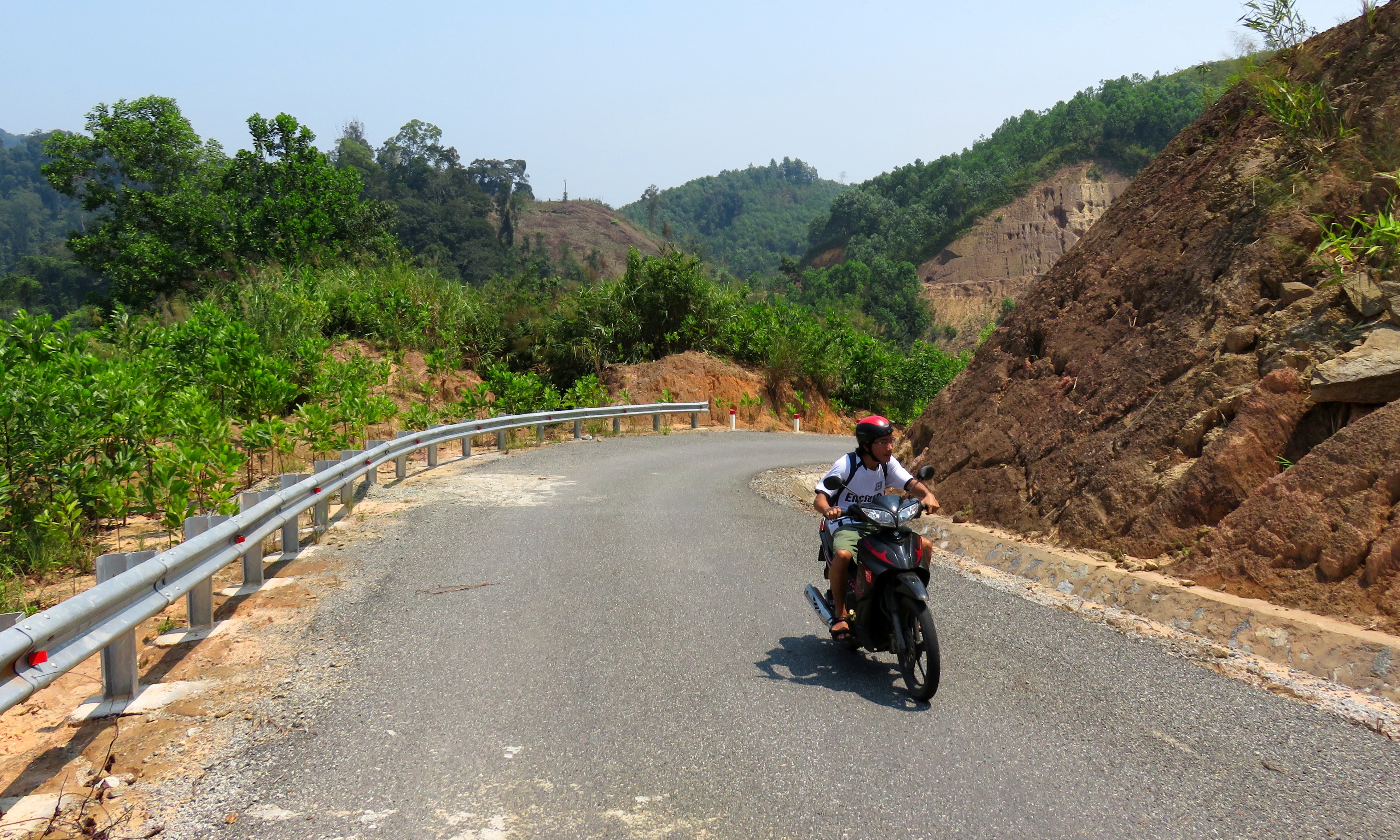
We made our turn and I was pleasantly surprised to find a paved road, not dirt. I had most definitely expected a long course of bumpy and dusty dirt roads but it ended up being in great shape the whole way. It's clear the road was built recently, and over time it will very likely become rougher in patches. But for now, it's in prime condition and is a very high speed road. |
It was immediately beautiful. The first stretch of the road went up a small steep valley between two ridges, and then dropped back down just as fast to meet up with small river valley that had some small villages in it. Apparently the original road into these small communities is in pretty bad shape, and it has a river crossing that can get bad, so one of the reasons they've built the Za Hung Road is to provide a better entrance into town for local villagers.
Goul early on along the Za Hung Road.
|
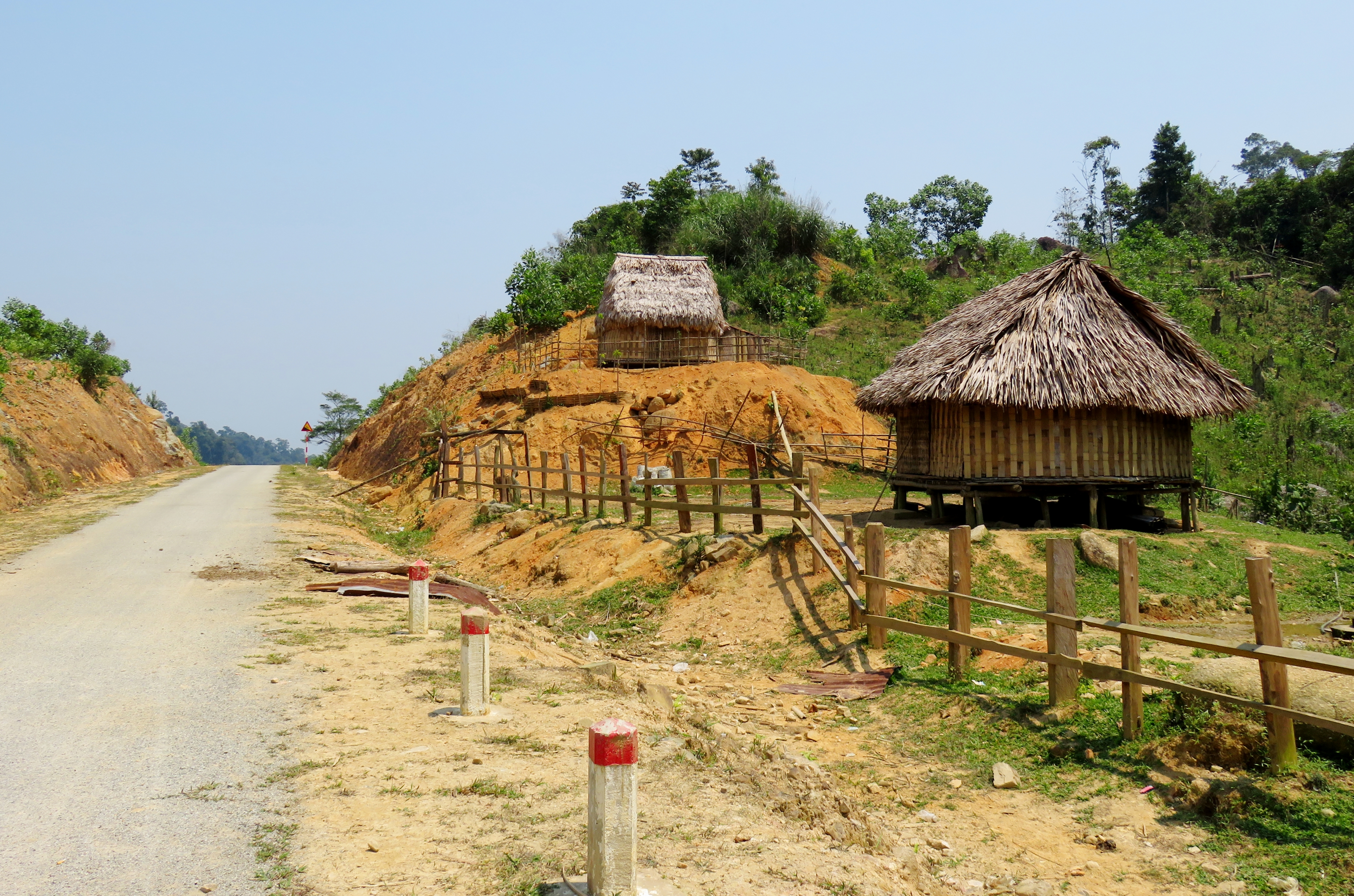
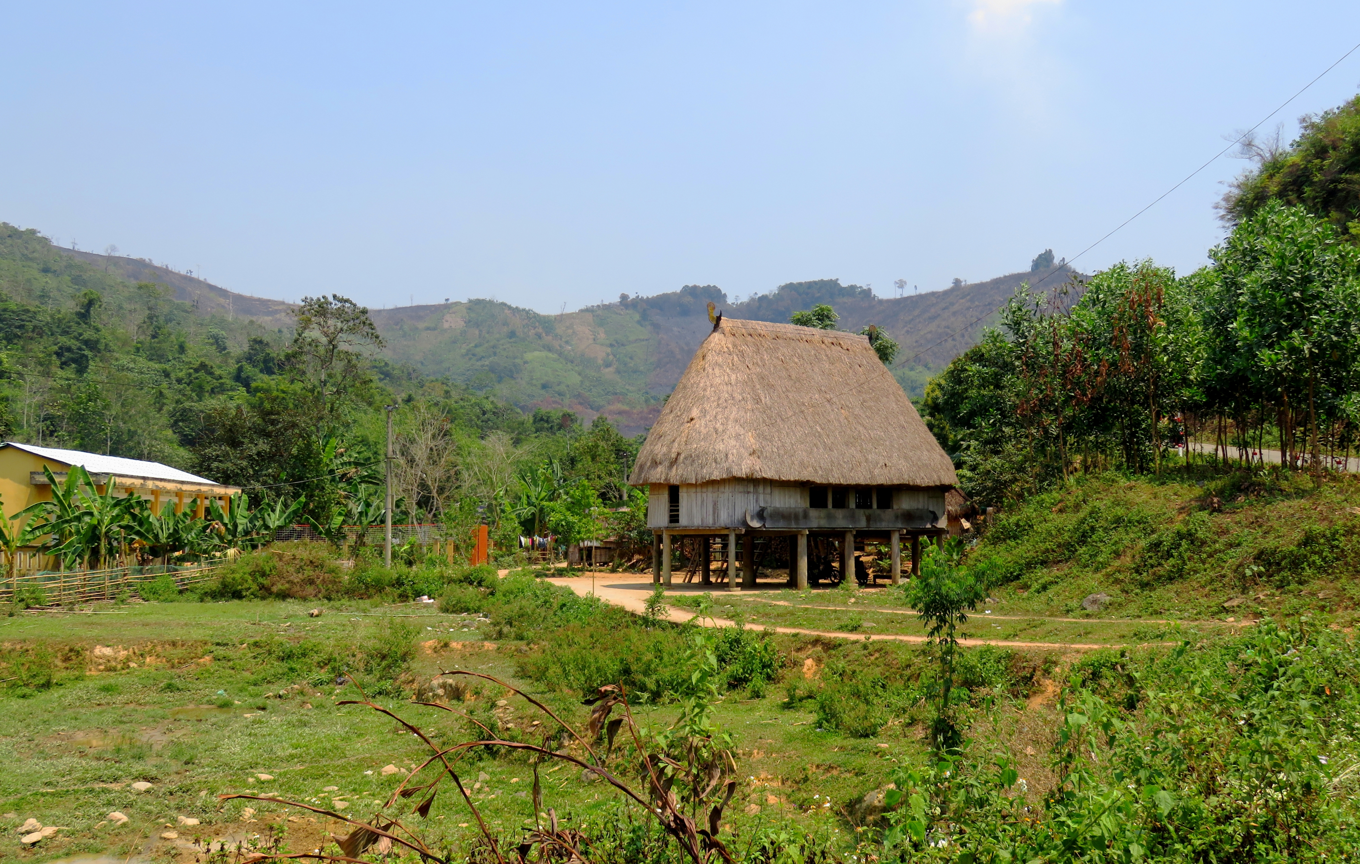
This village spread out for a couple of kilometers on either side of the road. Many, if not most of the houses are built of wood. This is interesting when compared to other house construction methods around the area. Along the coast, (read: more populated areas), almost all of the houses, even those in rural villages, are built with concrete and brick. However, the further you go into the mountains, the houses change to wood, and once you get REALLY deep in the jungle, the houses change to woven wicker or thatch houses. In areas like this, the wood is much cheaper than concrete and brick, although the wood houses are much more open to the elements than a concrete & brick one.
|
Vietnam backroad cruising.
|
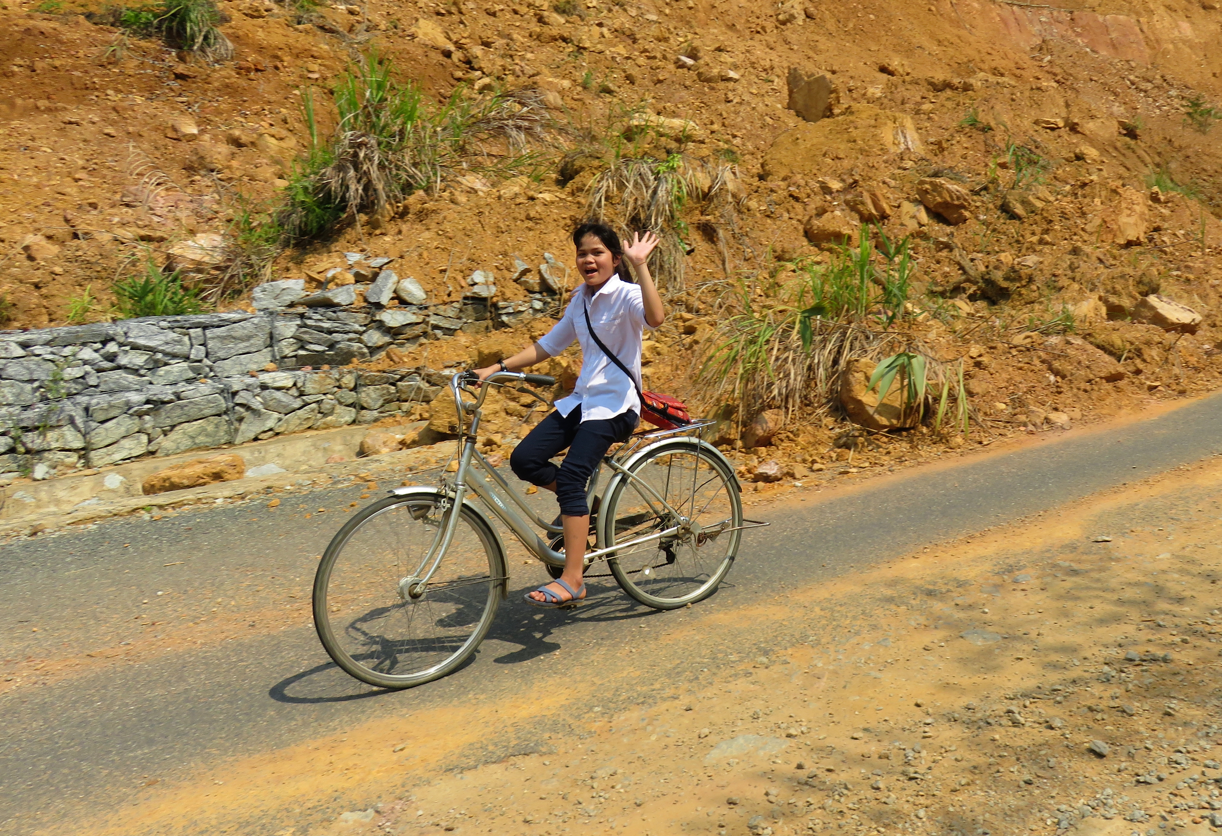
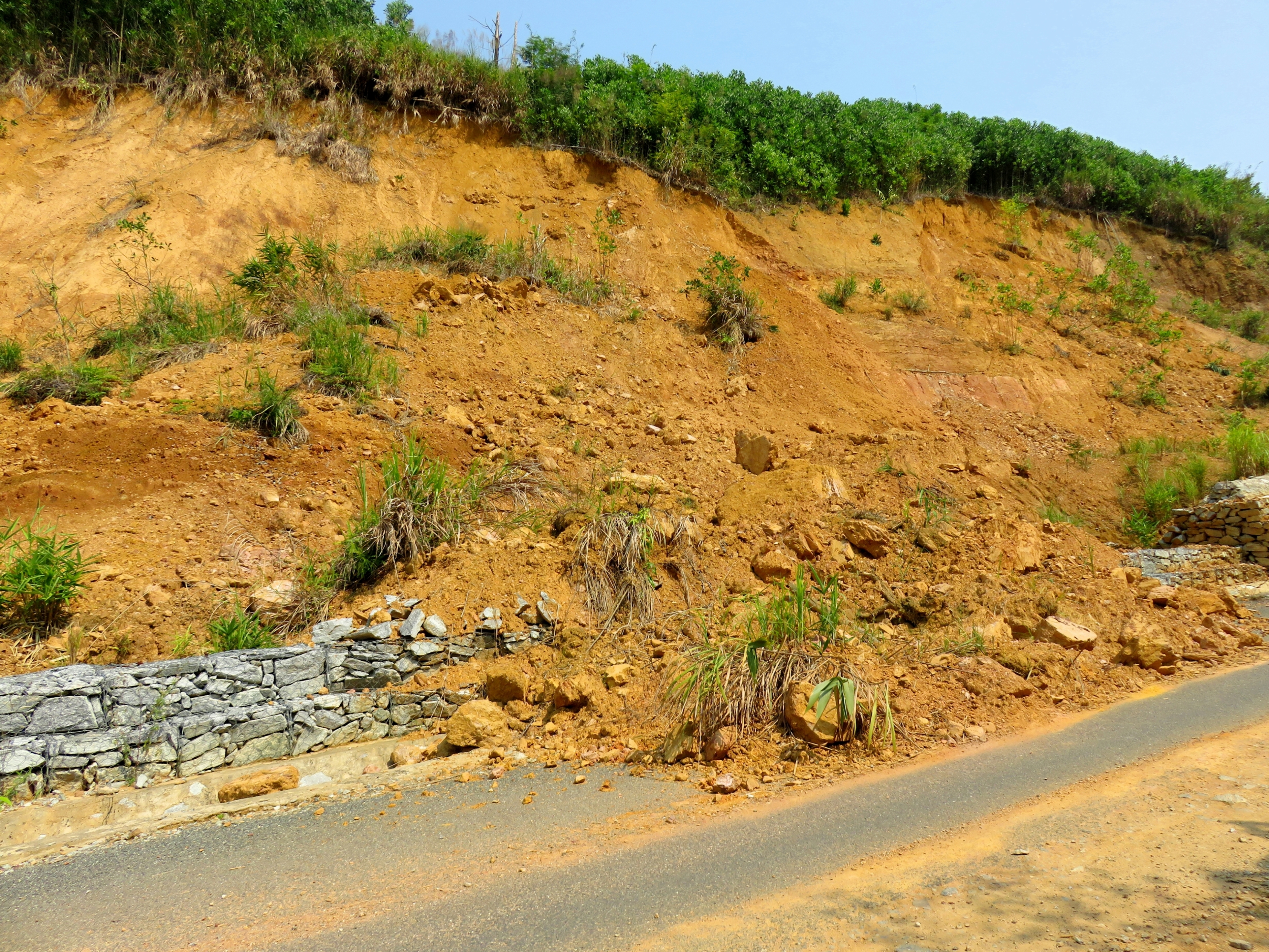
Not too far onto the road, we came across a good example of one of Vietnam's ongoing geologic issues- mass wasting- in this case represented with a large landslide that had broken loose and covered part of the road. These are quite common across Vietnam's roads, and they occur when you have the combination of loose, clay-based sediments making up the soil, exposed hillsides (of which logging and/or road building are good perpetrators) and of course, prodigious rainfall. Whilst I was taking pictures some local school girls rode by on bicycles, and they were all quite friendly and quick with a "Hello!".
Small landslide along the road.
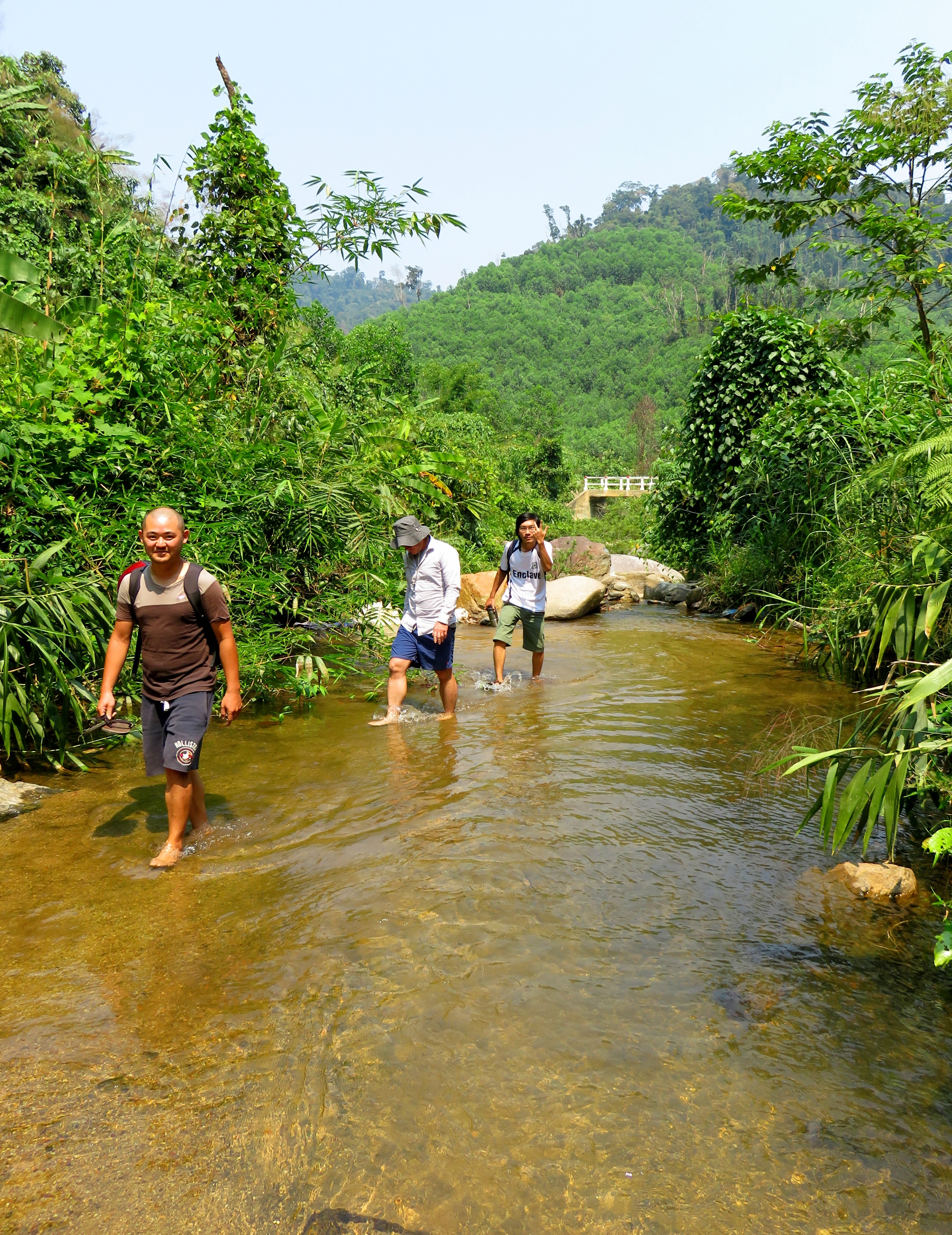
Buncha dudes in a creek.
|
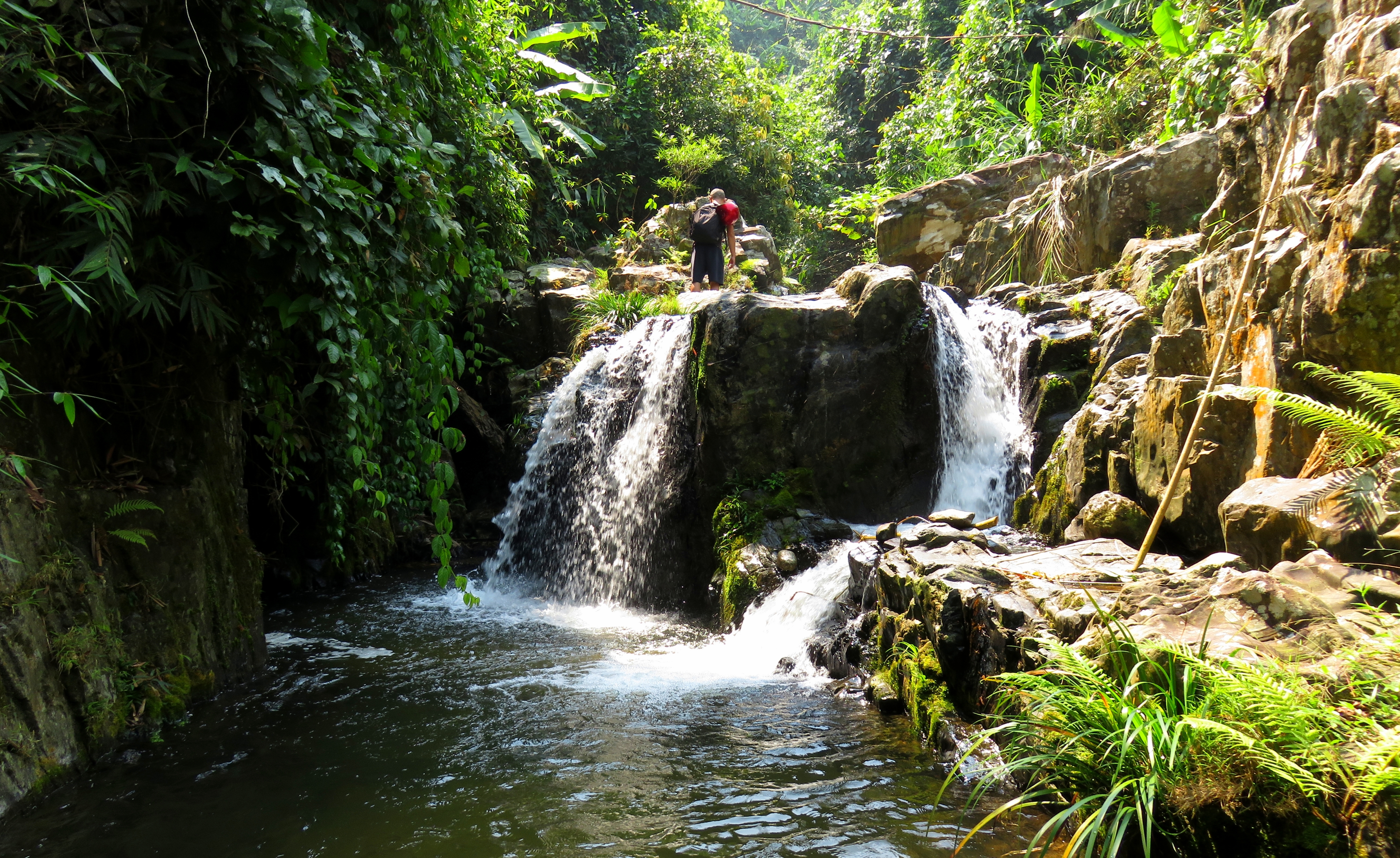
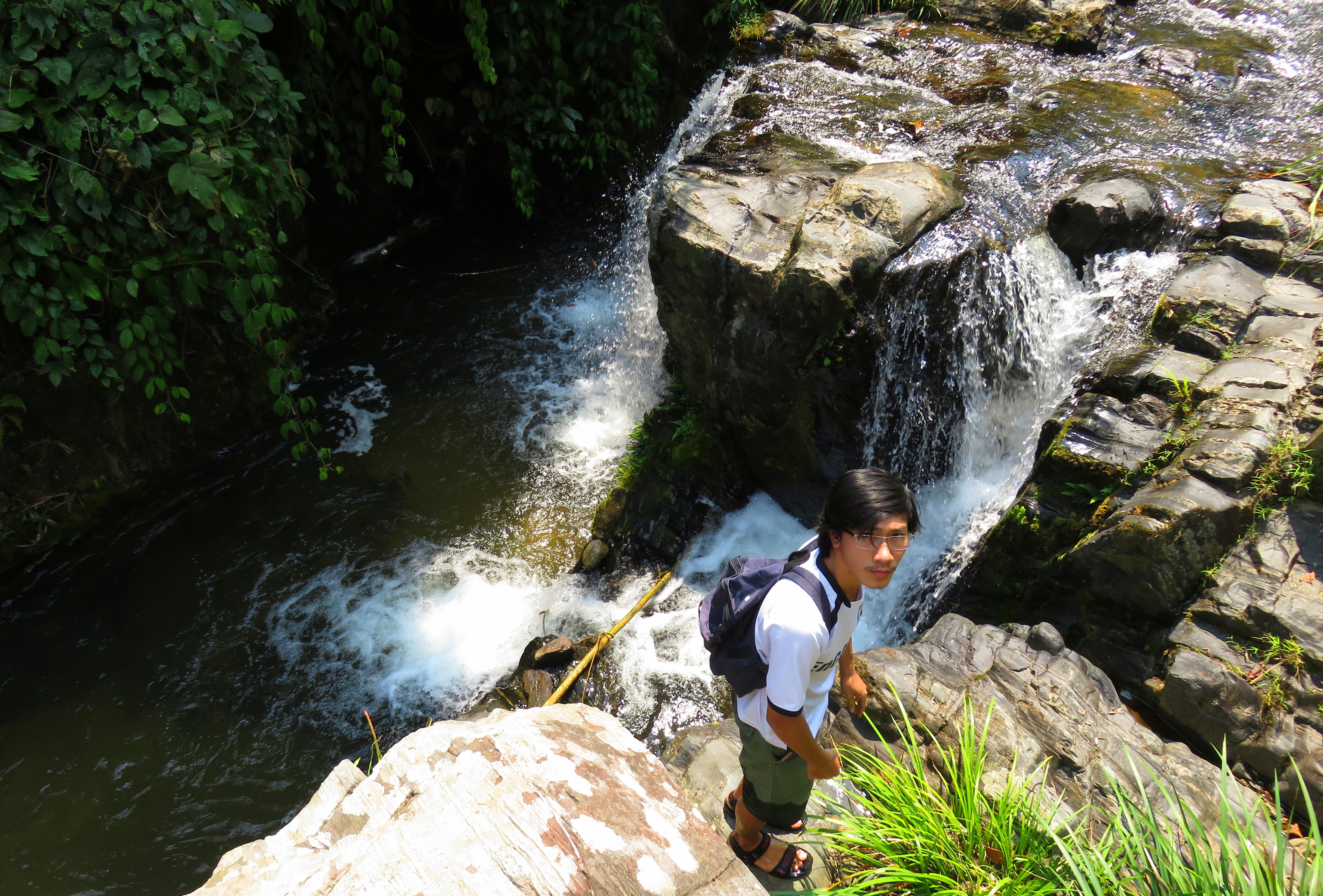
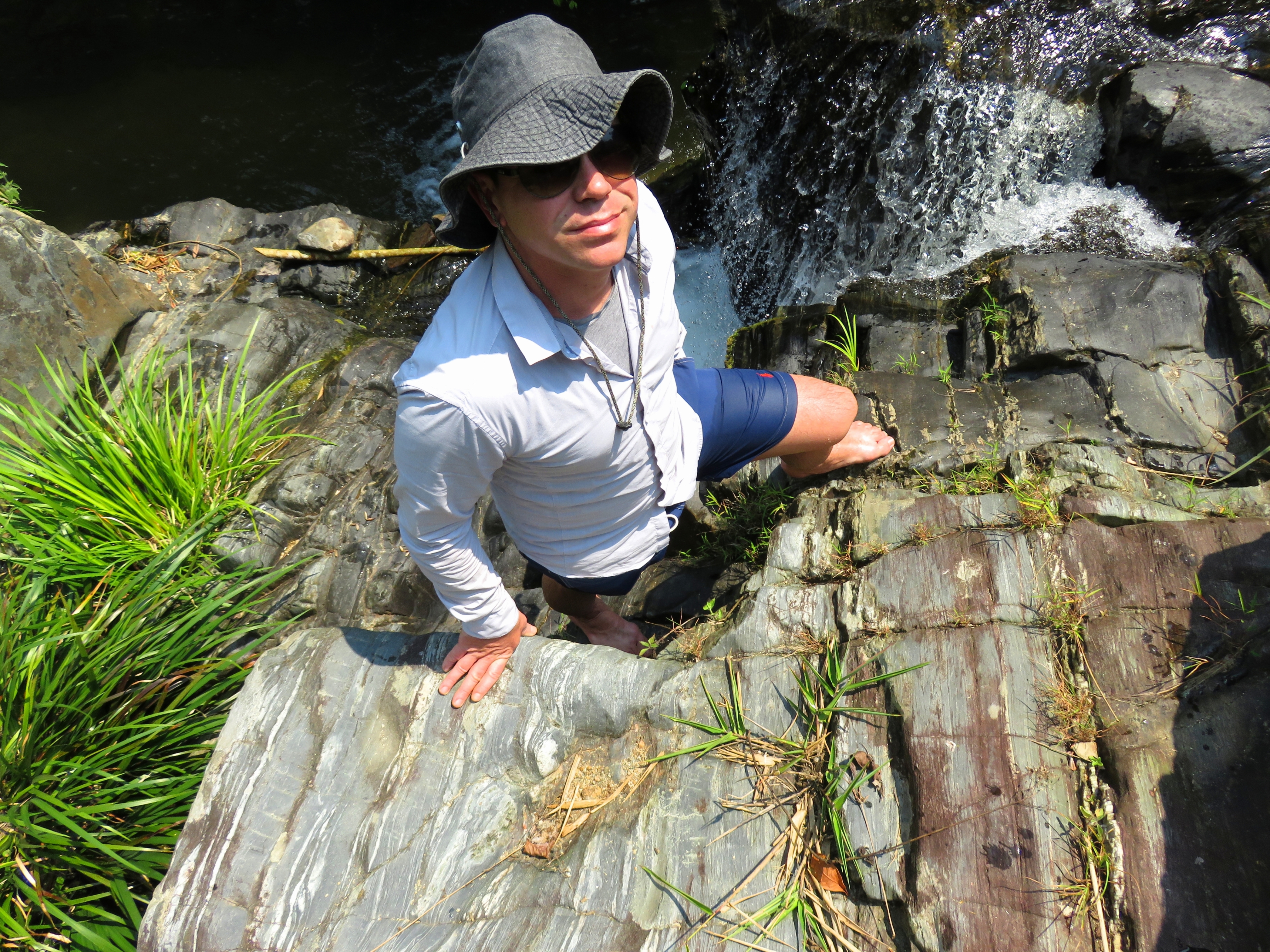
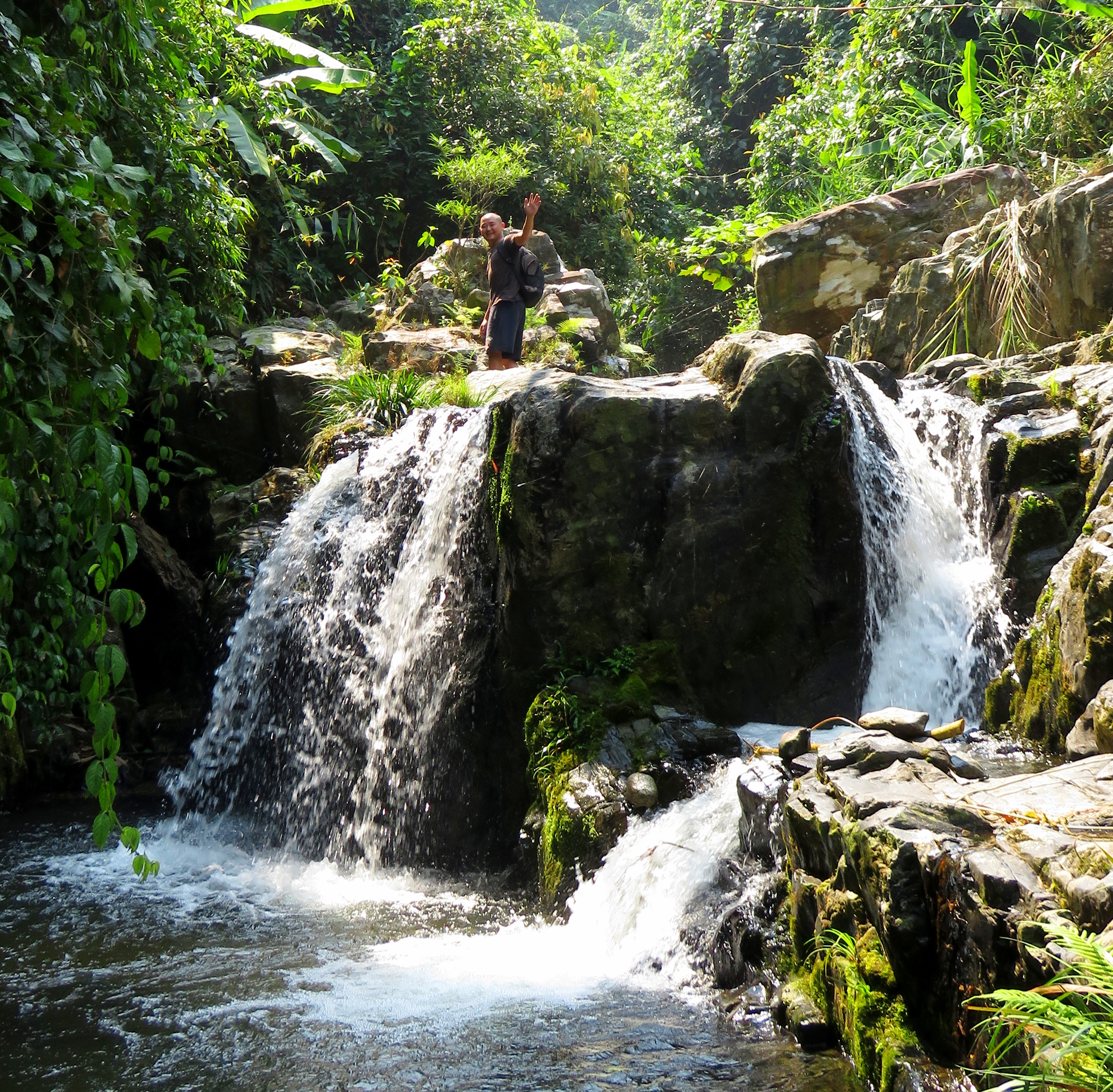
Once outside the villages, the road began to slowly climb into the hills. The houses fell behind and the canyon narrowed up quite a bit. However, we didn't make it very far, as a handful of kilometers up the road Kong and Tyler had stopped on a bridge, having spotted a waterfall just up the creek from it. We pulled over and tried to figure out how to hike up. There was a local man on the bridge, but either his Vietnamese wasn't so great, or ours was of a wrong accent, because we couldn't communicate that well. We did at least gather that there was a trail to it behind the small shack next to the parking lot. Sure enough, just behind the it was a small trail down to the water. It was a super quick walk up to the falls, which was a beautiful little plunge into a closed-in pool. The water was clear and cool and it made a great place to stop and relax for a few minutes. I was instantly hooked because the bedrock the stream flowed over was tilted almost 90 degrees, and was incredibly fascinating to nerd out on. On the way out we walked by the shack again, and this time it's owner, a friendly older gentleman, was hitting his bong as we walked up. We tried to chat but he was pretty skylined so we moved on.
|
|
|
|
|
All photos from waterfall area.
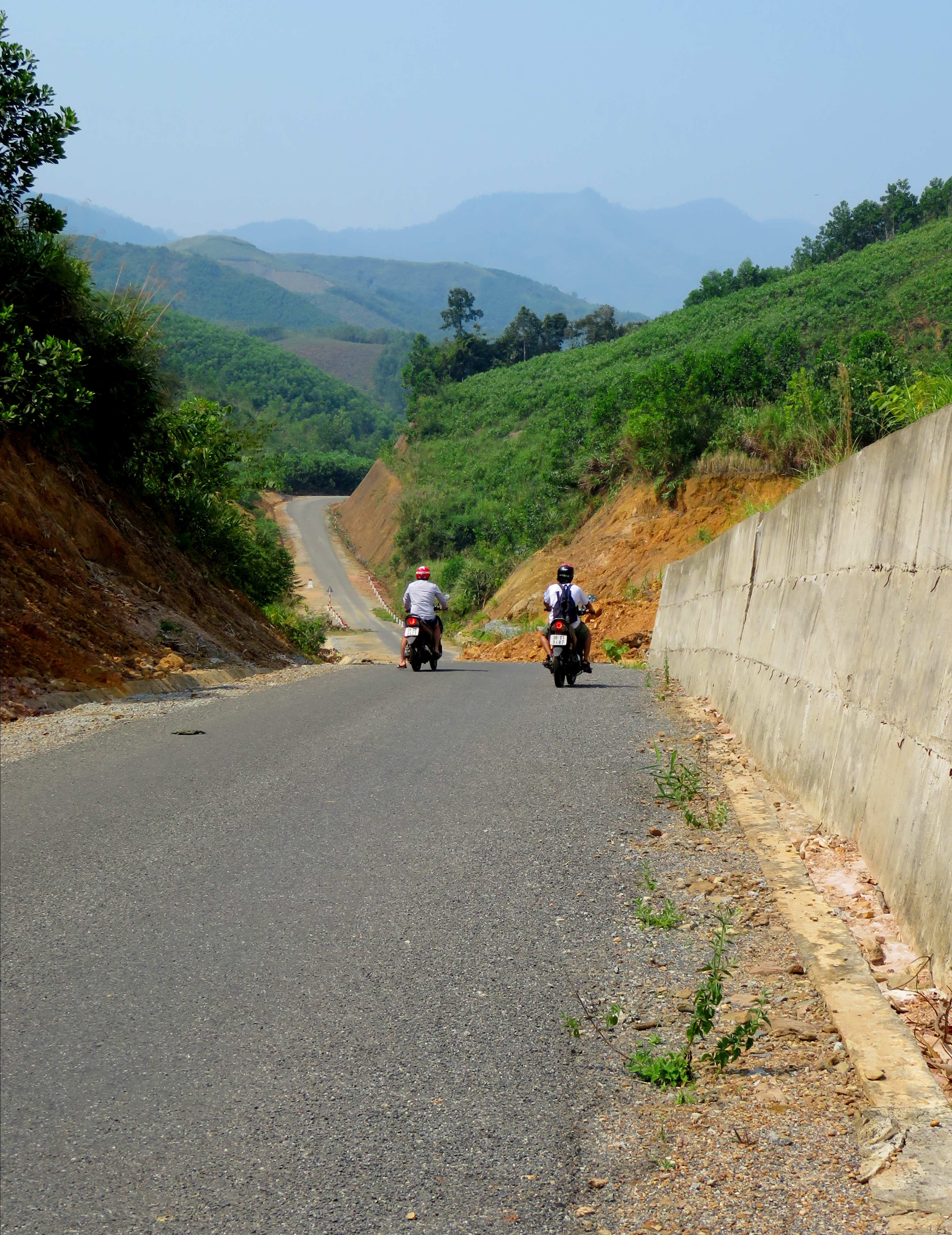
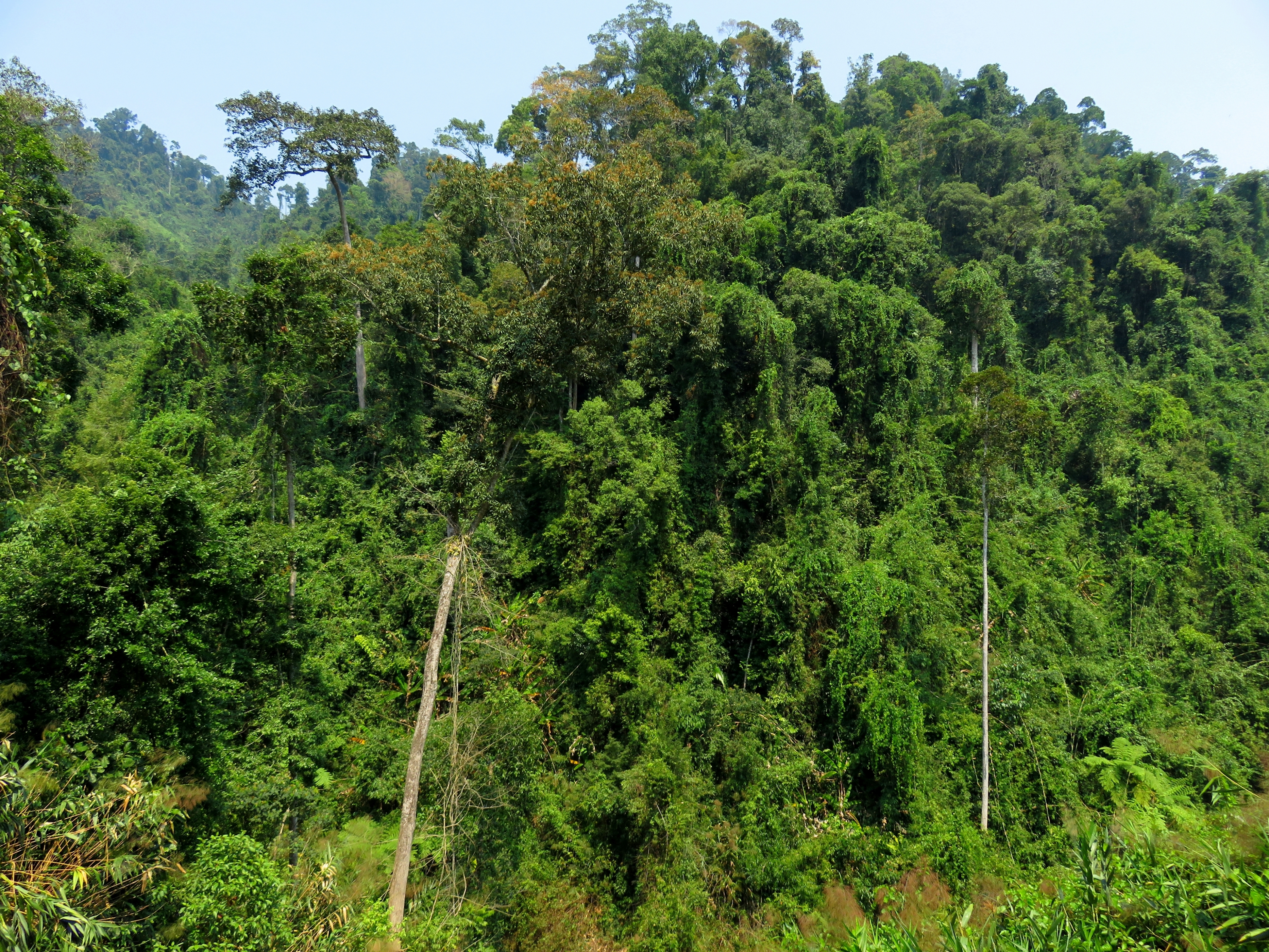
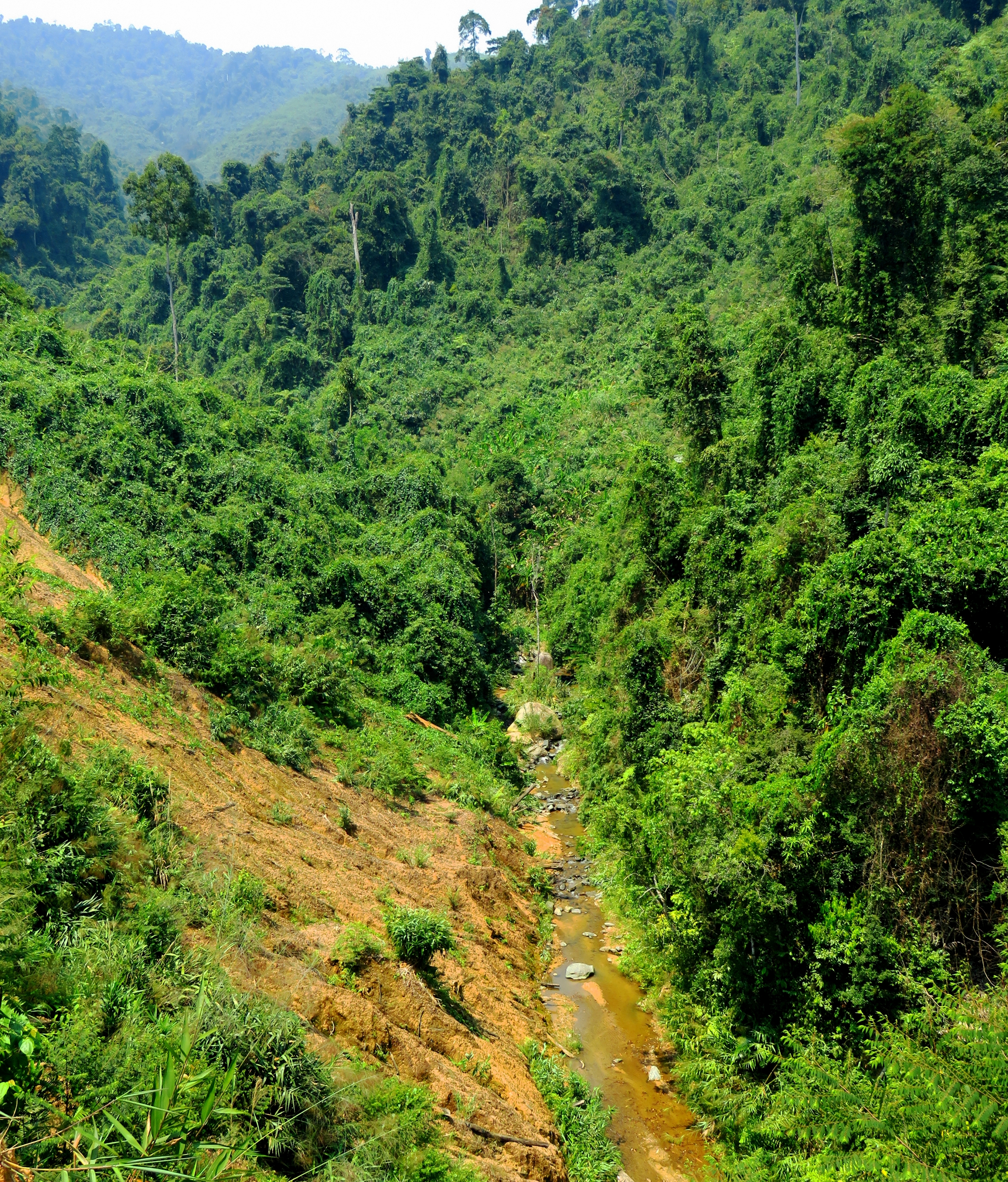
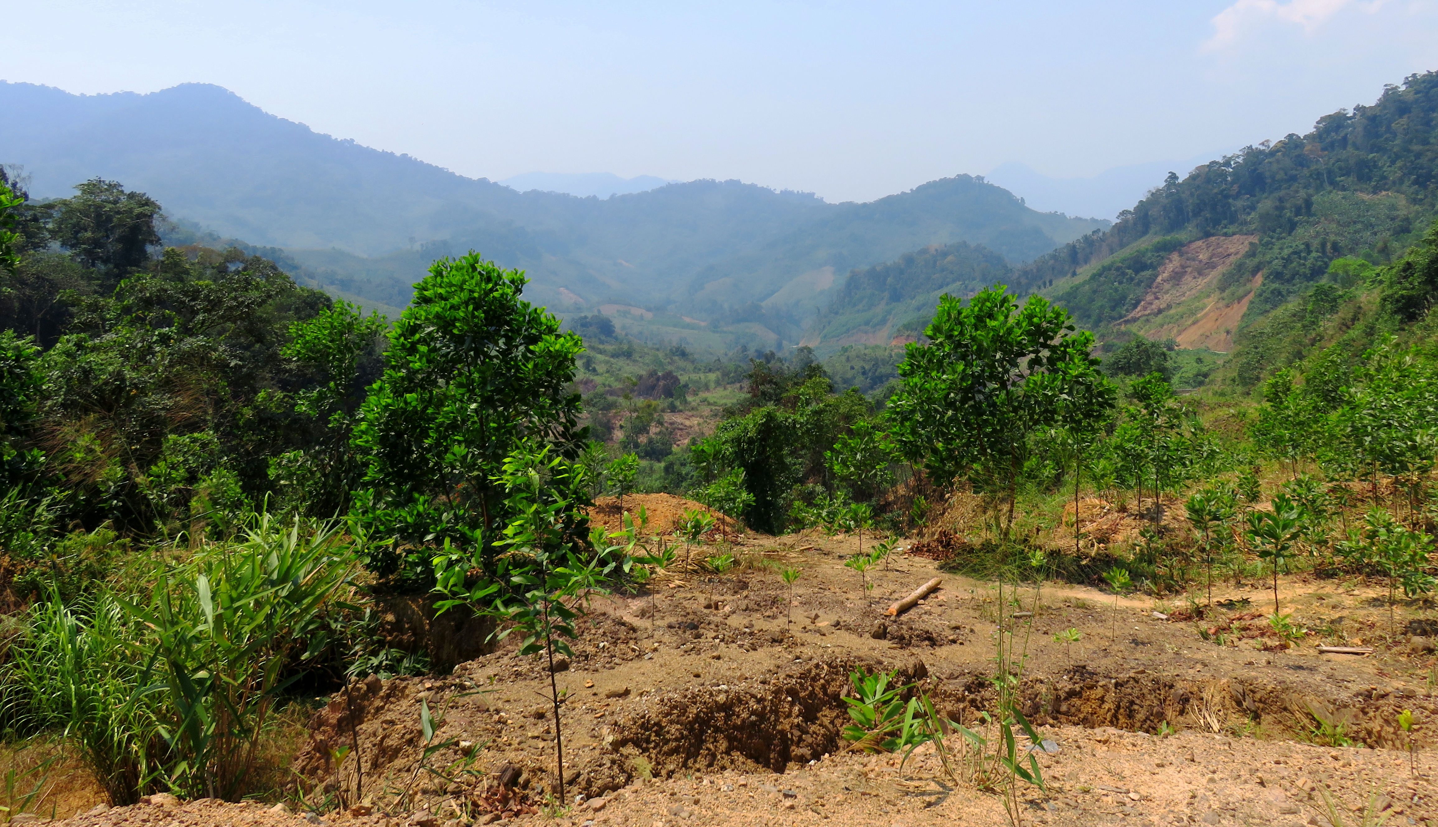
The next stretch after the waterfall is really good. The road winds in and out of small hills, with larger mountains appearing and hiding behind them. The road is in great shape (for now), and it stays a good distance above the small creek at the bottom of the valley below. Although large sections of the forests in this stretch have been logged off, (and will continue to be hewn away, more on this later) there are still good pockets and stretches of virgin, old growth mountain jungle along the way. Most of these are on the north side of the road, which doesn't bode well for the future, but for now simply stop and enjoy them. It's not uncommon to see trees just across the valley from the road that are over 30 meters tall. While the mountains are never that large, there is a lot of terrain out there, and some of the things that make the jungle so special- in this case, the scents and smells, as well as the sounds- can be seen and found along this road.
Typical road section.
Awesome old growth section.
|
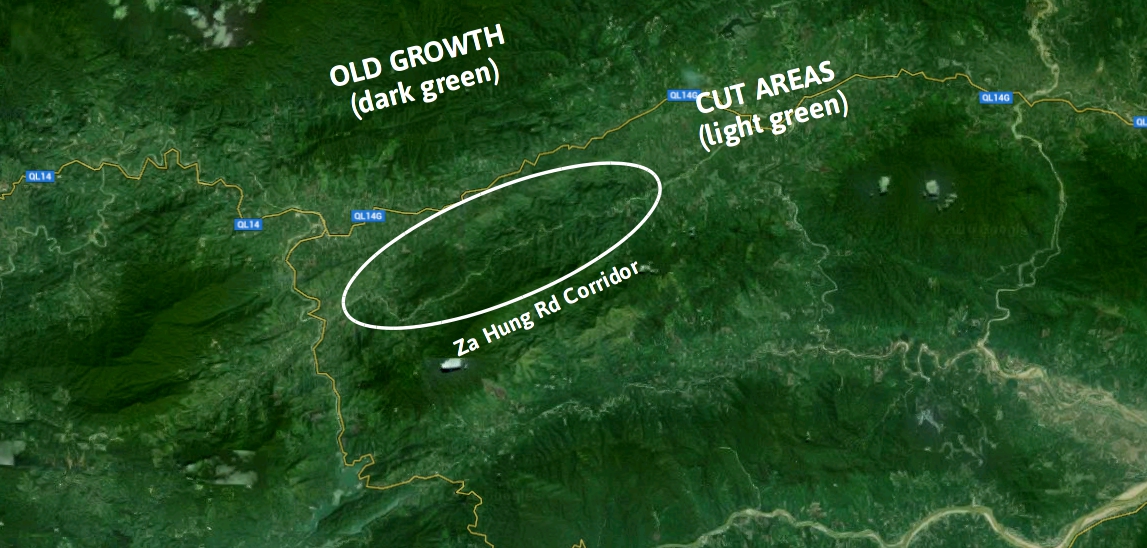
One thing that quickly became evident as we drove along was just how quickly the forests were being cut down. The buildings of these roads is a two edged sword; on one hand they do allow easy access to areas previously difficult to reach, for both local residents and visitors alike, however, they do allow easy access for illegal logging. This is readily noticeable on Google Maps, where the two different vegetation zones- virgin old growth mountain jungle, and 2nd (or even 3rd or 4th) growth timbered zones- appear as two very different shades of green.
|
Creek on the ascent.
|
Unfortunately, the old growth forests to the north of the Za Hung Road are in imminent danger of being cut, because they are getting pressure from BOTH sides of the ridge. Loggers pushing their way south from Ta Lu and Song Kon are eventually going to meet up with loggers pushing north from the Za Hung Road side, and before you know it all the old growth will be gone. Even as we drove this stretch we could see smoke from a section of old growth being slashed and burned near the top of the ridge.
The road climbed slowly and steadily up, going through several small fake summits, before we finally got to the high point of the Za Hung Road, a crossing known as Deo Be, or Be Pass. The summit is kind of unassuming, just a local woven wall shack, with a small shed, and other than the general idea that "hey, I think we are going down now", there's not much else to mark the fact that it's there.
The road climbed slowly and steadily up, going through several small fake summits, before we finally got to the high point of the Za Hung Road, a crossing known as Deo Be, or Be Pass. The summit is kind of unassuming, just a local woven wall shack, with a small shed, and other than the general idea that "hey, I think we are going down now", there's not much else to mark the fact that it's there.
Cuong gunning it on one of the hills.
Lonely local's shack is the only marker on the top of Deo Be.
|
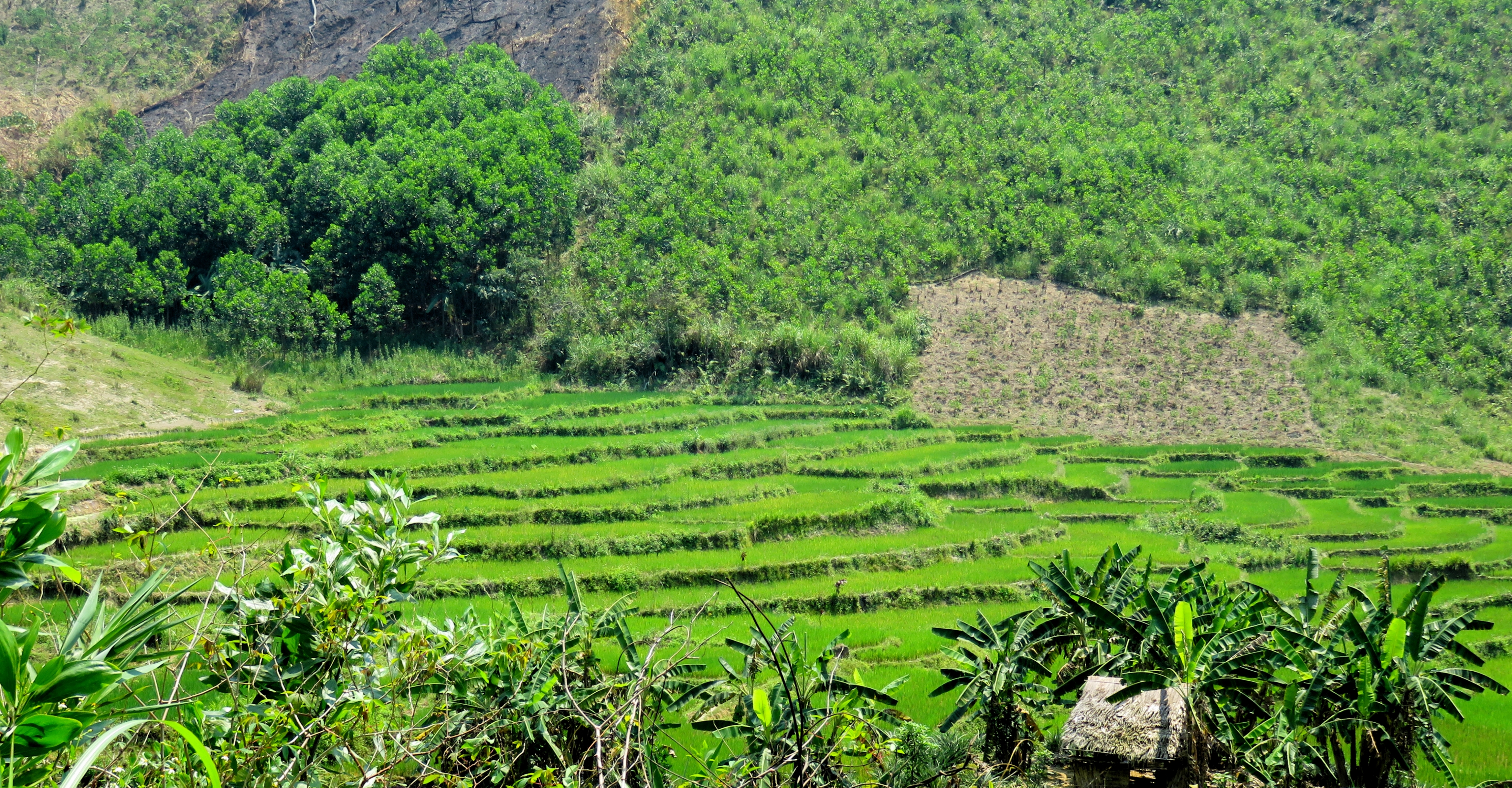
Once over the top, the views are pretty incredible, with a huge valley immediately presenting itself. This valley has a patchwork of colors and patterns, as some of it has been logged off, some of it has been cleared but remains undeveloped, and some of it has been turned into beautiful terraces reminiscent of areas further north in Vietnam. Unfortunately it was a bit hazy so trying to capture a view of the whole valley was a bit difficult, so I instead tried to focus in on the terraces and some of the fields that dotted the bottom of the valley.
|
Super hazy conditions.
|
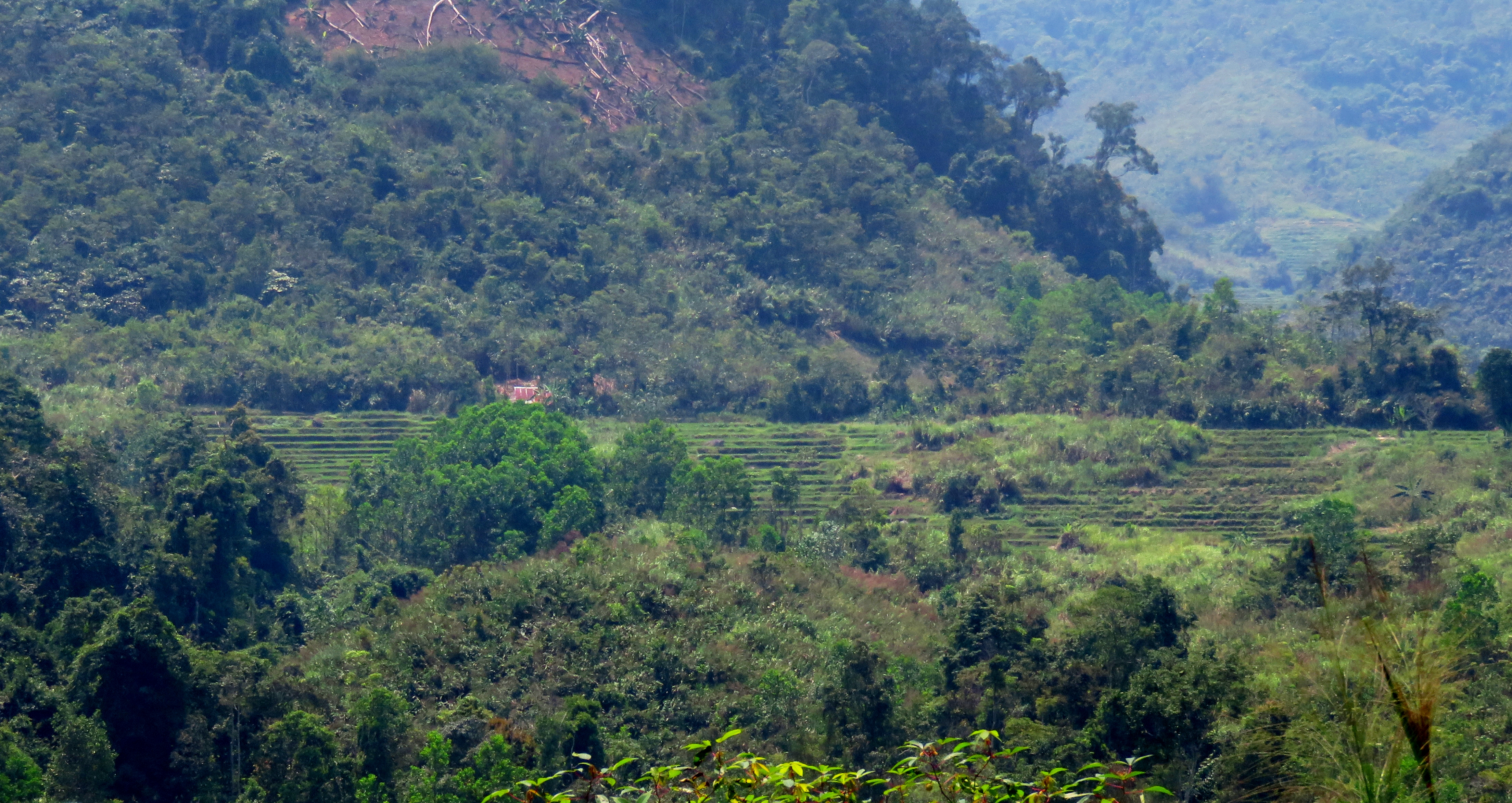
Above & below: Terraces in the valley just below Deo Be.
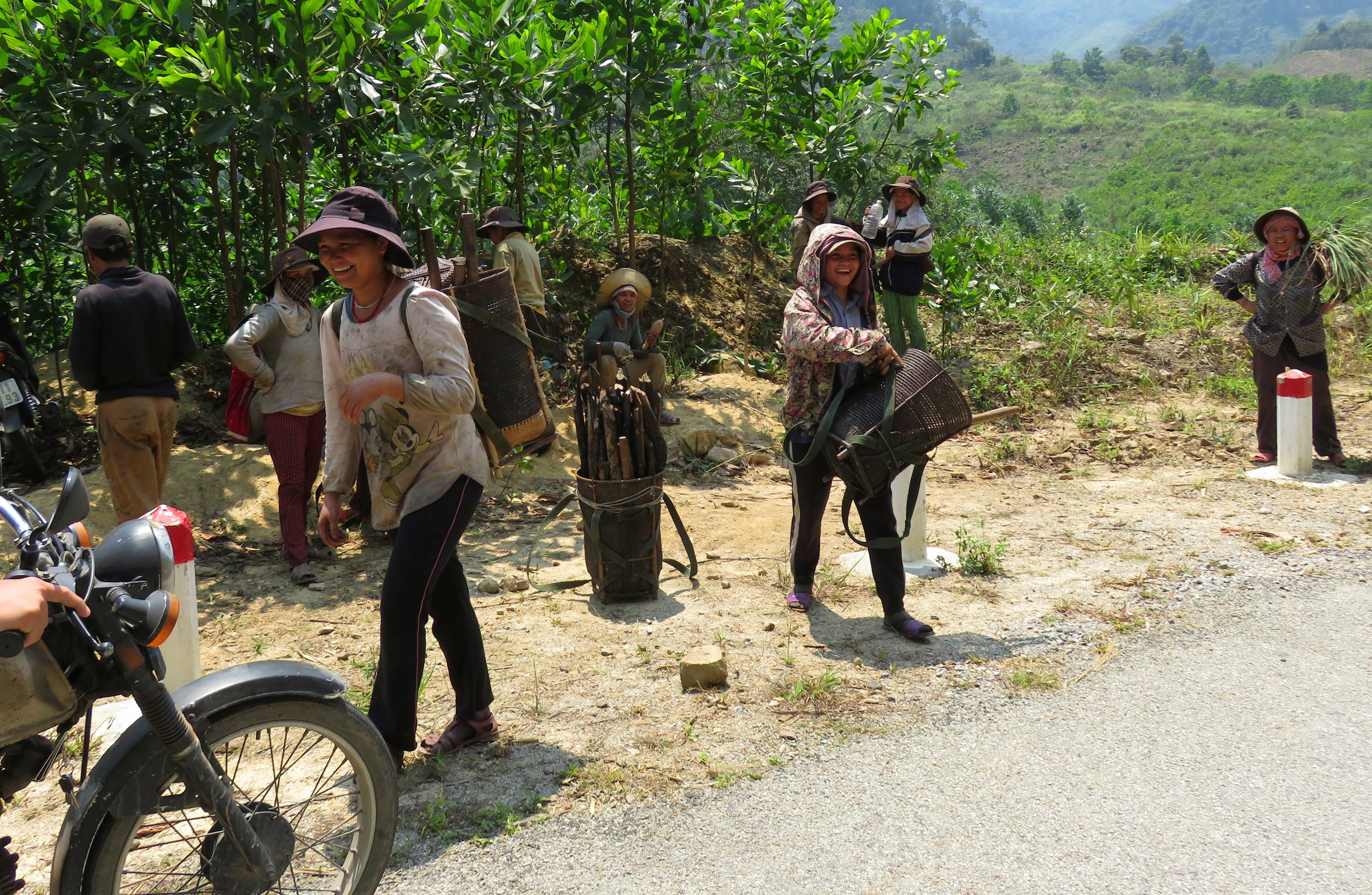
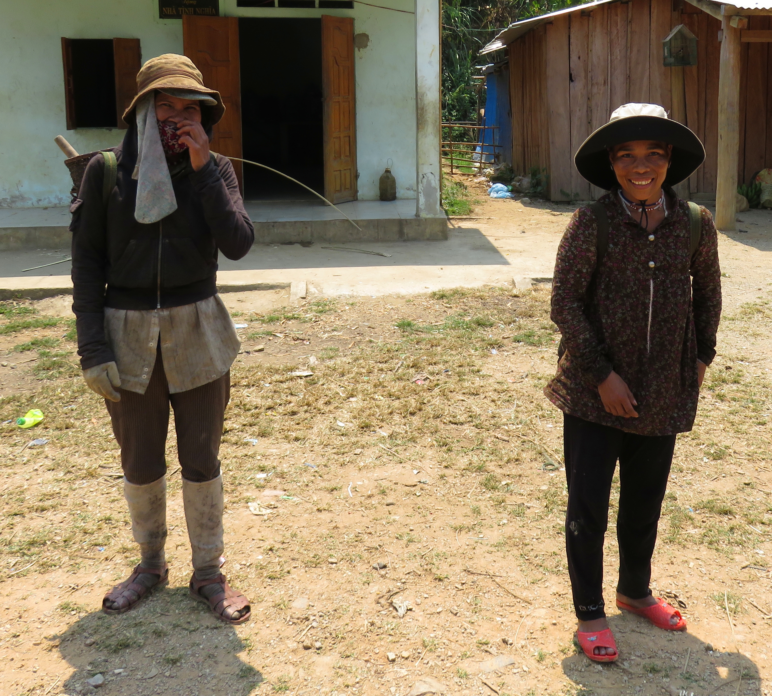
A little ways down into this valley we came across a whole bunch of locals who had just come out of the forests after a morning of chopping wood and working some fields. They were all headed down the hill, to the next village down the road of Za Nghiep. A bunch of them wanted rides, so we squeezed as many of them as we could on our bikes and gave them a short lift a couple of kilometers down the road. As we were getting them squared away, they were talking to each other and it was clear that they were speaking a language different than Vietnamese. Not sure if it was Co Tu, Gie Rieng, or a different language spoken in the general area, but it was not anything we could understand. I tried to initiate some communication as we drove along, but either my Vietnamese wasn't good enough, or she didn't speak it at all, and thus we didn't really communicate at all. Still, got a sweet photo with the local lady out of it. I'm not the biggest fan of selfies but this was one I was happy to take.
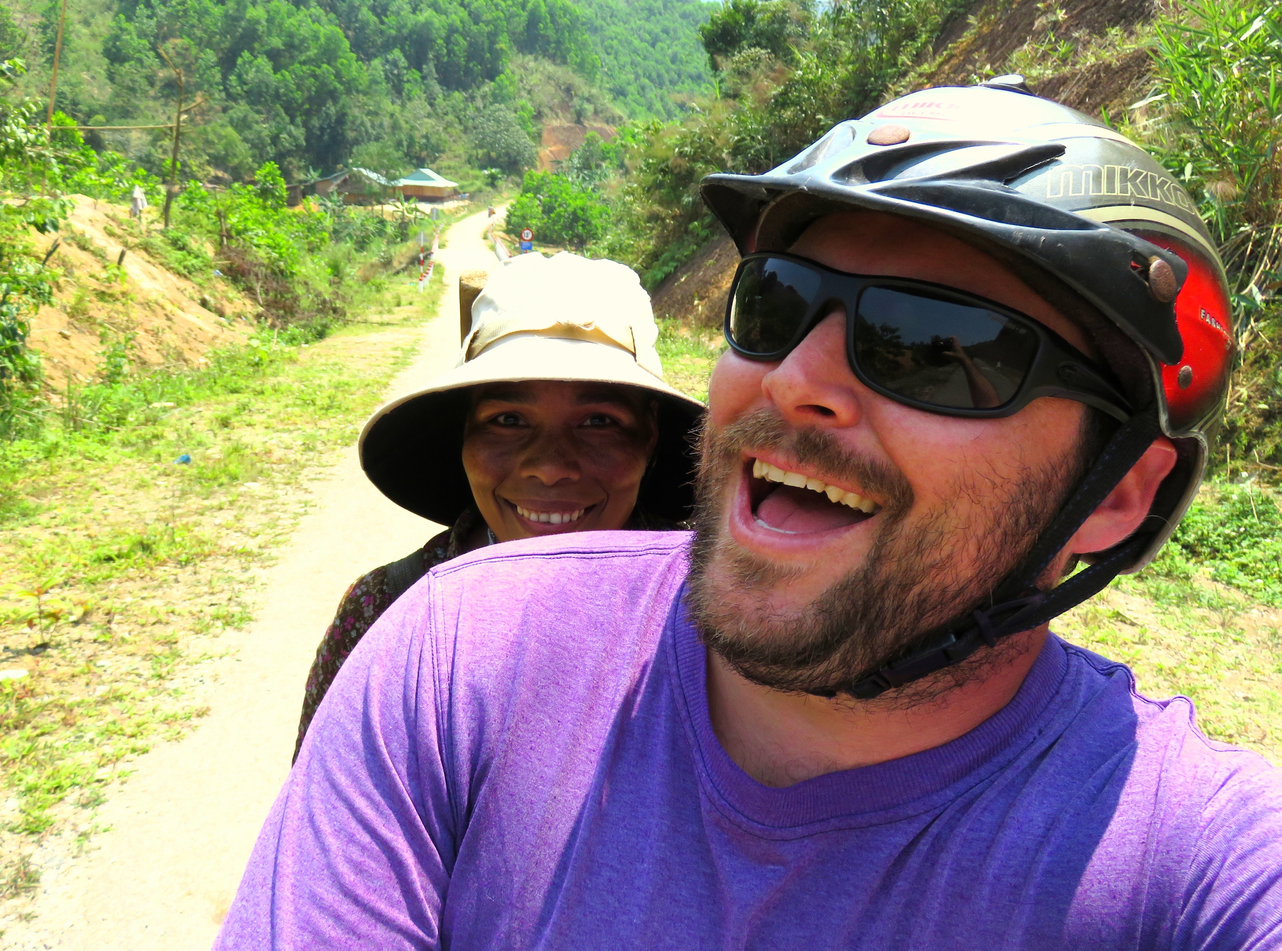
Above: Selfie with a local. Below Left: Picking up passengers. Below Right: Friendly smiles all around.
|
|
|
Once we dropped them off, we cruised a short kilometer or so down the road to the next town of Za Hung, the town the road is named for. In the middle of the village area was another of the omnipresent gouls. Unfortunately, one of the other things we could see from town was one of the downsides of the local population: a nearby hillside, cleared of all it's vegetation, and burned down to dirt level. It was quite a shocking sight, and a brutal reminder that these amazing local cultures that we love to see and visit are also responsible for some of the escalating environmental problems being faced by developing countries such as Vietnam.
|
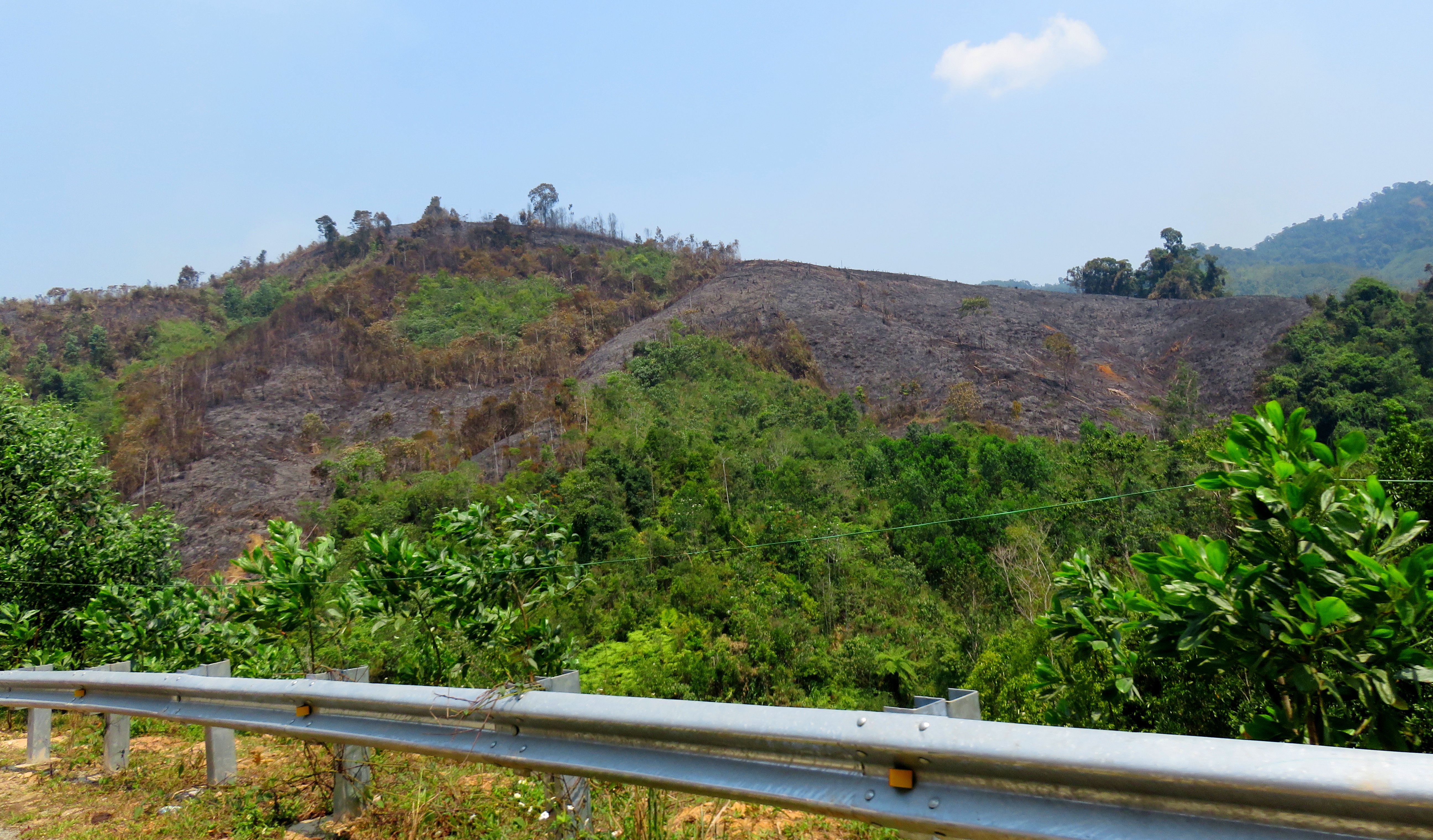
Hillside reduced to black earth just outside of Za Hung village.
|
Goul in the middle of Za Hung Village.
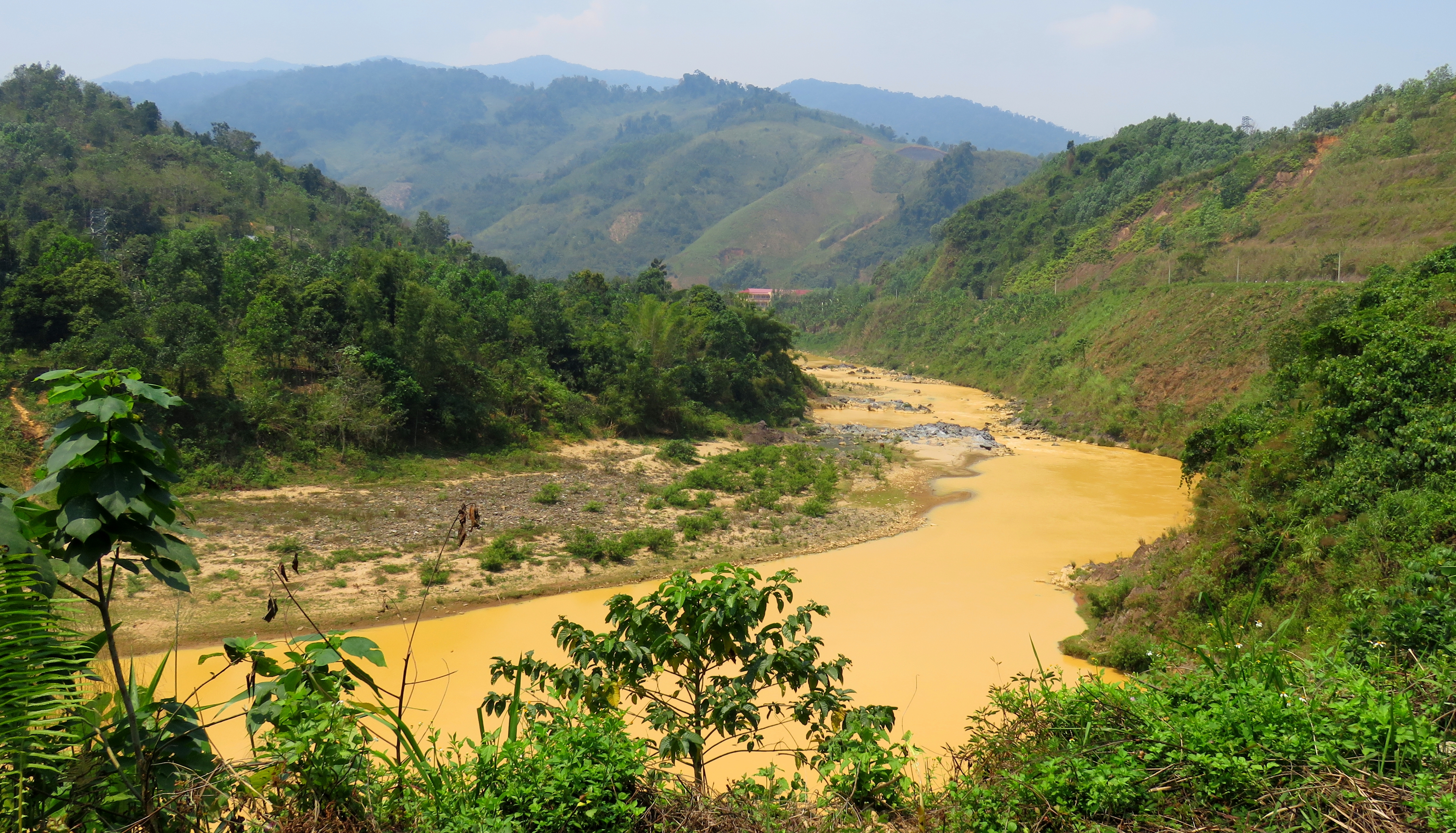
The mighty A Vuong River at the end of the road.
Once past Za Hung, it was just a few quick minutes and we suddenly found ourselves on the Ho Chi Minh Road, in downtown A Sanh. From here it was a quick jaunt north to Prao (about 10 kms), and then back to Da Nang.
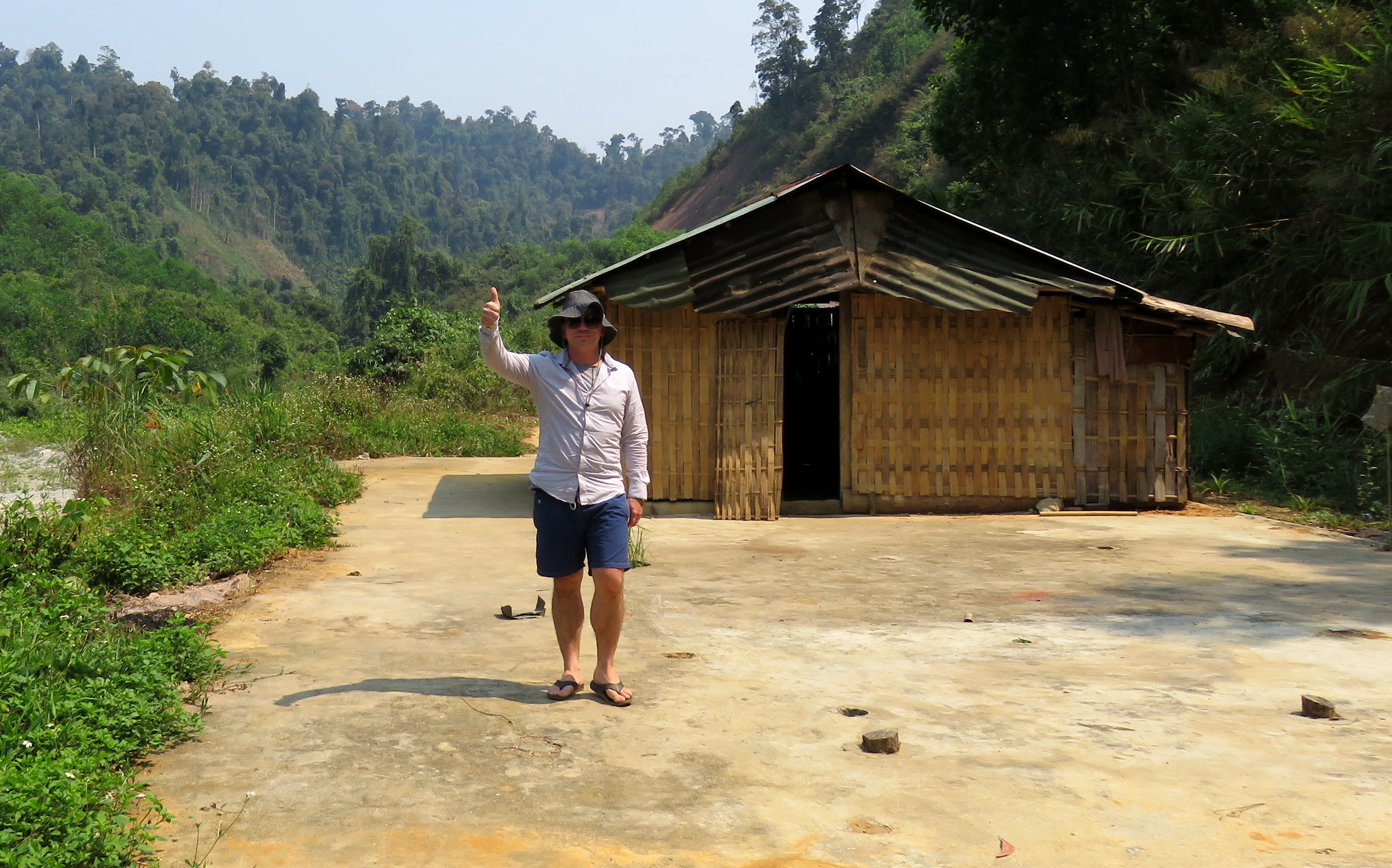
Some helpful info about the road. The road itself is about 22 km, and connects Jo Ngay on the 14-G with A Sanh on the Ho Chi Minh Road. All 22 km are in great shape, and aside from some mild dirt on the road in a couple places, it is completely smooth and in good condition. Any bike could do this road (again, not sure if I'd take a 50 cc Honda Cub out here, but anything bigger should be great) and while the Za Hung Road itself could be driven in an hour and half or so, by the time you factor in driving out to Jo Ngay, across to A Sanh, north to Prao or south to Thanh My and then back home, it will take the better part of a full day. When we went, we left the city at 8 am, and were back by 4 pm, although we were hustling and trying hard to keep high speeds up. So better factor 8-10 hours for this trip. Gas can be found in Xa Ba or P'rao, but there are not actual stations along the Za Hung Road itself, and some restaurants can also be found in both towns, although don't expect gourmet cuisine! Thanks for reading and enjoy the drive.
Some helpful info about the road. The road itself is about 22 km, and connects Jo Ngay on the 14-G with A Sanh on the Ho Chi Minh Road. All 22 km are in great shape, and aside from some mild dirt on the road in a couple places, it is completely smooth and in good condition. Any bike could do this road (again, not sure if I'd take a 50 cc Honda Cub out here, but anything bigger should be great) and while the Za Hung Road itself could be driven in an hour and half or so, by the time you factor in driving out to Jo Ngay, across to A Sanh, north to Prao or south to Thanh My and then back home, it will take the better part of a full day. When we went, we left the city at 8 am, and were back by 4 pm, although we were hustling and trying hard to keep high speeds up. So better factor 8-10 hours for this trip. Gas can be found in Xa Ba or P'rao, but there are not actual stations along the Za Hung Road itself, and some restaurants can also be found in both towns, although don't expect gourmet cuisine! Thanks for reading and enjoy the drive.
The Map
All photos copyright Kit Davidson unless otherwise noted.
Maps created with Google MyMaps and are copyright Google.
Maps created with Google MyMaps and are copyright Google.
