
South Fork Cu De River | North Fork Cu De River
Cu De River (Main Section)

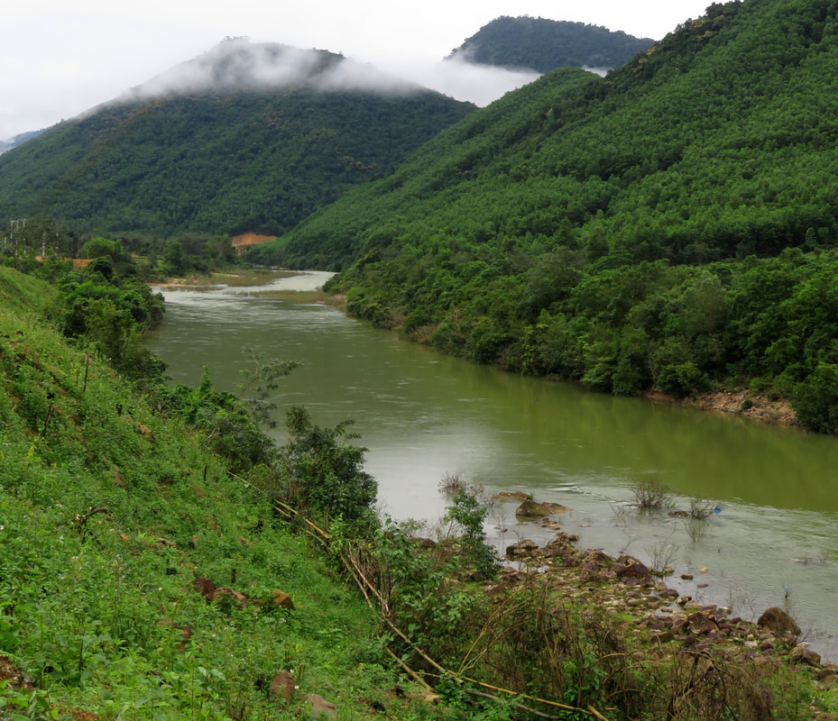
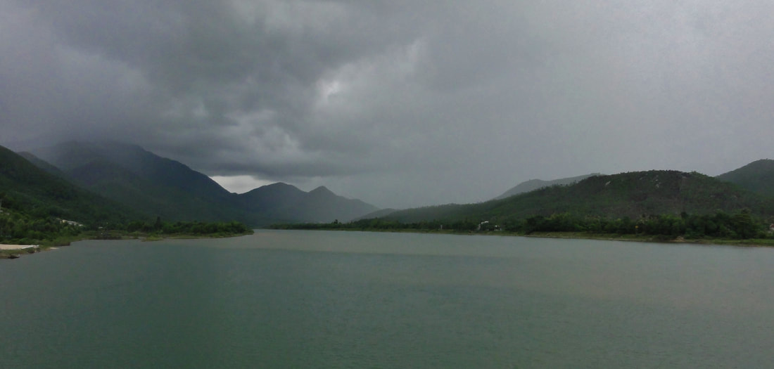
View looking up the valley of the South Fork Cu De River.
The Cu De River system is found northwest of Da Nang. It drains the mountains in an area roughly between Ba Na Hills, the southern slopes of Hai Van Pass and Bach Ma, and the mountains of Nam Dong in Hue. The river has two different forks, and a main section, and although none of them are that long by themselves, it represents a fairly close and quality boating option to the Da Nang area. The center of activity for the whole system is at what is called the "Cu De X Spot", which is another name for the confluence of the North Fork and South Fork, where the main stem of the Cu De River is ultimately born.
South Fork Cu De River
|
Section Length: ~ 3 km
Put In: Tunnel Construction parking lot Take Out: Cu De X Spot |
Difficulty: III (III+)
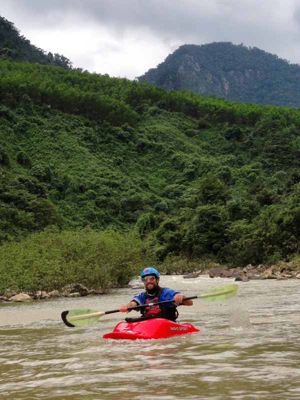
Est. Flow: too low < 200 < 1500? < too high Paddlers: Alfonso Perez & Kit Davidson |
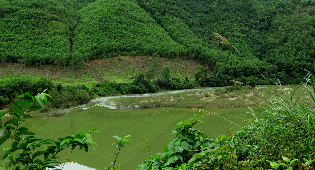
The South Fork of the Cu De River drains the backside of both Ba Na Hills (Nui Chua / Temple Peak) and Nui Mang (Bamboo Shoots Peak), and while the canyon itself is actually quite lengthy and like holds quite a bit of potentially good whitewater, for the time being the only accessible section is a very short run of class III just above it's confluence with the North Fork of the Cu De. The reason for this limited access is the construction of the new superhighway from Da Nang to Hue that runs up the Cu De Valley; once this stretch of highway is finished access to upper parts of the stream will hopefully become much easier.

View into the mountains from the put-in.
|

..and a friendly construction engineer there.
|
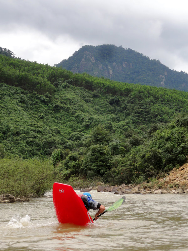
The run itself is basically a handful of straightforward boulder garden rapids. There is some gradient but not a lot, so the rapids are similar to gravel bar style rapids of larger and flatter rivers, but here with larger, rounded boulders. Although the potential is high for further exploration upstream, for now, the best put in for this "lower run" is found alongside a parking lot for construction of the highway tunnels. A road leads down to the river itself, making a great access. There is a short corridor of flat above this, and one of the biggest rapids of the run just below so it makes a good put in.

Tuercas Rapid looking better from below...
|

....than it does from above.
|
This first drop, "Tuercas", is a junky plop and drop down a boulder pile. It's not a super clean line but it goes better than it looks. At higher levels there can be some decent holes in this drop, so while more water will clean it up, it will also make it a touch more sticky. The lower rapid of this is easy, although a bit manky as well at lower flows. After a short flat is a rapid with some awkward pin potential (watch the video below) and then a short calm section. At the end of this calm section is the first of two bridges that are currently over the river for large trucks to use. Once the tunnel and highway project is finished, it is hopeful that these bridges may be removed but for the time being they must be dealt with.

The second low bridge.
|
|

Spring along the river.
In between the two bridges are two small rapids, the upper of which is easy but shallow, and the lower of which is junky and has some awkward rocks lurking in it. In addition there is a large spring on river left, where a decent amount of water splashes its way down into the river from several distinct spouts. Although it is not hot, or even that warm, it is beautiful to see with lots of ferns and moss growing over the rock. At some water levels the second bridge can be floated under by ducking enough but the first one is a no go.

Beautiful views on the South Fork.
|
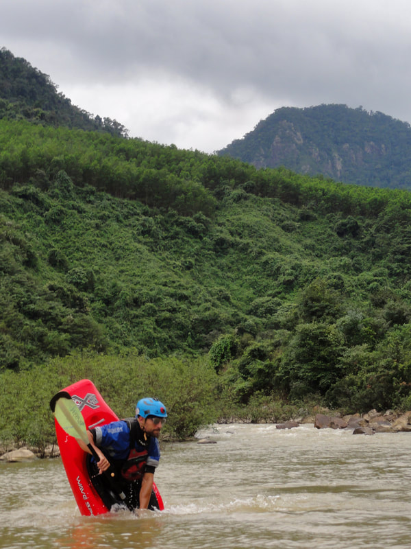
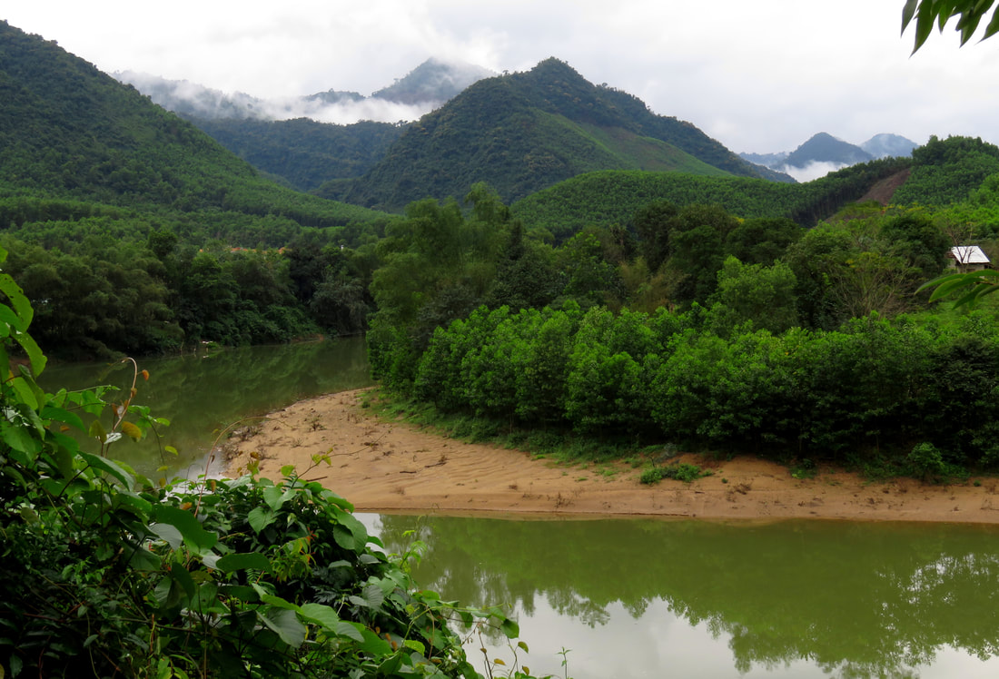
After the second bridge the rapids continue in spaced succession. Although the run is short, the rapids are surprisingly busy, and provide a decent amount of action. The first rapid, "Cow Rapid", is immediately after the bridge and sets the tone for what most of the rapids will be: moving in and around granite boulders and the holes they create. A short flat, and around a corner leads to "Good Clean Fun", a three part rapid that is good, clean, and fun all the way down. Around the corner is a mess of rocks without a great line. This is called "The Minefield" [the picture at the top of this page], and generally staying center at lower levels, and right at higher, will give the best chances of a good line. "Lower Minefield" comes quickly after its sibling and although shorter, is just as manky.
|

Bottom of Minefield Rapid.
|
|
|
|
Almost immediately after Lower Minefield is the first of the Ta Lang Rapids. These are three drops set on a long straightaway of the river, and run parallel to the new Co Tu village of Ta Lang on river left. The first is a straightforward shot through and around some holes on river left. The second is a short drop underneath a water pipe crossing the river, which is slightly manky. Finally, the bottom drop is a nice rapid that is clean and fun with a couple of easy moves down into a fun splashy hole at the bottom. The bottom drop is the "hardest", although that isn't too difficult at all. The bottom drop also has a nice wall of bedrock on river left that is quite scenic.

Upper Ta Lang Rapid.
After a brief calm, the river makes a bend to the left, while squeezing into the right side of the channel. The resulting rapid is called "The Green Corner", and is an easy two part rapid. The first half is a splash through some waves and away from the overhanging trees, and the second is just a fun romp through some splashy waves and holes. Below this is another brief calm, and then the second "bigger" drop of the run- "Autoboof". This fast drop consists of two sets of waves/holes with a short moving section between them. Being off line can lead to bouncing off hidden rocks in the drop, but if you hold steady the pourover drop in the middle will autoboof you to freedom with little effort. A short runout, dubbed "Lower Autoboof" is a fun series of holes and rocks to paddle around.

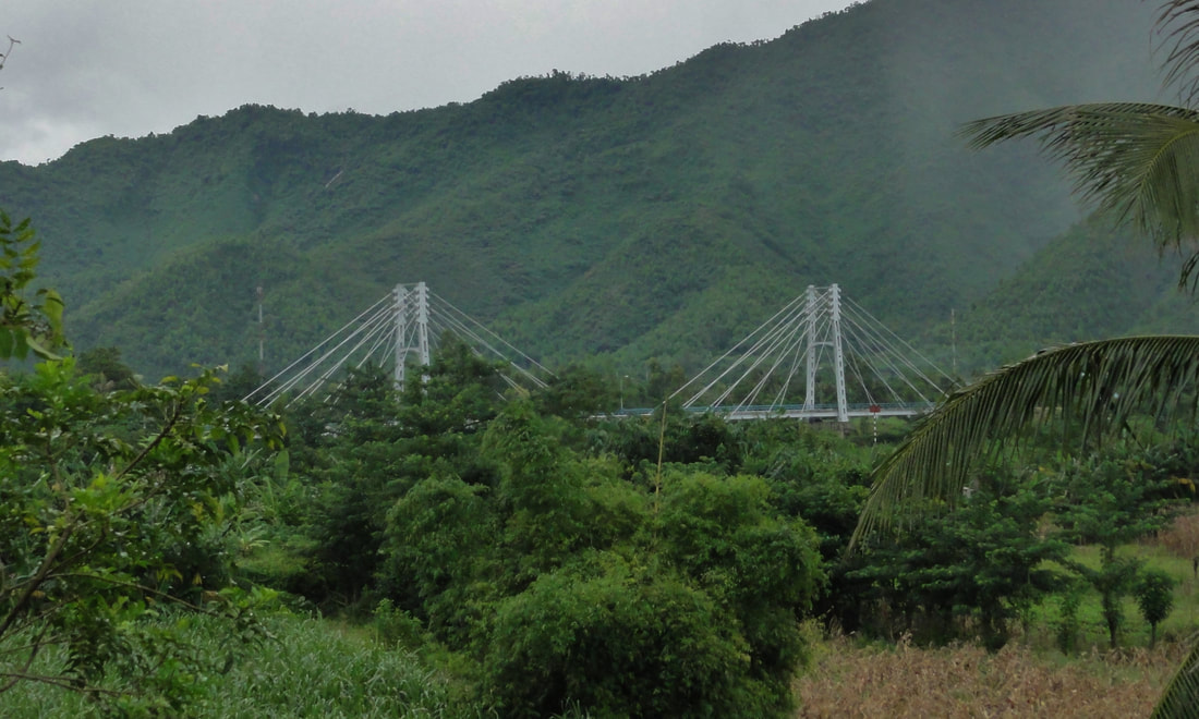
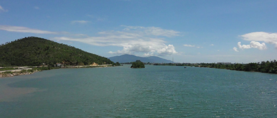
Autoboof Rapid, the Twin Bridges, and looking up into the valley of the North Fork.
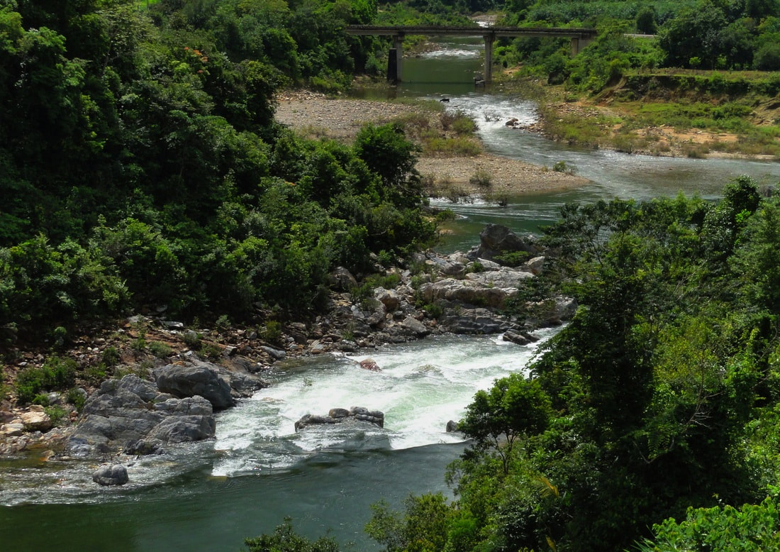
At this point the twin bridges of the DT-601 and the HCMExpressway will be in view, signaling the end of this section. Three short rapids remain, the first almost directly under the new highway bridge, which is a simple ledge made of boulders. Just before the confluence with the North Fork is a two part rapid with a short staircase of small holes and then one last series of holes into the large pool at the confluence. Takeout on river right, and walk over to the small road that comes down from the main road.
Lower North Fork Cu De River
|
Section Length: ~500 m
Put In: above the mini gorge Take Out: Cu De X Spot |
Difficulty: III+ (IV+/V- if running river right in the 1st rapid)
Est. Flow: just about any (use your judgement for upper end) Paddlers: Alfonso Perez & Kit Davidson |
2nd drop on the North Fork Cu De.
At the very end of the North Fork Cu De River is a very short and very abrupt mini gorge of bedrock formed where the river has cut through a fault-block line of hills. The result is two rapids that come out of nowhere and disappear just as quick, but pack a solid and impressive punch for such a short stretch. The first drop is a bedrock ledge that can be run on left or right. At both higher and lower levels, river left offers a staircase of drops, the two first ones being the largest, although the boof well. There is a plan B at lower levels if you need to. On river right is a narrow slot that only gets narrower and tighter as the level drops. The hole isn't super sticky, but the geometry of the drop could still offer up injury if you were to drop in off-line or awkwardly.

Left side of the 1st Drop.
|

Right side of the 1st Drop.
|
The lower drop ihas two channels around a bedrock island on top, followed by a large flat, moving pool, and then the lower part of the rapid, which is nothing but a bunch of small boulders to move around. Up top, the river left line is a bit more chunky, with some awkward rocks to watch out for, and the right is a fairly straightforward double drop through a couple of small but non-sticky holes. The runout is easy. Both of these rapids are separated by a flat pool that stretches about 200 to 300 meters. It is possible to walk up the road around the whole gorge and put in and run it, but it's much easier to simply paddle up from the confluence, portage around the lower rapid, and then paddle up to the upper rapid. The whole set can be ascended, scouted, and run in less than an hour.

The 2nd drop in the North Fork gorge.
Cu De River (Main Section)
|
Section Length: ~10 km to Red Bridge; ~20 km to the sea
Put In: Cu De X Spot Take Out: Red Bridge in Hoa Bac or Nam O Point |
Difficulty: II
Est. Flow: just about any |
Although the Main Stem of the Cu De lacks the whitewater that both the South Fork and North Fork have, it is still a very enjoyable stretch of river, and can be enjoyed by many different kinds of river users, not just the whitewater crowd. The "main stem" can be broken down into two sections: the Upper Main Stem, running from the Cu De X Spot down to the gray suspension bridge, and the Lower Main Stem, which runs from the grey bridge down to the sea. The upper section has some small class II rapids and possibly one portage, while the lower section is flat and calm the entire way. Unlike the South Fork and North Forks, this can be run basically any time of year as this section almost always has enough flow to float boats, even at lowest possible levels.

Depending on where you put on at the Cu De X Spot, you can either add one small rapid to start, or put in below it and not deal with the awkward waves in this first rapid. Regardless, the first decent rapid comes up pretty quickly where the river narrows slightly. This rapid, like most of the rapids on the Cu De Main Stem, is a simple riffle of small waves to splash down the middle of. After a short spell the river pours through another small riffle, this one made by a gravel bar, and again, nothing more than some splashy waves.
A short flat stretch gives way to one of the "larger rapids" on this stretch, although again, it is not very difficult. The river here gets pinched down to the left side of the river bed, and races through one good set of riffles, then through a fast calm, and then through a second series of riffles and making a bend to the right. Just about anyone should be able to navigate this with a good forward paddle. Below this the river gets quite flat and slow, as it enters an area called "Ho Hoa Bac", or "Hoa Bac Lake", in nods to the village on river right. The river is naturally slowed and pooled up here thanks to the next series of the rapids on the Upper Main Stem, which lies at the end of this long calm, and around a bend to the left. Much like the rest, this is a straightforward shot down through some easy riffles and waves. This rapid is a little long, wrapping along a slow right hand bend, but it is easily boated.
Once you finish the above rapids, and pass out of the upper Cu De Valley and into the lower reaches, the last rapids and obstacles comes up quick. This next section is a dynamic piece of river, as there is/has been some placer mining of the river here, leading to lots of sandbars being moved around and temporary river channels coming and going with each flood. There is usually a temporary dam-like structure in the river somewhere in this area, and if possible it is easiest to portage this structure and put in below it. It is possible to navigate around it and run some myriad of little channels, but watch out for quicksand and shallow channels. A short ways below this there is one more gravel bar rapid, and then the confluence with the Suoi Cay, a fairly large side stream. Once you've reached this point the geology of the riverbed changes, and the last of the bedrock fades away, leaving a completely flat and calm stream. From here it is just a short kilometer or two down to the grey bridge.
From the grey bridge down there are a few options for access but its all very uniform in nature, with flat water and very beautiful scenery. However, one thing to note when reaching this lower section is to be aware of large, motorized boats and barges in the river, which utilize the flat and calm lower section. Likewise, because it is so flat, this section is best suited to boats the do well in flat water, such as lake or sea kayaks, SUPs and canoes. Whitewater kayaks and rafts will likely not enjoy this stretch as much as it will require lots of paddling. A ways below the grey bridge is the concrete bridge, where there is an access point.
Below the concrete bridge, fishing infrastructure in the river itself begins to appear. At first these nets and fishing pots are randomly scattered, but the closer you get to the sea the thicker they become. Likewise, once you pass "Dao Dinh", the small island with a tiny shrine on it (worth a stop if you have time), the current also tends to run out pretty quickly around this area. Also be aware that if the tides are coming in, it will make navigating all the way to the sea somewhat difficult. If the tides are going out, it shouldn't be hard to paddle all the way to the breakers. A decent take out can be found just to the right of the mouth, near the famous Nam O Point.
More to come soon....
|
All photos and videos copyright Kit Davidson.
All maps copyright Google MyMaps. All music copyright original owners and is not to be used for profit. |
