
Thu Bon River - Hon Ka Da Dung Gorge
|
Section Length: ~ 40 km
Put In: bridge in Tan An, Hiep Duc Take Out: Thrung Phuoc, Nong Son |
Difficulty: II
Est. Flow: too low < 200 < 5000? < too high Paddler(s): Phạm Đức Toàn |
Information and photos provided by Phạm Đức Toàn.
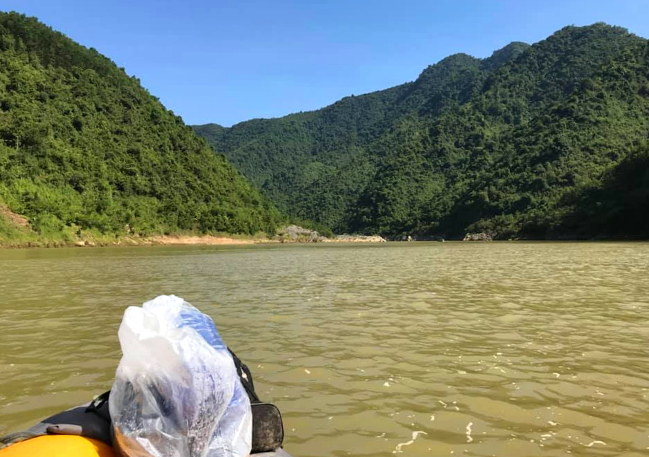
In the middle of the Hon Kem Da Dung Gorge. Photo: Phạm Đức Toàn.
Hon Kem Da Duong Gorge is a short, deep and narrow flat water gorge on the Thu Bon River in the mountains southwest of Hoi An. While lacking in any rapids, the scenery is immense and it is truly a wonder to see. This section is roughly 40 kilometers long, which means its best done in two, or even three days. If you go during any time of the year except high water, there will be plenty of sandbars and beaches to camp on, but if the water is high you should be able to find good camping during most of the length of the run.
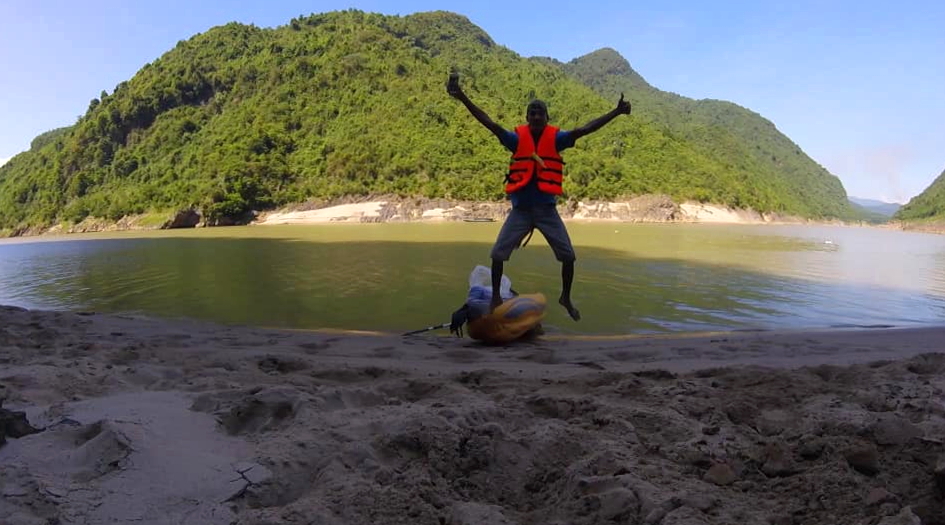
Celebration of life in the middle of the Gorge. Photo: Phạm Đức Toàn
While the Gorge is the highlight of this run, it actually represents a small part of the total length. The first 12 kilometers of river follows through the open valley of Hiep Duc District, with rural countryside and small towns all around. After a gradual turn to the north, there is a short section between a couple of small hills, and then follows a section of small valleys and hills down to the start of the actual Hon Kem Da Duong Gorge. The last valley directly before the gorge is home to ethnic villages.
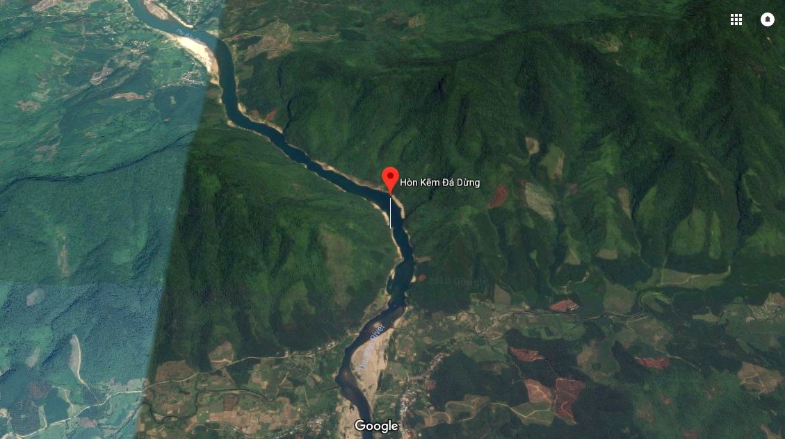
Looking at the Gorge on Google Maps.
The gorge itself cuts through a long range of peaks that starts quite a ways to the northeast in Que Son, and runs all the way to Phuoc Son to the southwest. The granite bedrock that this gorge is cut through is quite impressive, and that bedrock lines the banks of the gorge for quite a ways. The original mountain jungle has been left untouched through here, and because there are no roads through here this corridor is very impressive.
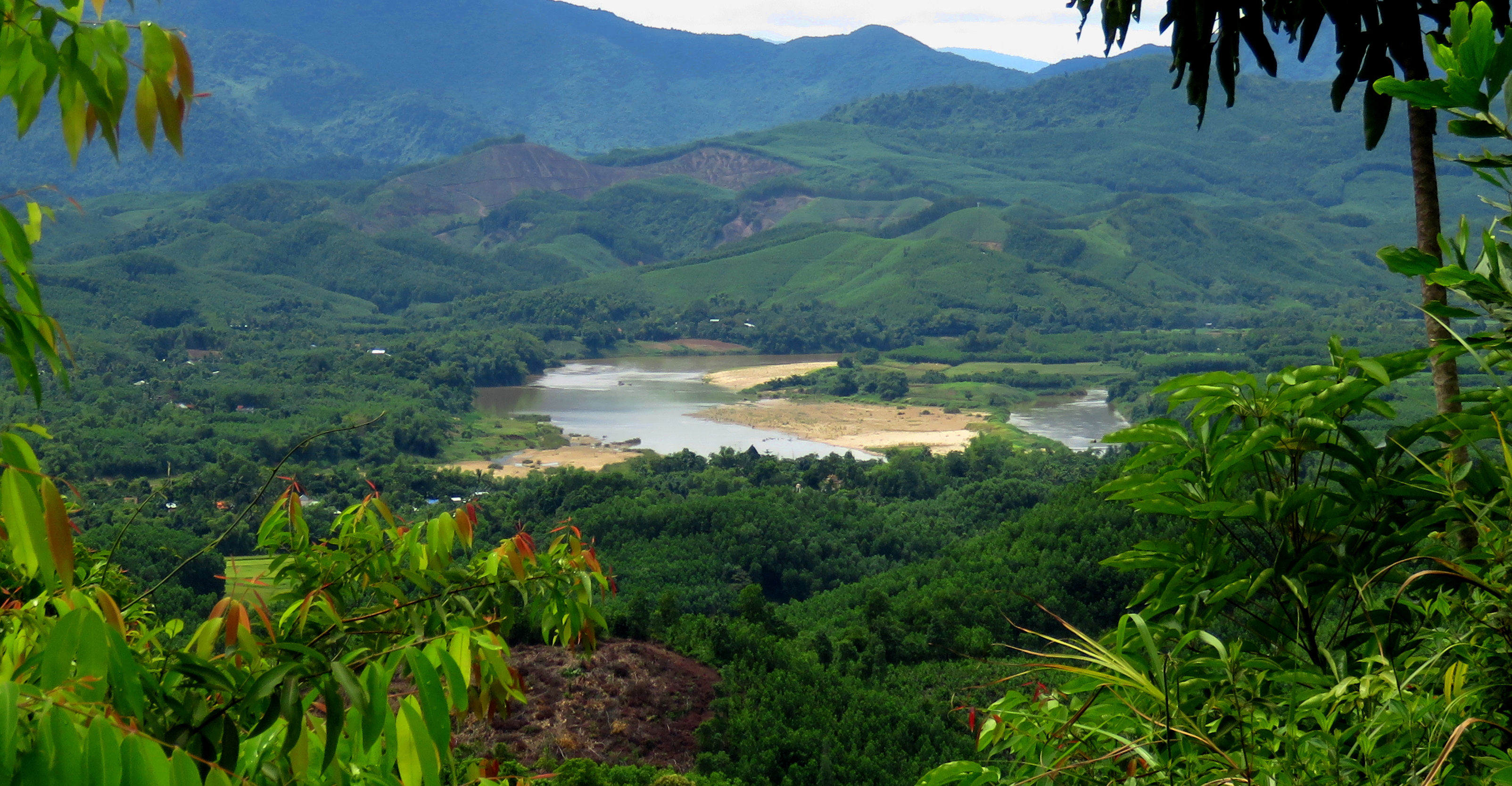
Thu Bon River below the Gorge running through Nong Son District.
Click to set custom HTML
Below the gorge, the river winds it's way through more hills and small valleys, and past numerous ethnic villages hidden in the trees. Only two bridges span the width of the river in the entire length from Tan An down to the takeout. The first of these, the Cau Treo Que Lam (Que Lam Suspension Bridge) comes up several kilometers past the end of the gorge. The second doesn't come for quite a while, the Cau Nong Son, and it signals the takeout is not far around the corner.
The Map
|
All photos copyright respective owners.
All maps copyright Google MyMaps. |
