
Journey to a Remote Ethnic Village
(Skip to the Interactive Map!)
Some trips take a while to happen. This one took me four tries to finally make it work. The first time I set out to do it, I ended up in the hospital with some kind of tropical fever. The second time I tried to do this my friend Cuong and I made it as far as Thanh My, before having to turn around because one of my boys was sick. The third time didn't happen because work schedules got changed at the last minute and all people involved couldn't go. Finally, on the fourth attempt, I set out solo and finally reached the Pa Pang Valley, high in the mountains of Nam Giang!
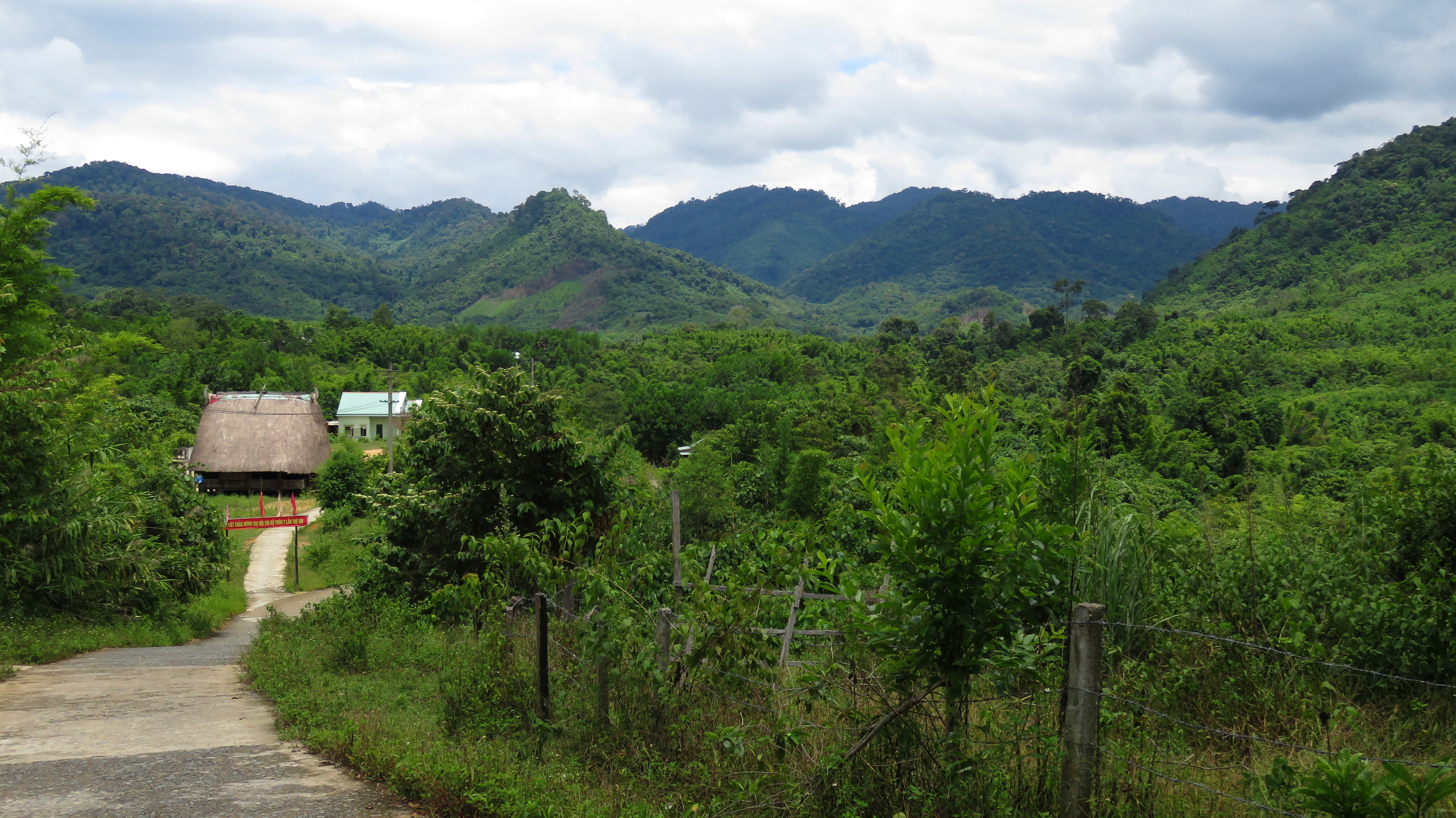
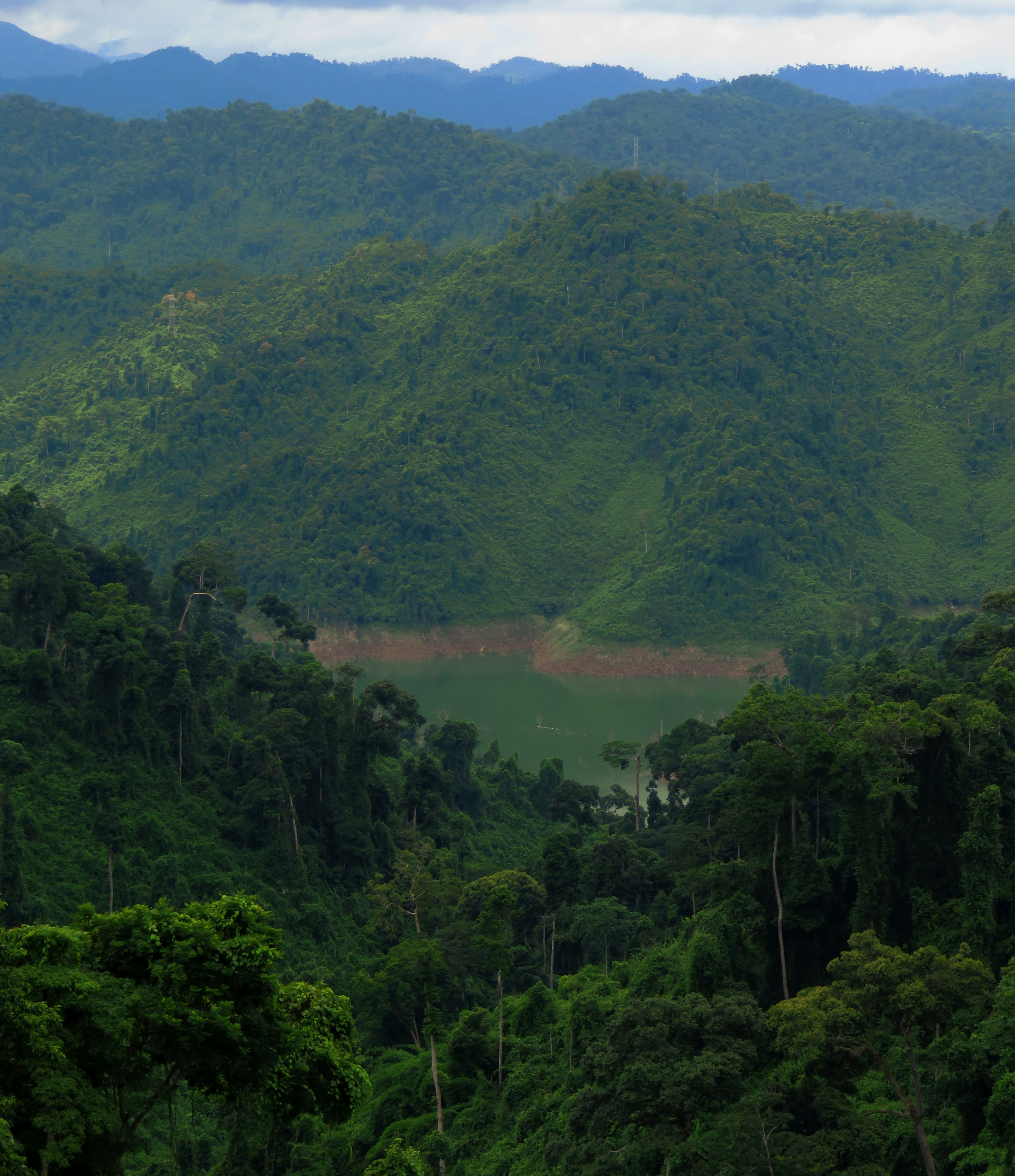
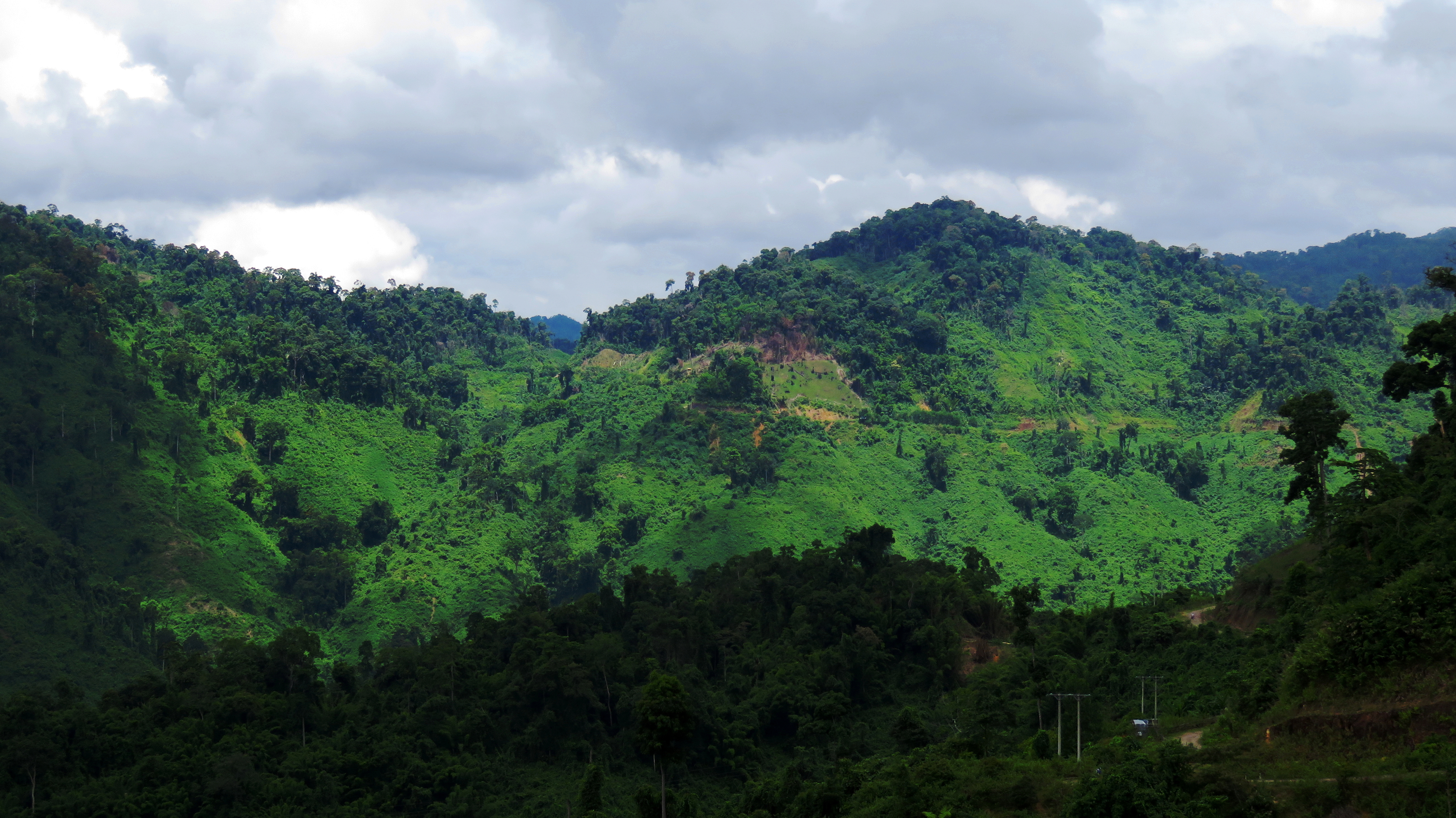
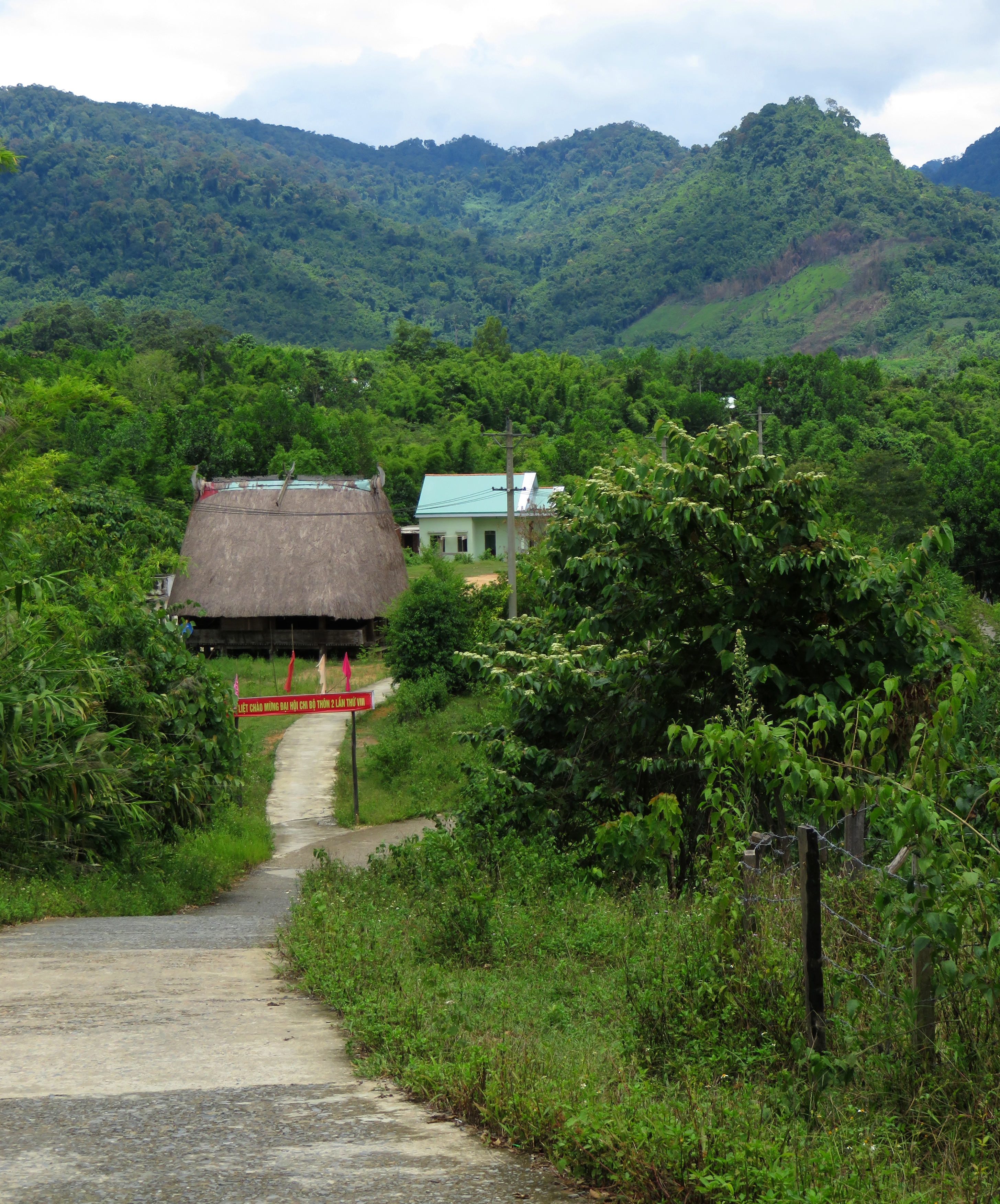
Lookng over Pa Pang #2 Village.
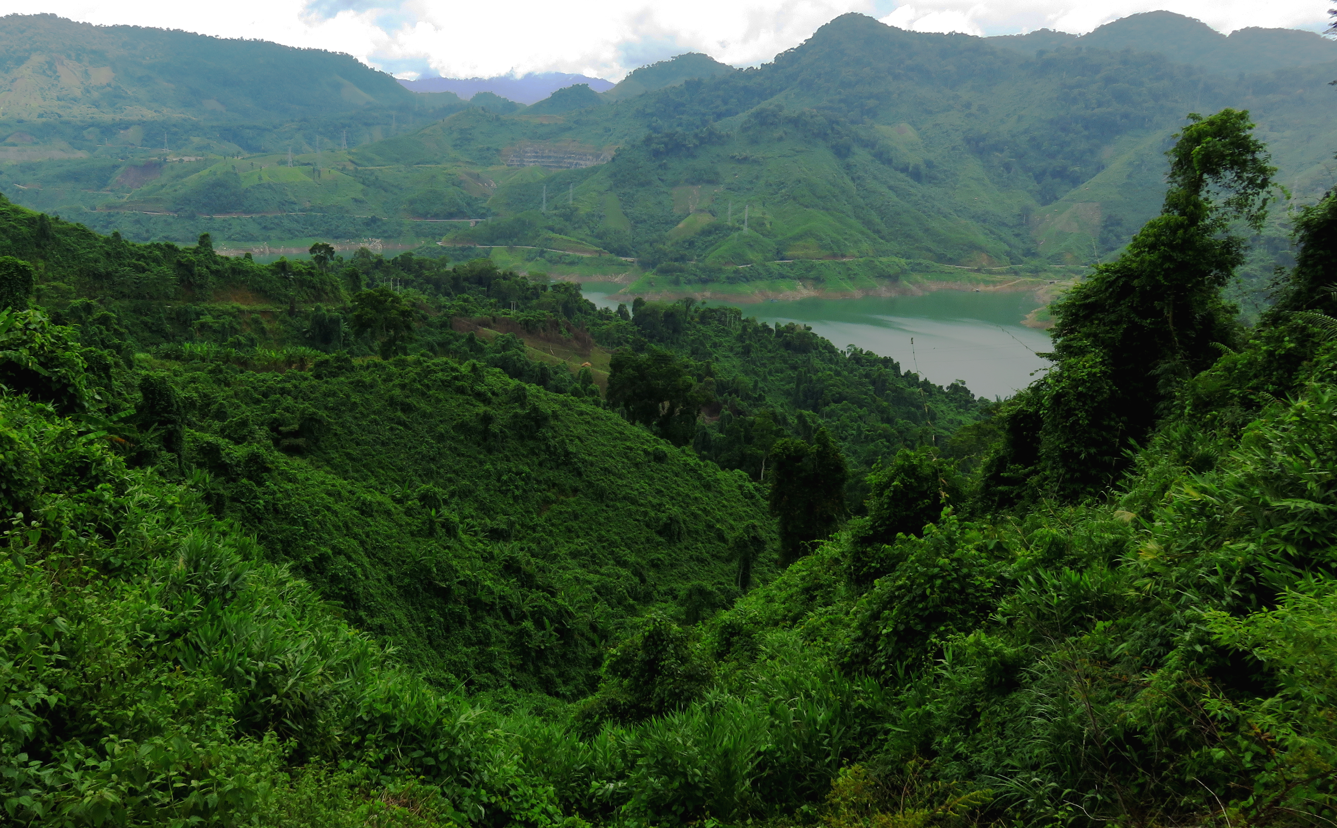
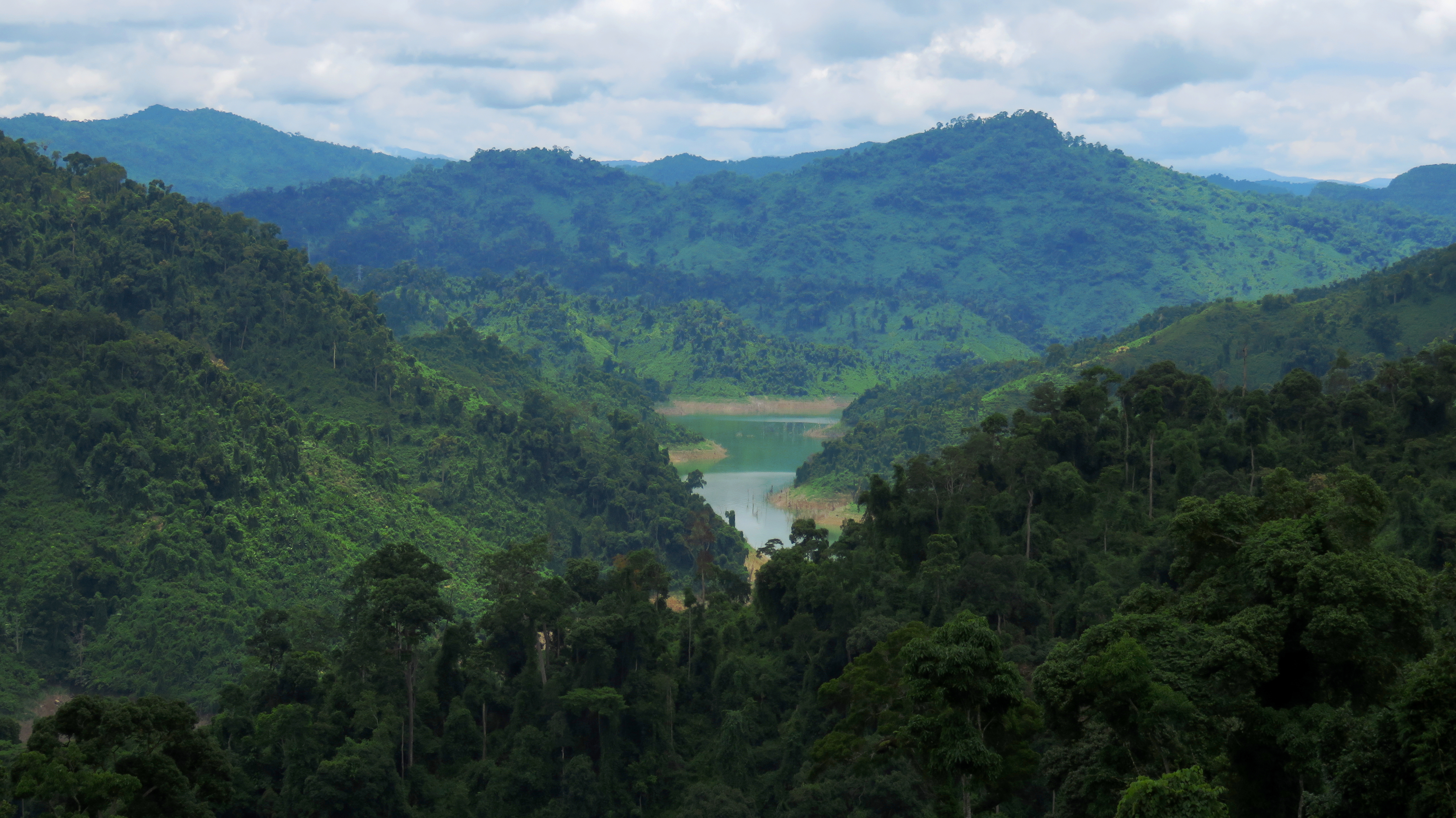
It feels weird to even say "Pa Pang" village, because for the longest time I thought this area was called "Ta Pang". This is because on Google Maps, the village and valley are labeled with a "Ta", not a "Pa". This road was first brought to my attention on a short scouting trip to the area. My friend Rob and I were on our first day of the Dak Mi Loop, and decided to take a quick spin down the 14-D, just far enough to see the Song Bung 4 Reservoir, which neither of us had seen yet. Once we reached we lake, we were able to look across and see this road crawling up the side of the mountain. Later, on return trips to explore the length of Highway 14-D, I saw more of the road from across the lake, and it had been enchanting me ever since.
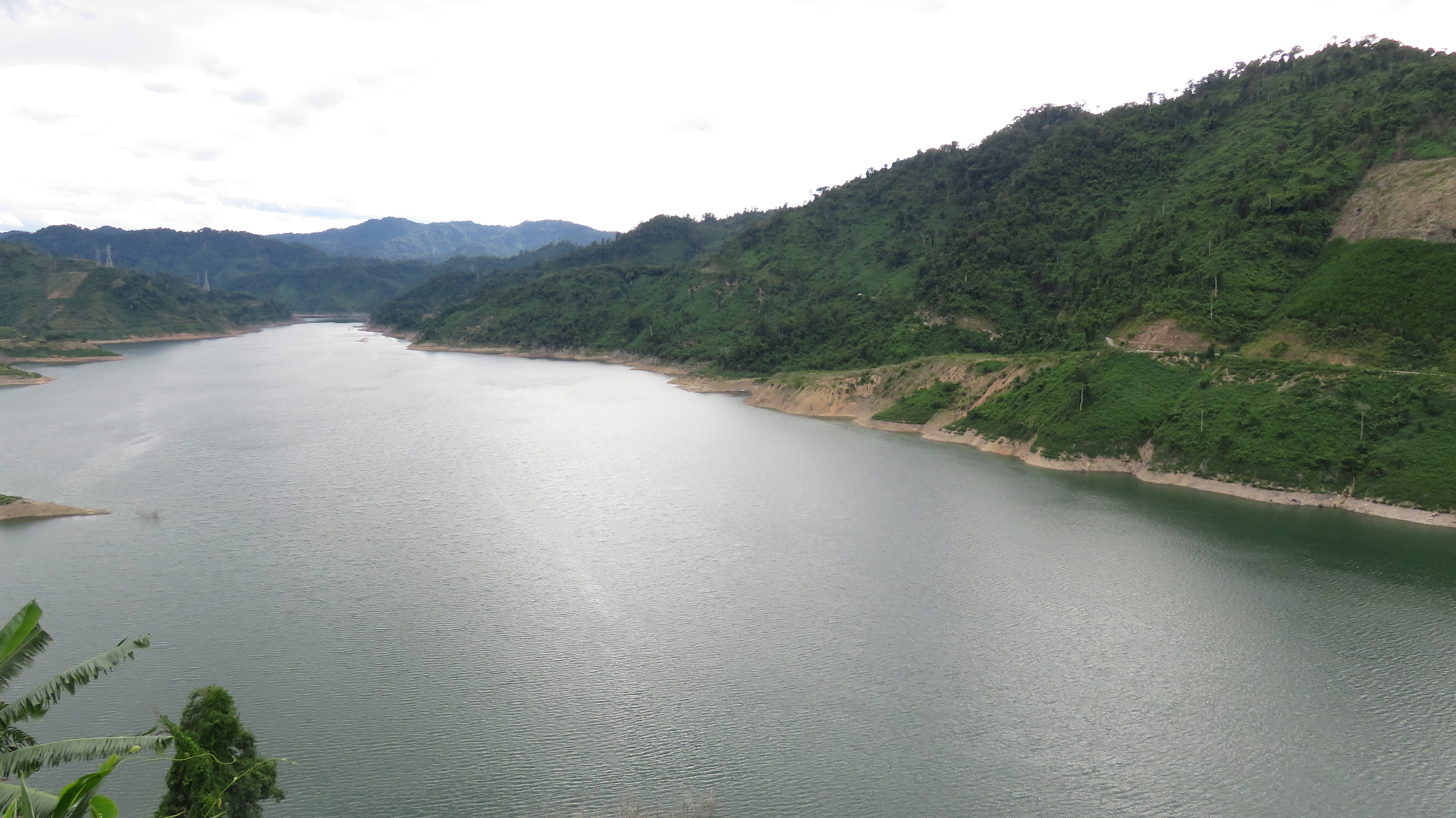
Song Bung 4 Reservoir. Note the road running across the hill in the background.
|
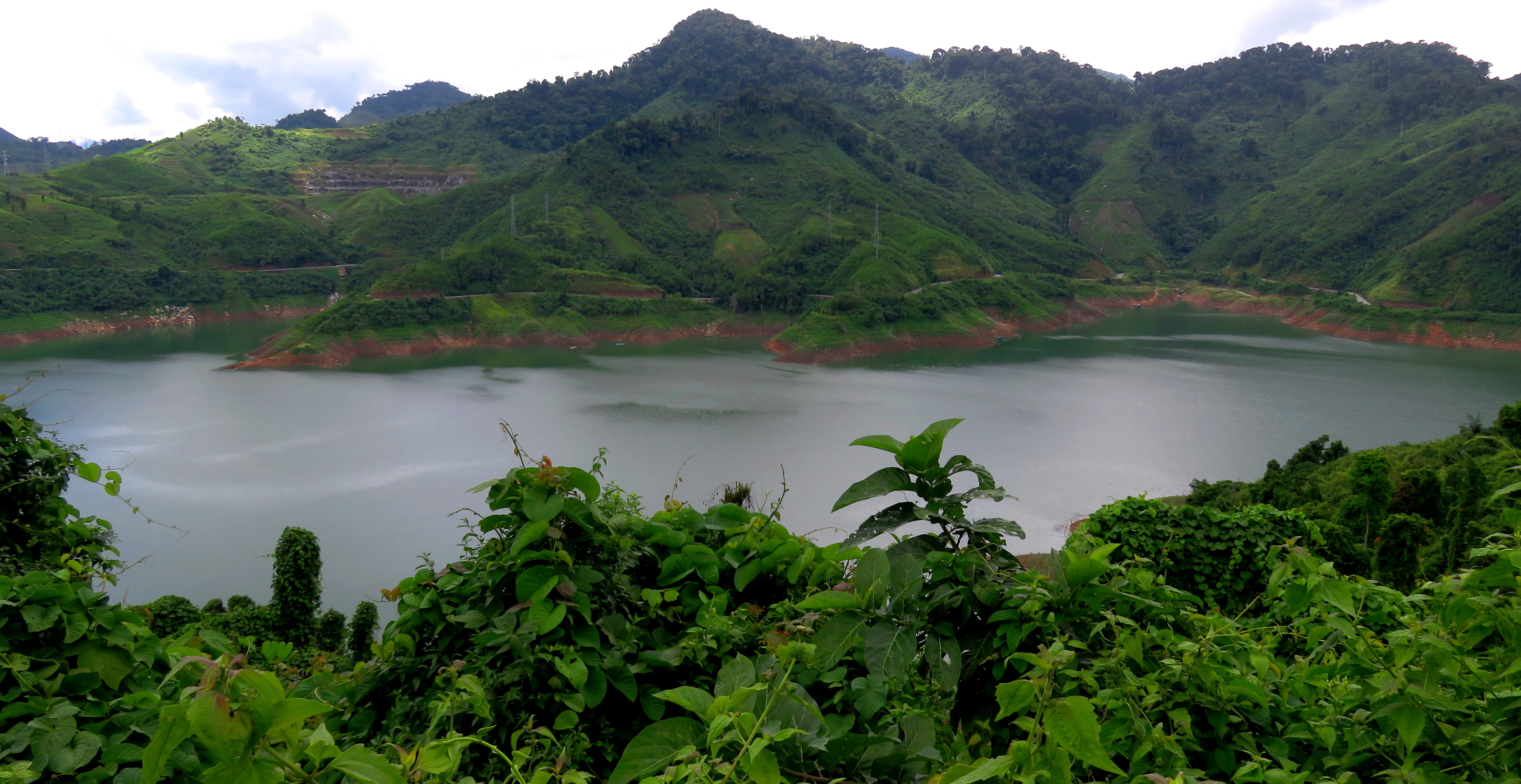
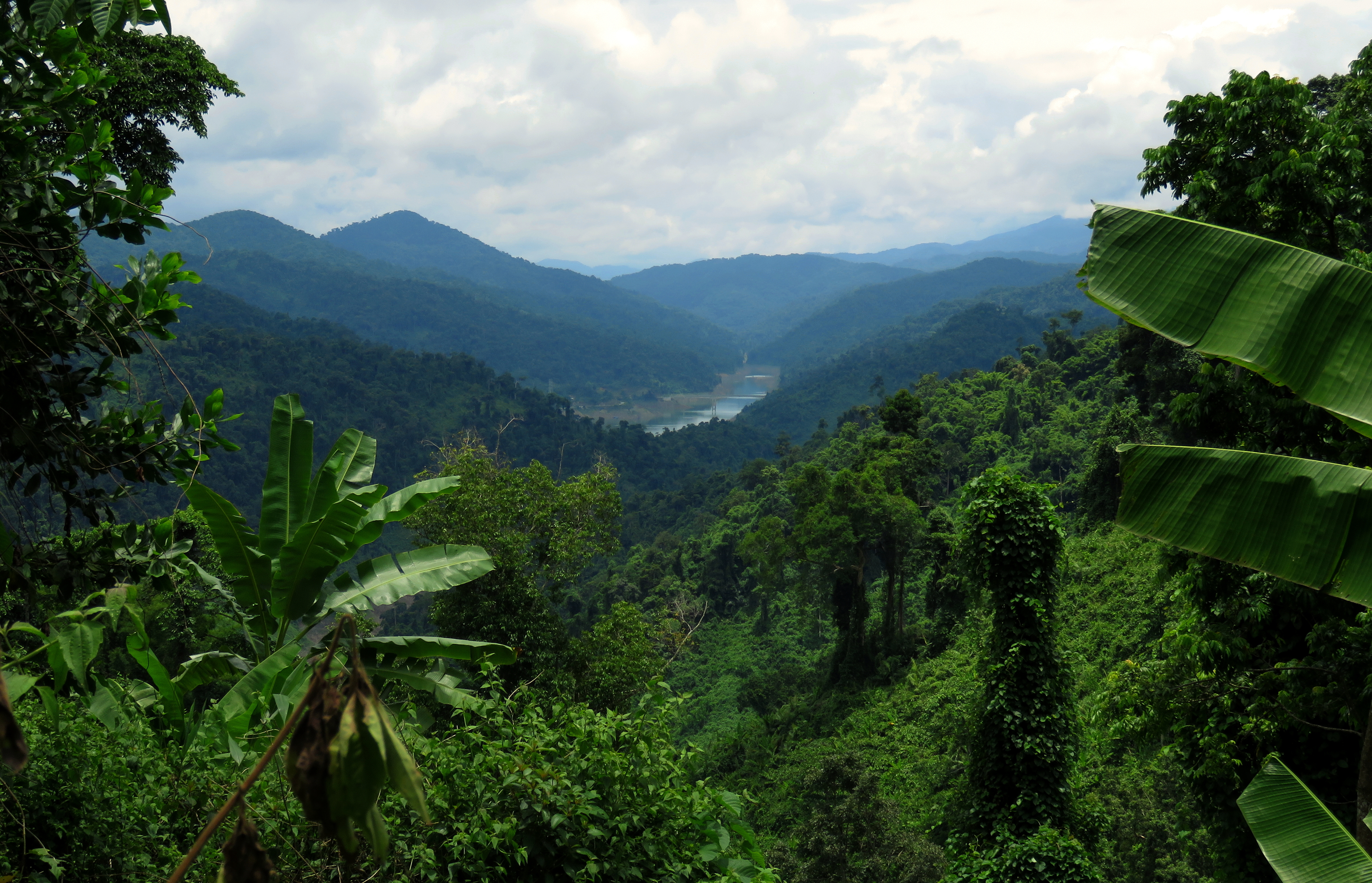
And looking back east across the reservoir at the 14-D.
|
On Google Earth, it was clear that the road that went up the village was in at least decent shape, so I thought it would be possible to do it in a day trip, with an early start and a late return. I was a little confused at first, as I thought the village was located high in a valley on a tributary of the Song Bung, with a creek or stream dropping from the village down to the Song Bung 4 Reservoir. However, when I went looking for creeks to go scout potential waterfalls on, I realized my mistake; the valley of Pa Pang actually sits in the very headwaters basin of a stream that actually drops into the A Vuong River to the north.
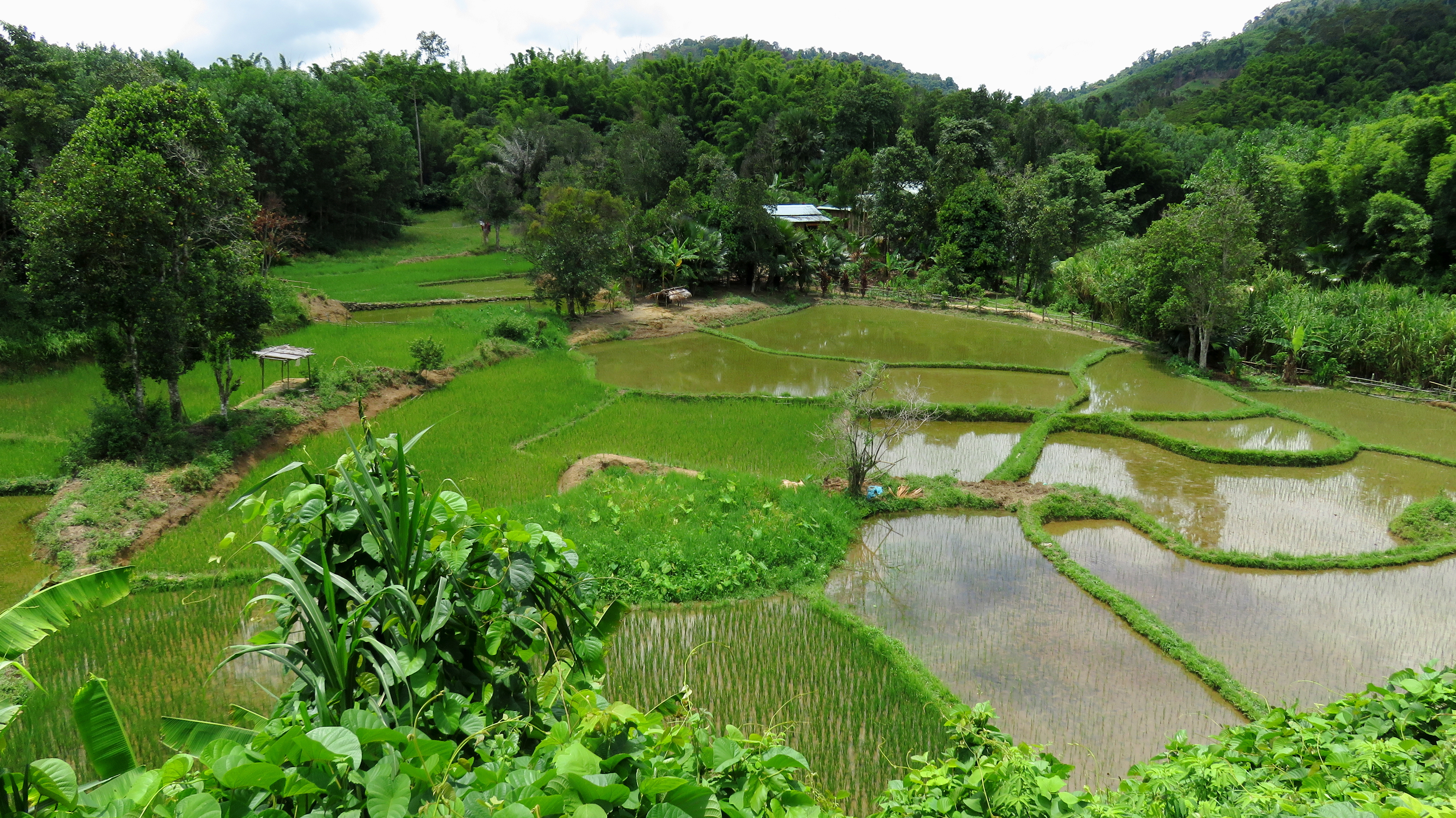
Rice paddies in Pa Pang #2 Village.
The road to Pa Pang starts in on the 14-D, just past the town of Ta Poo. Here, an intersection on the 14-D offers the choice to turn left, and continue along the 14-D towards Cha Val, Dak Ooc, and Laos, or right towards the Song Bung 4 hydroelectric dam and power plant. At first the road wanders along the reservoir, until it passes the area of the dam. Originally the road went up and around the dam, but thanks to a small landslide, the road now goes right past the dam. Don't head out on the dam as the security guard will follow you and yell at you. So you gotta drive down to a bridge a fair distance below the dam to cross the river before starting up. The Song Bung 4 hydroelectric dam is pretty massive, so massive in fact, that it has generated it's own page here on Beyond-Danang.
Song Bung 4 Hydroelectric Dam.
Looking downstream from the dam.
The road from here starts its long climb up to the valley. It is a steady grade almost the entire way and apart from the occasional dip in and out of a side canyon, is a continuous gentle uphill the whole way. Along the way the view is impressive to say the least, and as it continues along it is constantly changing and offering new sights and glimpses of far off places. At first, the view is back over the 14-D as it comes down from Ta Poo and starts wrapping around the Song Bung 4 Lake. There are some neat waterfalls on a side stream of the Song Bung here, which come crashing down in a short gorge between the hydro dam offices, and again right as the stream enters the lake.
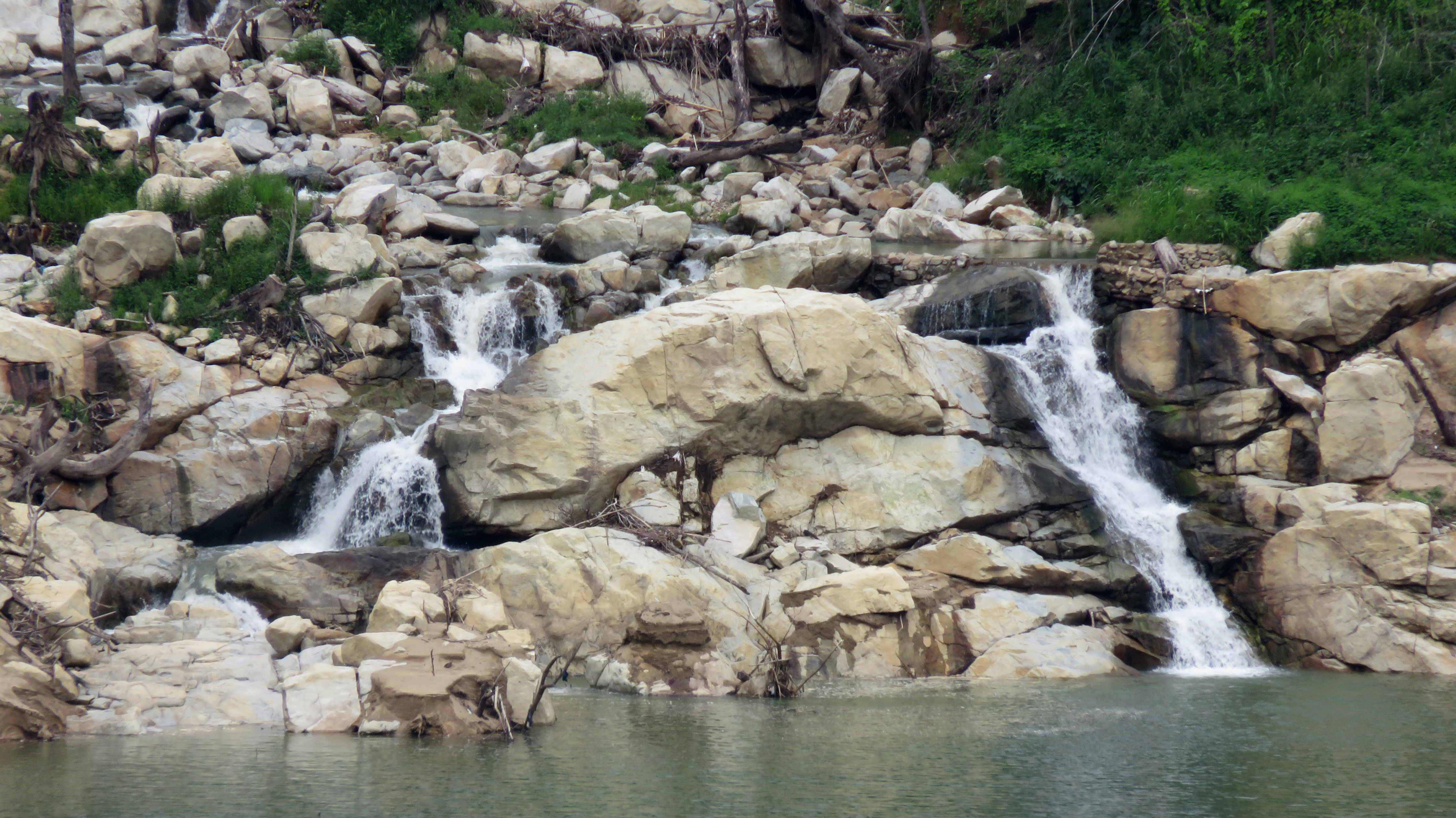
Waterfall into Song Bung 4 Reservoir.
Looking down at the QL-14D.
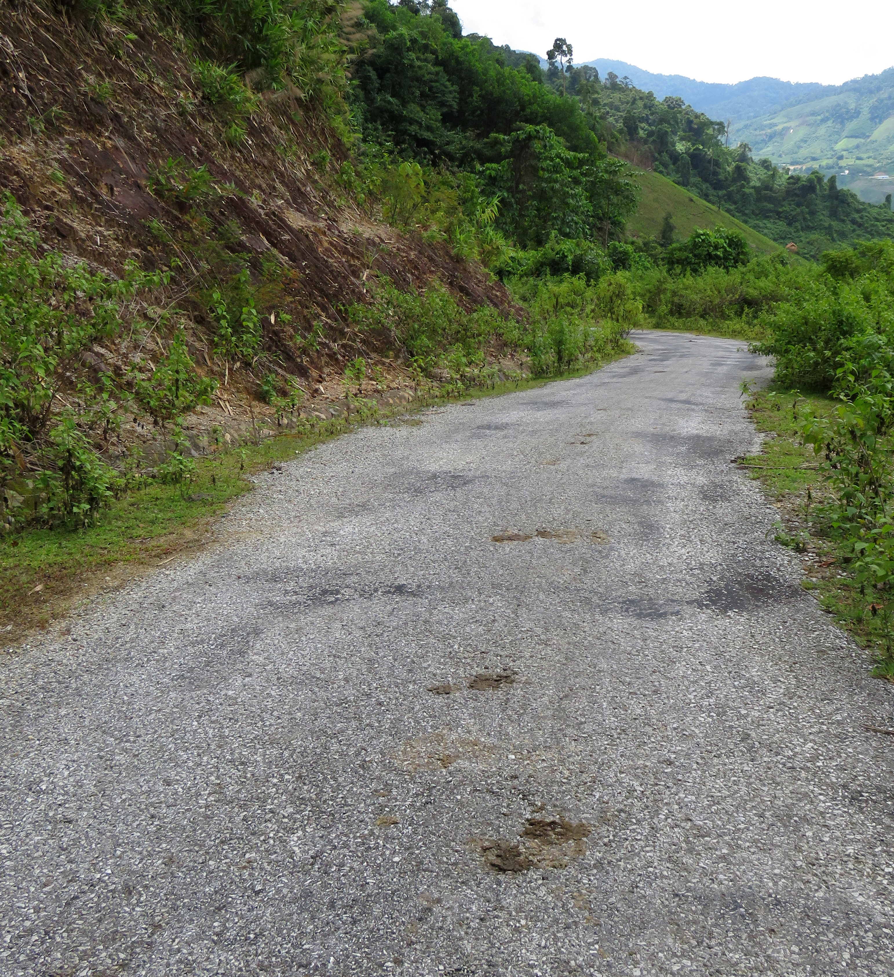
Typical section of road to Pa Pang Valley.
|
Looking down into the Song Bung river canyon.
|
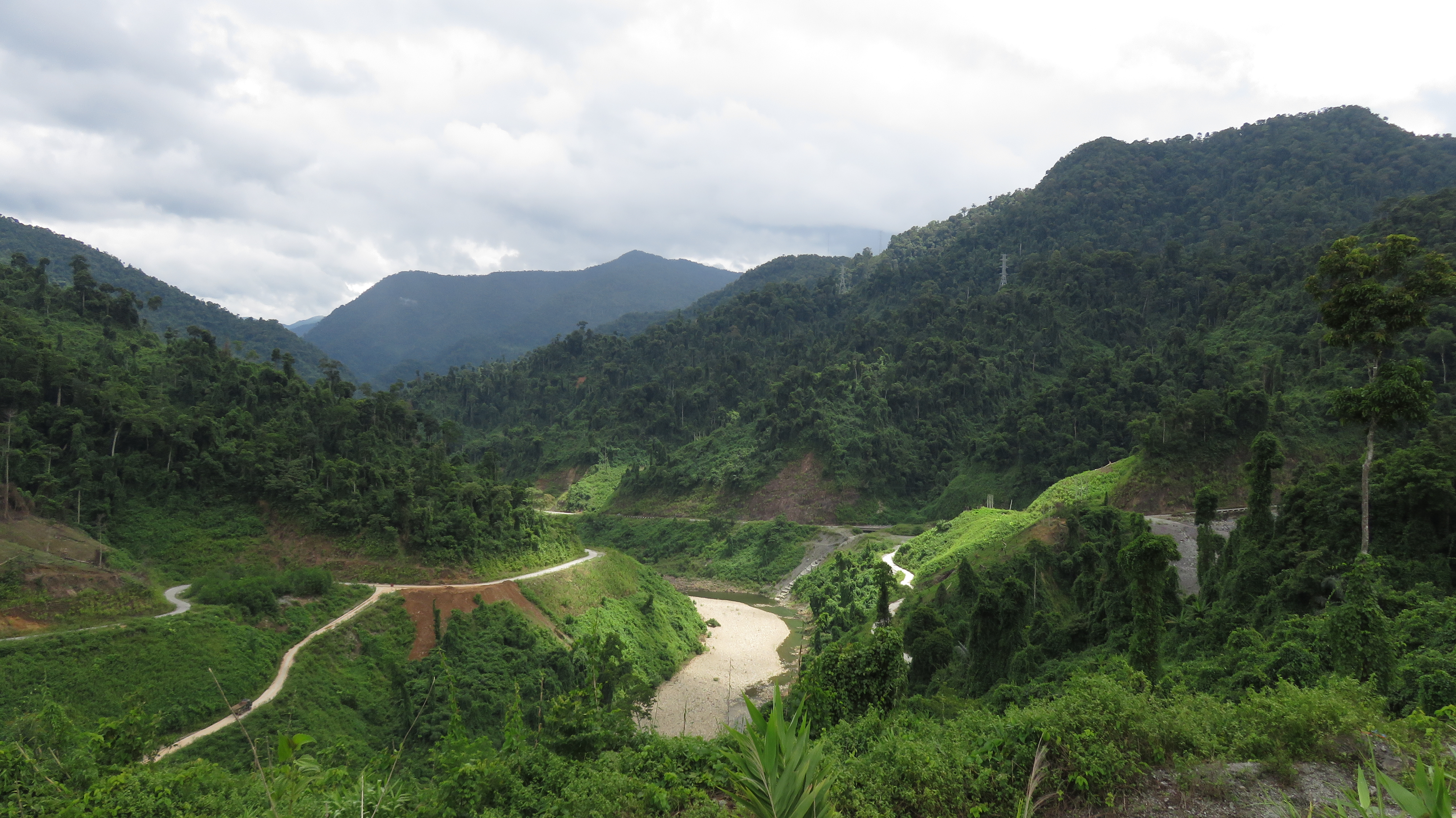
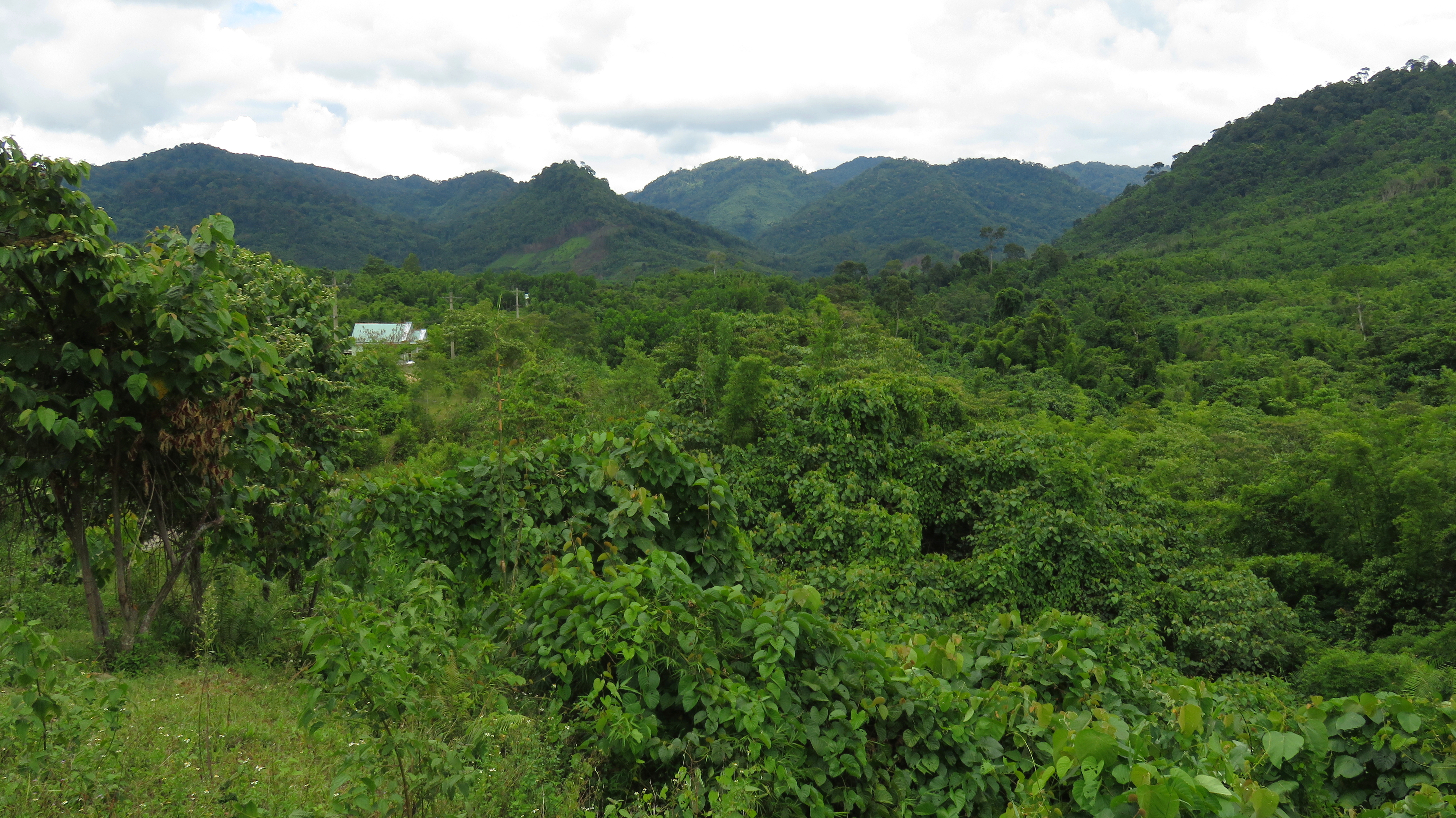
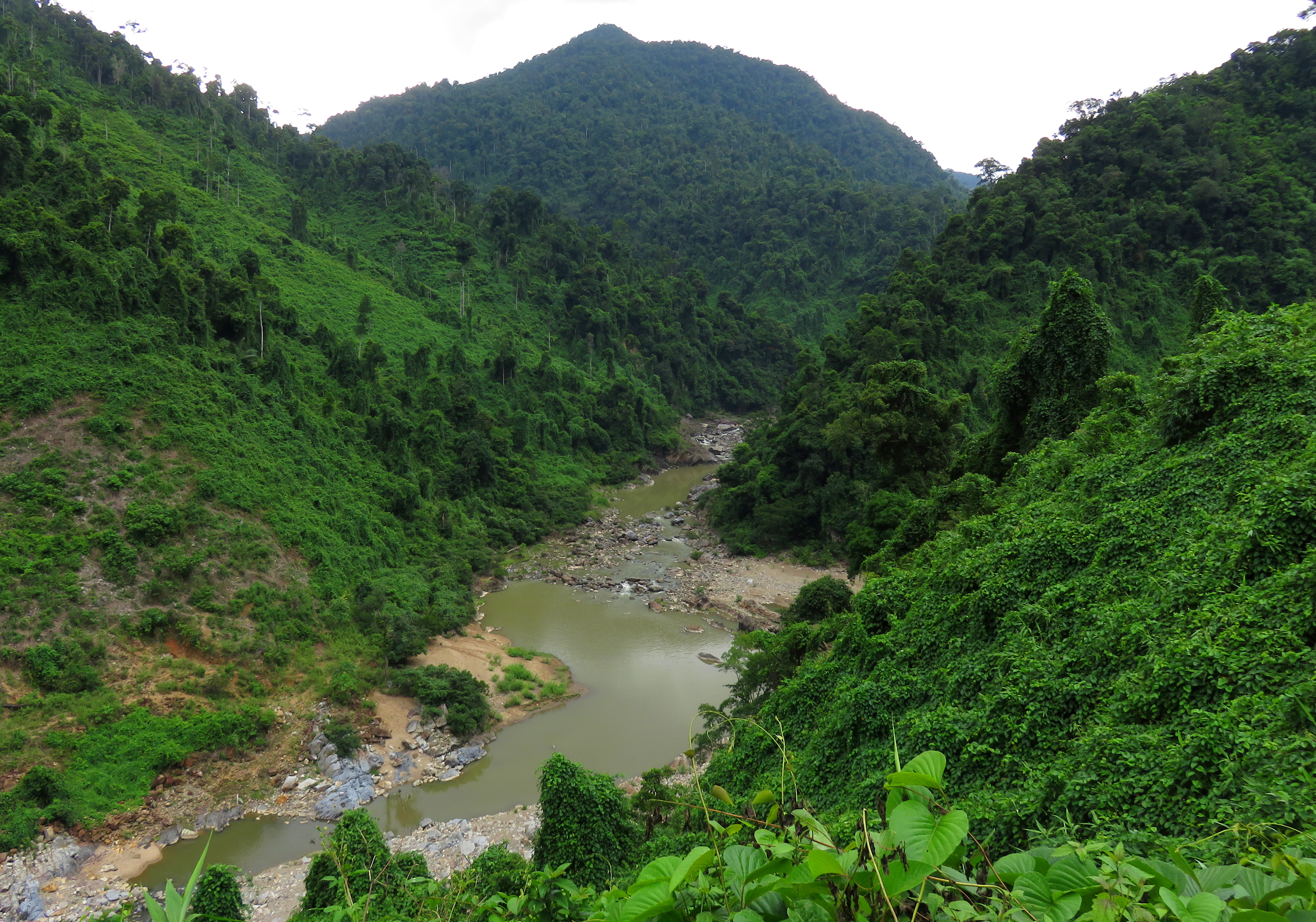
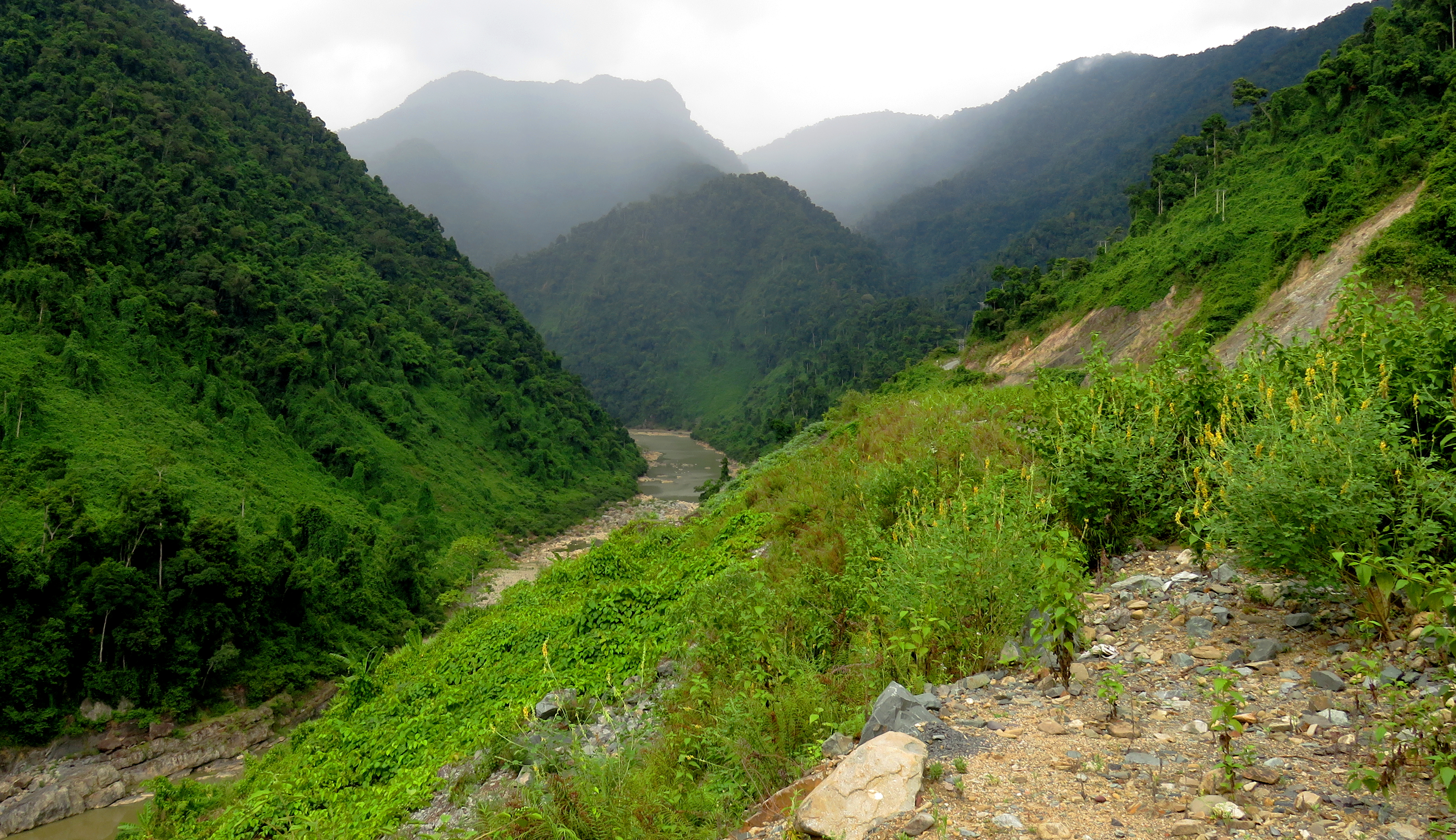
There are some sections of this drive that have seen logging, and some sections that are still wild mountain jungle. The lake at the bottom is the Song Bung 4 Reservoir, which fills the Song Bung river canyon, and the Pa Pang Road clings to the mountainsides of this impressive canyon. The Song Bung gorge dominates the topography of this part of Vietnam, with so many streams and valleys feeding into it. Far away across the canyon, I think I could see the 14-D, winding through the wilds near the town of Ta Ul, and far below I could see ghost forests in the former valleys of the Song Bung, testaments to once fertile river valleys drowned by the reservoir.
Another view down into the impressive Song Bung river canyon.

Tall trees and deep canyons. Nam Giang is a fantastic place.
Looking far off to the Ta Vinh Bridge on the QL-14D.
In the picture above you can see all the way down to the Cau Ta Vinh, a beautiful graceful bridge that you cross while on the 14-D. On a straight line distance, the bridge and place I took this photo are only a mere 10 km apart. However, to drive between the two places would take over an hour and would be 31 km of driving! The Song Bung river canyon is just that big and wild.
As it climbs up to the valley of Pa Pang, the road first winds it way up to a small "pass" on a large spine of mountain, before dropping down and into a sizable side canyon. Around the head of this, it breaks out on to a beautiful point where you can see the road into the Pa Pang Valley, some two canyons away. Then, the road begins twisting into another side canyon, this one much further back; once around the head of it, the road heads around a small point and in and out of one more side canyon before climbing up to the pass you could see from before.
As it climbs up to the valley of Pa Pang, the road first winds it way up to a small "pass" on a large spine of mountain, before dropping down and into a sizable side canyon. Around the head of this, it breaks out on to a beautiful point where you can see the road into the Pa Pang Valley, some two canyons away. Then, the road begins twisting into another side canyon, this one much further back; once around the head of it, the road heads around a small point and in and out of one more side canyon before climbing up to the pass you could see from before.
The final pass to Pa Pang is visible in the background left side of this photo. But first you have to wrap in and out of both canyons visible.
And, a closer shot from the point between the two canyons. The final pass to Pa Pang Valley.
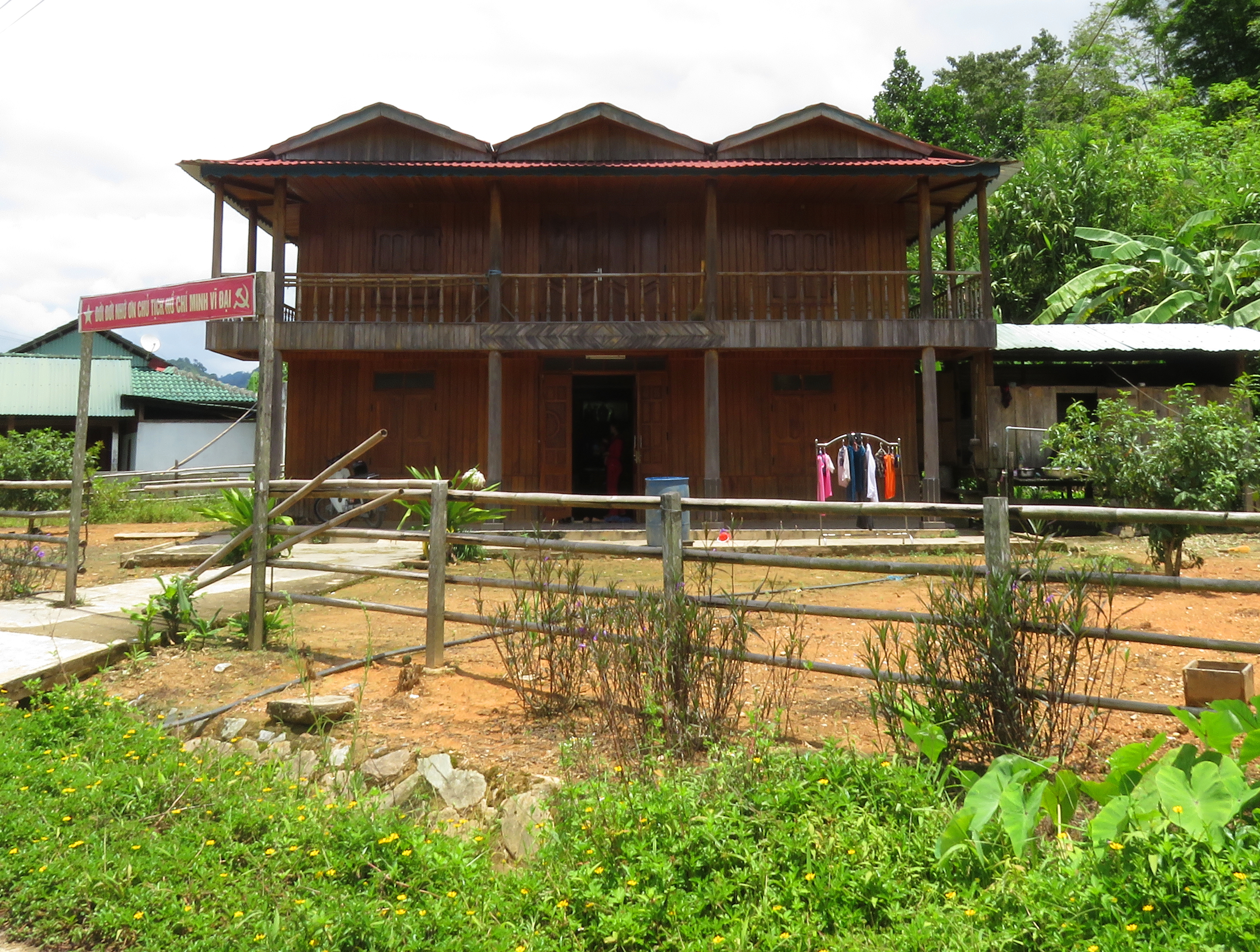
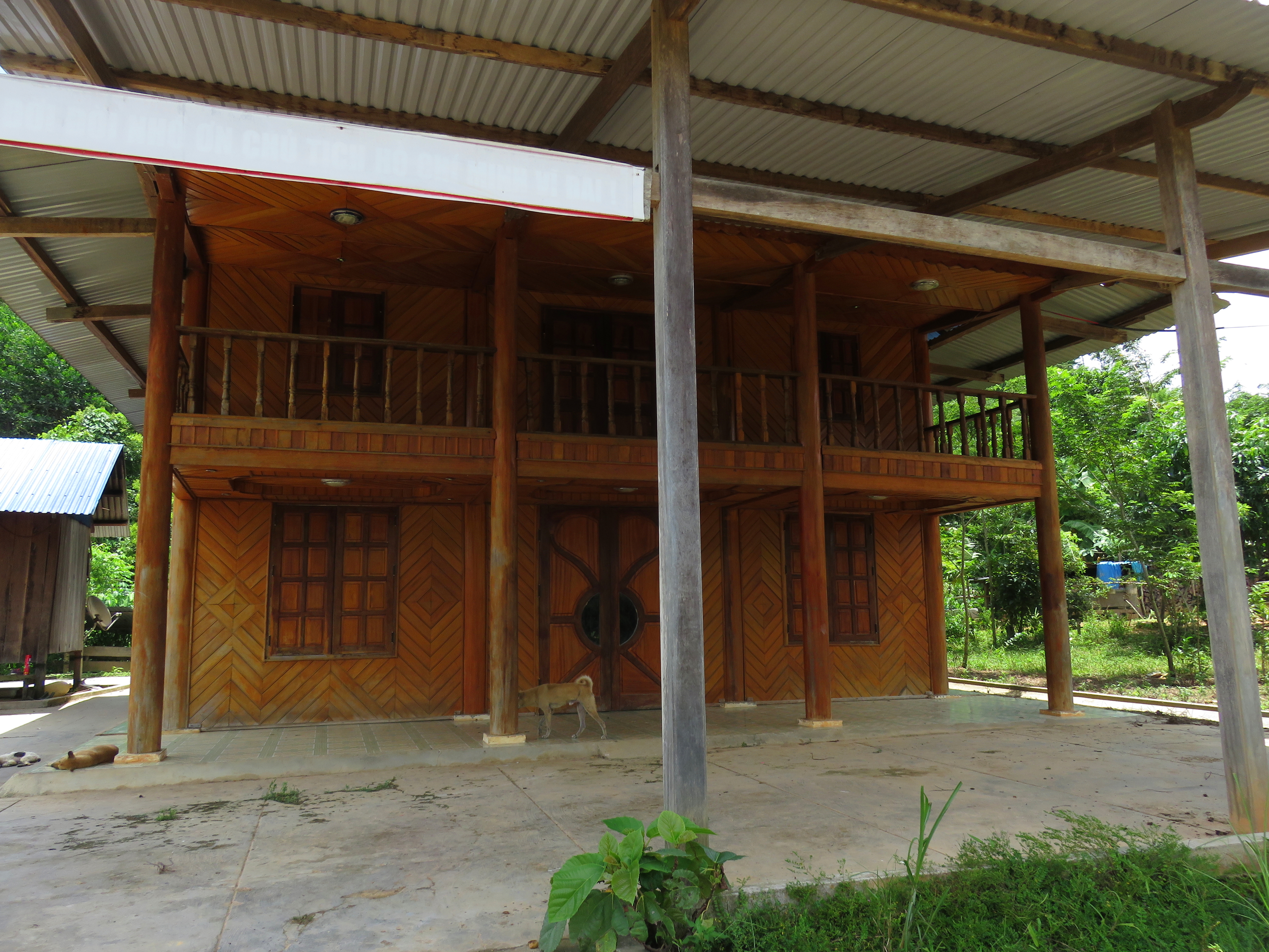
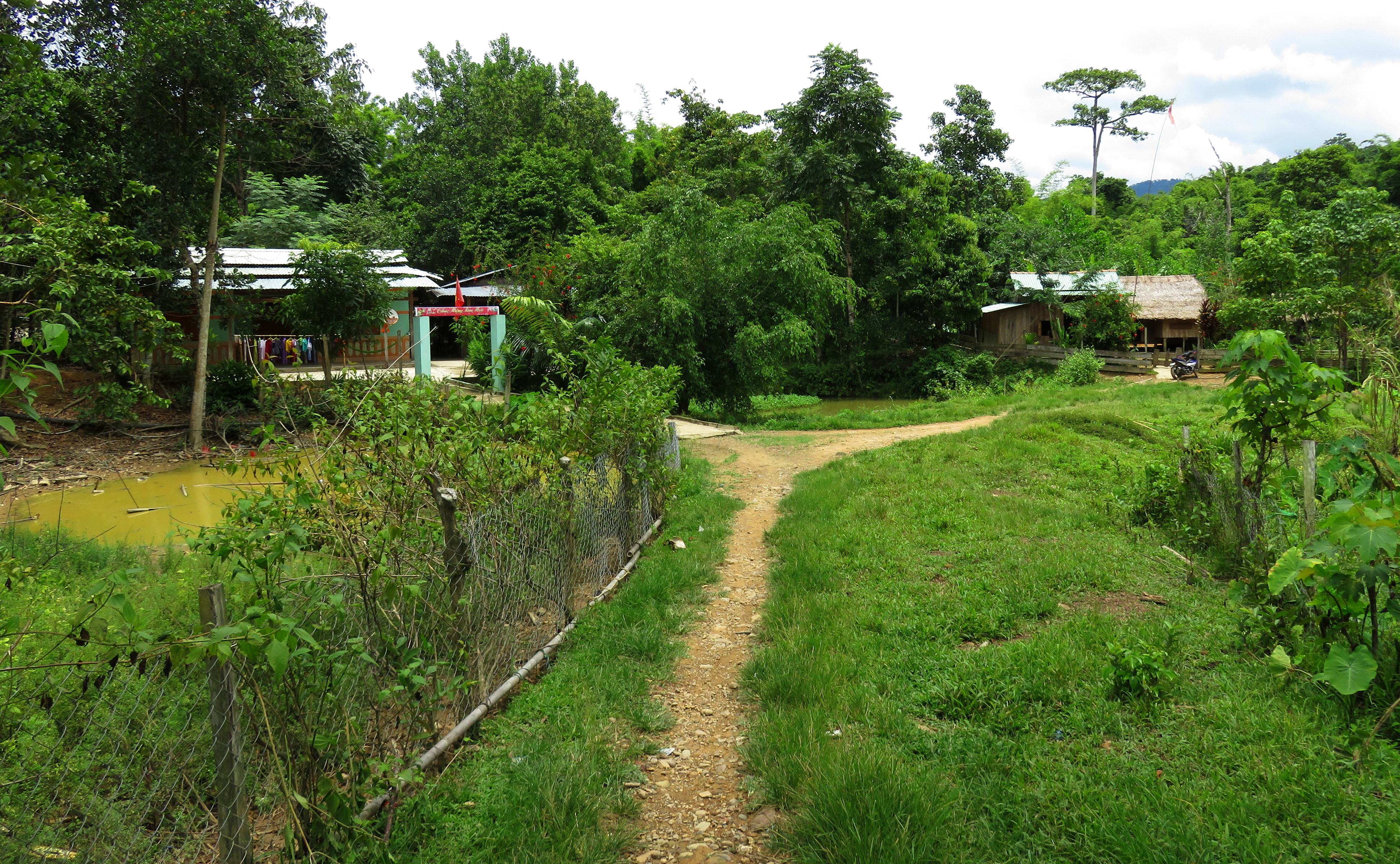
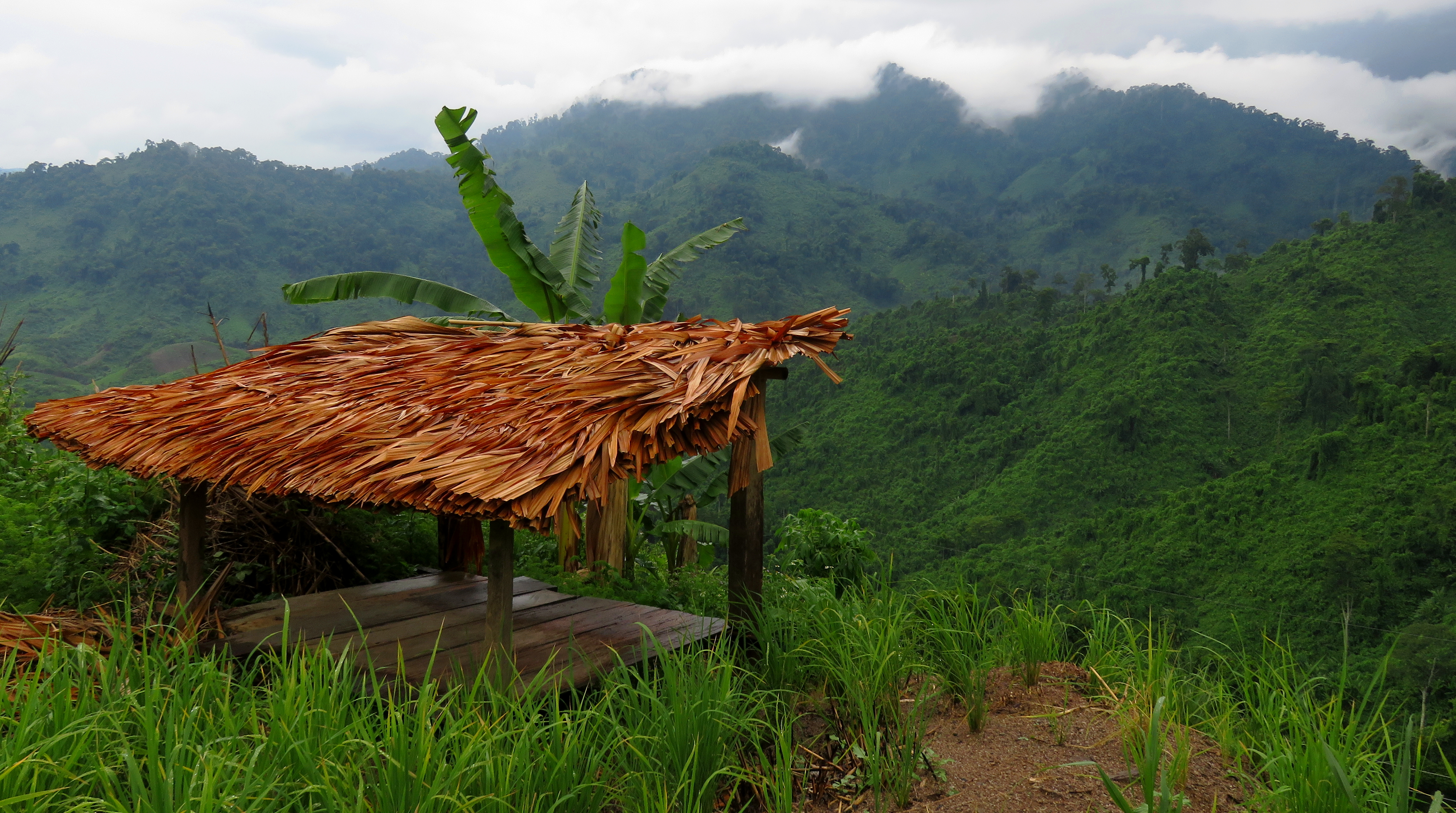
Finally, after one more uphill stretch, you climb up and over the final "pass" and begin dropping into the Pa Pang Valley. When I came up and over the rise, I didn't really know what to expect. Of course there was hope for an ultra-dramatic turn around a point, with a dramatic view of a gorgeous village in the bottom, but I knew this was just hopeful wishing. Instead, the road just sort of began dropping gently, and eventually some fields were passed, and then a shed, and finally around a gentle corner the first village came into view on either side of the road. This village had some very intriguing house designs, different from some of the others I've seen throughout the area. Here were many two-story affairs, built in a somewhat hybrid Vietnamese and Co Tu ethnic styling. Bricks and cement made up most the superstructure, but wood was used throughout in the decking, roofing, doors & windows, and design trim. Right away were several houses, each with its own design and flair, but all possessing the same attributes. The classic plank over the doorway was present as well.
|
|
All: Houses in Pa Pang #1 Village. The cement block style is very Vietnamese. but the wood-work is much more common amongst ethnic people in the area.
|
|
The Pa Pang Valley was originally settled by the Co Tu, and they had been in this valley for quite a few years. However, during the construction of the Song Bung 4 hydroelectric project, numerous villages along the fertile bottoms of the Song Bung had to be relocated, much in a similar manner to those evicted by the construction of A Vuong Reservoir, not too far away. One of these relocation villages was in Pa Pang Valley. But there is still an interesting question of where the money in this village is coming from, as it is clear from this first group of houses that there is definitely a fair amount of money here. One house even had a fairly new Toyota car sitting in front of it. Perhaps someone is getting rich from lumber trading and has shared the wealth with the village. Either way it was very interesting have driven so far out to such a remote place and yet still see signs of obvious money. I thought for a second that perhaps this village was home to Kinh Vietnamese, and not Co Tu, which could help explain it a bit, but just a few houses down I came across the famous neu pole in front of a house, the central symbol of religious significance in any Co Tu village.
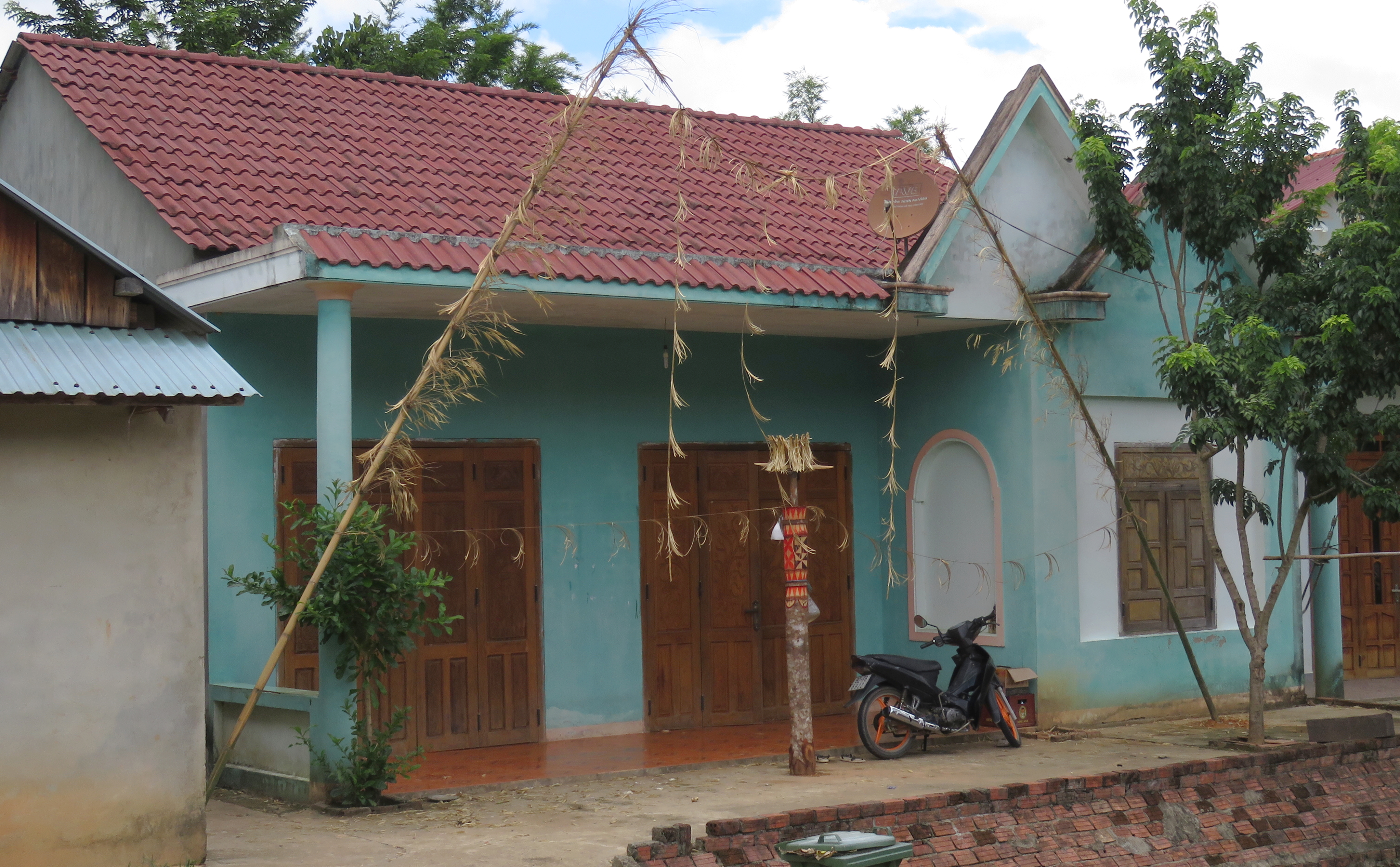
Neu pole in front a house in Pa Pang #1 Village.
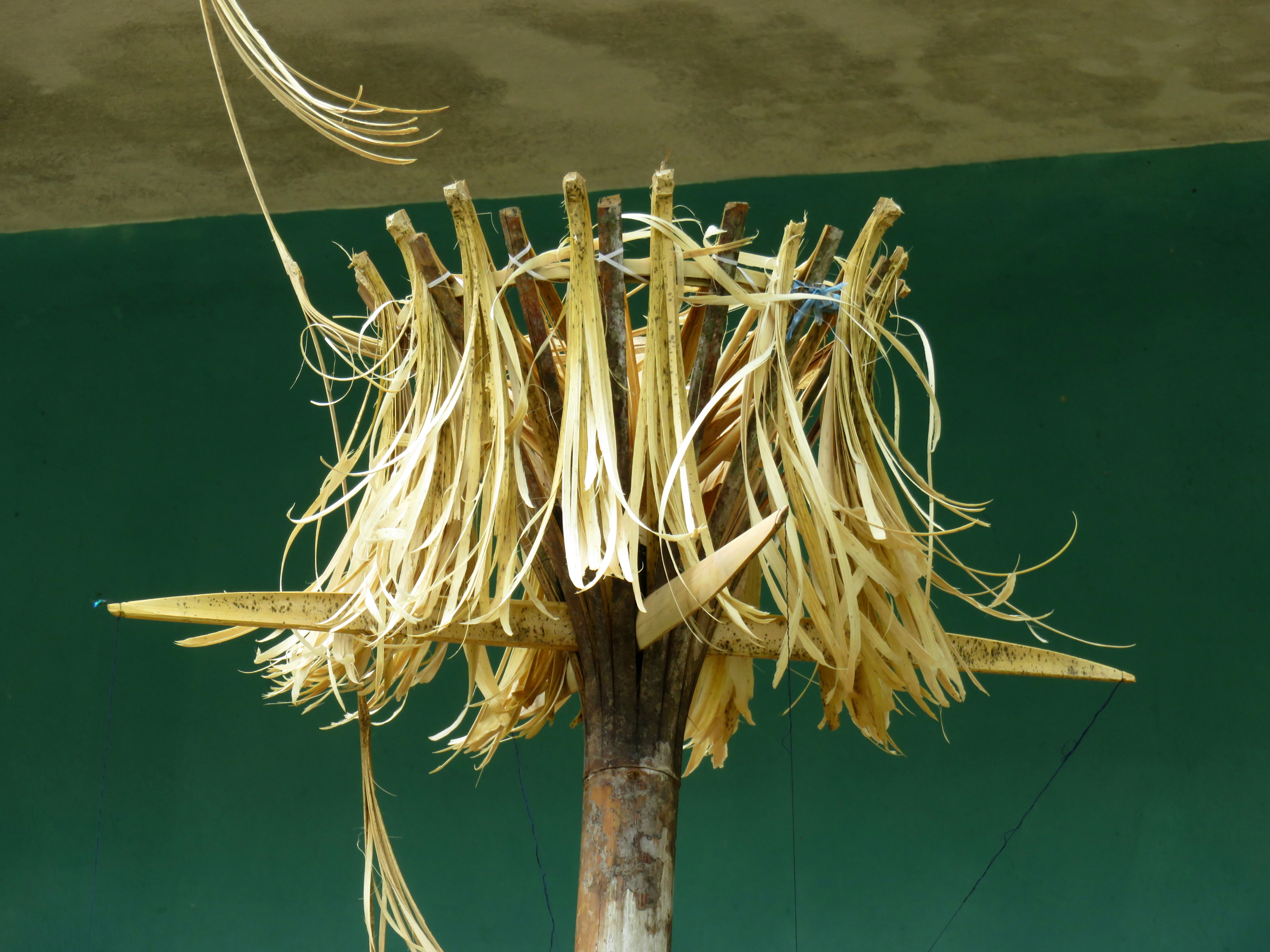
Close up of the neu pole.
|
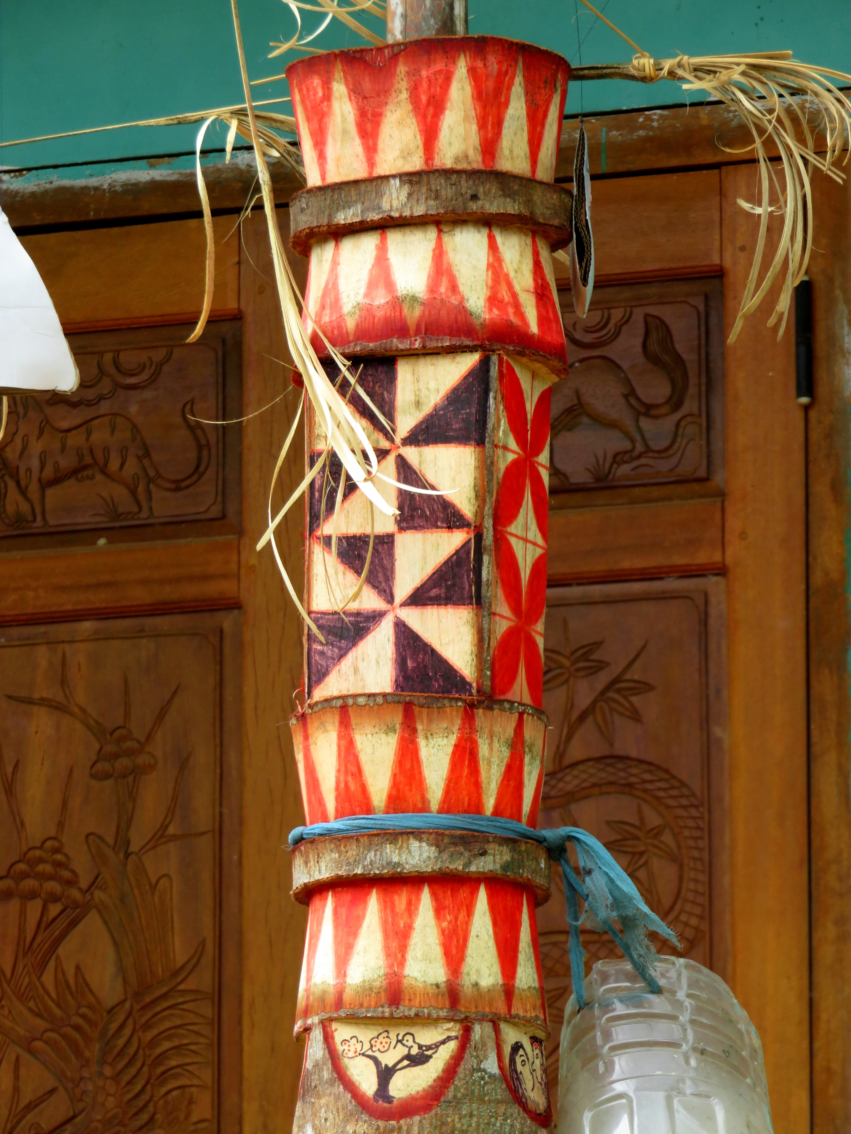
Beautiful design work.
|
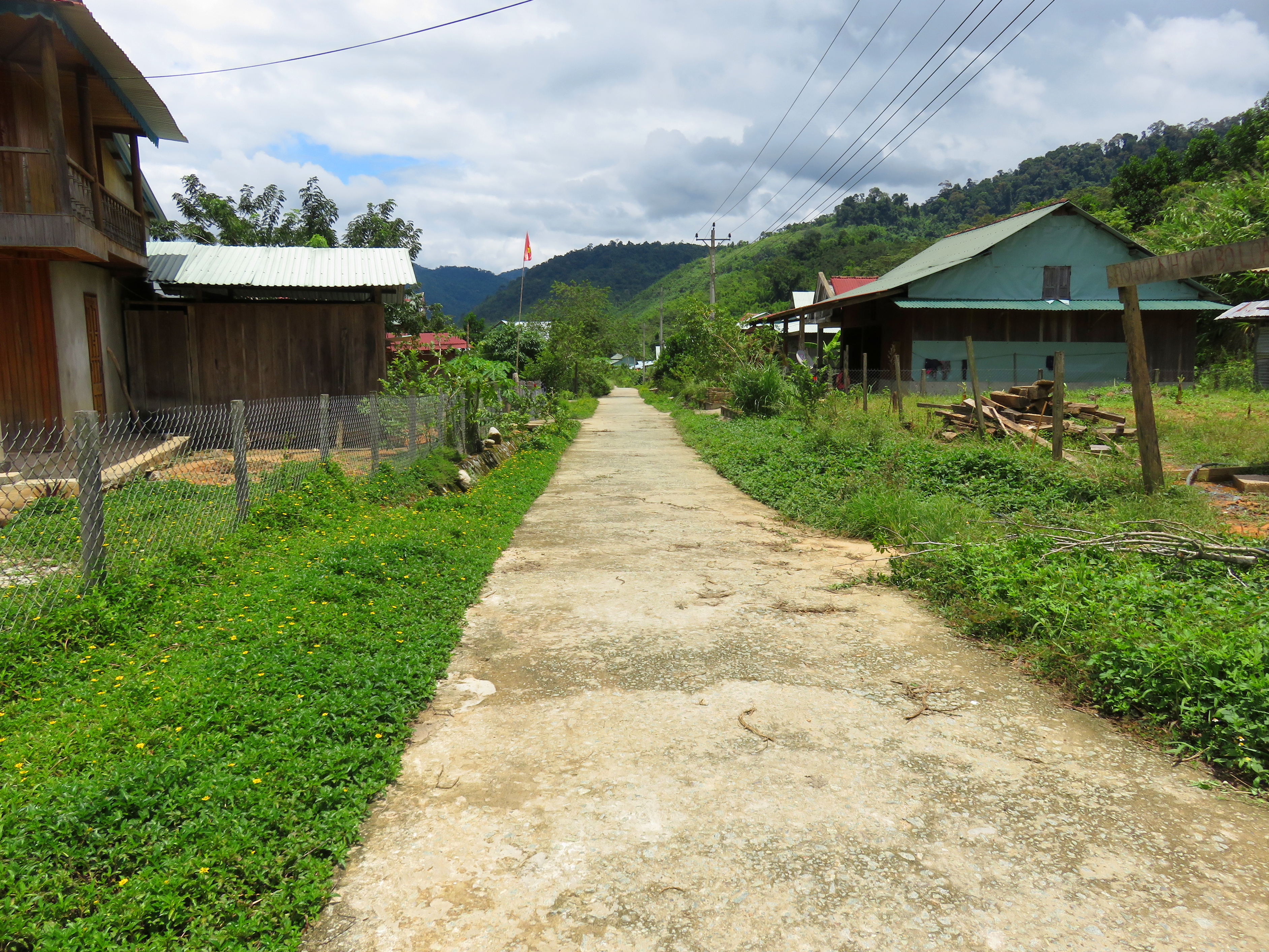
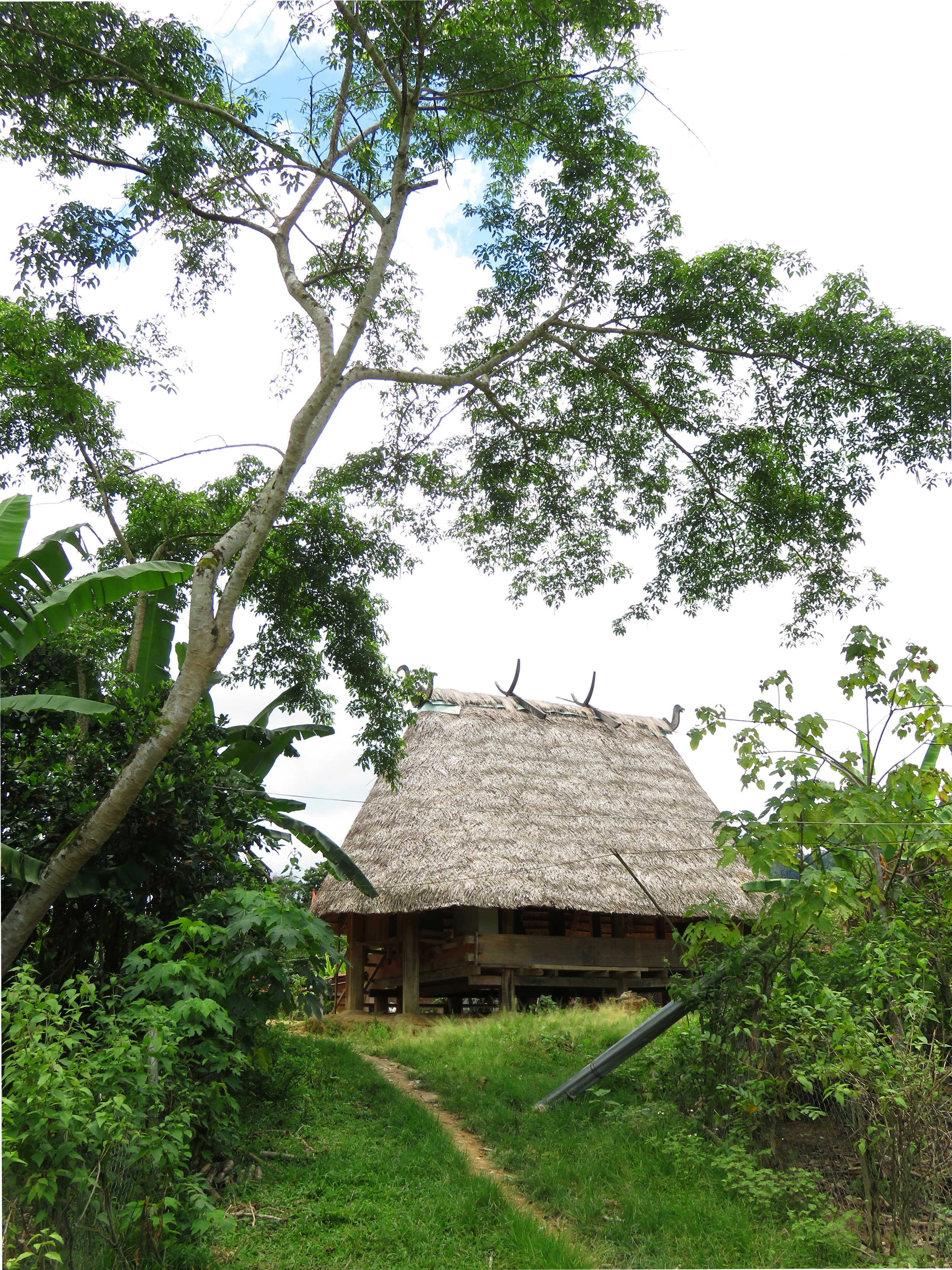
After saying hello to some locals, I kept on motoring, soon passing a Goul on the left. Down the hill, alongside one of the thickest and most verdant bamboo groves I have seen in Vietnam, and through some classic Vietnamese rural countryside (fields and cows and buffaloes and rice paddies) soon brought me to another village, this one being Pa Pang 2. This one looked much more like a classic Co Tu village, with simple, single storey wood dwellings. The road went right into the center of the village, and dead-ended directly in front of the Goul for this settlement. It was very curious to see the two communal houses so close together- they couldn't have been more than two kilometers apart. If I had to wager a guess, I would guess that the first village I came to was likely the older of the two, and pre-dated the reservoir, and that the second, or lower village, is a resettlment village of folks from the former Song Bung river valley. I am not sure but based on the difference in development levels of the two villages that is what it seems like to me.
Goul and Pa Pang #2 Village.
|
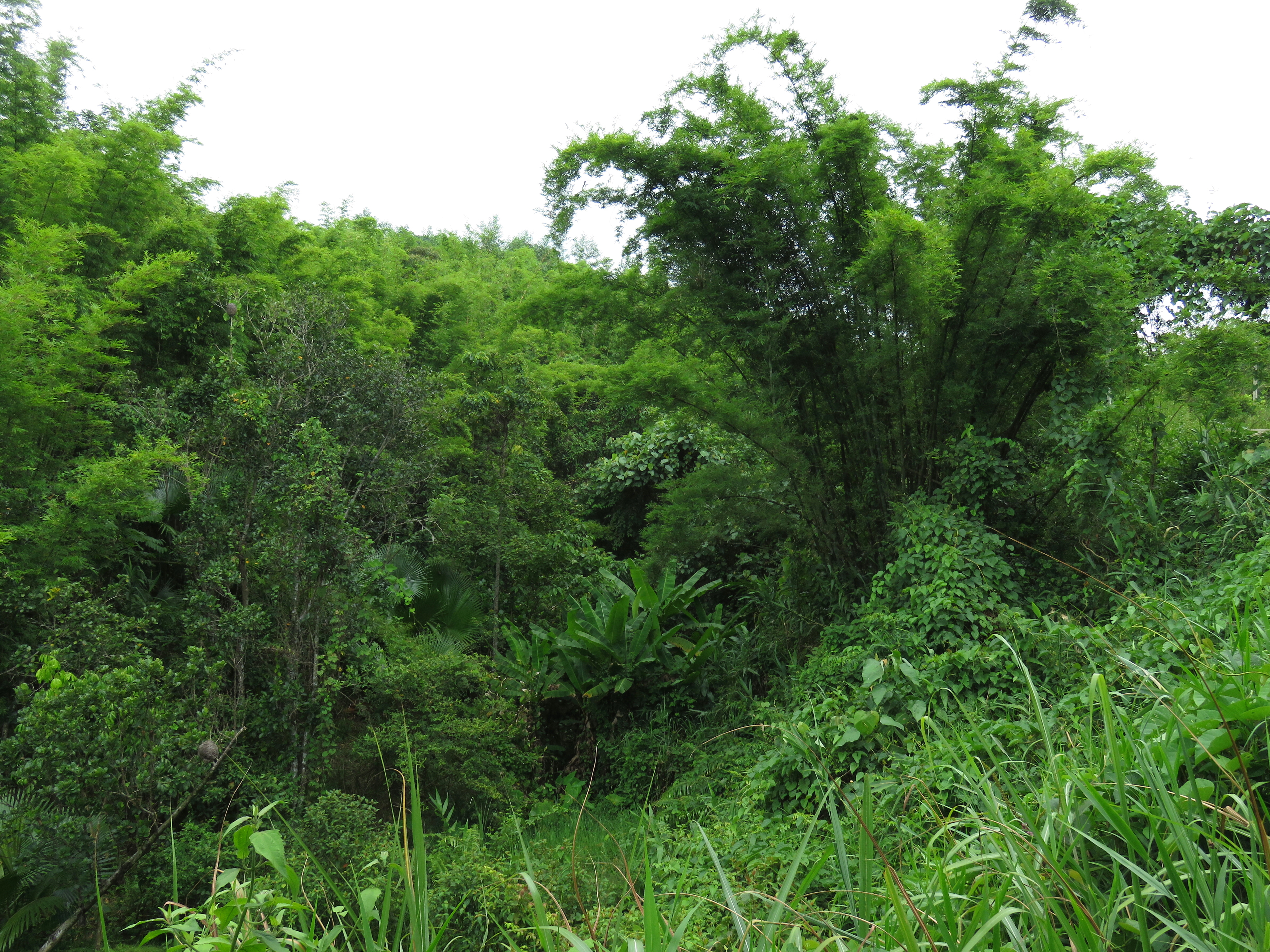
Verdant bamboo groves.
|
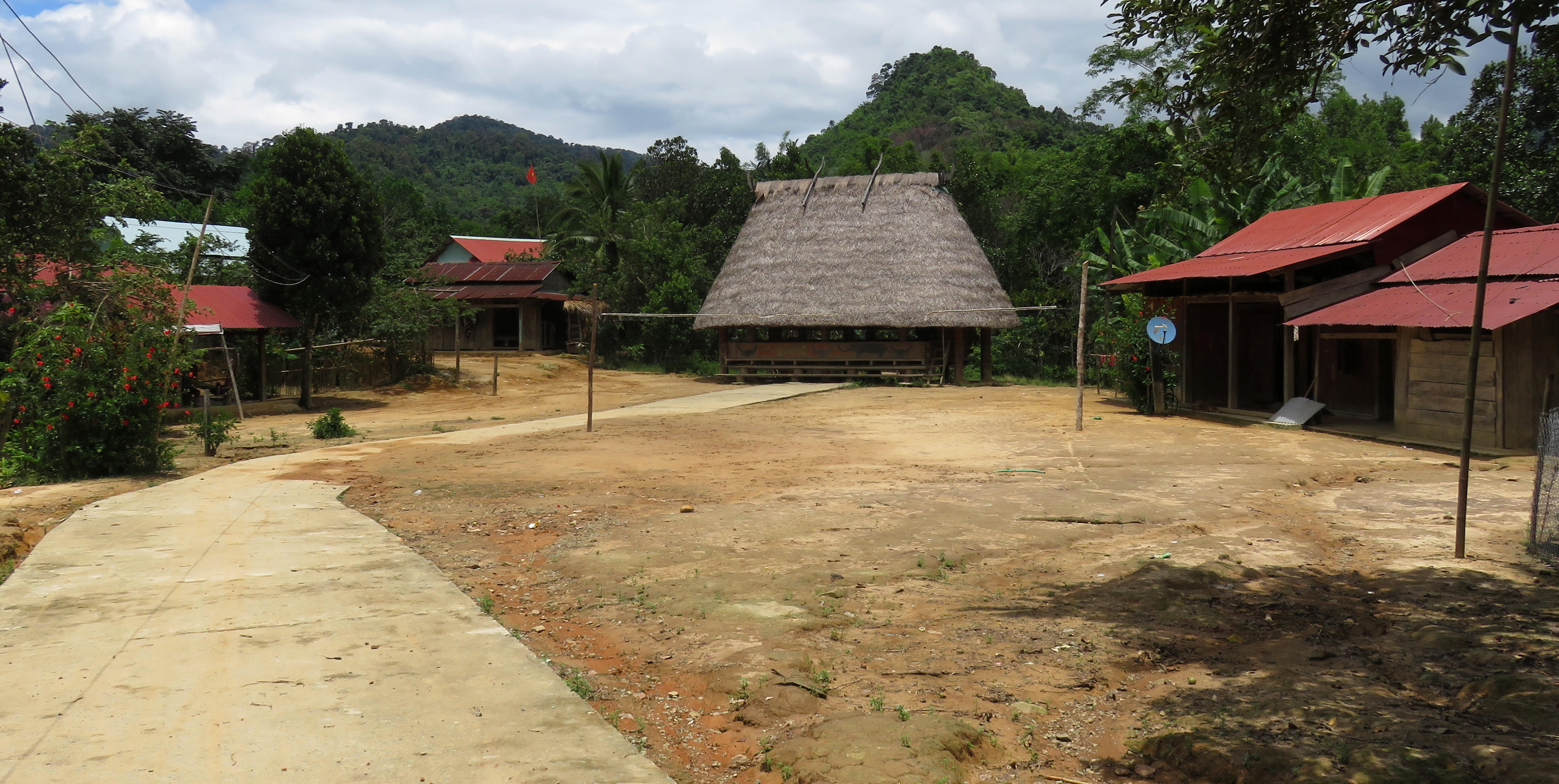
Goul and downtown Pa Pang #2 Village.
|
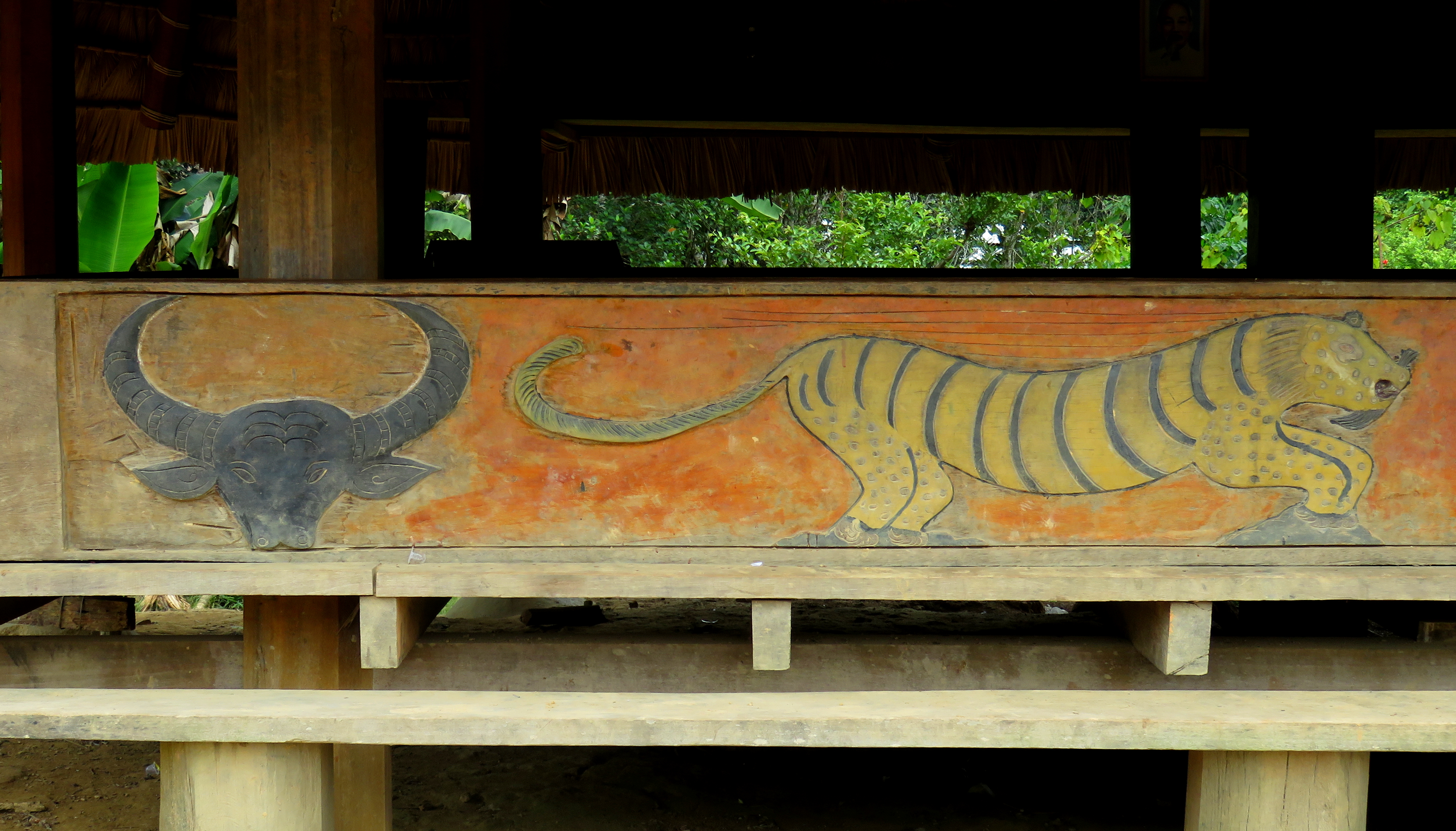
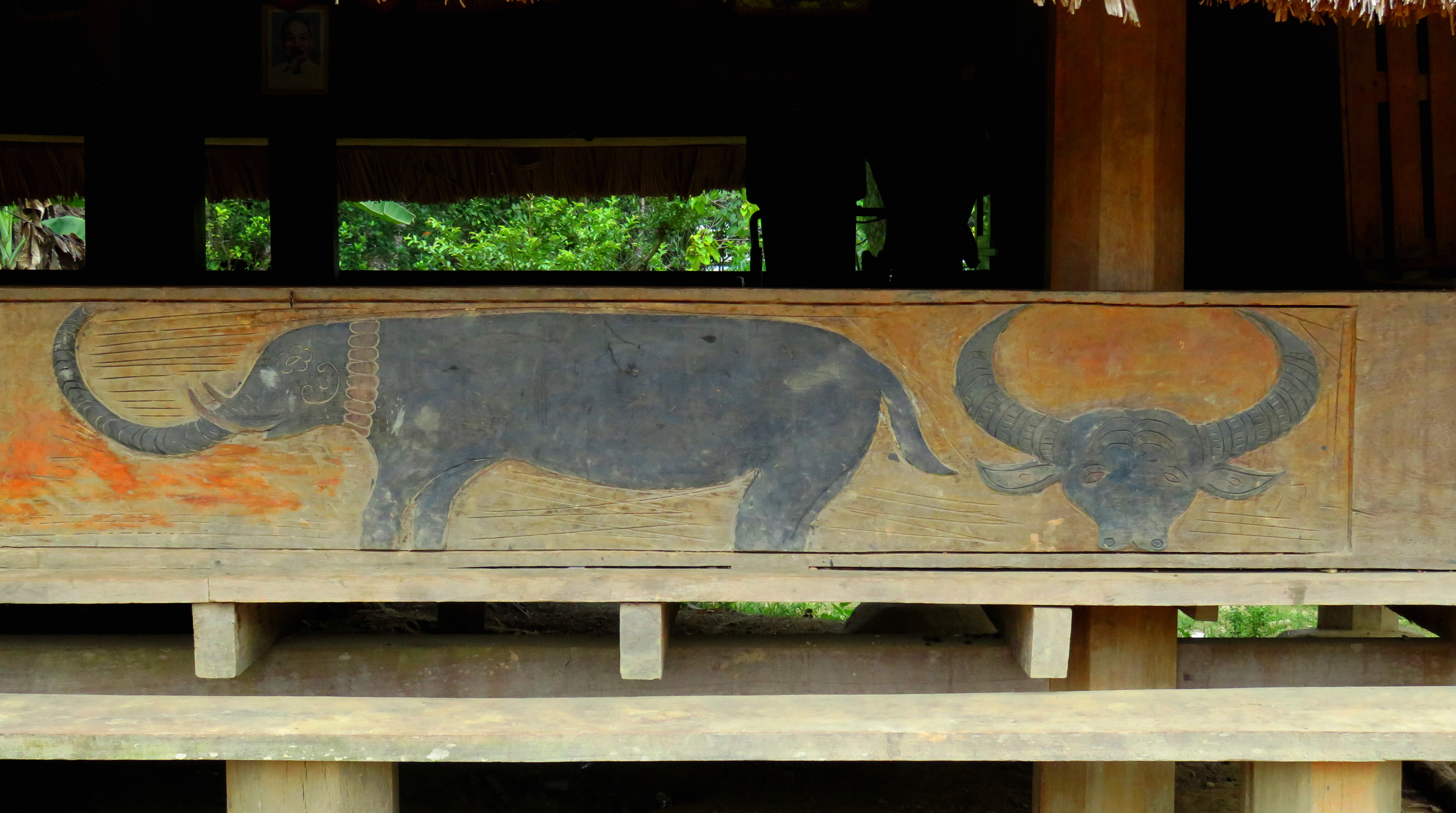
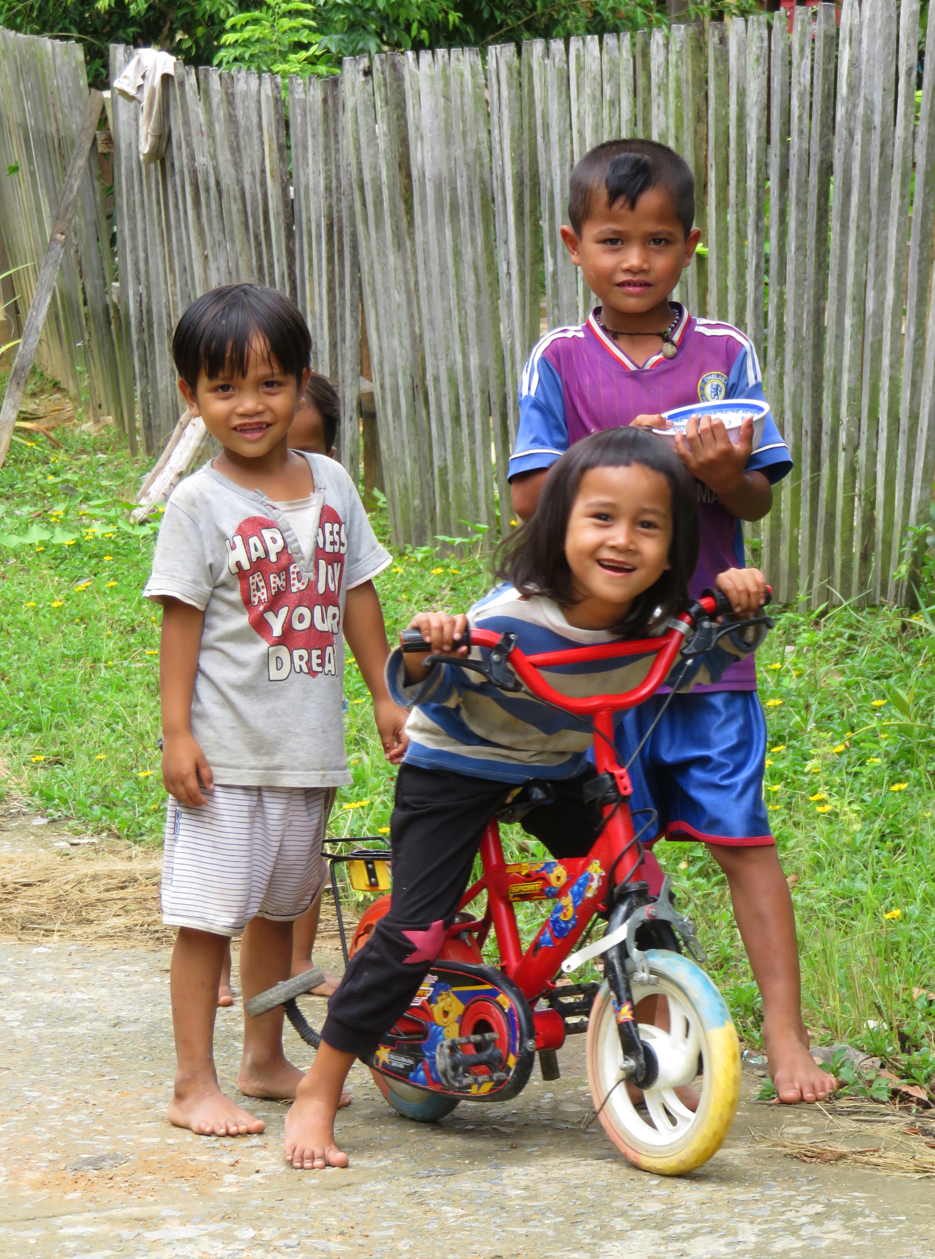
Parking my bike in front of the goul, I stuck around for a couple of minutes, talking to some local boys who strolled over to check me out. They were quite friendly, but their Vietnamese was as bad as mine, and my Co Tu language skills are non-existent, so we tried to talk, enjoyed some laughs and they let me snap a photo of them. This goul had some interesting designs painted on it, figures of animals including buffaloes, elephants, and tigers. After reaching this valley it is not hard to imagine this landscape at one time being home to certainly tigers, but perhaps even elephants, in addition to the ubiquitous Southeast Asian staple, the buffalo. The paintings were a bit faded but with some post production they came out quite nice.
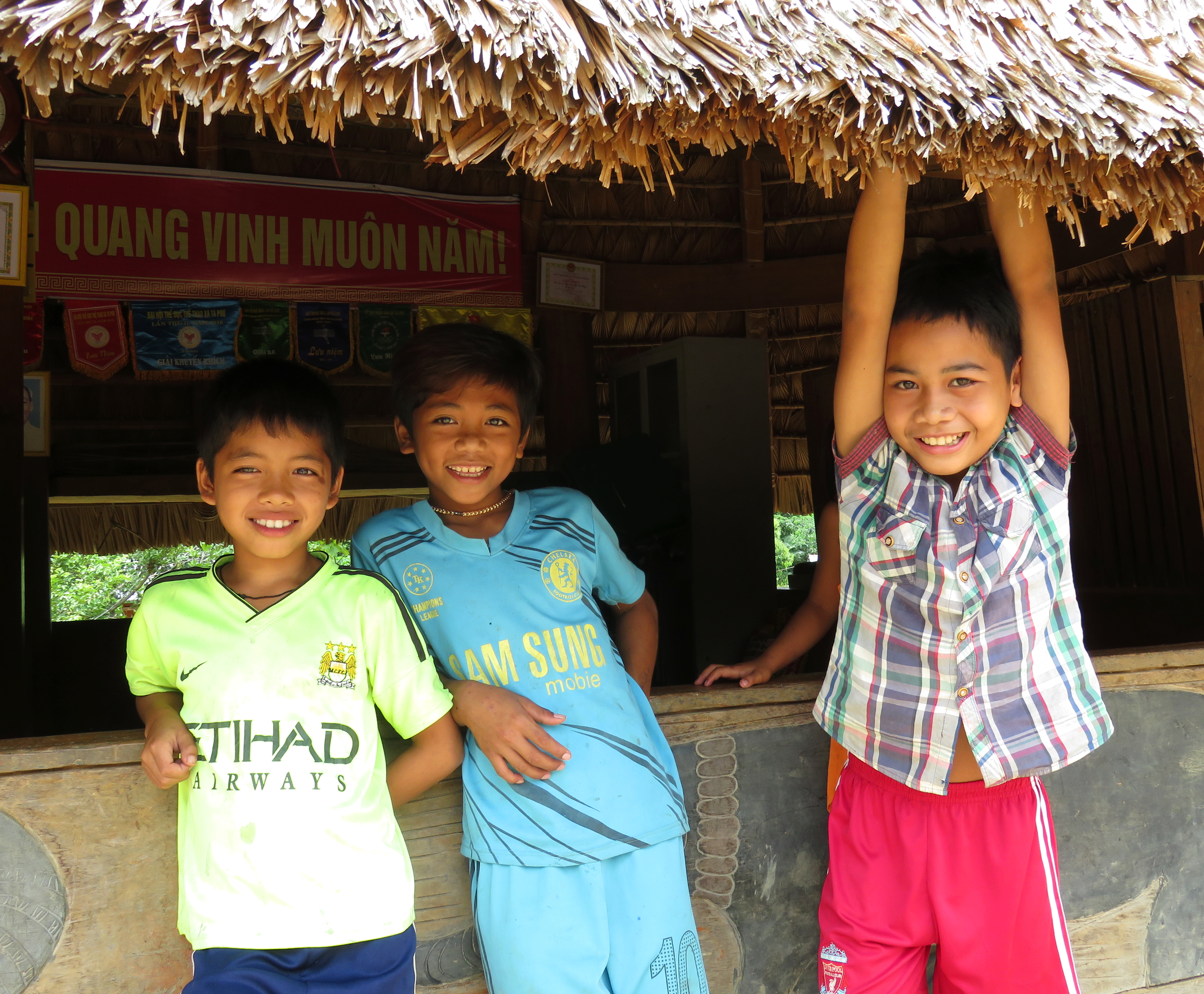
Friendly boys in Pa Pang #2.
|
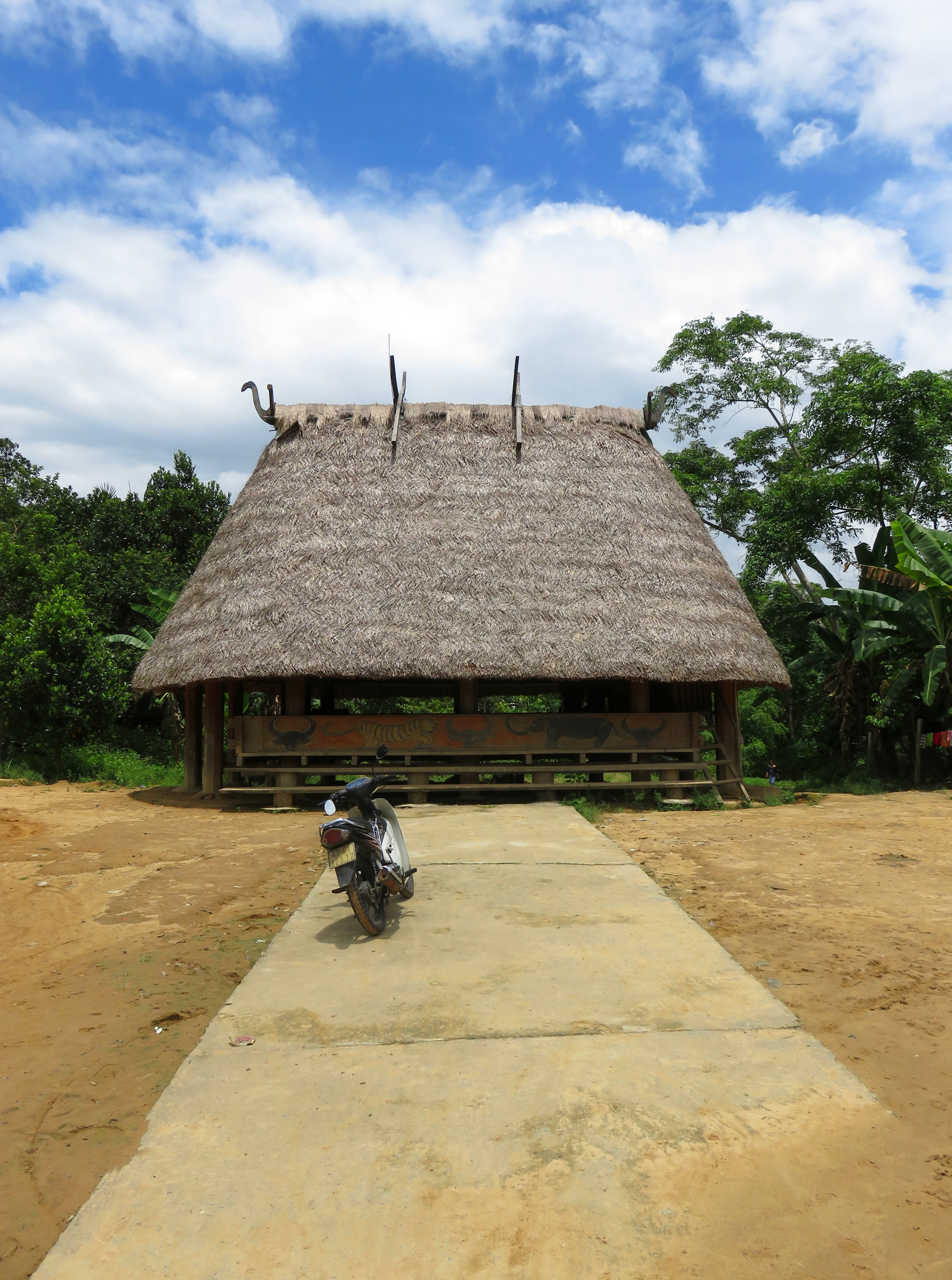
In Pa Pang #2 all roads lead to the Goul. Ok, the only road.
|
|
|
Pa Pang #2 Goul.
|
Whenever I reach these far-flung ethnic villages, I often times try to just quietly walk around and limit my impact as much as possible. Sometimes when I roll into a village, I quickly become the magnet of attention for everyone in the village, and I end up swarmed with plenty of friendly, curious people. But if I can get the chance, I will try to quietly slip into the background. This enables me to see the village from a different side, as it is on any other day when a random foreigner doesn't drive up into the middle of town. So after saying goodbye to the friendly boys, I saw an opening and took a quiet walk through the rest of the village. The trail led past several small farms, each with a personal rice paddy, a small pond, and a small assortment of livestock.
The trail kept going down, deeper into the jungle, after the houses and farms ended. With having a short time window, I only walked for about 20 minutes down the trail, until I reached a nice quiet spot along the stream. It wasn't anything super spectacular beauty wise, but it was very quiet (except for the nature sounds of course) and peaceful, so I enjoyed my few minutes in the meadow, had a nice safety meeting, and then reversed my course. |
Trail deeper into Pa Pang #2.
Pa Pang Valley.
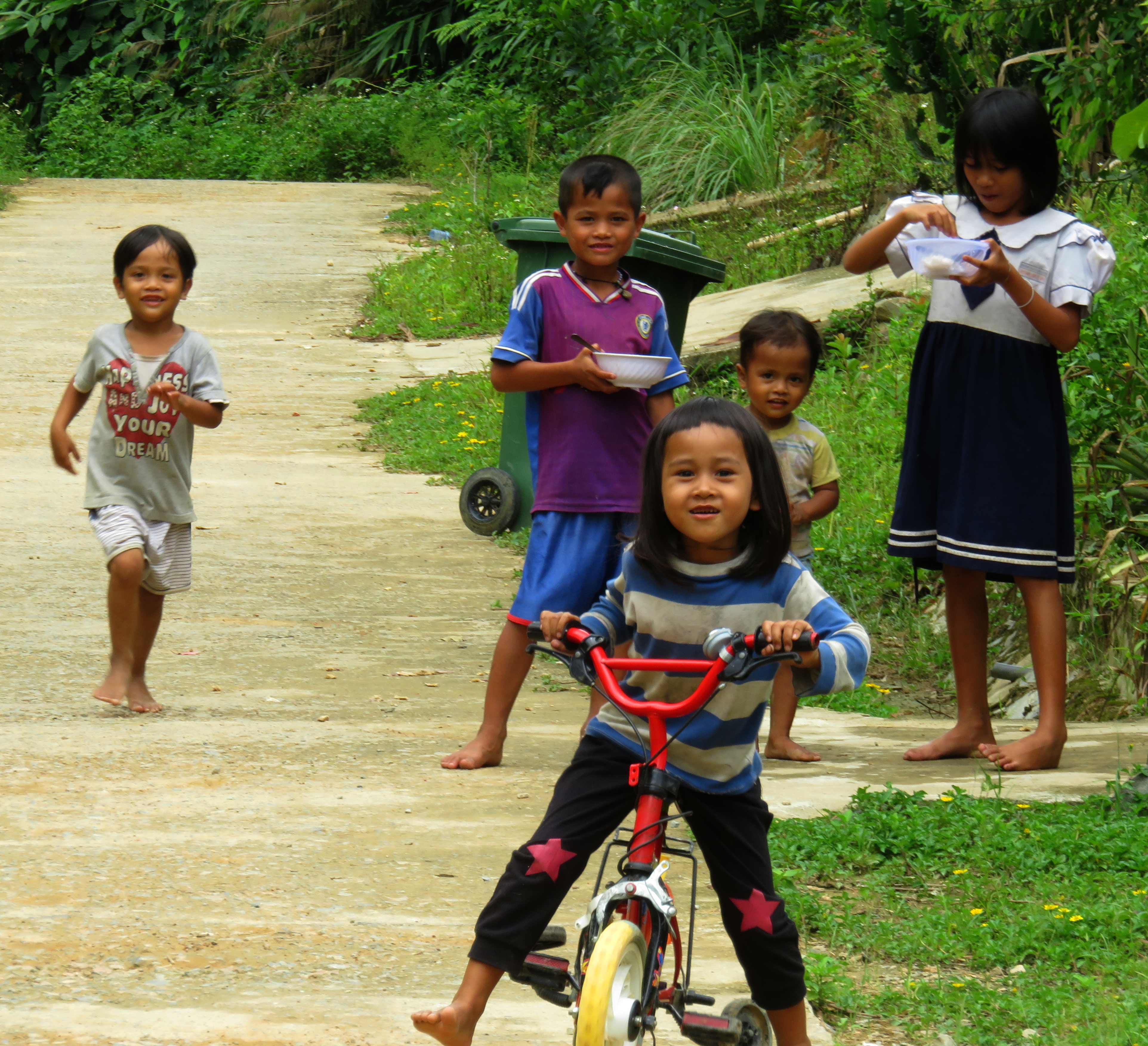
Getting back to my bike, I stayed long enough to say some greetings to some locals, and then started my way back out. Along the way, between the two villages, a group of kids came around the corner and showered me with "Hello!'s", so I had to stop and talk to them for a little bit. They were all super friendly, and soon enough the rest of the family came out of a nearby house to talk to me. One of the men spoke very broken Vietnamese, but his daughter happened to speak it quite a bit better than he did, so between the three of us we ended up having a decent conversation. Amongst the many questions on both sides, one I asked was, "how many foreigners have come to this village?" I always enjoy hearing the answers, because sometimes villages a much more popular than people would imagine, and other times I find out I am on a very short list of foreigners to visit some places. After talking between themselves, they said that foreigners had been to the village before, but not for almost 10 years. For all the kids, I was the first white person they had ever seen or talked to, and they couldn't stop talking about my beard and my dark skin. It was a very humbling- and still entertaining- moment to say the least.
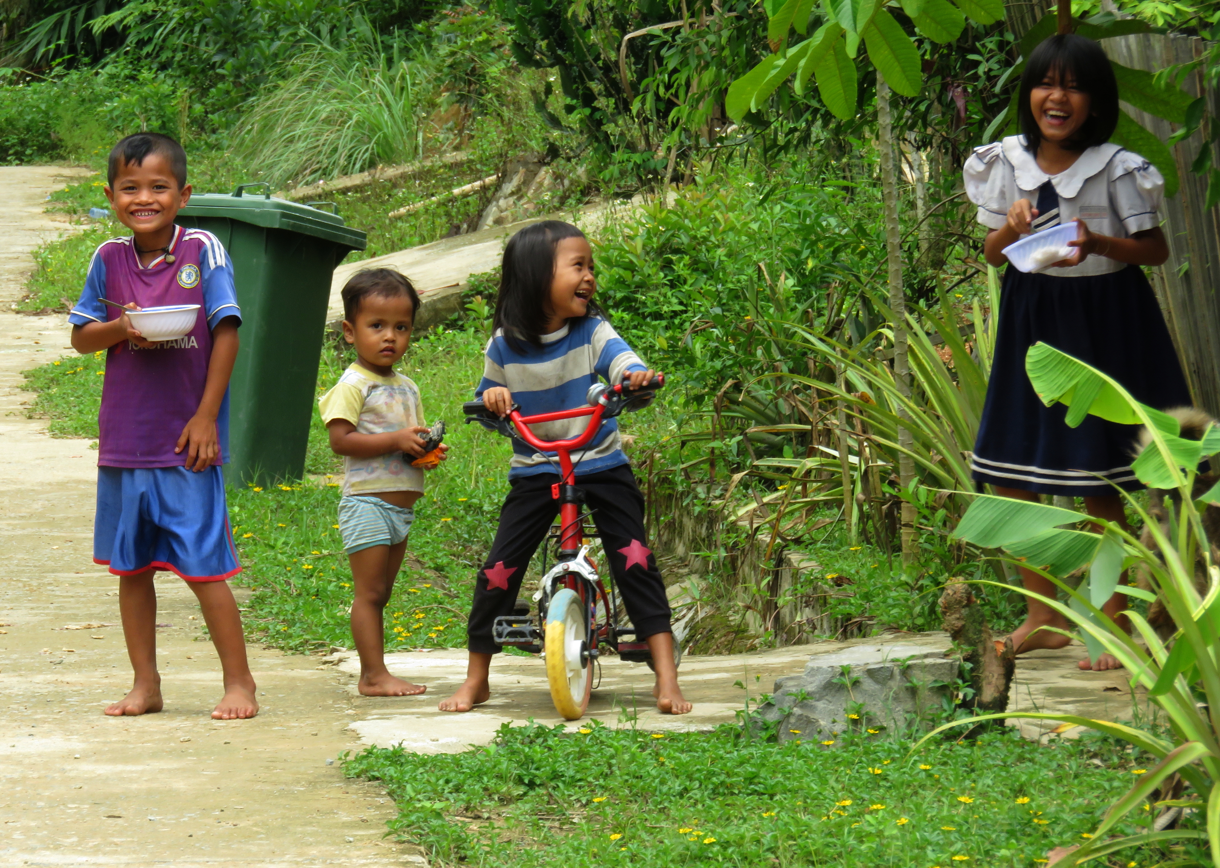
All: Friendly children in Pa Pang #2.
|
|
However, my timeline was calling, and needing to be back in Da Nang at an early hour had me back on the bike too quickly, and back down the road I headed. One stop was necessary at a beautiful waterfall that had been passed on the way up. The cool mountain water was too powerful to resist, and letting it pour over my head and neck was a welcome relief from the heat and humidity, which despite the elevation (almost 600 m) was still unrelenting. The moss on the rock behind the falls was pretty incredible too, and very photogenic.
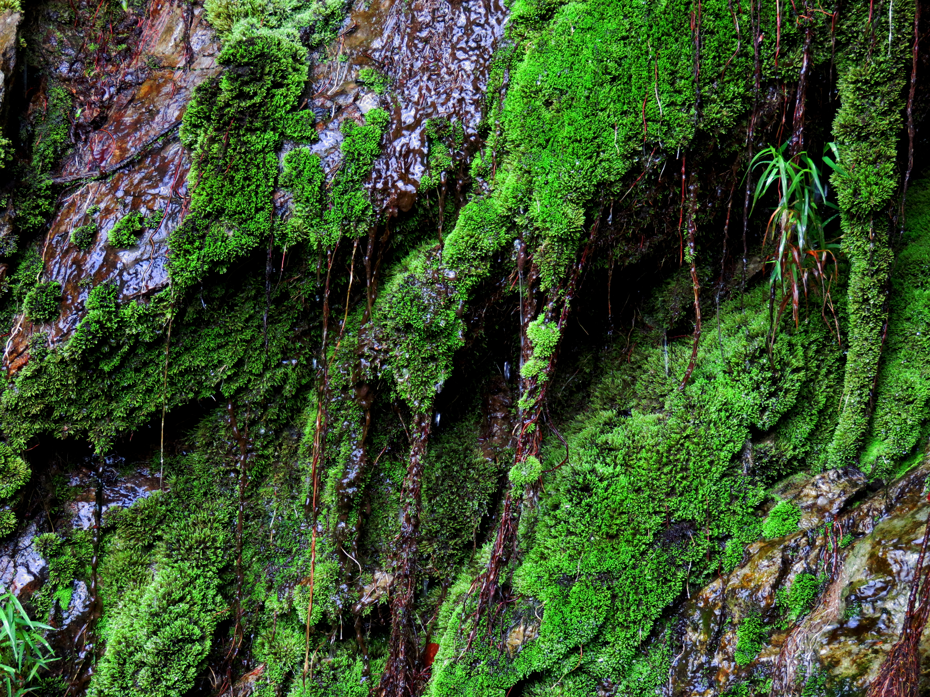
Mossy waterfall along the road.
The Song Bung / Song A Vuong Confluence
One reason the timetable for the day was so rigid was because Pa Pang Valley was not the only place on the list. After completing the trip to the valley, the next item on the list was the confluence of the Bung and A Vuong Rivers. These two rivers drain almost the entirety of northwestern Quang Nam, an area that is home to many villages, towns, valleys and wild places, as well as numerous road and civil engineering projects. It is an area of Vietnam that is very dear to me, and after having spent the last six years exploring in and around the basins of these two rivers, one place that had eluded me was the actual confluence of the two. Followers of the Hindu religion believe river confluences to be sacred, as a joining of energies and a focal point between the planes of the real world and those of other existences as well. I personally am not a Hindu, but I can understand the draw and power that these places can have, especially if they are set deep inside large river canyons.
Looking up the A Vuong River. The Song Bung enters from the bottom left.
And so for me, reaching the confluence of these two rivers was a bit of a personal fufillment in some ways. It meant finally reaching a place I had seen for so long on maps, a veritable terra incognita that was finally known, and even though both rivers have been emasculated by nearby hydropower projects, the physical confluence remains, set deep in the Song Bung Gorge. This spot is accessible by road, thanks to the Song Bung 4 project, who's power plant is located just a kilometer down from the confluence, which is currently unreachable due to a rather unfriendly security guard and his dogs.
Looking down the Song Bung canyon. Song Bung 4 Power Plant is just out of view in a side canyon on the right.
This really is a bummer as the Song Bung Gorge through here is quite majestic- the walls are large and steep, the vegetation is lush and surprisingly majority old growth, and it has the "immensity" generating feeling that can leave people breathless. However, it just means that for the adventurous few that do get out to this place will be all but guaranteed to have it to themselves. The confluence is about 1 km downstream from the bridge below the Song Bung 4 Dam, so as you come down from the valley, instead of turning right, to return to QL-14D and Nam Giang, turn left and follow the concrete road, first to the confluence, and then to the security guard's shack. Once you are done return the way you came, keeping to the east/left (looking up) side of the dam as you approach. It should take about 10 minutes to get back to the 14-D.
Small day shack on the 14-D.
The Map
All photos copyright Kit Davidson.
All maps copyright Google MyMaps.
All maps copyright Google MyMaps.
