
Song Rao Quan - "Lower Canyon"
|
Section Length: ~ 5 km
Put In: Thuy Dien Quang Tri 2 Take Out: Da K'Rong River confluence |
Difficulty: Class II+ (1x IV and 1x V-)
Est. Flow: too low < 500 < 10,000? < too high Paddlers: Alfonso Perez, Cuong Huu Tran and Kit Davidson |
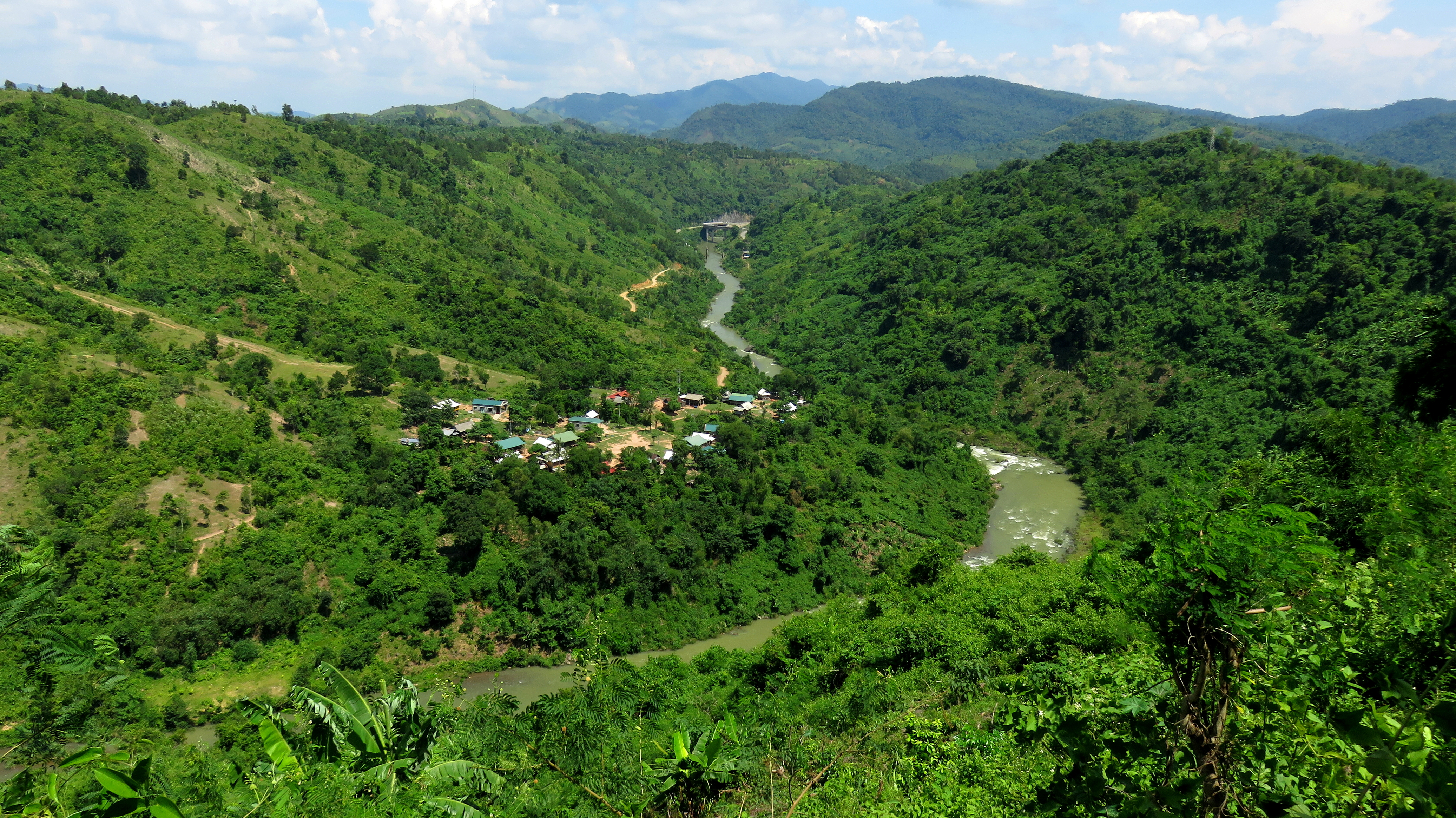
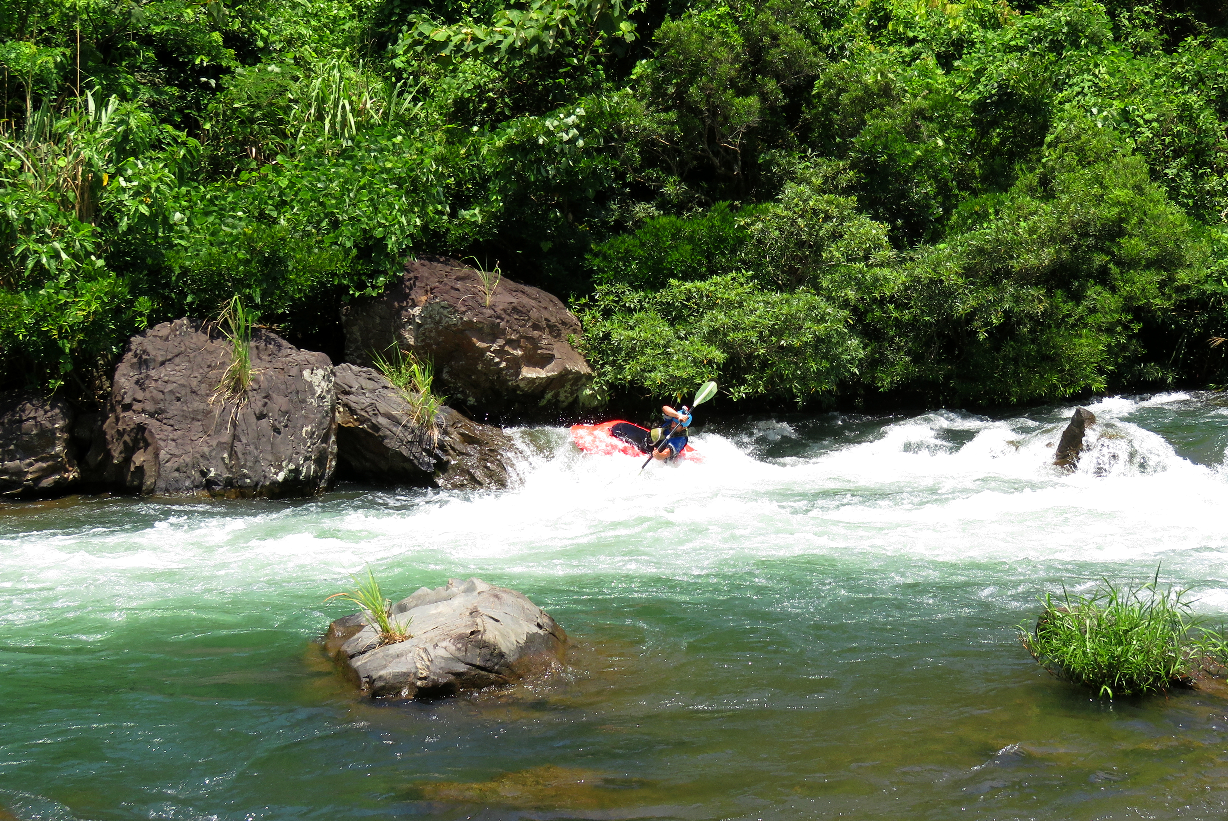
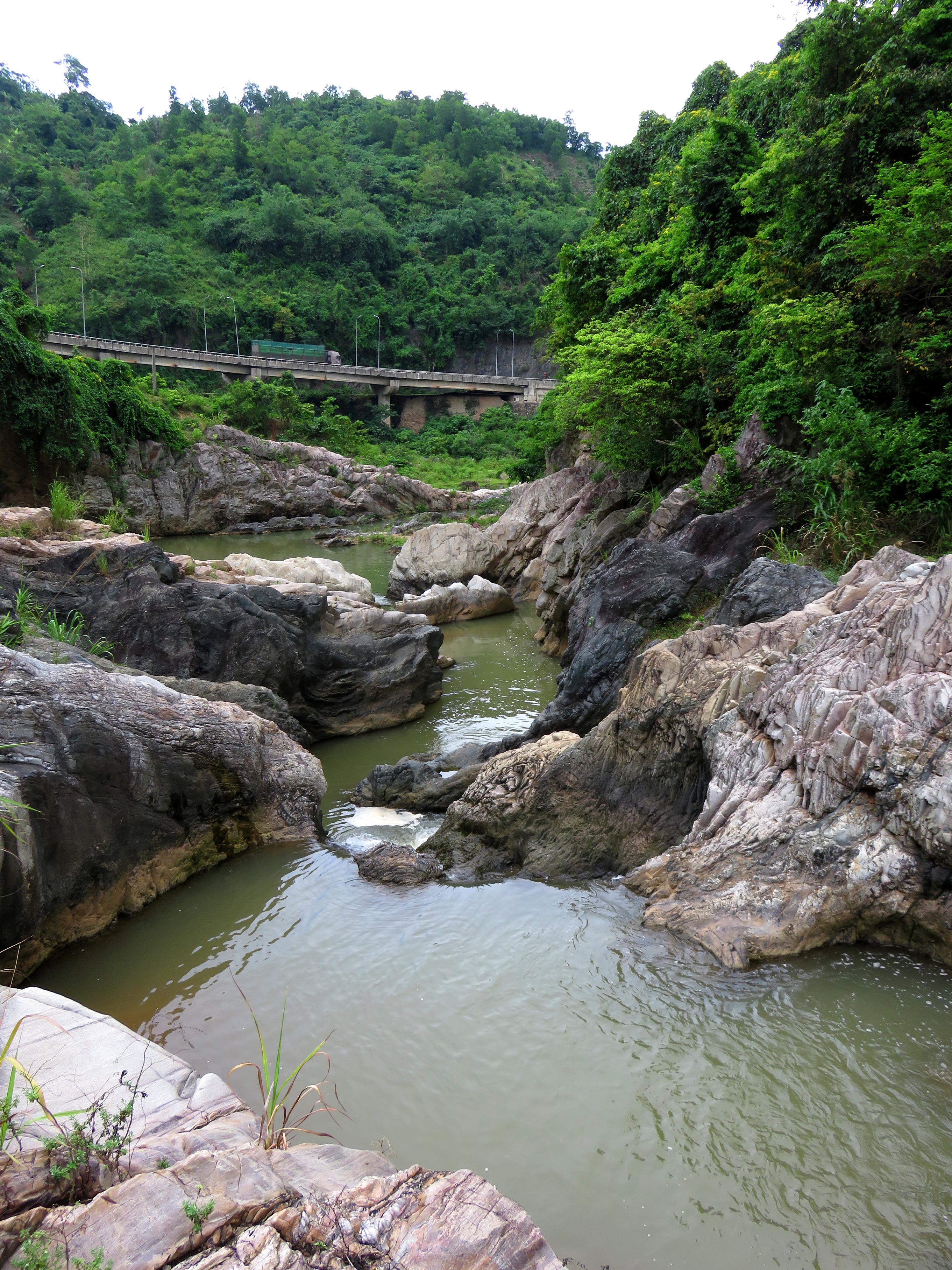
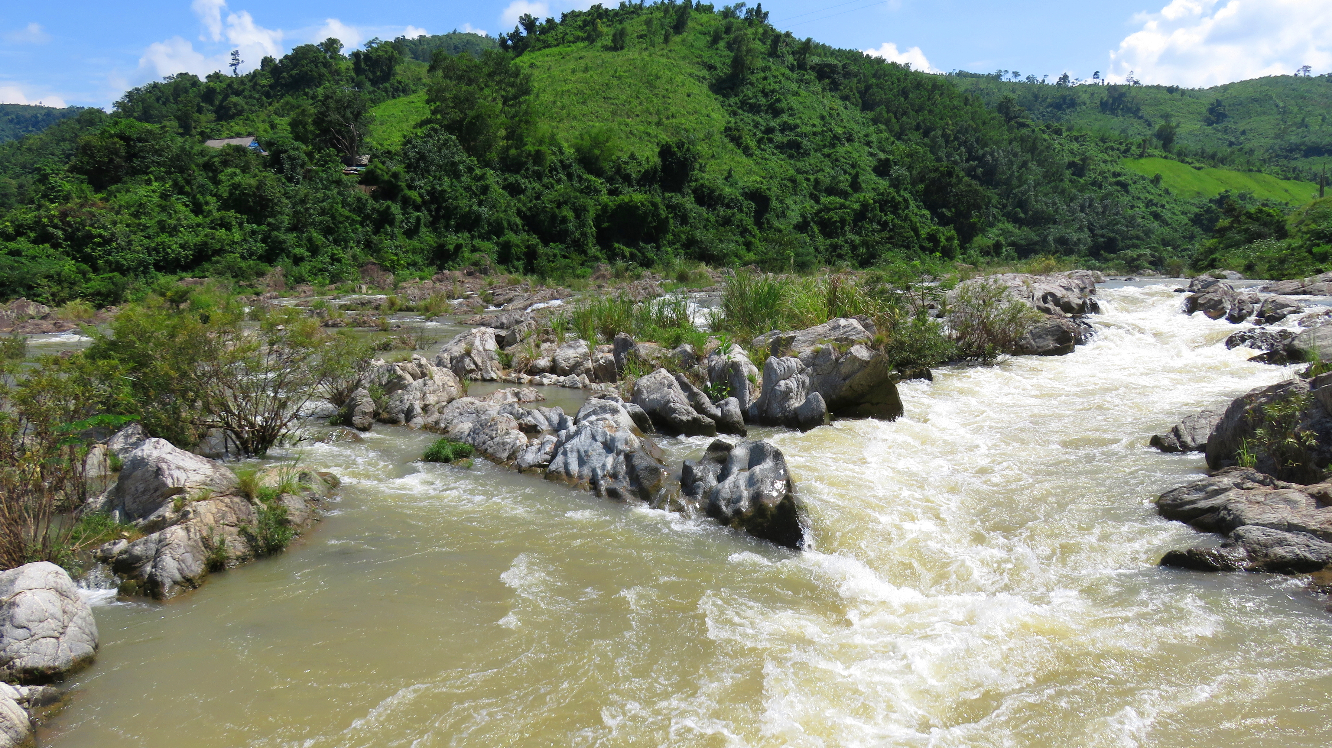
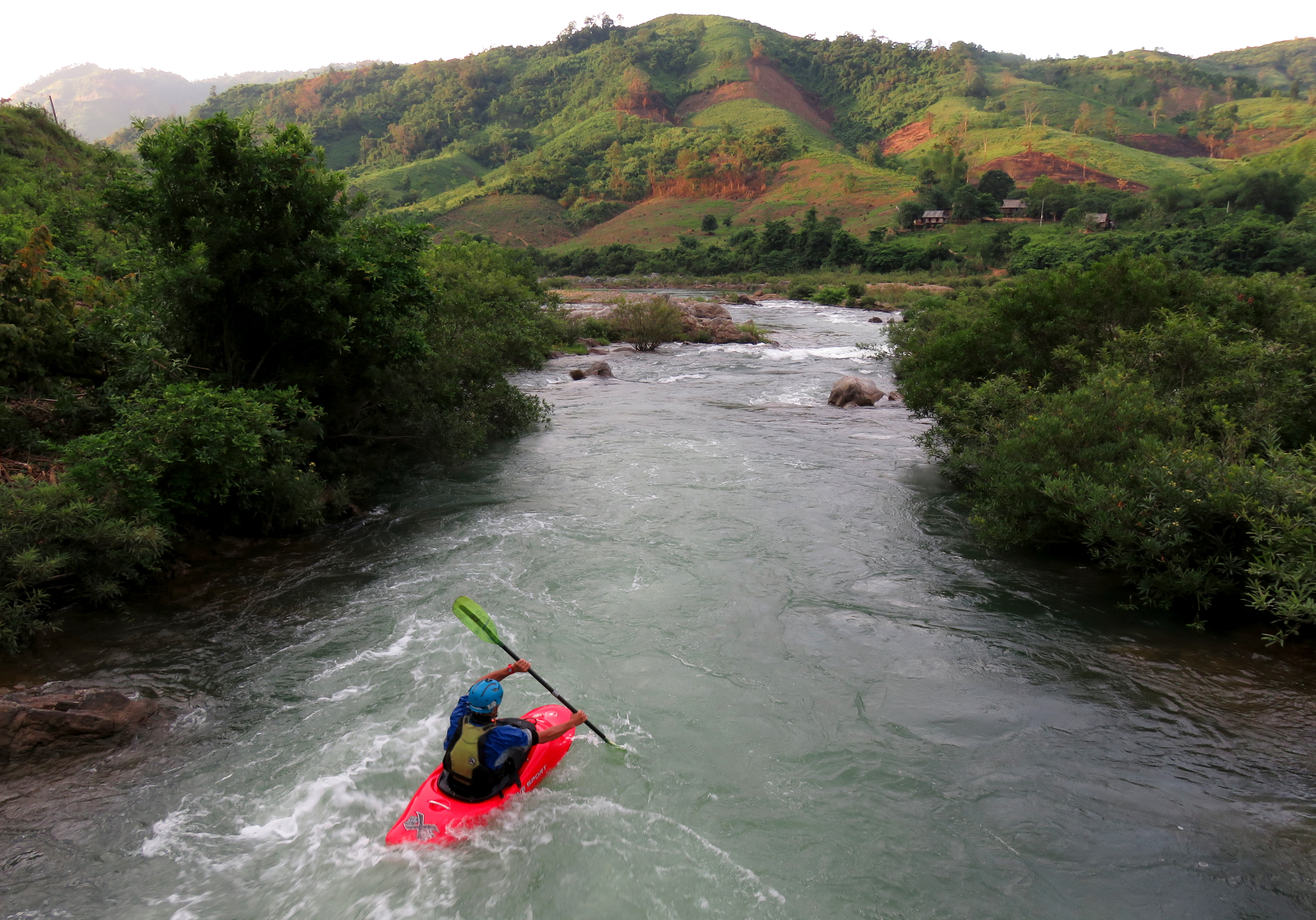
Looking down onto A Tu Village, the upper part of Behind Enemy Lines Rapid, and the Lower Rao Quan Canyon.
Draining the mountains north of the famous town of Khe Sanh, the Rao Quan River drops through an impressive series of gorges, waterfalls and canyons on it's way downhill. Although the uppermost of these gorges is too steep to kayak, and it and the middle section are mostly de-watered for hydroelectric power, the final canyon stretch before it's confluence with the Da K'Rong River does hold a good amount of fun whitewater. More importantly, because this sits downstream from one of the primary power plants in the entire area, flows are generally pretty reliable, and it is rare to find this run without at least some water. So thanks to that dam-released water, which is surprisingly chilly, and the big and playful rapids, this run is actually a lot of fun- if you are willing to make the drive to get there.
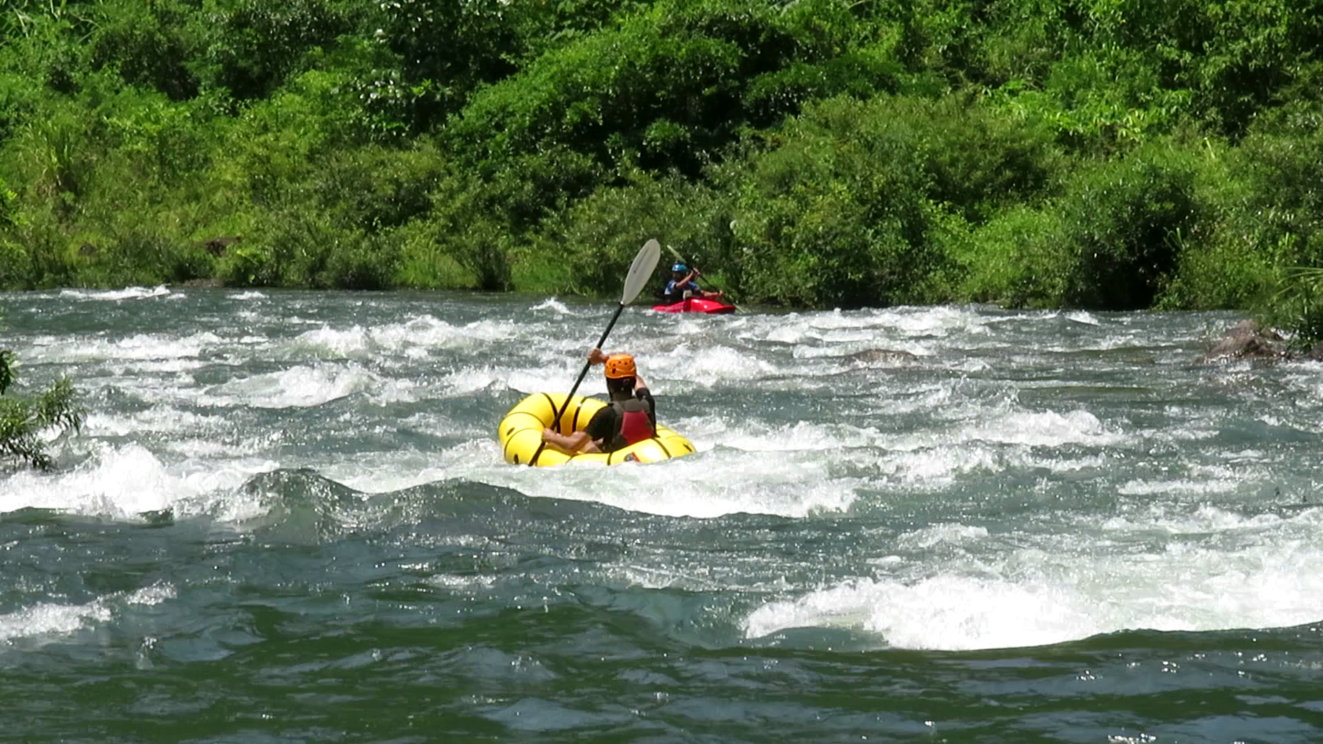
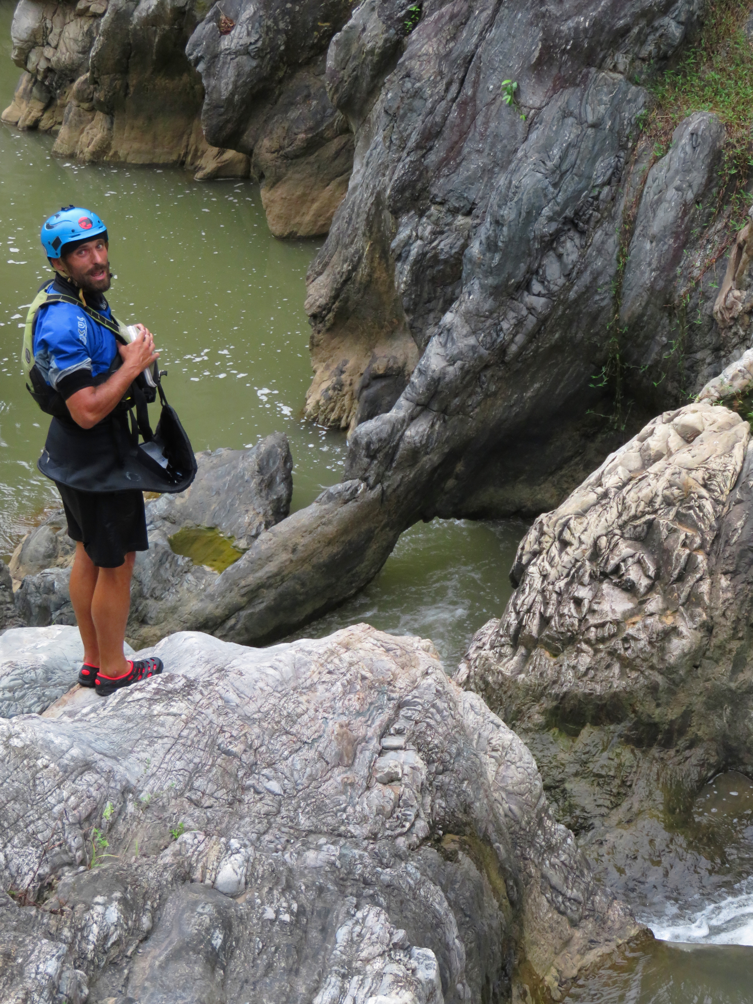
Alfonso coming in hot at the bottom of "Decision Corner".
The run is not long, perhaps no more than 6 to 7 kms if putting in at the highest possible put in and taking out after the Rao Quan's confluence with the Thach Hanh River. But, thanks to lots of play, an easy ability to hike up and repeat most of the rapids, this stretch can definitely take most of a day. There are two put in options, one of which is a little more dubious; the first is to put in just below the Quang Tri II hydro power plant, which is accessed from a road off the highway about halfway between Khe Sanh and the river, and the second is to park at the village of A Tu, inside the canyon itself, and walk upstream along a trail for ~10 minutes to reach an access to the river. There are pros and cons to each. Putting in at the hydro plant is dubious for now thanks to the sensitivity of the area, and its possible you will get chased away by security guards. However, putting in there also gets you a handful of warm up rapids before turning the corner and reaching the village put in. The benefit of putting in just above the village is a shorter shuttle, but you lose the handful of warm up rapids.
Looking upstream from the village put in.
The warm up rapids are just that: warm up. As in, they are easy and straightforward, and staying in the main current and avoiding the big holes and rocks will see just about everyone down with clean lines. The river makes a pronounced right hand corner not far below the power plant, and comes into the area of A Tu Village, and also reaches the put in that is found by hiking upstream from the village. The first rapid that is accessed by this lower put in, "Malibu Cruisin", is short drop that goes around both side of a small island. The left side looks good, but don't be fooled as it ends up in a manky rock pile in the bushes. The right side is the way to go, and staying center through the first part, and then going either left or right of the rock at the bottom will provide a nice clean line.
Looking down into "Malibu Cruisin".
|
Alfonso on the pillow at the bottom.
|
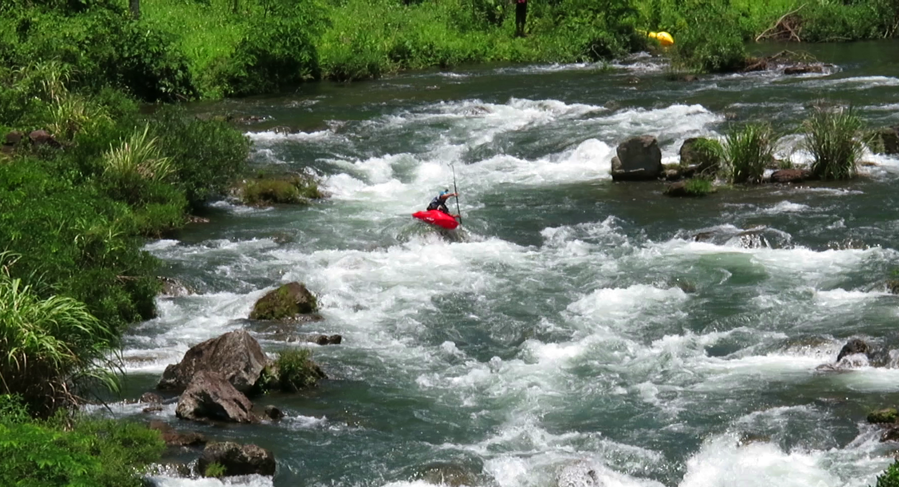
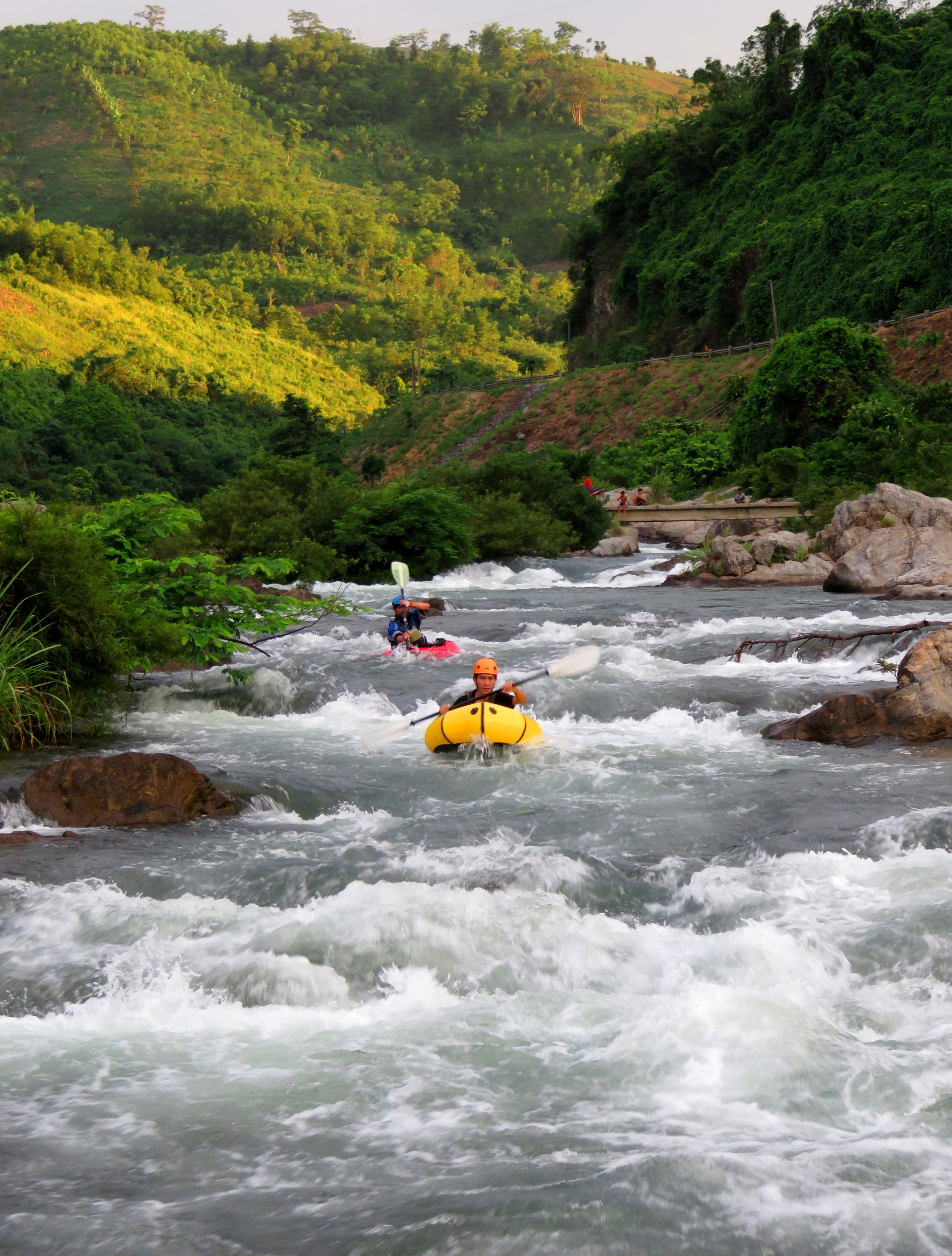
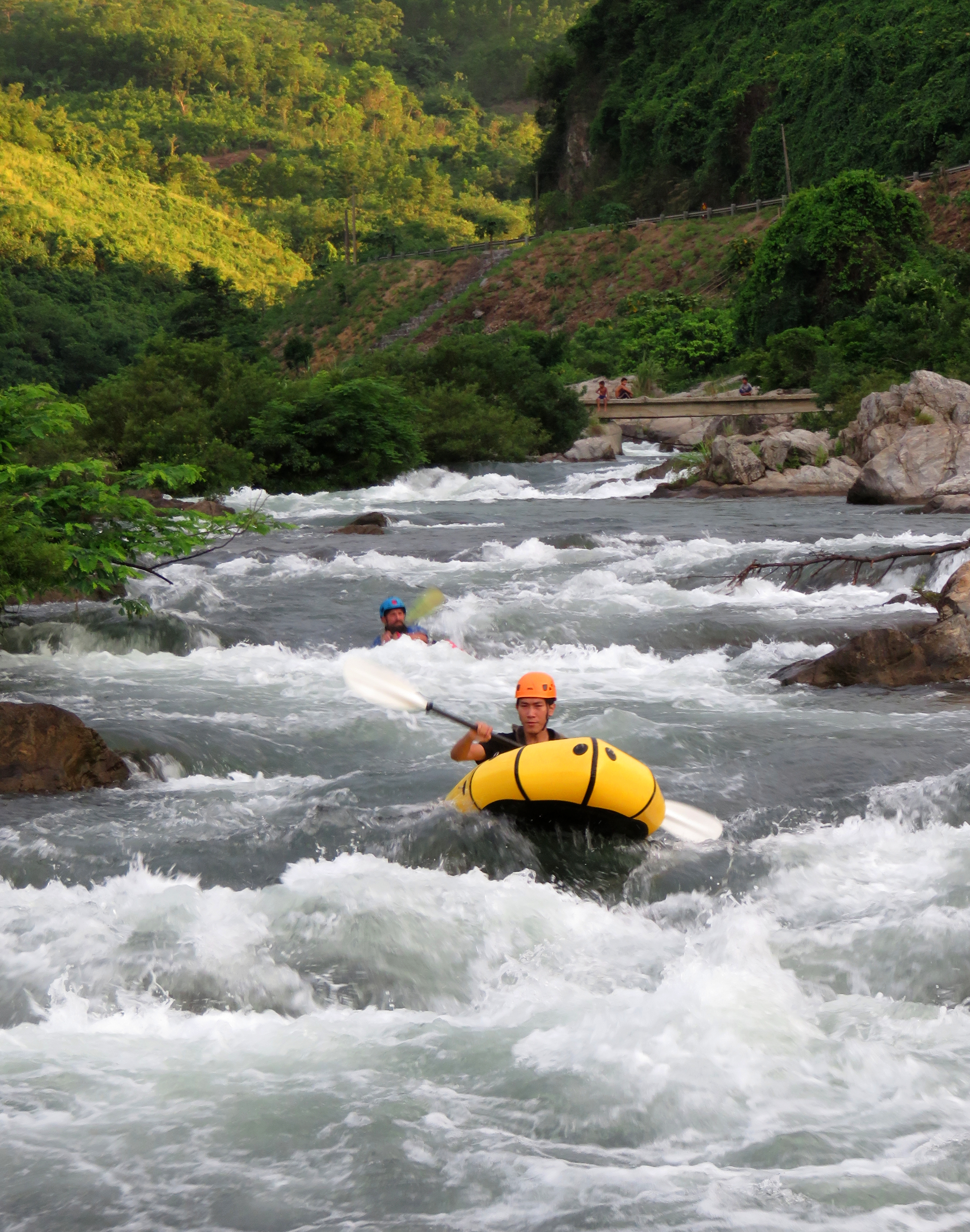
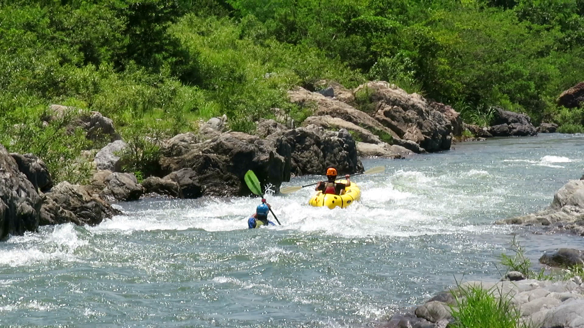
The bottom right of this rapid has a pillow sitting on top of a large rock, and it is easy to get pushed into it. However, it is not as bad as it looks and even the most offline boater should be just fine. A swim here would be a non-issue either, as it does empty into a large flat pool. A short ways below this is "Kids Rapid", named for the local ethnic youths who decided to swim this rapid on rattan mats with us while we boated. Brave boys that could be the first generation of boaters in this part of Vietnam! This rapid is very simple, just follow the wave train down the middle and enjoy the ride. Just down around the corner is the biggest drop of the run, "Behind Enemy Lines", so eddy out river left or river right for the scout. River right has the best vantage point, but it is hard to see the whole rapid clearly since it is somewhat lengthy.
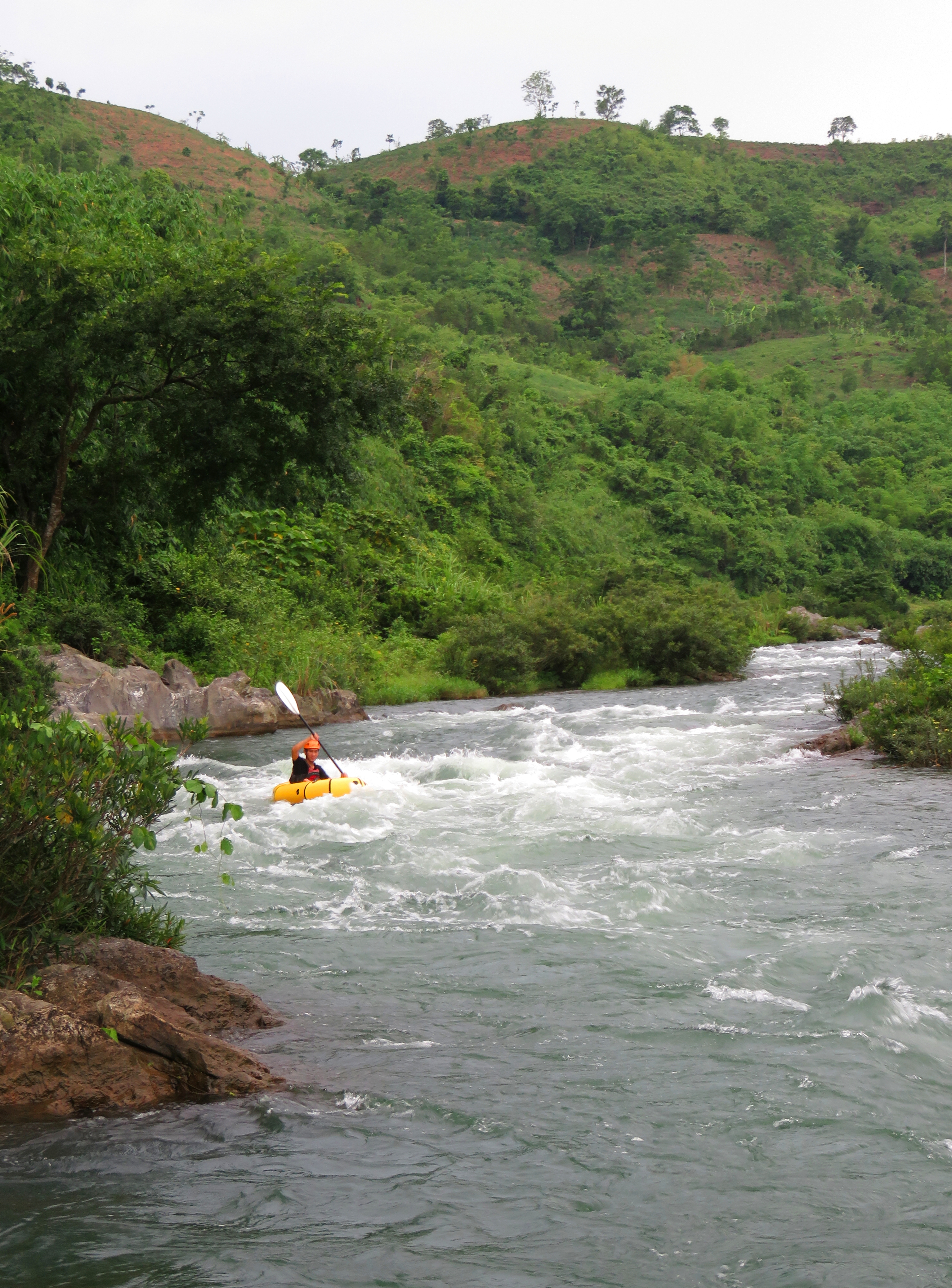
Cuong dropping into "Kid's Rapid".
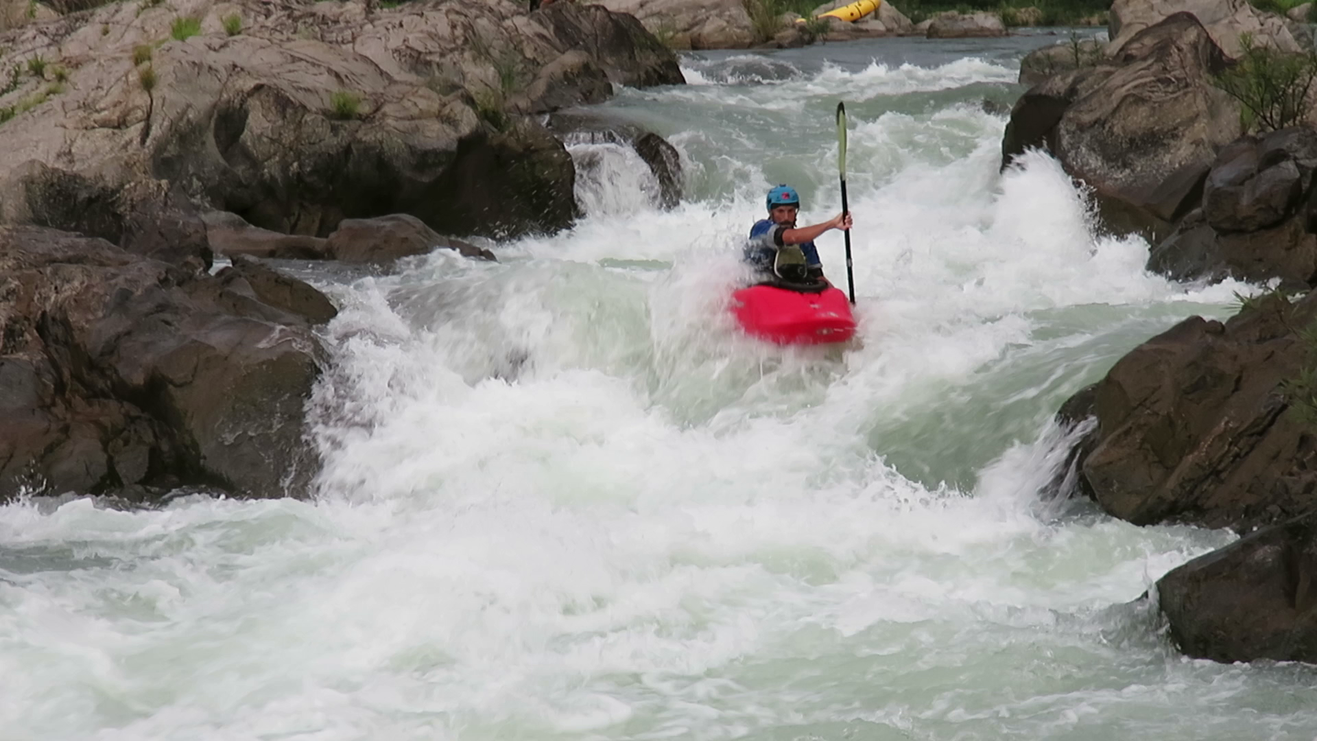
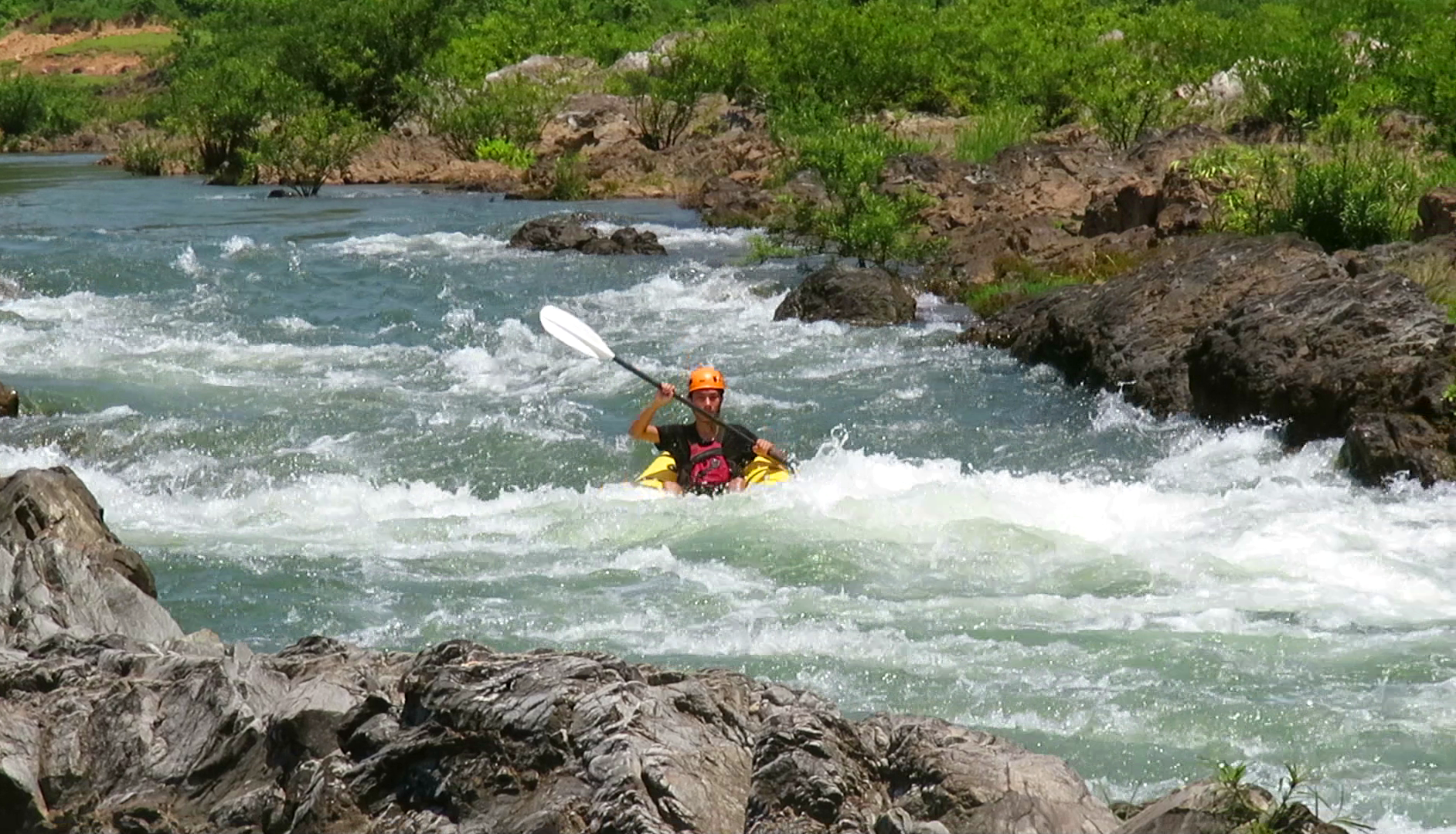
"Behind Enemy Lines" is a big drop, and not one to mess around with or take lightly. Although it doesn't have a serious lethal hazard or a specific nightmare formation, it is a series of large, broken ledges drops stacked on top of each other as the river makes a bend to the left and drops a surprising amount of vertical over the course of the rapid. There are several clean lines, and most competent boaters should be able to make it down safely, although it is large and pushy, so it is a good idea to set safety in case of swimmers. Fortunately it is flat for a ways below this, with only one small rapid that is not dangerous breaking up what is otherwise a long flat section.
"Behind Enemy Lines" Rapid at higher water levels.
Finishing up scouting.
|
Alfonso coming down "Behind Enemy Lines" rapid.
|
There is a portage around this rapid, but it is a bit of work. Take out on river left and scramble onto the rocks immediately above the rapid. There is a well established local's trail that cuts up into the forest. It's somewhat steep and has some rocks to climb up at a couple points but it goes by within 10 minutes. Once you reach the road, turn right and walk AWAY from the village and within 50 meters you will see a trail dropping into the forest off the right side of the road. You can tell you are on the right path because you should have a great view of the rapid as you start down this trail. If you can't see the rapid, you are on the wrong trail. Just below the road, at the fork, go left. This path drops consistently all the way back to the river.
Surfing at the lower put in.
|
HAZARD NOTE: Immediately below the short rapid after Behind Enemy Lines is a power cable stretched across the river. At certain flows the cable "bounces" in the current, throwing it into the air randomly at times and submerging it other times. It was ok to bat out of the way with a paddle on river right in 2018 but that may change. Clean passage is on river left, and if time it right while the cable is underwater.
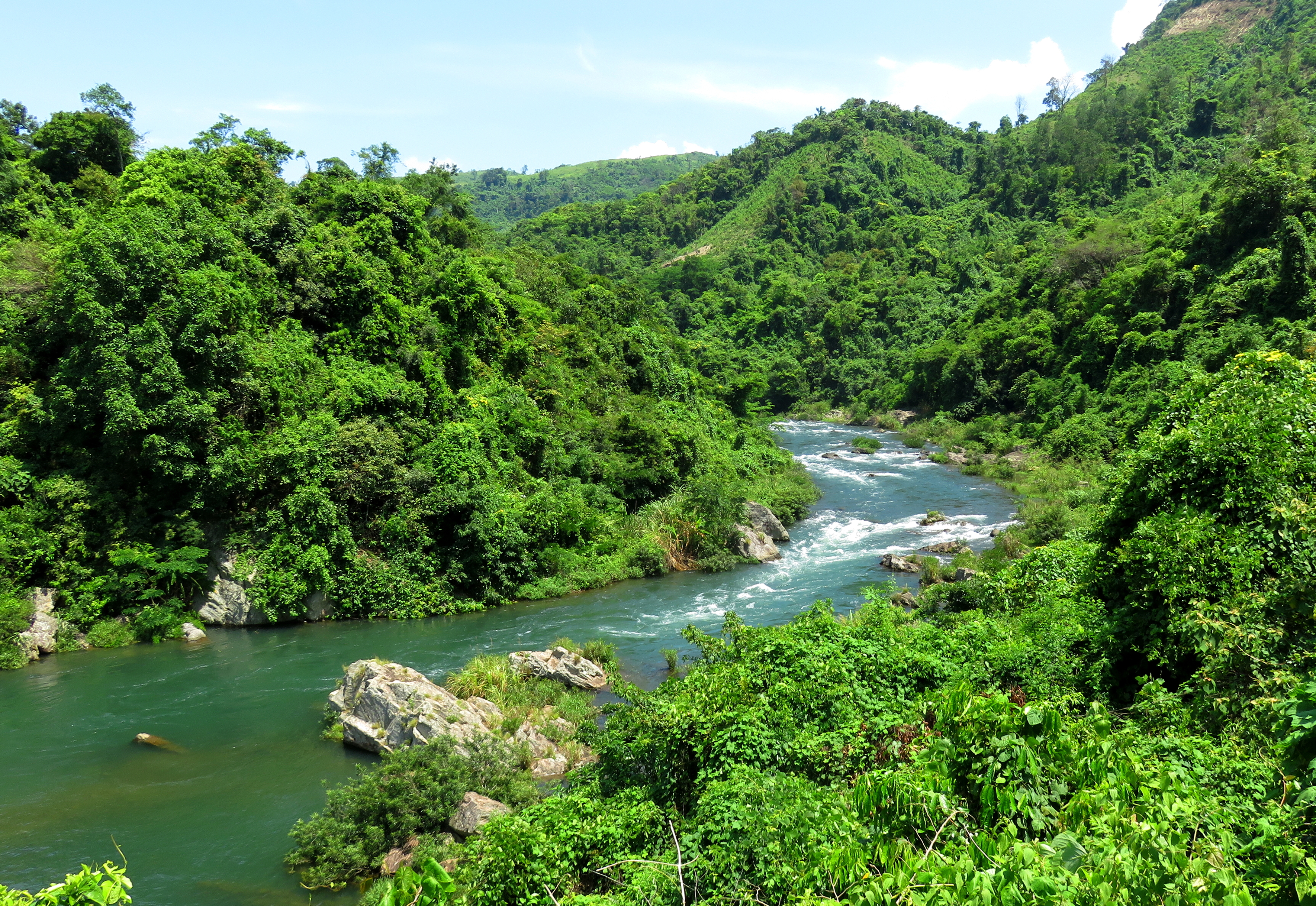
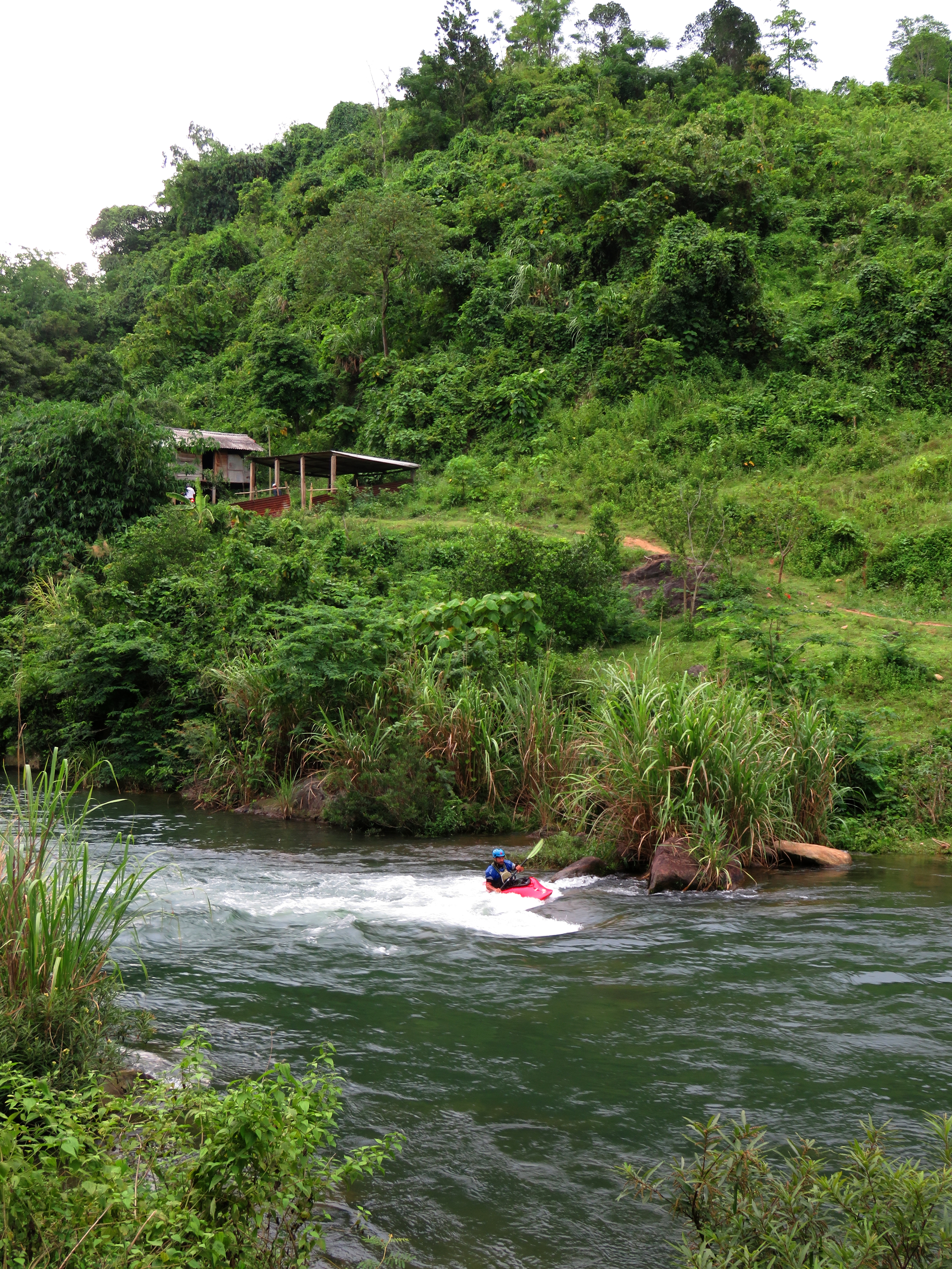
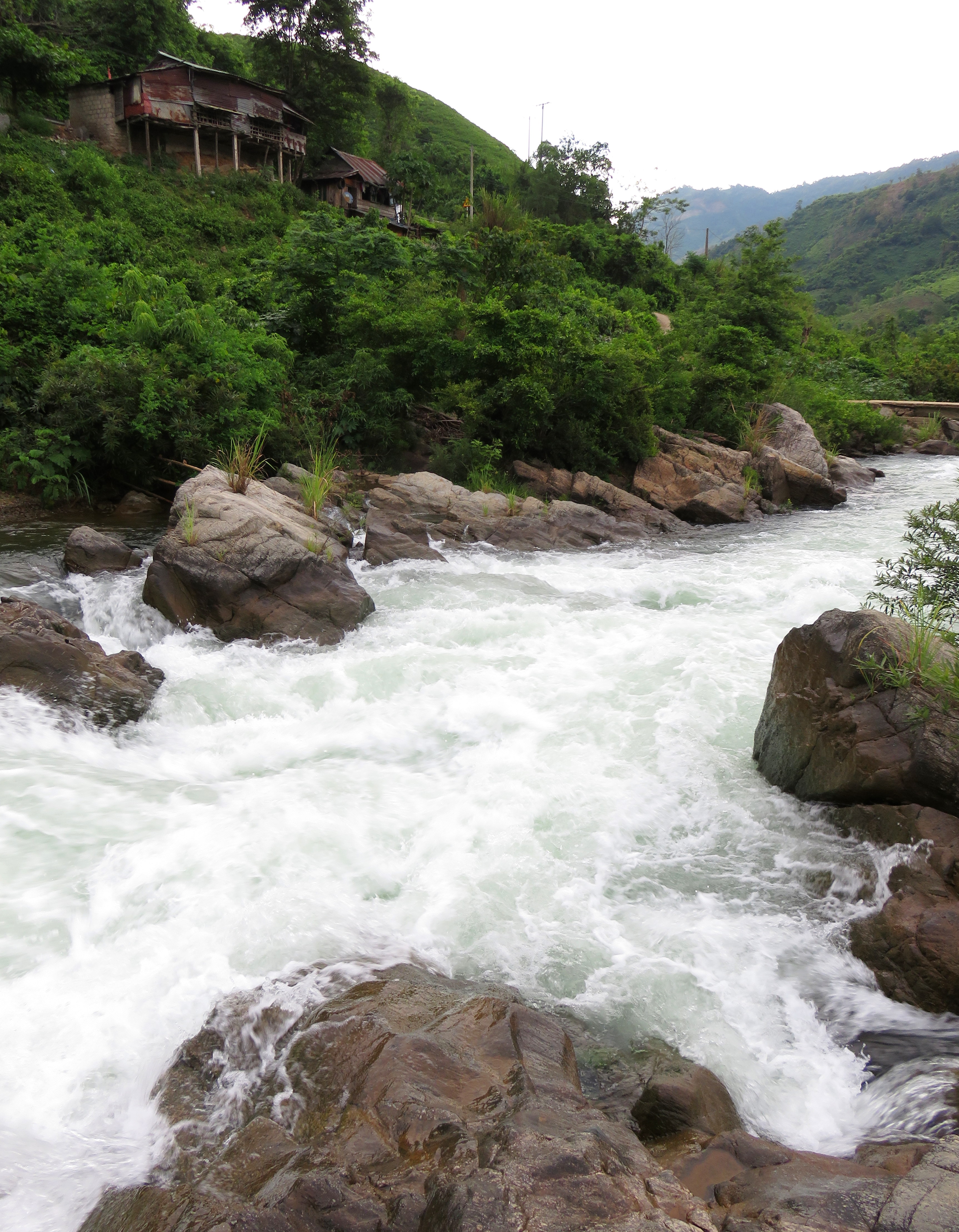
Below this rapid the river enters it's longest and flattest section, which makes a nice break after a fun beginning. There is an optional put in here, which is nice for both afternoon runs or for those not wanting to take on "Behind Enemy Lines" upstream, where the road to A Tu Village drops down to river level. Just downstream and across from the river is a small but enjoyable surf wave. There is a small village perched on the riverbanks on both sides here so don't be surprised if you quickly become the center of attention. Downstream from this the river flows past the remains of an old bridge, one of the many bridges on old Route 9 that were destroyed during the US-Vietnam War, and just downstream goes under the modern Highway 9 bridge. There is a short rapid here, called "Under The Bridge", which is very easy and best done down the left. Right goes, but it is shallow and manky. |
Paddling under the old Route 9 bridge towards the modern Highway 9 bridge.
Side Hike: Suoi Lang Cat Gorge
A not great drop to a decent double drop to an arch and tunnel that turns into a siphon at higher flows.
If you eddy out river right directly after Under The Bridge rapid, and the flow coming down it allows, you can paddle upstream and hop out and check out the bottom gorge on the stream that comes down from the village of Lang Cat. This mini-gorge is beautiful, although at most flows (except flood) the water quality is a little dubious. The series of falls is just shy of runnable, as at low flows the first drop doesn't really go, and at high flows the siphon in the bottom comes into play. Still, it is worth looking at for 10 minutes and enjoying some geology and hydrology in action. You may notice lots of red rocks and boulders scattered around the limestone; these are basalt boulders and are part of the old lava flows that cover lots of the local area.
Looking down the gorge at Highway 9.
|
Alfonso doesn't like the looks of that arch....
|
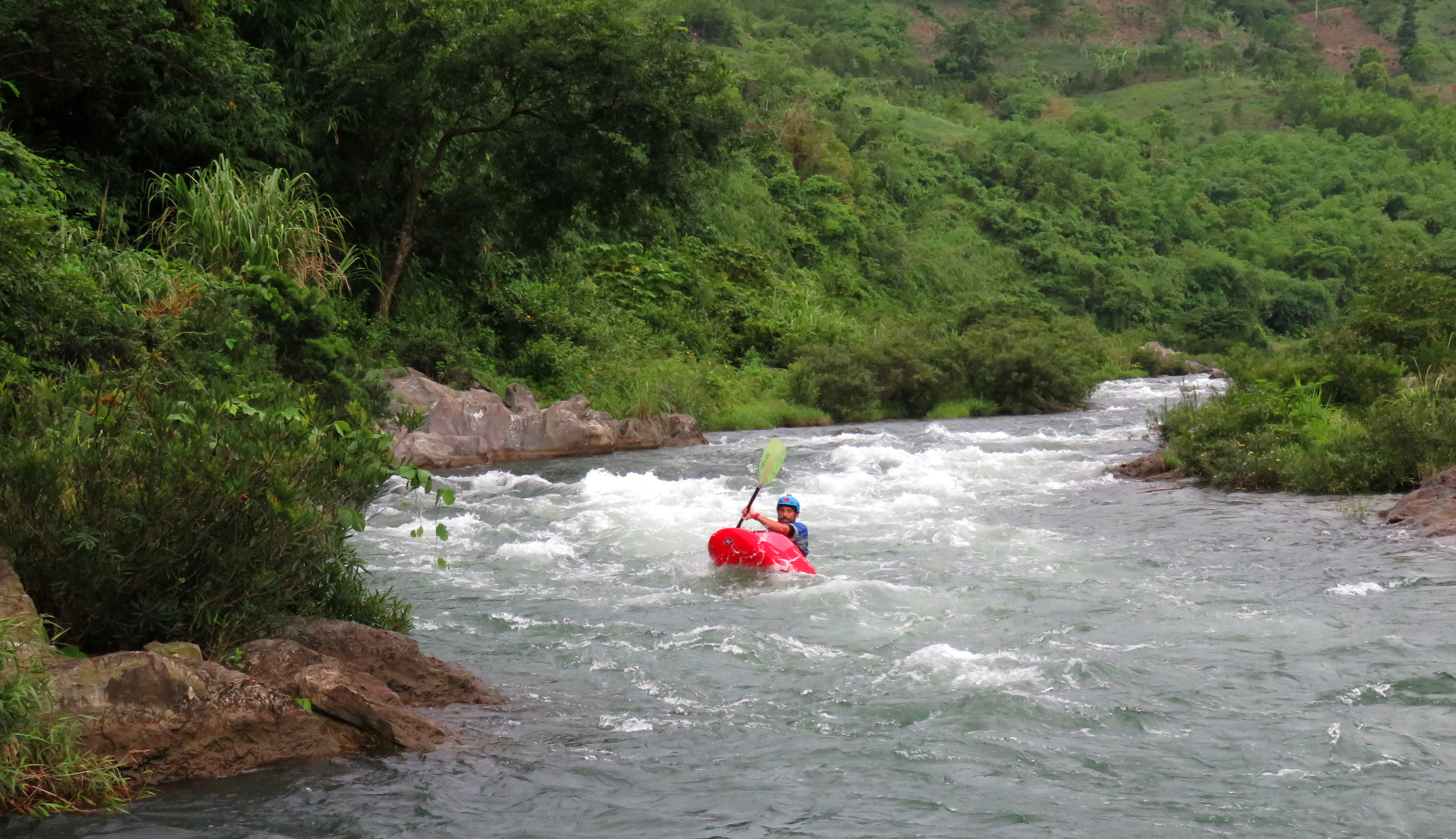
Back on the Rao Quan, the river drops through a series of really fun and similar rapids. These all have the same characteristics: a shallow left side, with a fun wave train on the right and one or two fun little holes that pack a surprisingly strong punch. None are dangerous at all and some even offer up some surf. This is another section to not be surprised if local kids suddenly show up swimming alongside you in the middle of the river. This continues around the corner, but once you pass the corner, eddy out river left, as the next drop is worth a quick scout. This rapid, "Decision Corner", has a choice of several channels up top (all of them go, left is the best line) that all converge on one line at the bottom past some fun and playful waves and holes. It would take all but the most off line of boaters to really blow this one but it is nice to simply see what you are working with before you run it.
Top of the left side of Decision Corner.
|
Bottom of Decision Corner.
|
Just below this is the grand finale. Here, the Rao Quan drops over an impressive sheet of old limestone basement rock, resulting in an impressive array of small channels filled with small features, and one big drop on river left. This drop, "Cascada Chicane", loses a surprising amount of elevation and is quite fast and pushy. However, it is deep, and with the exception of one rock in the second hole that is not in play as much as it looks, the whole thing flushes pretty easily. None of the holes are keepers, except at the very lowest flows. The biggest reason for this drop being rated as high as it is (V-) is that it is several moves long, and blowing one move up top could result in a swim all the way down the rest of the rapid. The best line is the come in center, and work slightly towards the left for the second hole. For the most part the best line is to just stay in the middle and try to hang on the whole way.
Cascada Chicane at higher flows.
Video screengrab of Alfonso coming down Cascada Chicane.
Room with a view.
|
Looking down at 0-60 and Triple Stacker.
|
HAZARD NOTE: There is a fairly low bridge that comes up quick after the end of the run, but if levels are at a "normal" level, the danger comes not from the bridge, but from a low hanging cable that reaches beneath the bridge. Thankfully the river is deep below the bridge, so you can just roll or hop in and swim below it. If the cable is IN the water, I would consider walking this rapid as the margin is quite narrow. If the river is high enough for the bridge itself to be in play then you obviously know what you are doing and need little advice from me.
Immediately after the bridge the river continues its mad dash to the Thach Hanh River in impressive fashion, fanning out and dropping through several channels filled with whitewater. The best of these is to just stay center. The first rapid immediately after the bridge is called "0 - 60" because the speed it can generate as you drop into it. Remaining upright is more challenging than expected in the runout of this, testament to the strength of the whirlpools here. Finally, just below this is "Triple Stacker", which is a series of three fun boulder garden ledges that go quite easily and are a lot of fun.
Late evening view from the bridge down to the top of 0-60.
Coming down through the Triple Stacker.
|
This rapid is easy and lots of good clean fun.
|
Bonus: Thach Hanh Rapids
Cuong about to drop into the Typewriter and it's awesome lateral.
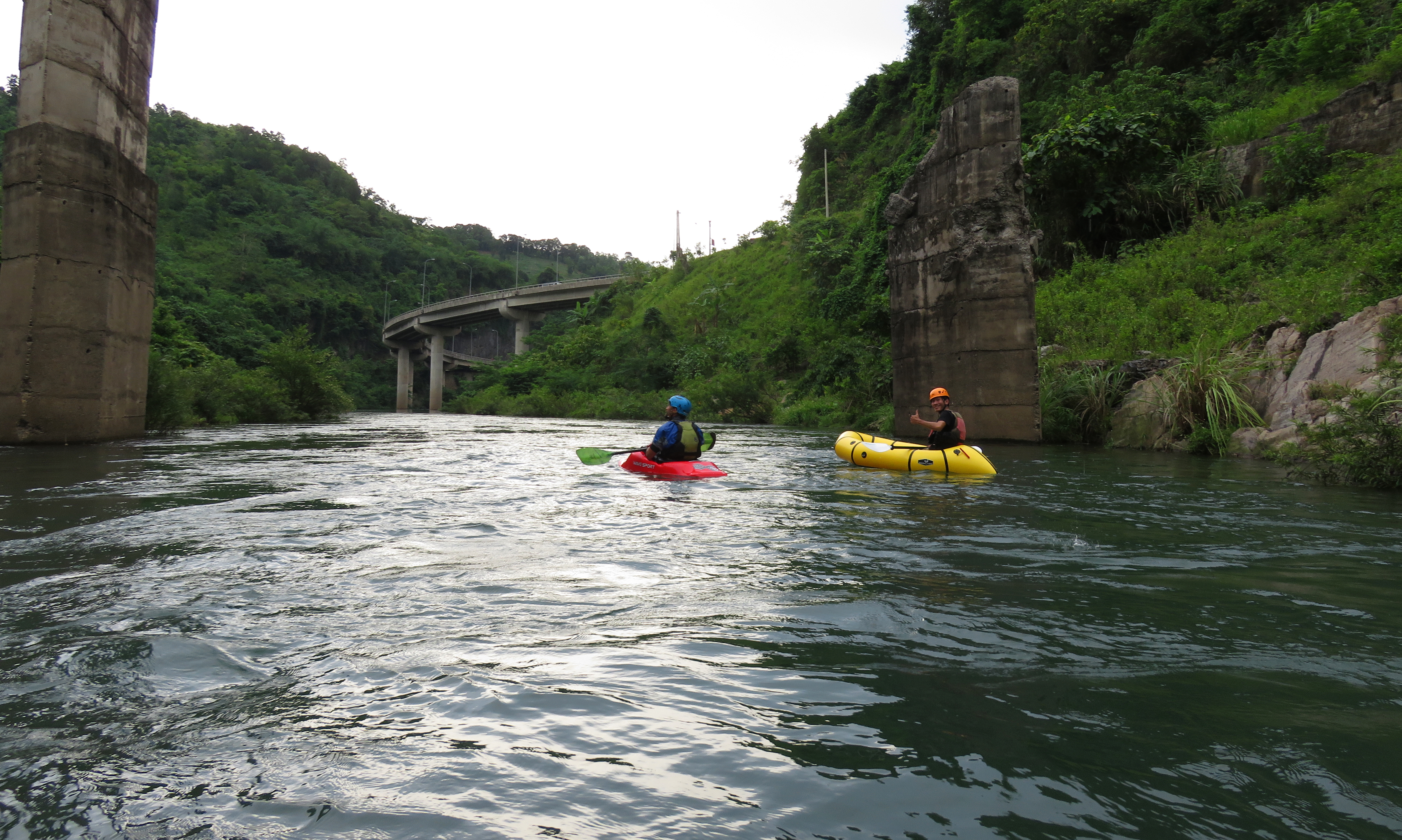
It is possible, and quite convenient to take out right at the confluence. Thanks to the road that goes across the river here, and a super helpful parking spot just across the road, this makes for a great place to end. However, if you choose to continue downriver a short ways, you get some small but fun added bonus rapids on the Thach Hanh River, which you just joined by flowing on the Rao Quan River into it's confluence with the original course of the Da K'Rong River. Although not much water comes down the original channel of the Da K'Rong these days due to a hydropower project nearby, these rapids are technically on a different river, even though it doesn't necessarily feel like it.
Cruising through the Chutes.
These rapids, "Typewriter" and "The Chutes", are simple point-and-shoot affairs. Typewriter is named because the drop itself is one gigantic lateral that runs from right to left downstream, and if you hit it square on you will be just fine, after the holes moves you a couple meters to the left. The Chutes are actually several small drops scattered along the last remaining bits of bedrock here. The first one has a super fun wave train, which is a lot of fun, and the rest are simple choose-your-own-adventure routes. The best takeout is found just past this, where a trail and an old road both drop down to river left. There is another takeout at the village visible downstream at the next bend in the river, Bong Kho, as well as some small rapids ("Full House" Rapid), however, reaching these requires paddling across a dreadfully flat and slow section called "Lago Bong Kho". I personally won't paddle this section again unless running the full Upper Thach Hanh.
The Video
The Map
|
All photos and videos copyright Kit Davidson.
All maps copyright Google MyMaps. All music copyright original owners and is not to be used for profit. |
