
Tranh River - Upper Section
(Nam Nim & White Rock Gorges)
|
Section Length: ~ 13 km
Put In: variable- see text Take Out: bridge @ end of gorge |
Difficulty: III - IV (P)
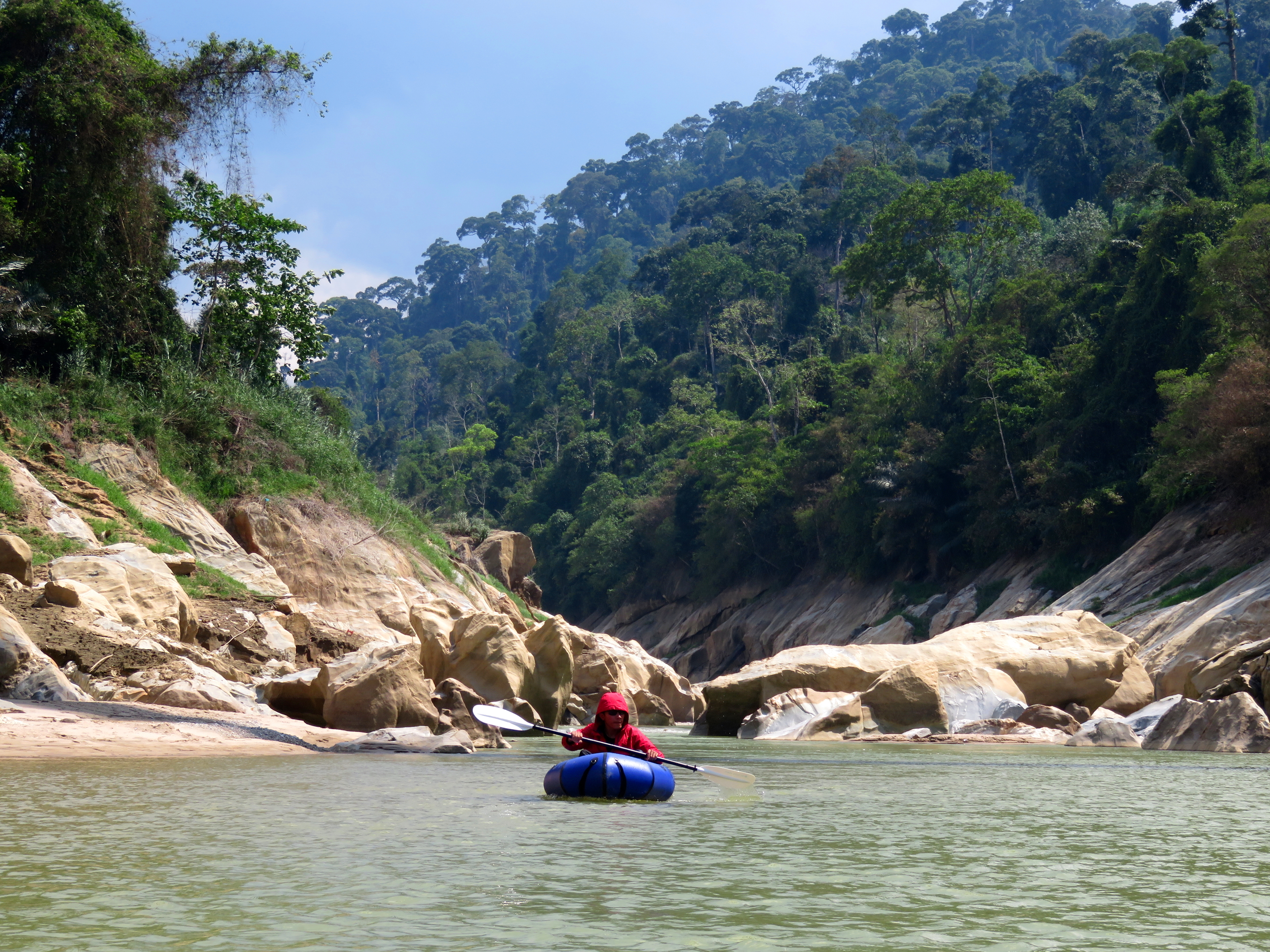
Est. Flow: too low < 500 < 10,000(?) < too high Paddlers: Tim Bouch, Cuong Tran, Kit Davidson |
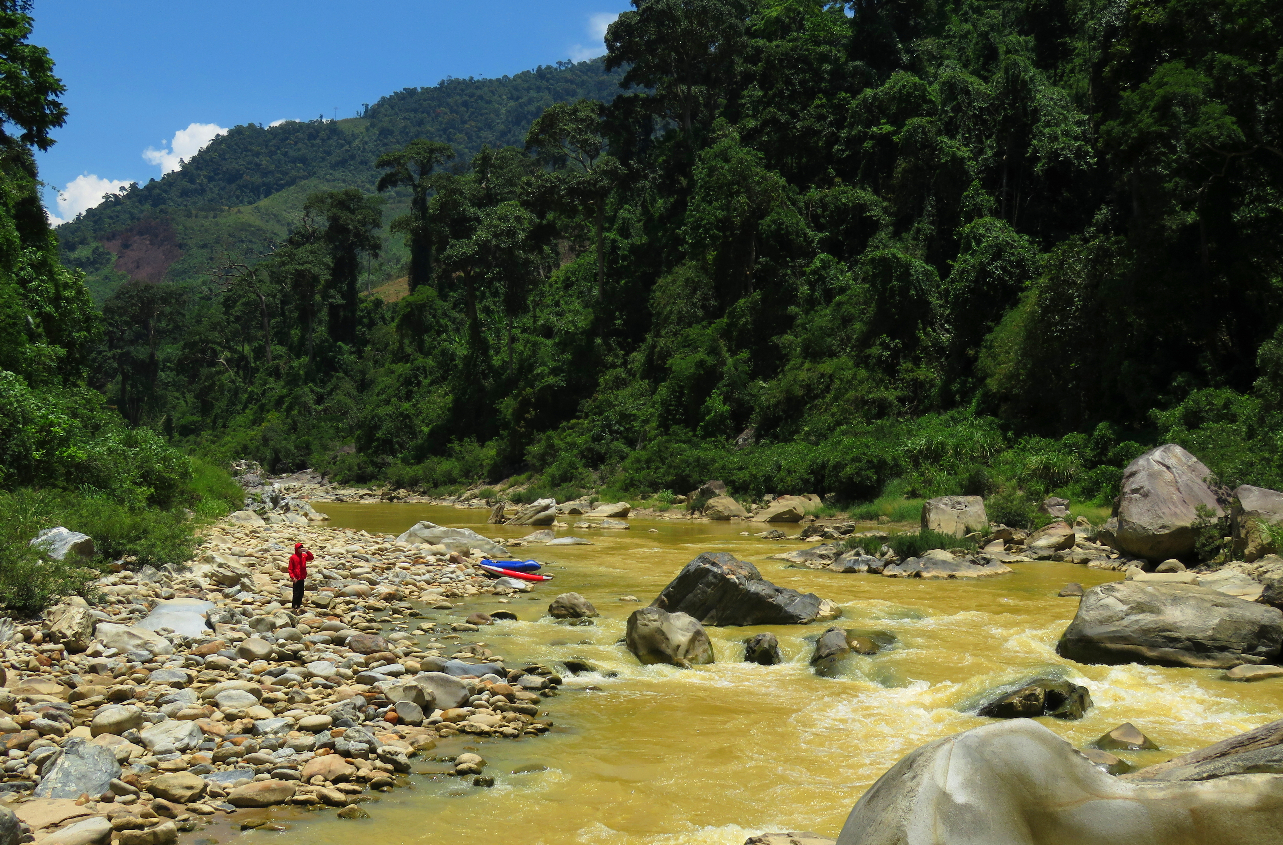
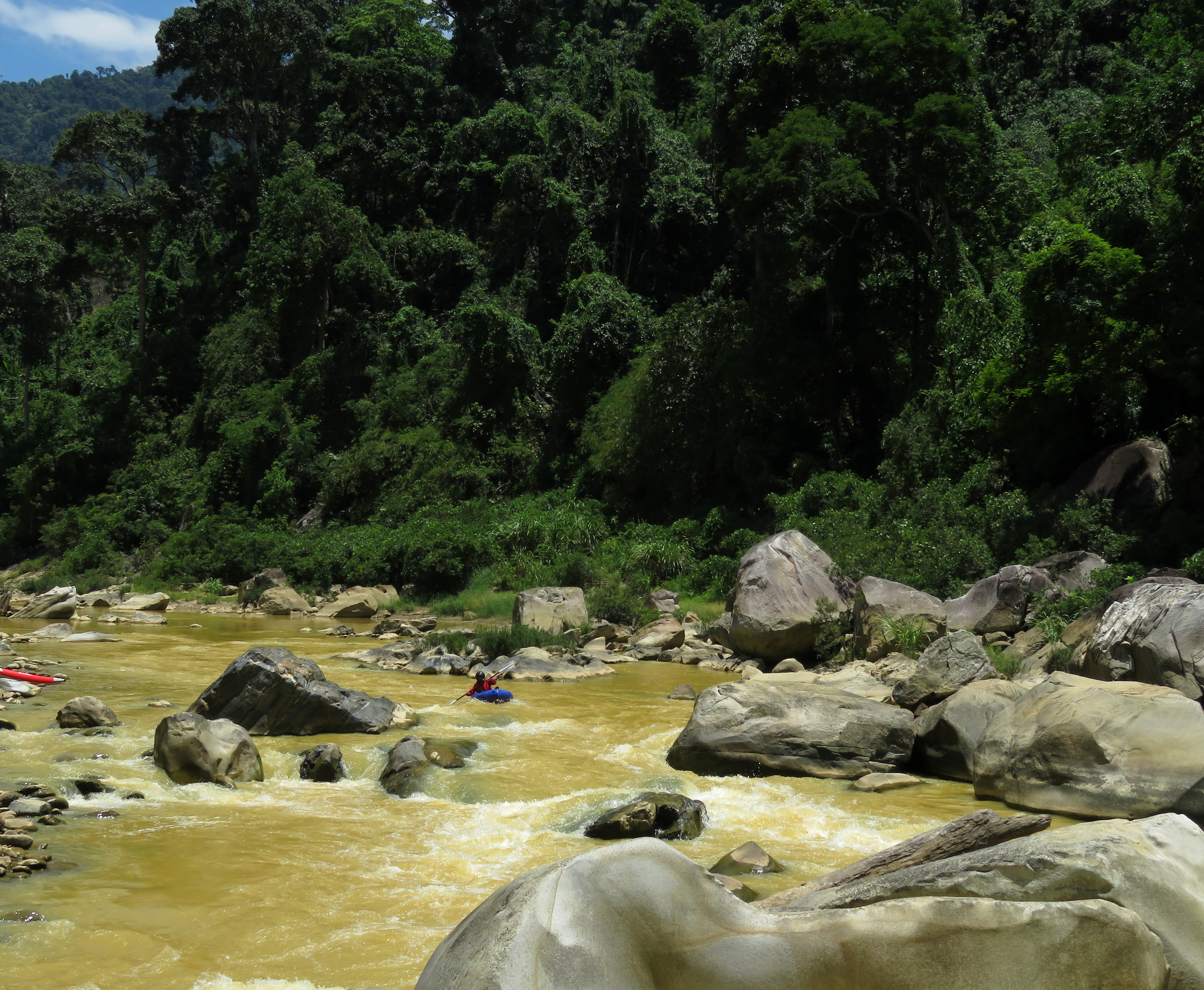
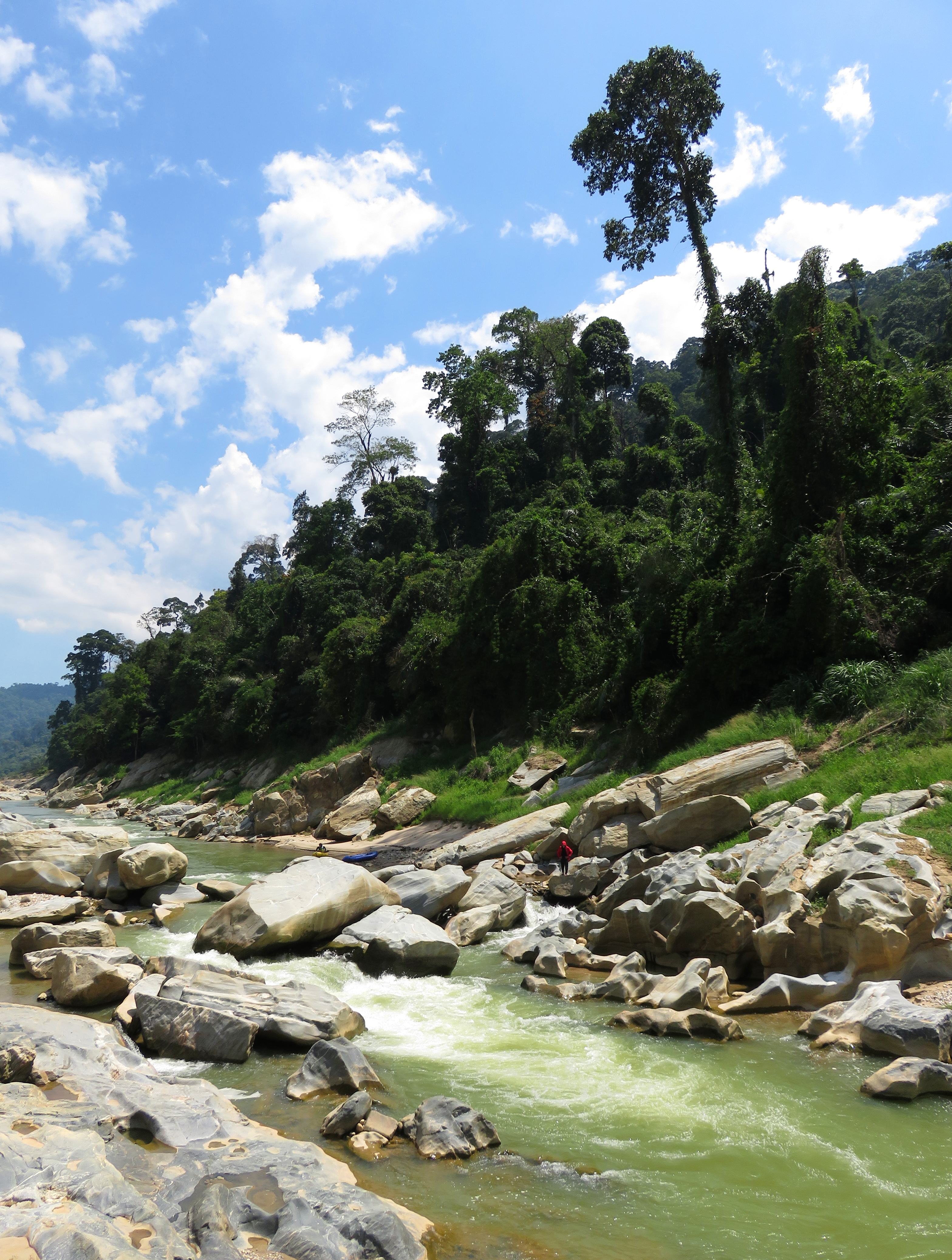
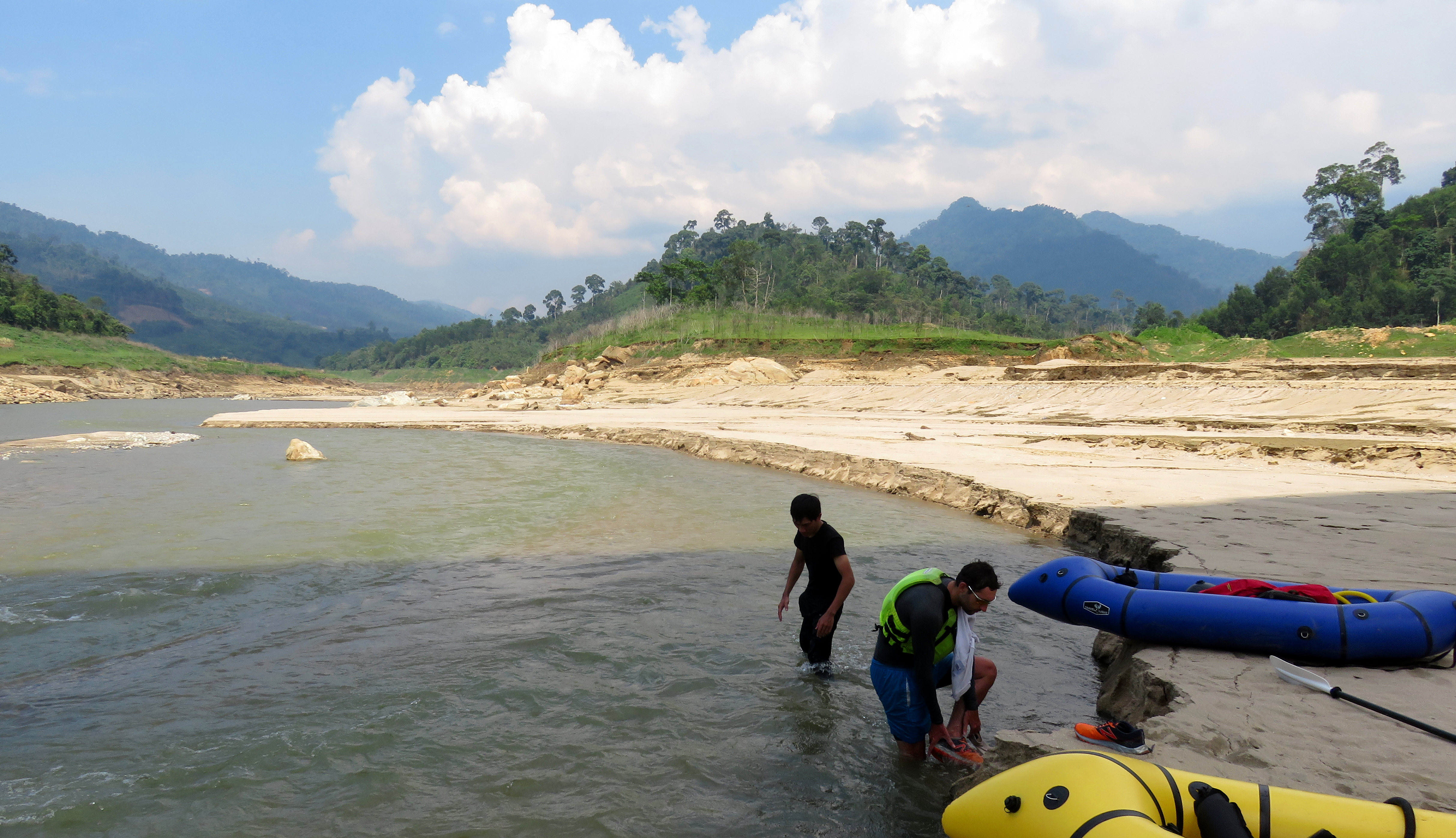
Out to scout in the heart of the Upper Song Tranh.
This lengthy canyon is most definitely a classic in Vietnam. The only knock against it is just how far it is from anywhere- with a minimum 3 hour drive from any of the normally traveled corridors, it isn't very easy to get to. However, with numerous high-quality granite rapids, impressive bedrock walls and fun mini-gorges, this run is of the best quality. The scenery factor is beyond outstanding, as the river carves its way through the impressive mountains of Nam Tra My district, and huge mountain slopes covered in old growth dominate the views for a lot of this stretch. Bottom line, this is a very quality stretch of river.
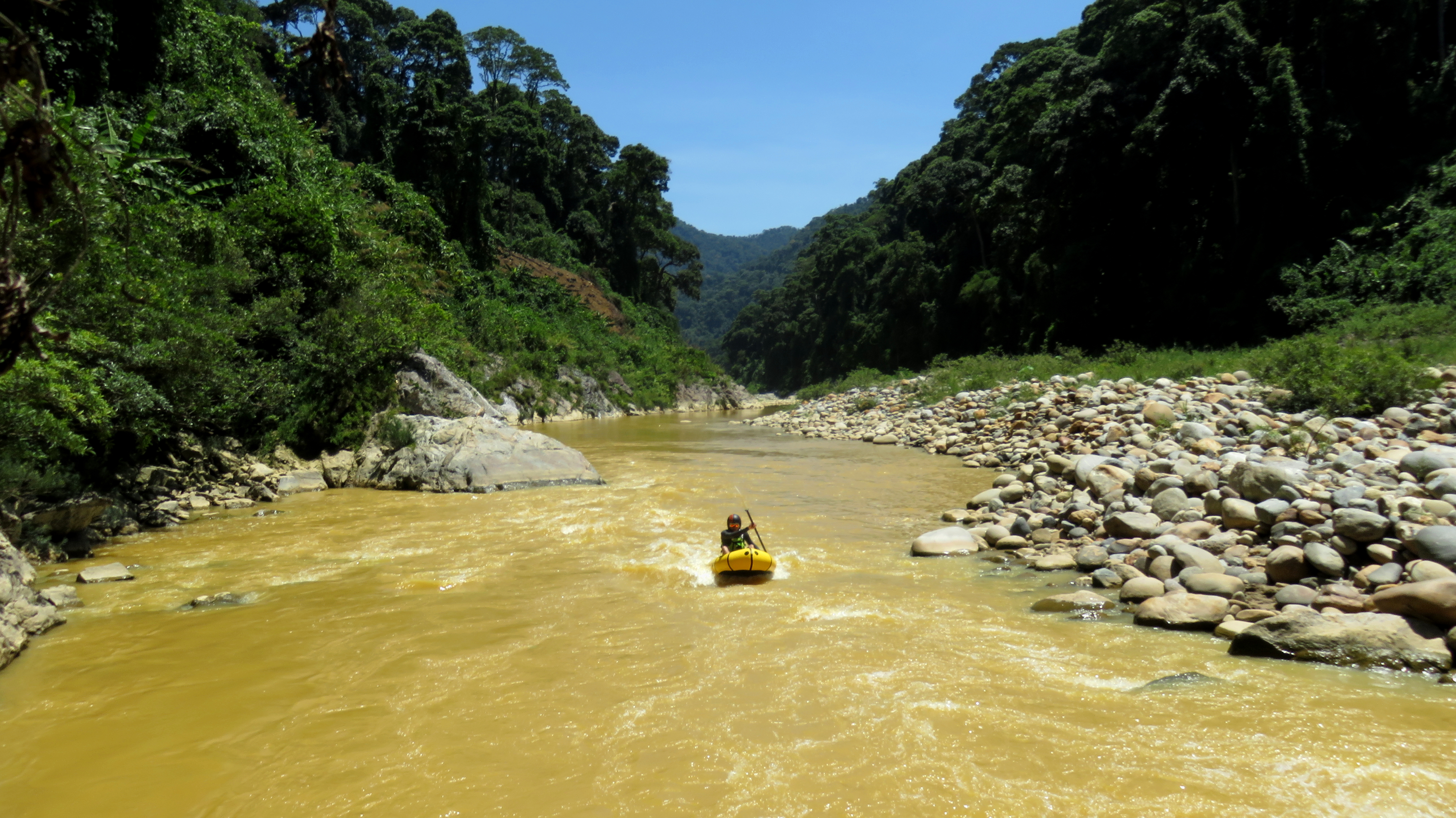
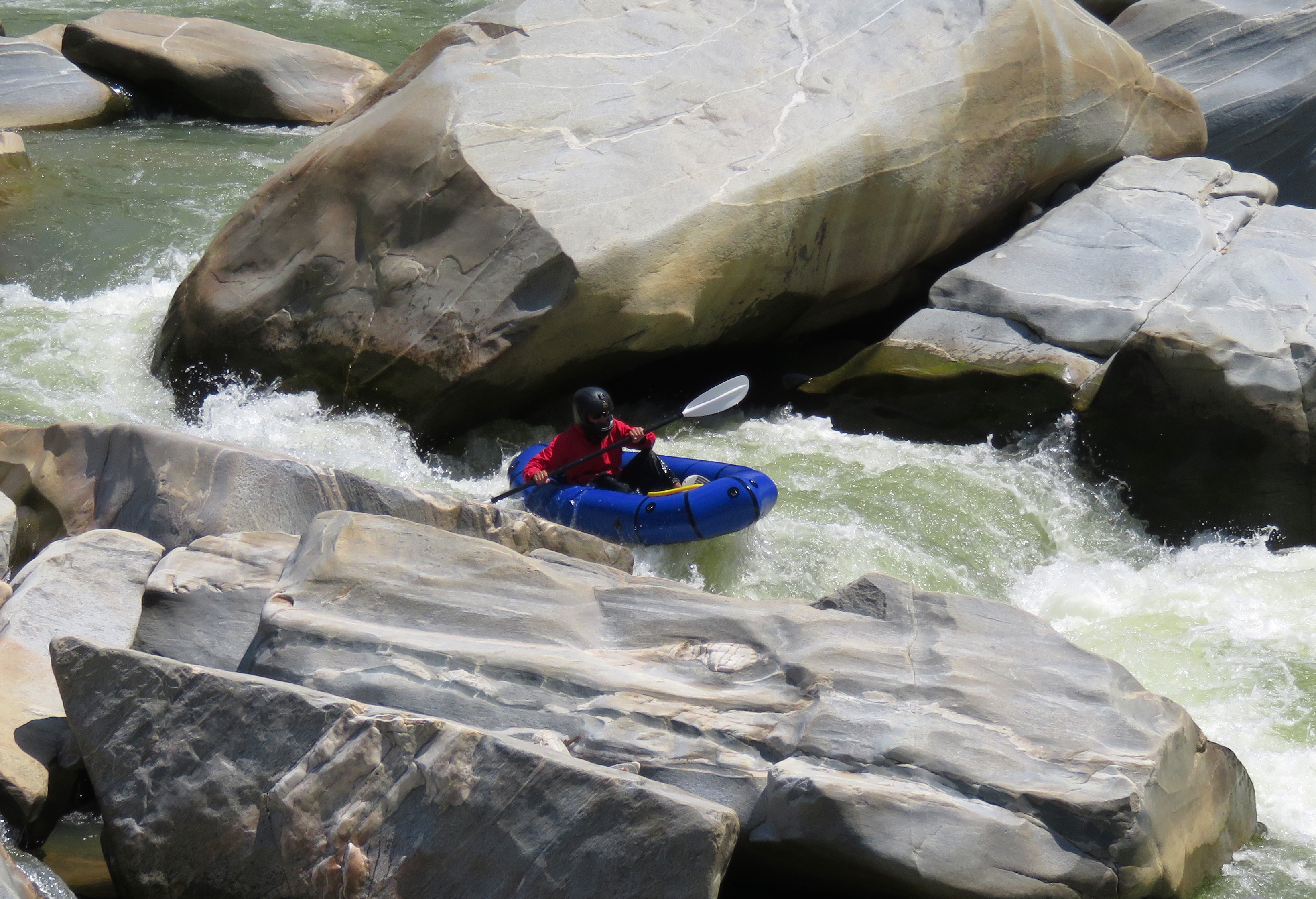
Enjoying a surf just below Banked Turn rapid.
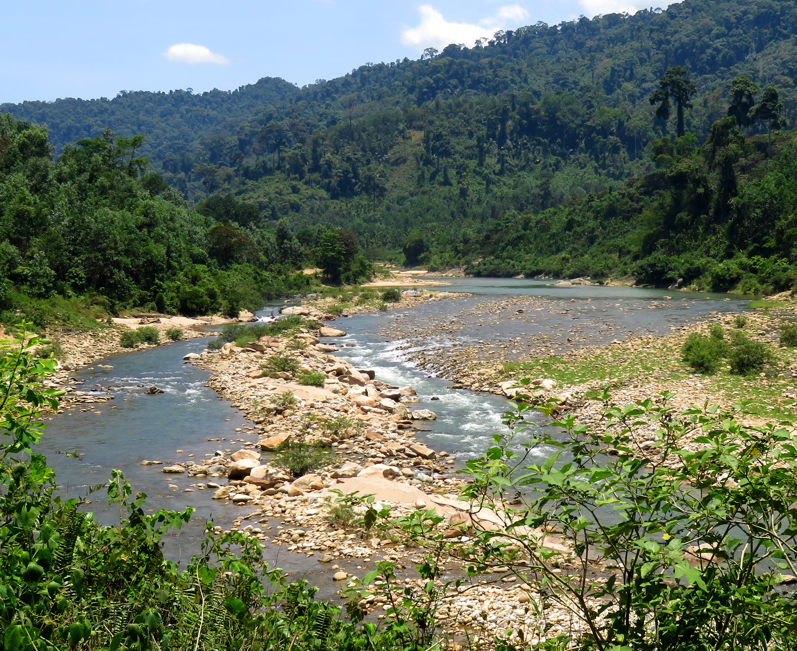
This canyon is the real deal. Although there is a provincial highway that parallels this stretch, the highway is far removed high in the jungles above, and except for one access around 2/3rds of the way down, the only access into this canyon is through small locals' trails, or by boat. Because of it's length and this inaccessibility, this run has a high committing factor. The river can be run down to surprisingly low levels, as well as up to terrifyingly high levels too, and once you are in the only way out is down the river, and what flow you attempt it at will determine how difficult it will be. At lower levels, this flow tends to be Class III/III+, with a couple of rapids that would quickly turn into decent IV's with even just a little more water. At medium levels it is solid IV and V- bigger water, and at high levels it is full on Class V big water. Because this canyon is the ultimate drain for all of the area streams, it is a huge river with a dynamic range, and also a huge riverbed. Interestingly, because the river has two characters emerging in this stretch- gravel bar rapids and bedrock rapids- the features themselves are quite different, and you get a wide range of rapids in this stretch, from wide and shallow gravel bars to narrow, deep, sculpted bedrock.
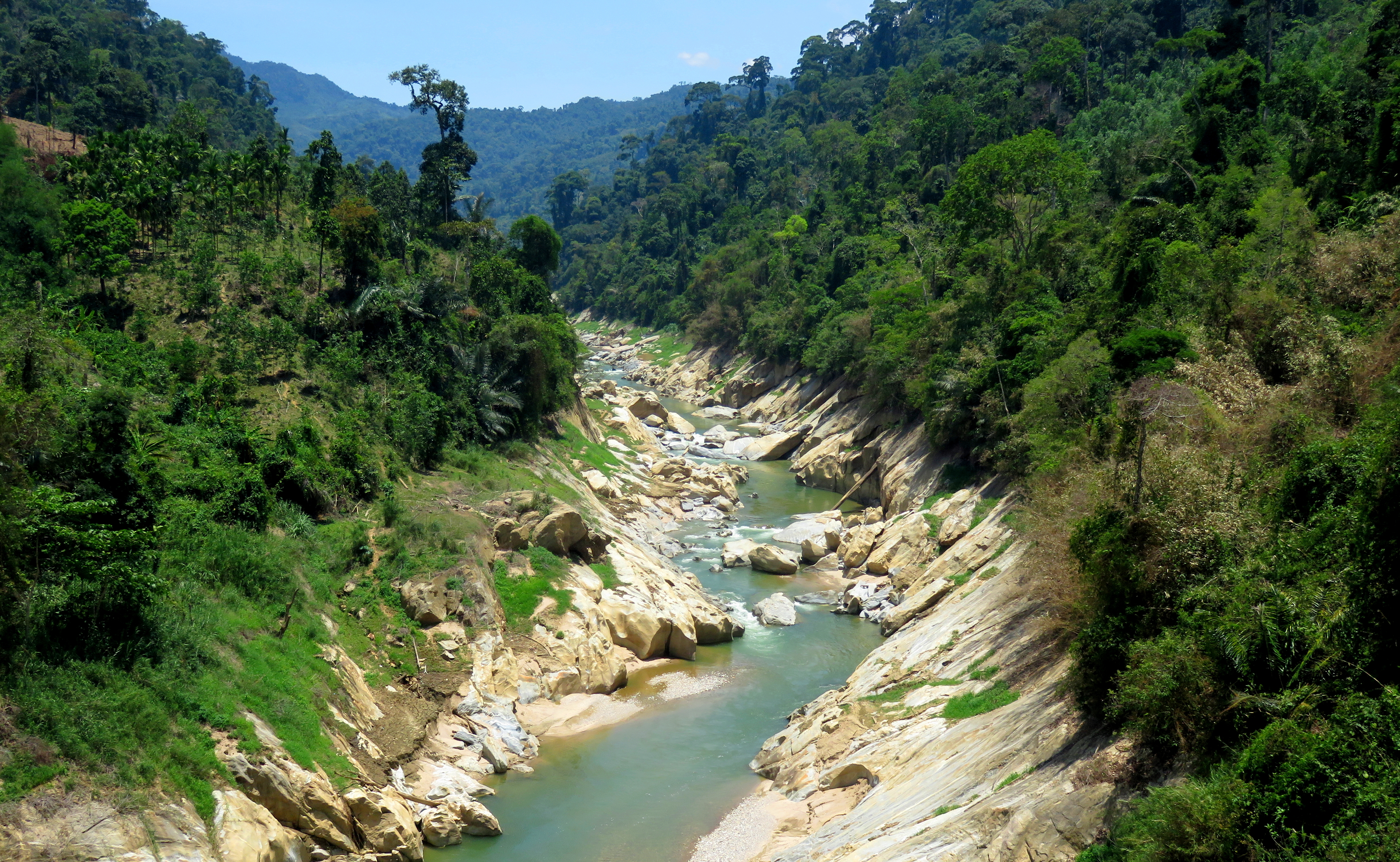
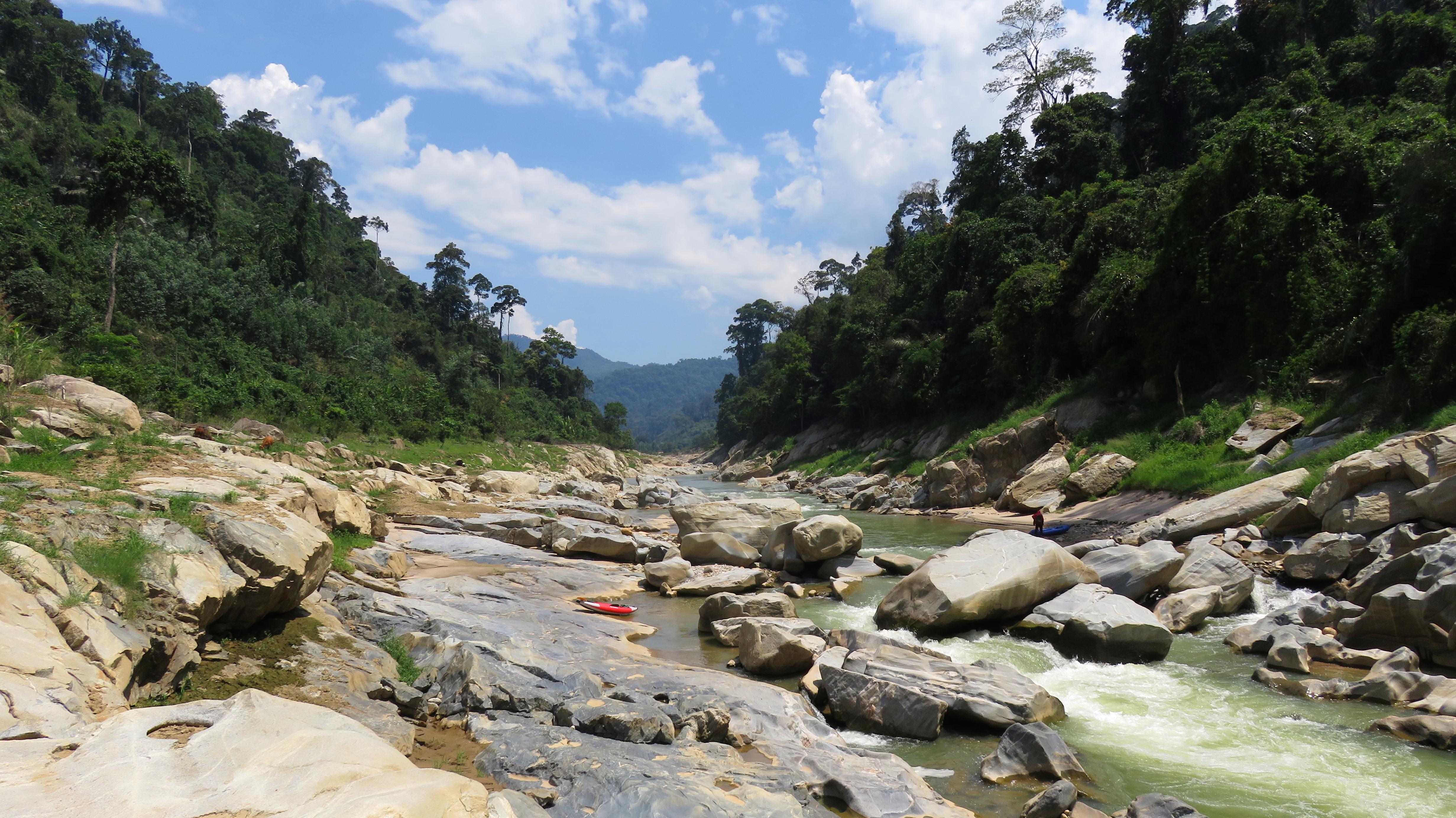
Its hard to see the immensity of this canyon from river level, but it is an impressive place.
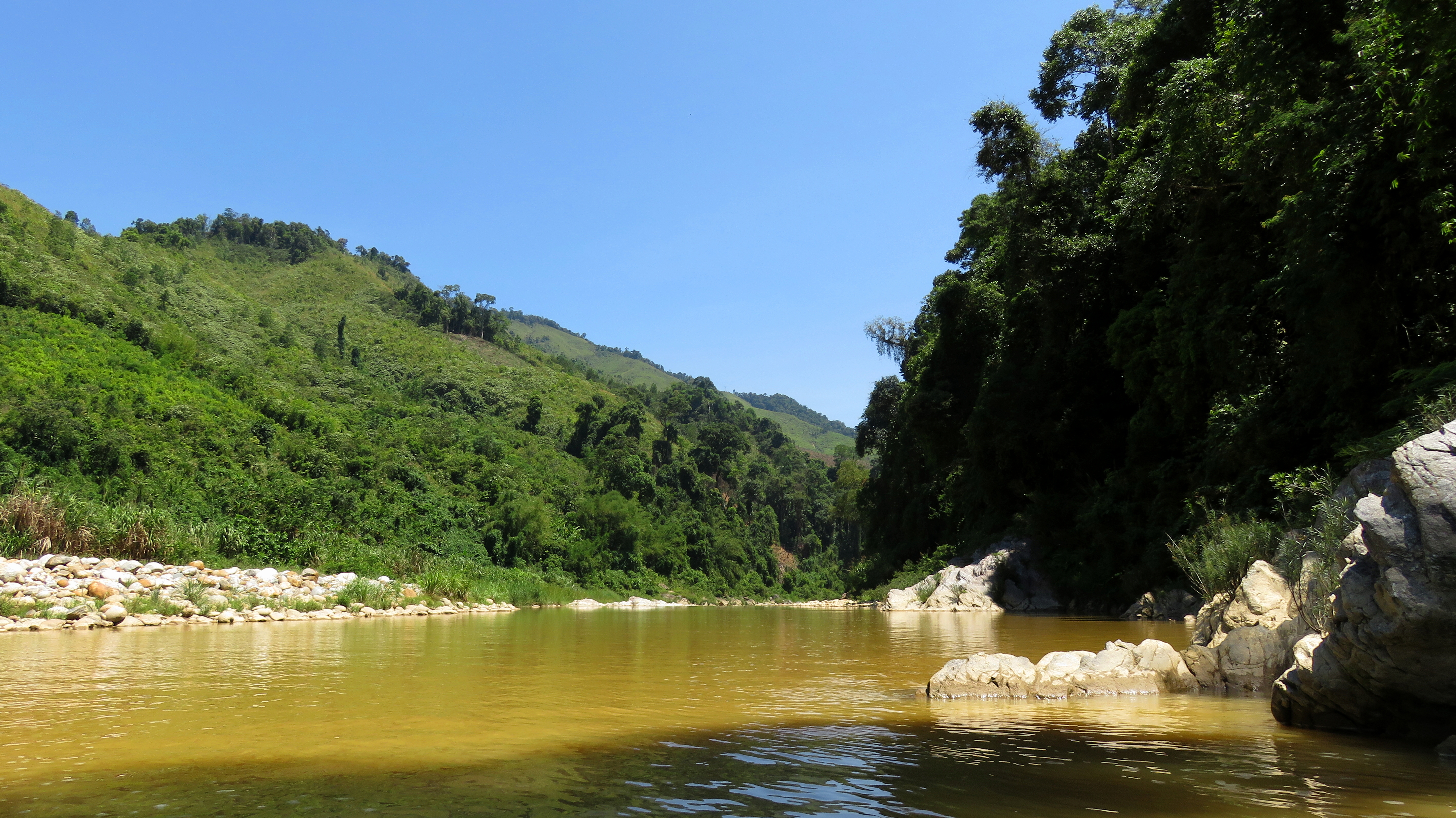
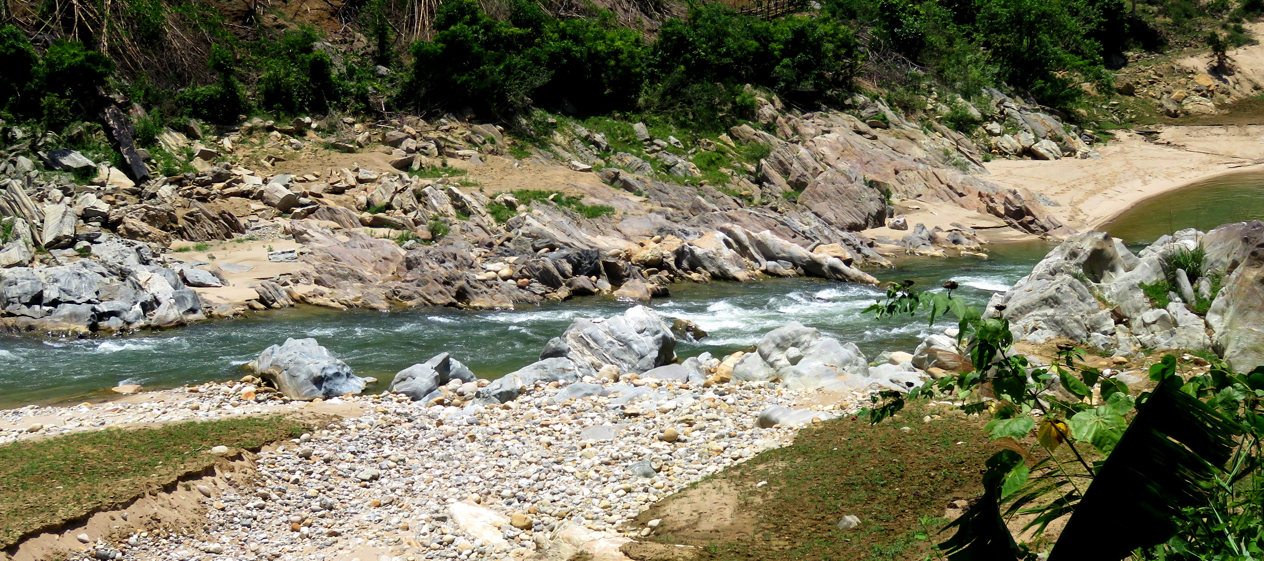
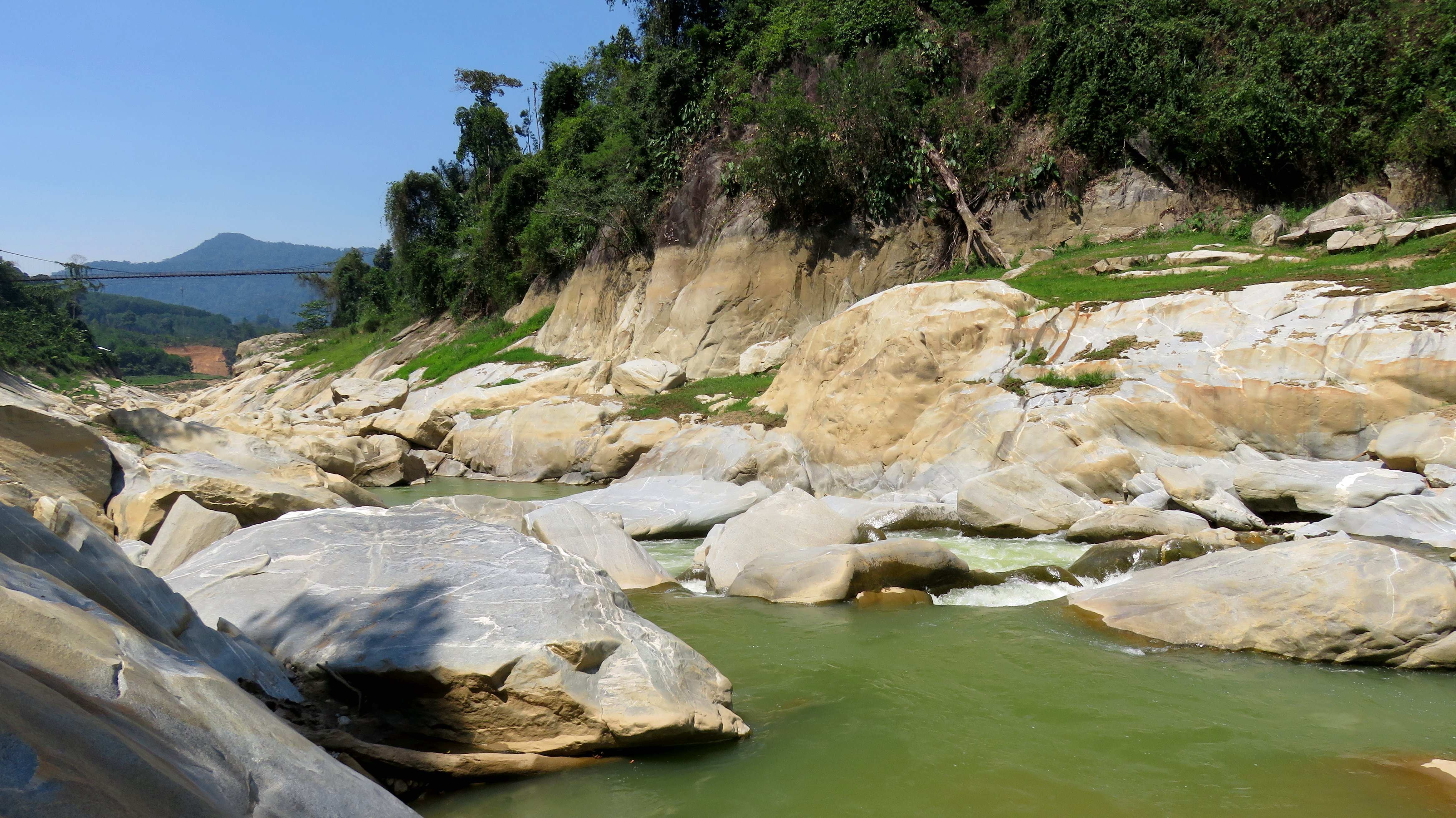
This section starts right in the heart of Nam Tra My district, running through Tra Mai, the district capital of the area. The landscape here is dominated by the massive bulk of Ngoc Linh rising to the southwest (unfortunately invisible from this canyon), as well as some impressive smaller ranges to the east as well. The headwaters of this river eventually begins as the Song Dak Di, which has a couple of good runs on it, before becoming the Song Tranh when it merges with the Nuoc Lah in Tra Mai. Below Tra Mai the river runs through a longer, somewhat boxed in upper gorge, a short open section, and then, if the reservoir hasn't flooded it, a short but much more boxed in gorge to finish it off. The predominant rock type through the whole area is granites, and it is definitely impressive how hard some of the river-level bedrock sections are.
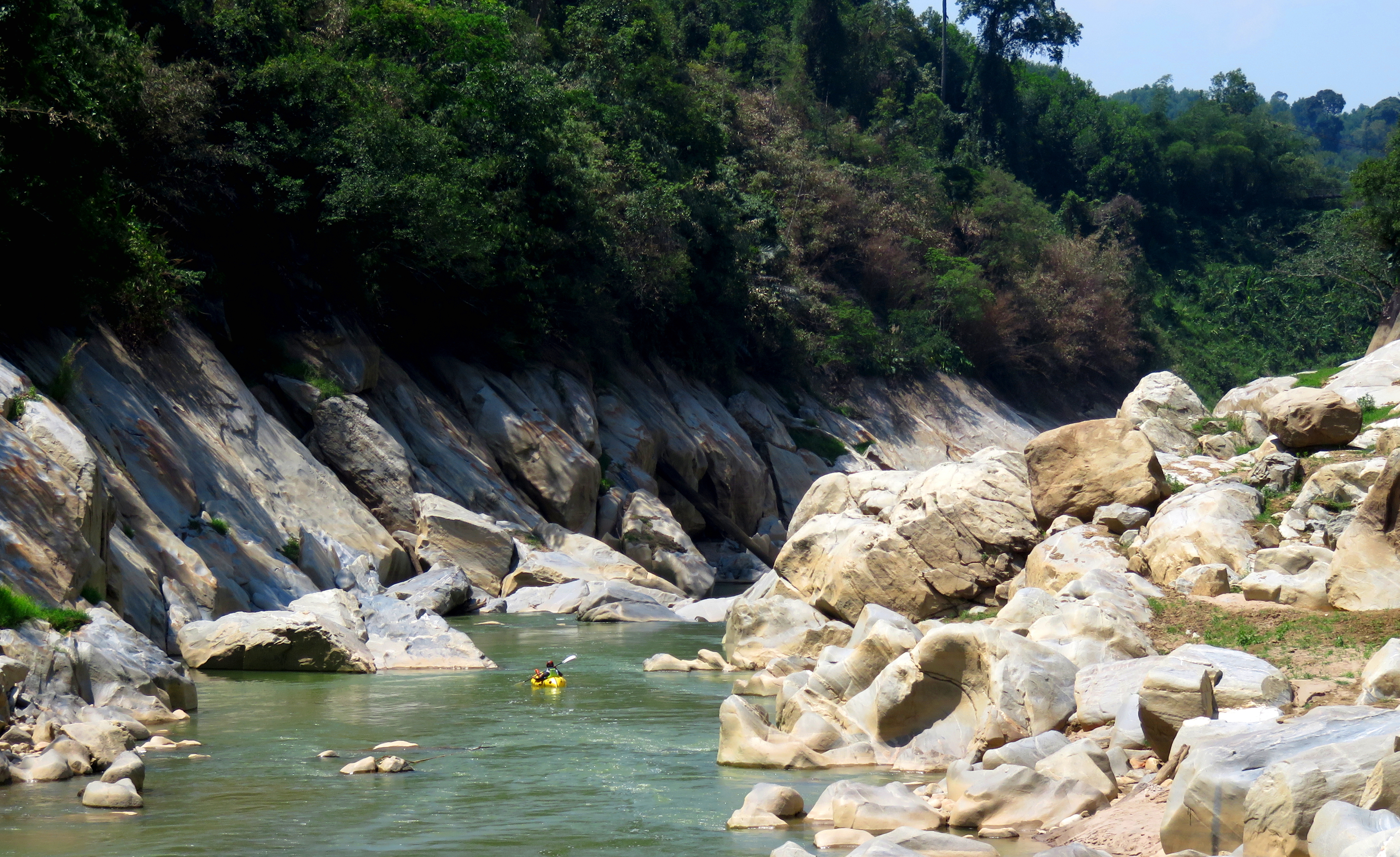
Looking up the White Rock Gorge at the bottom.
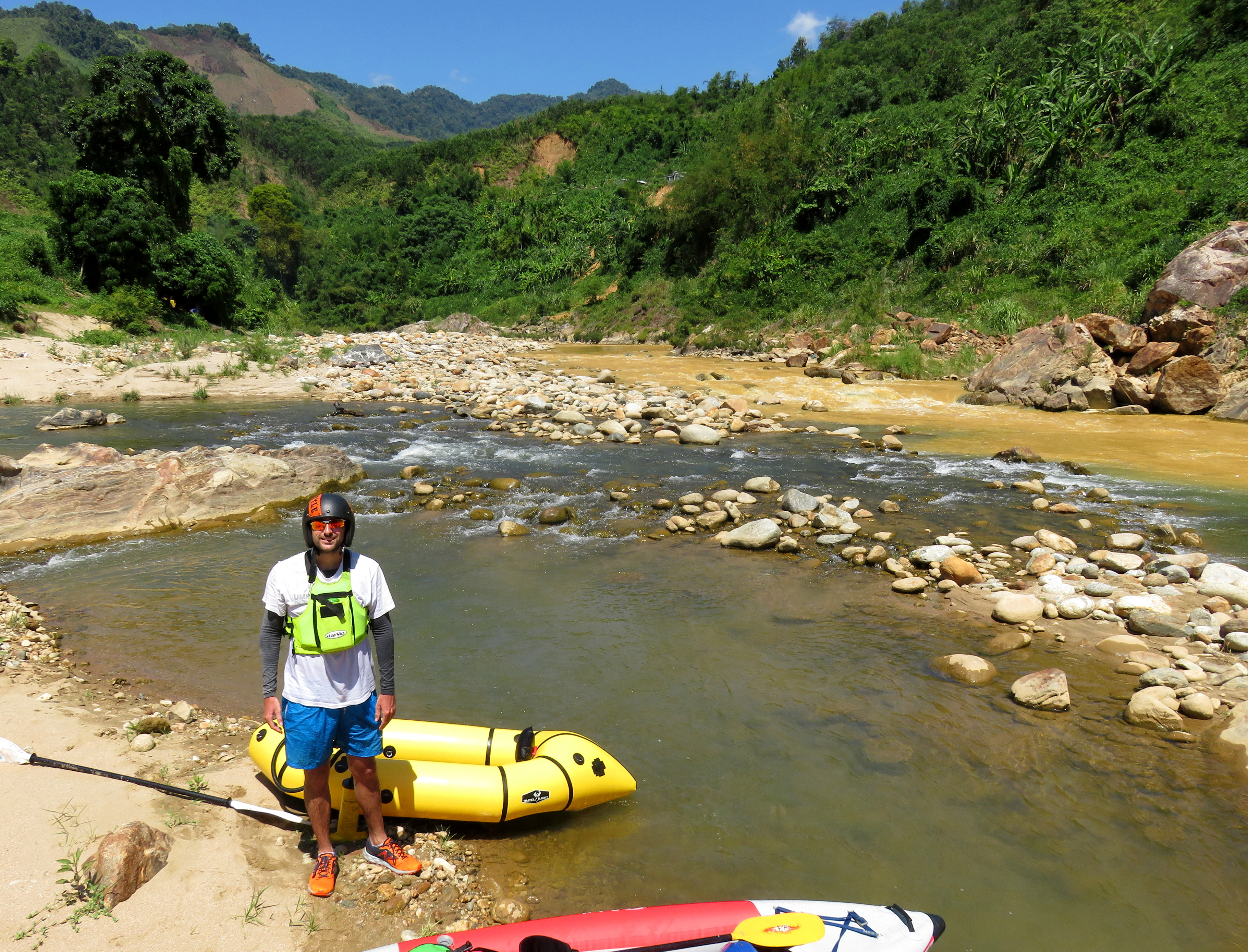
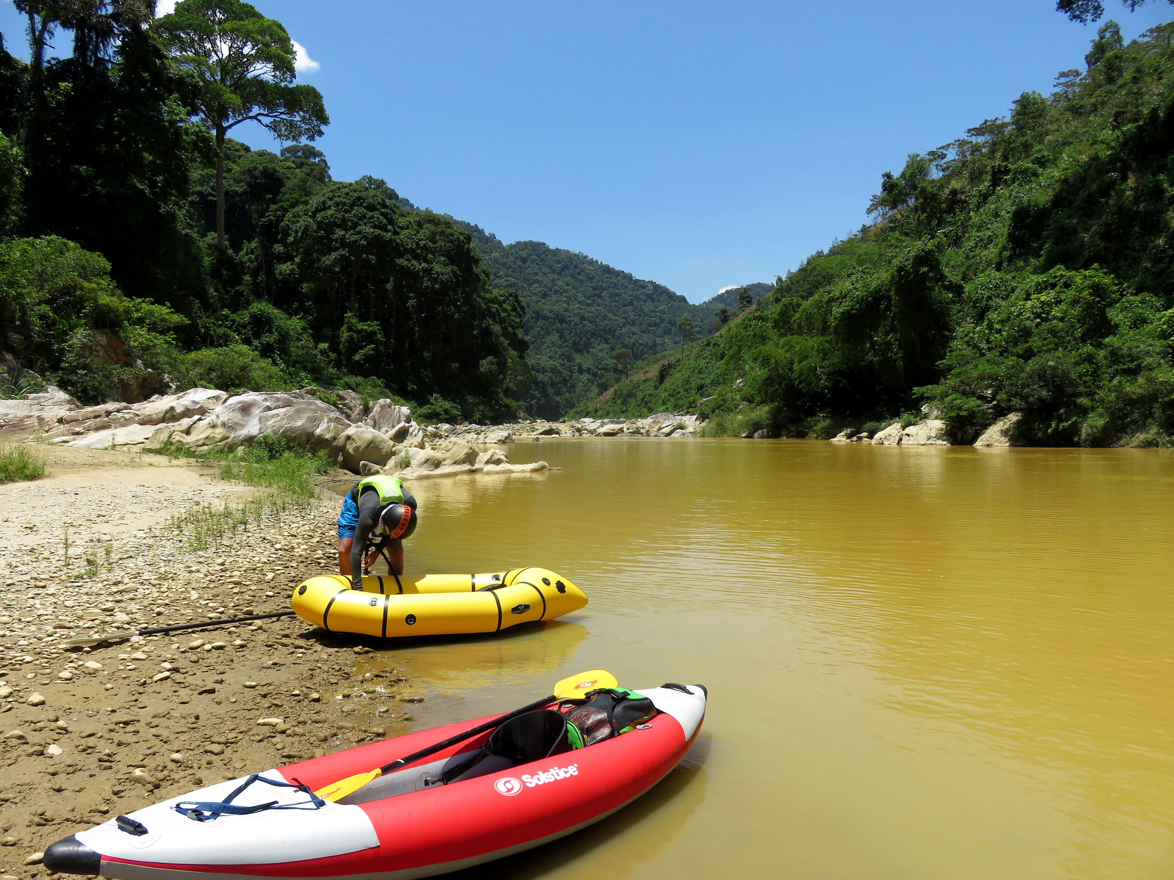
The put in is kind of confusing; private land prevents putting on right at the Nuoc Lah confluence, so you have two options. You can go upstream on the Nuoc Lah around 1.5 km to a footbridge, and float the small rapids of the Nuoc Lac (or the lake if the dam is full) and get to the Song Tranh. Or, you can go downstream 200 meters to a bridge over the main river, and then turn right and cross a bridge over a tributary stream and take the small road down to the river. There is one small rapid between the two, but its a tiny class II+ and nothing exciting. Beyond the put in, the river is flat for a short while.
Confluence of Nuoc Lah & the Song Dak Di.
|
Cuong on an early drop.
|
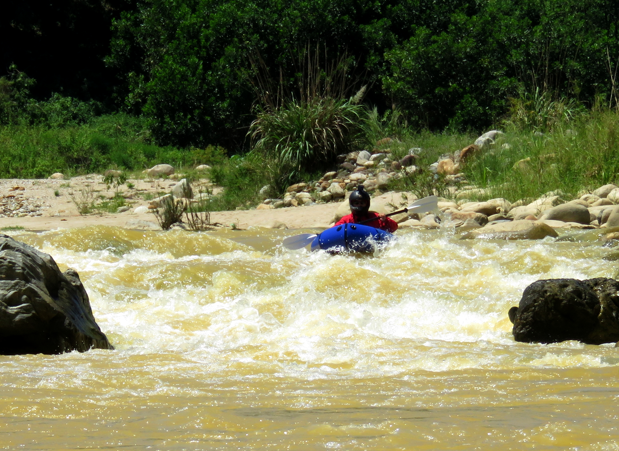
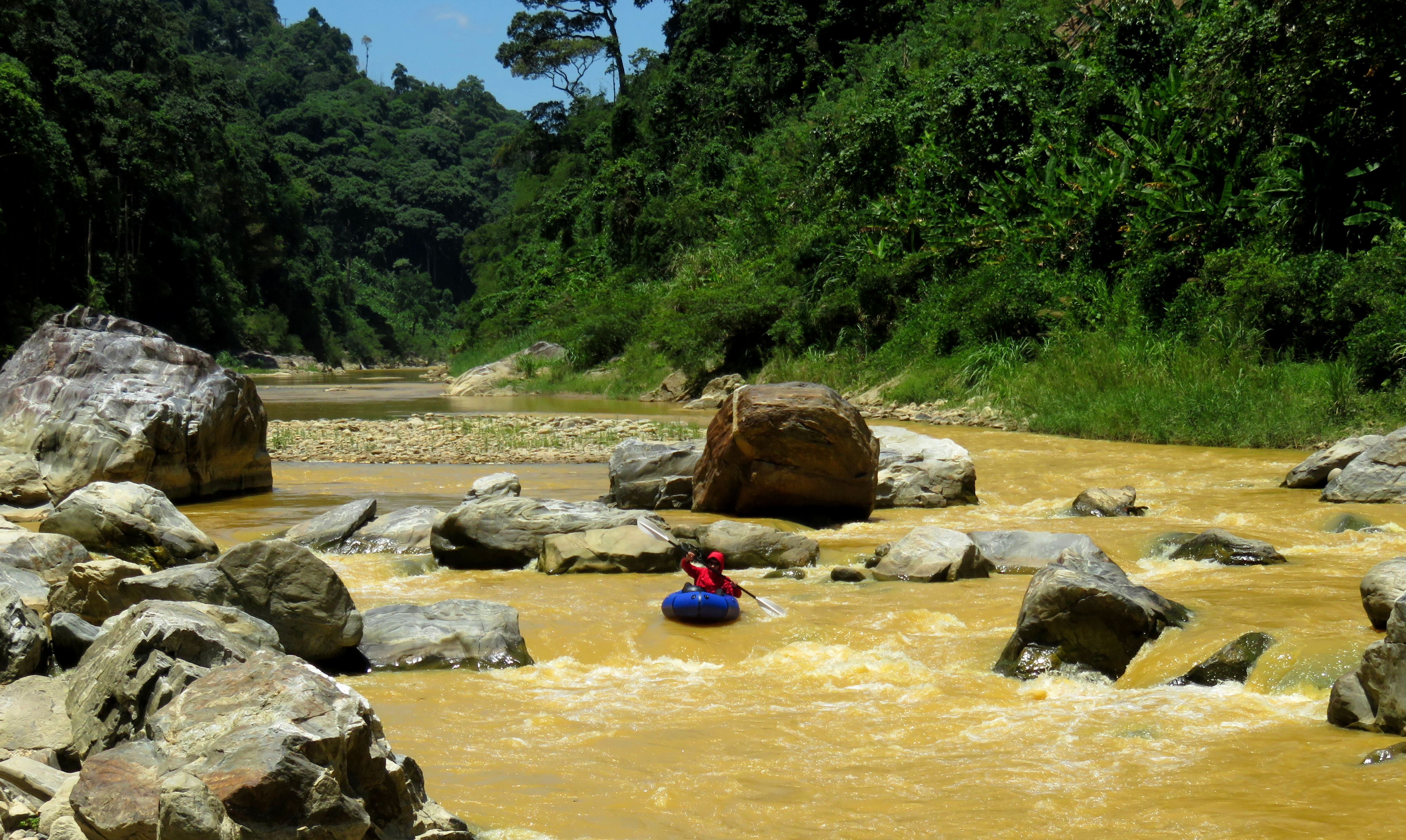
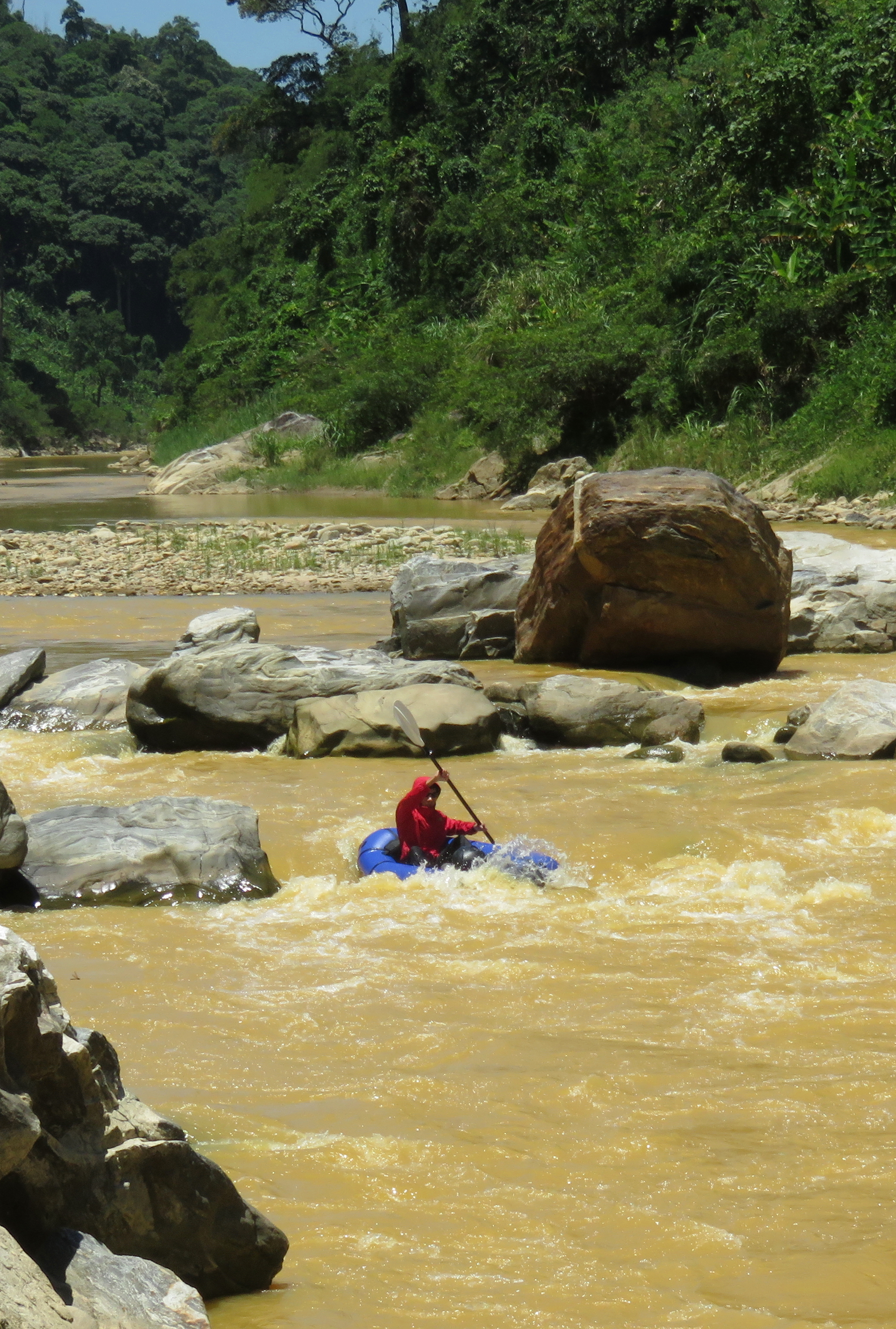
The first rapids come up fairly soon, and for the first kilometer or so they are of the wide gravel bar variety. However, because it is a big river bed, even at low levels there is often one channel that has more than enough flow to run. There is one small bedrock drop in the first couple of kilometers that is drops a surprising amount of vertical, but it goes clean and fun. Another couple of small gravel bar rapids leads to a fun and interesting drop called "Banked Turn", which is a series of two wave trains stacked on top of each other, set at different angles, wedged between a wall of bedrock on the left and a gravel bar on the right.
Cuong coming in hot through the Banked Turn.
Nam Nim Gorge
A couple more small rapids are spread out over the next half a kilometer. It is in this stretch that the bedrock walls really begin to ramp up on river right, as the mountains to the east start to press against the range to the west, which creates the first gorge of this section, the "Nam Nim Gorge". While not as confined as the "White Rock Gorge" lower down, it is actually deeper, and does possess several standout rapids. A short ways down, Suoi Doi joins in an impressive fashion, spilling over several small waterfalls into the main river. This water is spring-fed, and is usually refreshingly cool, so if you are paddling the Song Tranh on a hot day, consider paddling under these falls for a spell to cool off.
Looking down into the start of the Nam Nim Gorge.
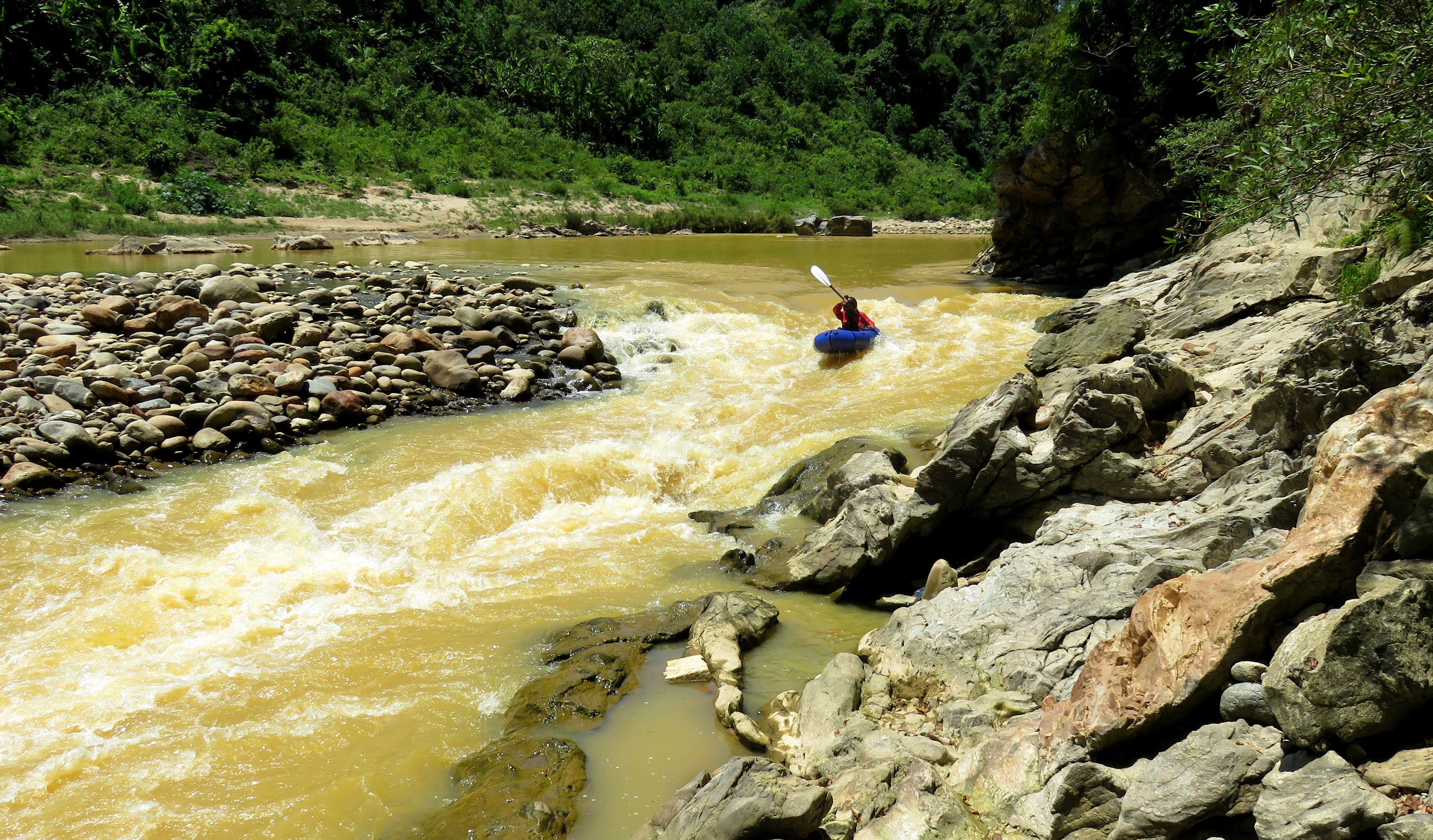
A couple of hundred meters downstream and the first reasonably sized rapid, "Lane Change" comes up. This boulder garden is clean and fairly straightforward. At lower levels the line is to come in left, and then work your way right and clean the bottom. At medium levels the center and left lines begin to open up, at high water it becomes an easy minefield of holes to avoid. Spaced evenly below this are two more rapids, easier than Lane Change, but still requiring attention. The first is called "Fishermen's Drop", and is straightforward through the bedrock and around the boulders, while the second is called "Wrong Way" and requires a correct line or you will end up in the shallows.
Lane Change Rapid, in the heart of the Nam Nim Gorge.
Lane Change.
|
Calm in the gorge.
|
After Wrong Way, the river flows through a brief flat section, around a couple of small corners. Shortly, a large, wide rapid appears that is quite noisy, marking the start of the crux section of the Nam Nim Gorge. Here are three rapids in fairly quick succession over the course of about 400 or 500 meters. The first of these is called "Skanky Chicken", and is an interestingly-shaped rapid. A large wing of bedrock sits on the left side of the river, with a small field of boulders in left and center. Right is a massive bar of small rocks, and at low flows the river is pinched to the left side. The line drops quite a bit of vertical and is technical, but it does go pretty easy. The right side is a mess, and even at medium levels it can still be manky. At high flows it is best to skirt the hole in the middle of the river as it can be quite nasty.
Tim checking out Skanky Chicken Rapid.
Not far downstream is one of the better rapids of the whole run, called "Hard Left". This drop winds down through the boulders and over some pieces of bedrock. At low flows the line is to come in on the left, work right, and then take a hard left around a large mid-stream boulder before lining up for a couple of possible lines at the bottom. A small chunk of bedrock at the very bottom creates incentive to stay on line through this drop. As flows increase this drop becomes more meaty, as the holes increase in size and the ability to slot through and around them decreases. At high flows this drop is a solid class IV or IV+ rapid and should be scouted.
Cuong lining up for the first half of Hard Left.
One more unnamed rapid marks the end of the crux section. This one is pretty easy; it is longer and technical, with lots of moving around from channel to channel, but there isn't much vertical drop to it, so even as flows increase, it will still be fairly easy to move around and make the required lines. There is one drop in here that will become stickier as the flow rises, so setting safety might not be a bad idea, but as the flows continue to increase sneak lines on right and left will open. After this rapid, the gorge does open a bit and the walls scale down; don't be fooled though as another longer rapid soon comes up in one last bedrock pinch. This long, technical rapid is mostly easy and clean, and a good boat scout should see you through nicely.
Clearwater Rapids.
Just below this is the first realistic river access since the put-in, where the highway comes very near to the river, with a short road connecting the two. Additionally, after one brief and easy bedrock rapid, a small cluster of local shacks appears on the right, and there is easy access to the river here too. If the lake downstream is full, and has flooded the White Rock Gorge, of if your group simply doesn't want to tackle it, then either one of these are a good alternate take out. If you are continuing on to the White Rock Gorge, there is one final gravel bar rapid just past the village called "The Ditch" that actually goes surprisingly well, even down to low flows, because the river splits into two channels, with the left one channelizing quite well and making a fun rapid. As the flows increase this rapid will get easier.
The Ditch Rapid.
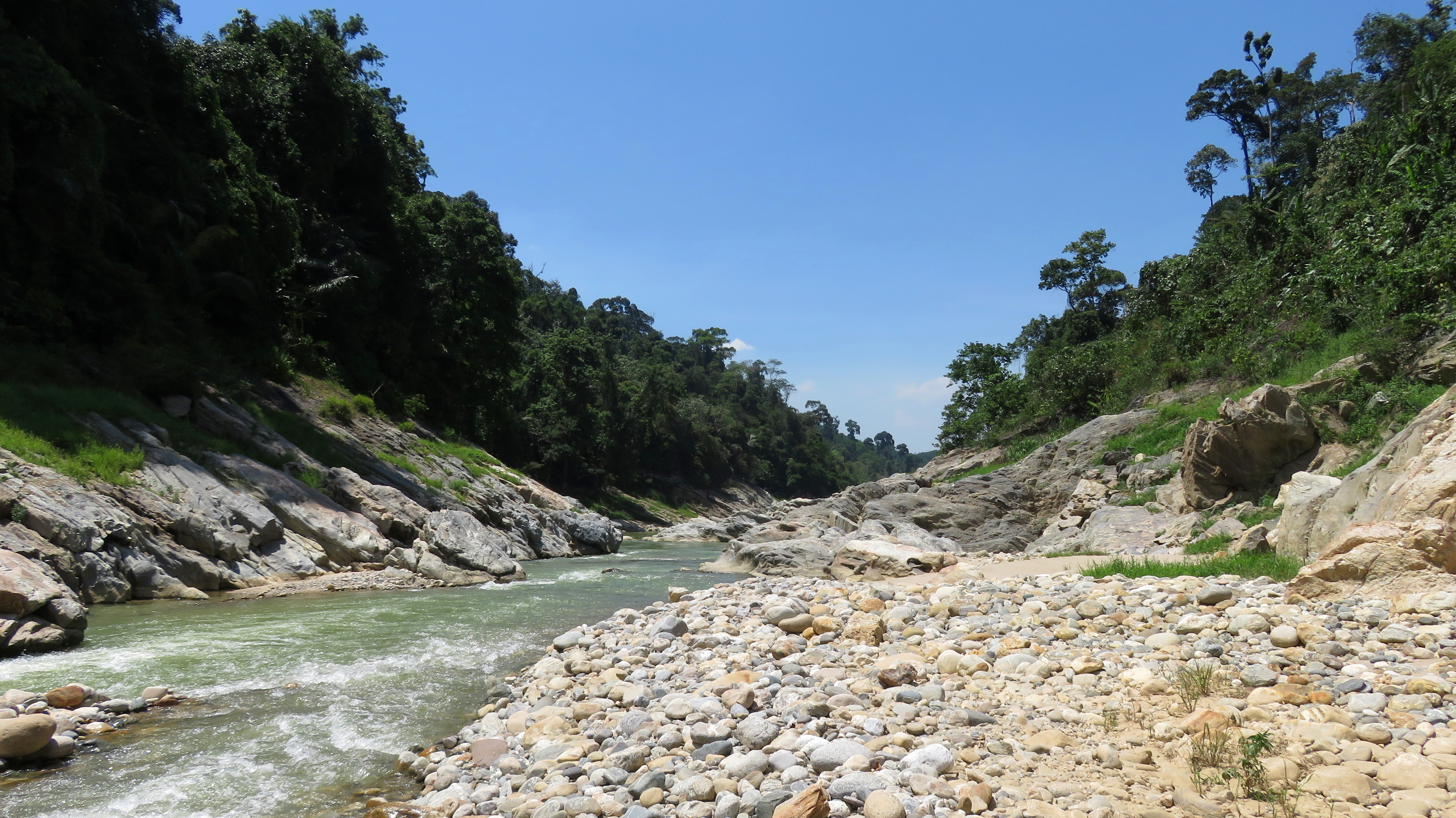
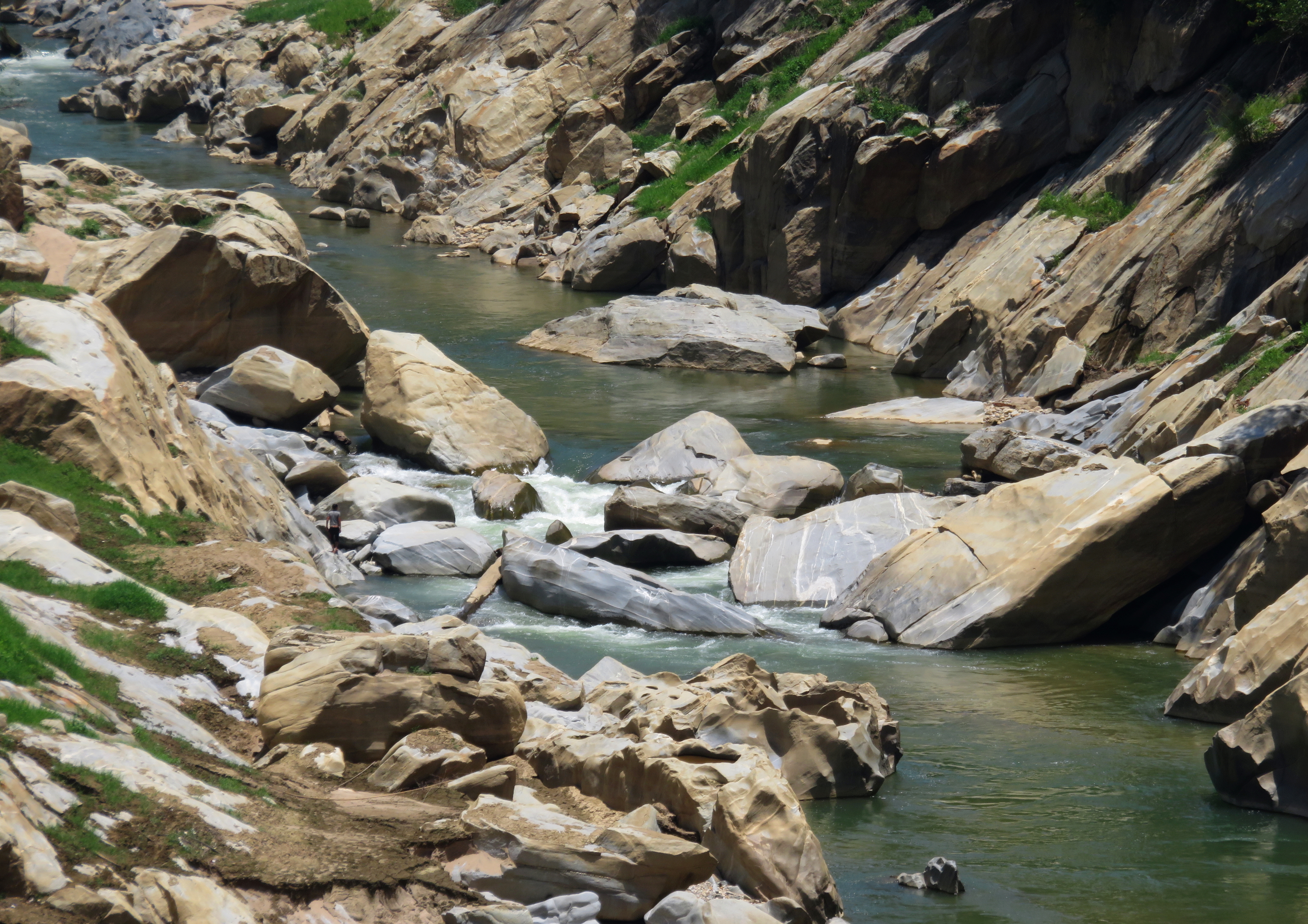
White Rock Gorge
Below The Ditch, the river begins a fairly obvious change as it drops into the White Rock Gorge. This short canyon is much more boxed in and committing than anything else upstream, and has carved an impressive narrows through the granite here. Countless years of high water floods, and more recent reservoir immersions, have bleached the rock to a nearly white color, and the rapids inside are piles of huge bedrock boulders with the river coursing through, around and over them. Within the gorge itself are around 4-5 distinct rapids, which start easy, and then build to a small crux just above a footbridge high over the gorge. The first few drops are very simple and easy.
Looking down into the start of the White Rock Gorge.
So pretty.
|
Cuong coming down White Rock Rapid.
|
Looking back up at the first half of the White Rock Gorge.
The first rapid of note is worth a quick scout. At low levels the line is come in from the right, and then cut back left, through and over a couple of small holes. As flows increase, the line gets easier, and at high flows an easy right side sneak, or a more direct left side run both open up. This is one of those rapids that at low flows is a class III, but as the flows rise the difficulty will also rise accordingly.
Approaching the portage. You can see the easy portage around on river right.
The portage from above...
|
...and from downstream.
|
After this nice rapid, the gorge walls get a little deeper, and an ominous boulder pile approaches. This rapid is the only mandatory portage of the run, although at high levels if the wood has been moved, it does become runnable. However, this rapid has quite a few sieves in it, and is generally pretty ugly, so it's best to hop out and avoid this one. The portage is made by exiting river right, about 75 meters upstream from the drop, and walking up and around on the bedrock shelves. There are a couple different paths back down to river level, and all told the portage only takes 5 to 10 minutes.
Above the last rapid.
|
Cuong floating out of the gorge.
|
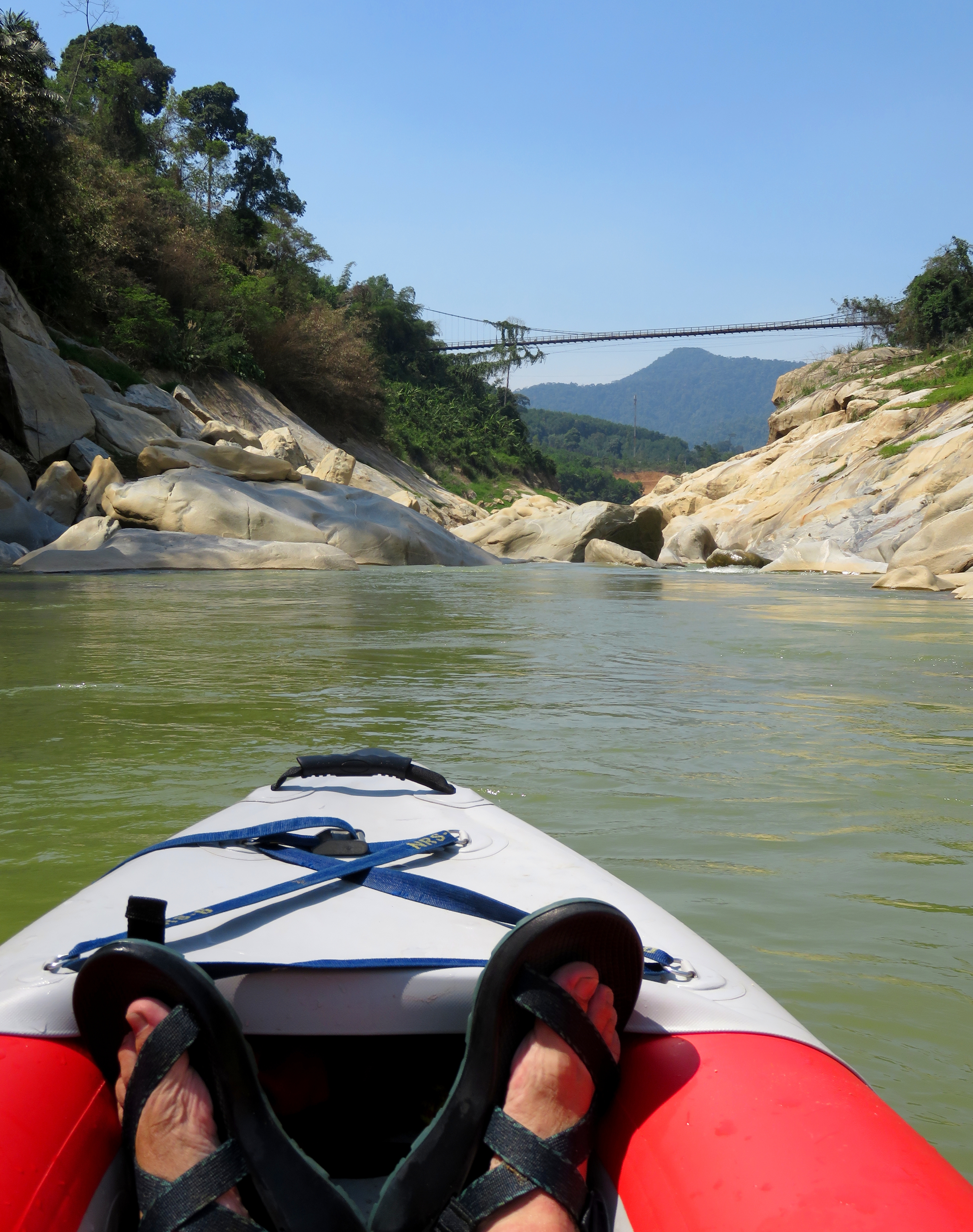
Below the portage is one more easy rapid that is a simple shot down the right, around some rocks and through some small holes and splashy waves, and then the gorge is finished. The best takeout for this run is found after the end of this gorge, just east of the bridge to Tra Bui and Tra Leng- the newish concrete road bridge just downstream from the older suspension footbridge. Here, a small dirt road goes behind a small roadside coffeeshop and down to the river. Because this is the very upper end of the Song Tranh 2 Reservoir, the takeout will either be a longer walk up and along the sand bars up to the road, or it will be a paddle over to the shore and then a quick walk up.
At the takeout.
The Video
The Map
|
All photos copyright Kit Davidson
All maps copyright Google MyMaps. |
