
Song Vang Drainage: Headwaters | Upper Gorge | Lower Gorge
This is somewhat of a lost paradise in the Da Nang area. Thanks to a rough road coming from the upstream side, and no access possible from the south side, this section of the Song Vang canyon has escaped the development or heavy logging that has befallen many areas of the mountains around it. For those who are willing to put with a little bit of inconvenience, this is a nice destination with a reward of a beautiful jungle canyon draped in old growth jungle.
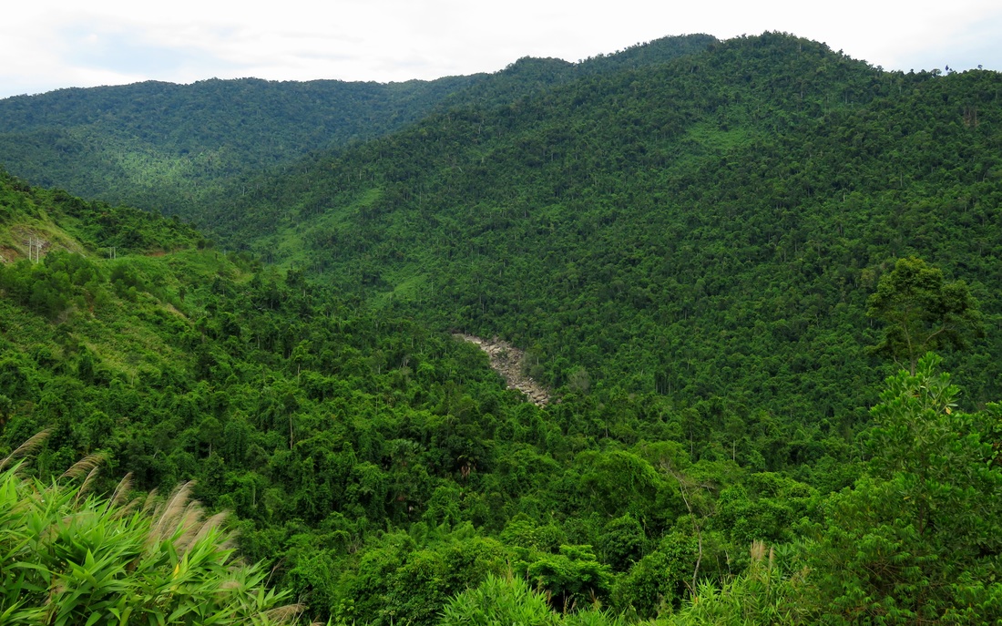
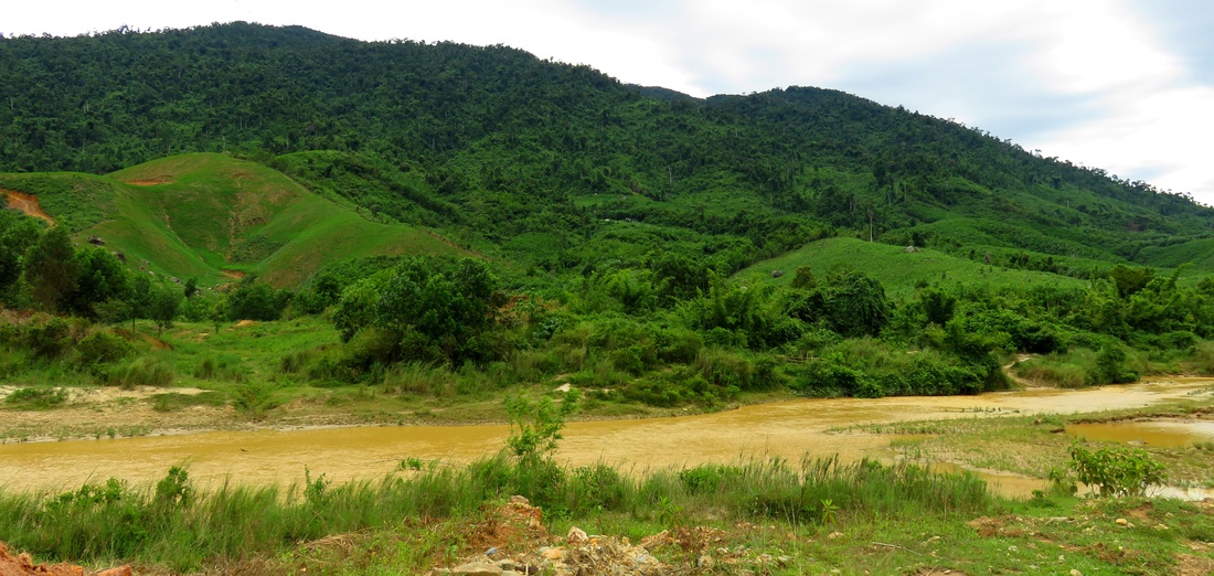
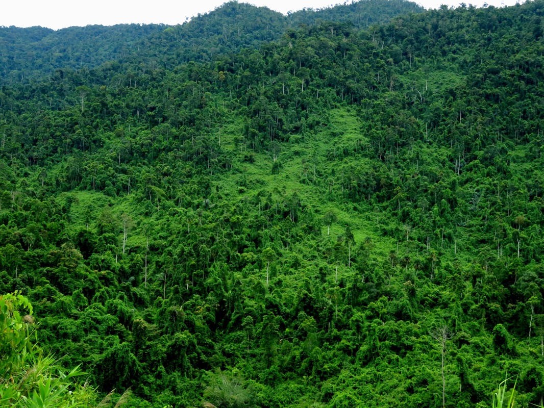
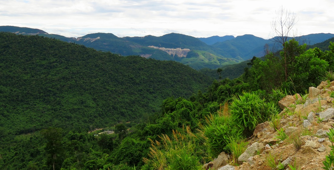
Below Xa Ba and the QL-14G bridge, the Song Vang (or "Yellow River") leaves the wide open floodplains and meandering valleys of it's headwaters and begins to funnel down into the mountains. These large peaks, including a number of small ranges such as Nui Tien and Nui Tho Thennon on the east, and the "Mountains of the Mist" to the west, are solid granite bedrock at their core, and are quite resistant to erosion. As a result, over time, the Song Vang has carved an impressive and deep gorge straight through the heart of the mountain range. While the river itself has suffered from man's development thanks to some hydropower projects (more on this later), the canyon itself remains, and it is quite a large gash through some big peaks.
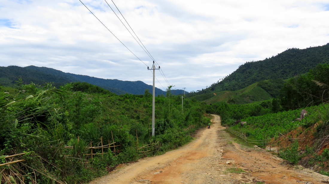
The road takes off from the QL-14-G and is rough right away. Get used to it, as the road will stay like this all the way to the dam, several kilometers down the canyon. At first the road passes through several areas that have been cleared and will likely become plantations for quick-growing, easily harvestable second-growth trees, or possibly farms and grazing areas. A short couple of kilometers down the road is a large project where they are building a large assembly of small warehouses for raising pigs. Quickly beyond this the canyon becomes more wild and free of development.
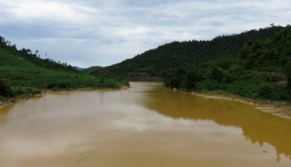
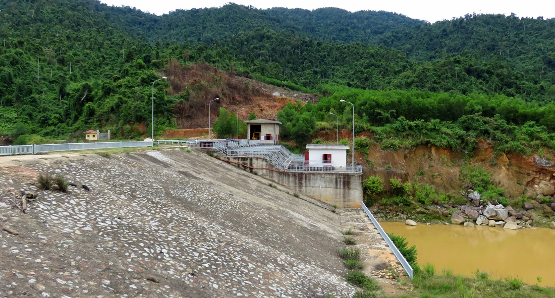
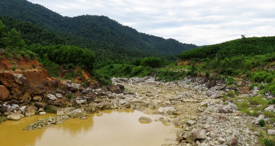
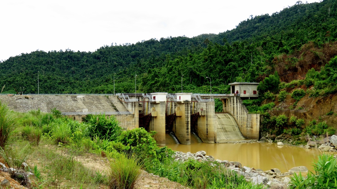
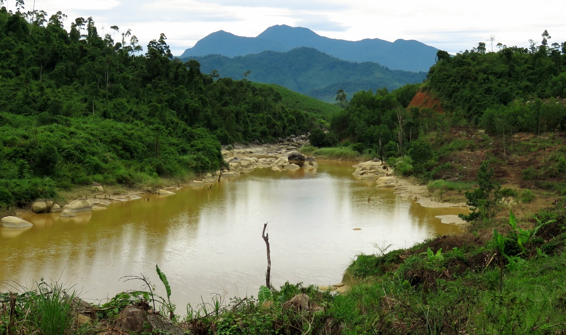
Soon, one final mini gorge appears on the river, and then the river peters out and backfills into a small reservoir. This small lake is part of the Song Vang Power Project, and water from this reservoir is transported via canal downstream several kilometers, until it falls down a large tube that runs down the slope of the canyon wall and feeds a power house at the bottom. Electricity is generated as the water spins the turbines. During our trip the reservoir was low, which meant that the Song Vang below the dam was essentially de-watered. This fate has sadly happened to too many streams around the Da Nang area.

|
|
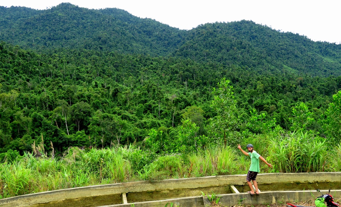
Around the corner, the Upper Song Vang comes out in it's full glory. Large mountain sides of old growth run from river level all the way to the very tops of the peaks. The road continues along the side of the canyon wall, following the course of the feeder canal. There are concrete bars across the canal in a lot of places but please do be cautious if you try to go out across them. Unfortunately some of the better views are on the outside of this canal, so try to cross where it seems safe, like where there are two of them together. The biggest danger is not from an impact, but being able to get out of the canal once you fell in. Just avoid the whole danger and cross where it's safe.
|
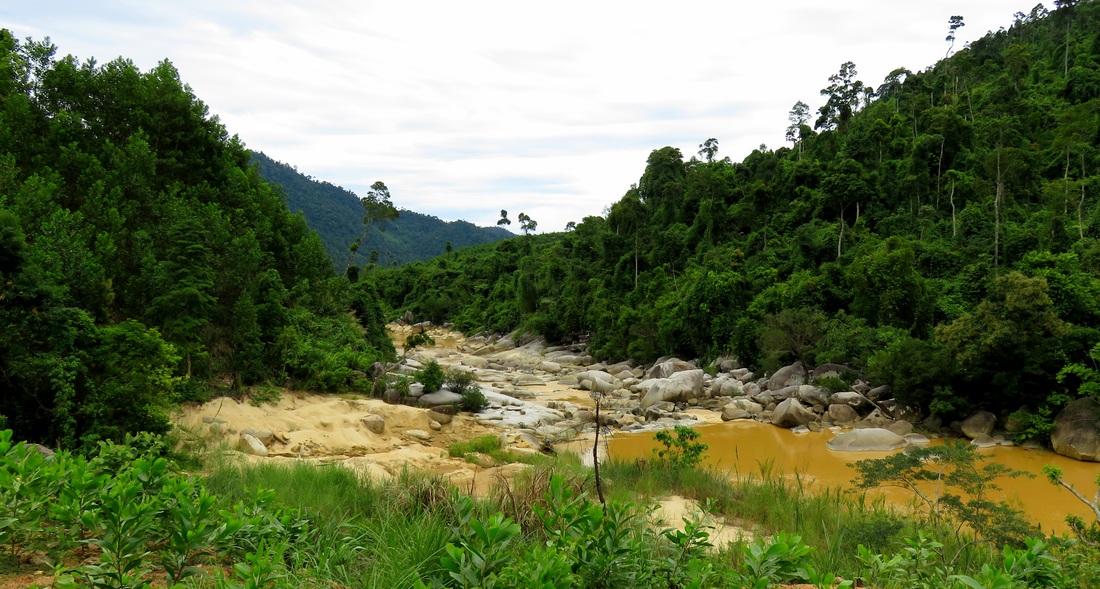
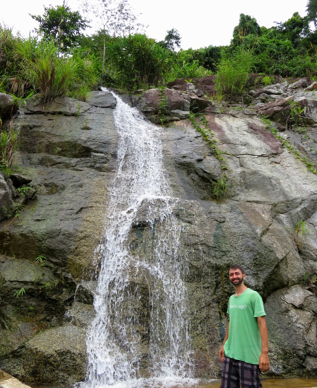
After a couple of corners a small waterfall appears that's worth dunking the head under for a minute to cool off. It also sits next to yet another hassle for this road- the low spots. Along the course of the canal, between the canal and the mountain, the road sometimes drops into low spots where there is no drainage from. The result is areas of perpetual water and mud. None of them are that deep but they get kind of old crossing time and time again.
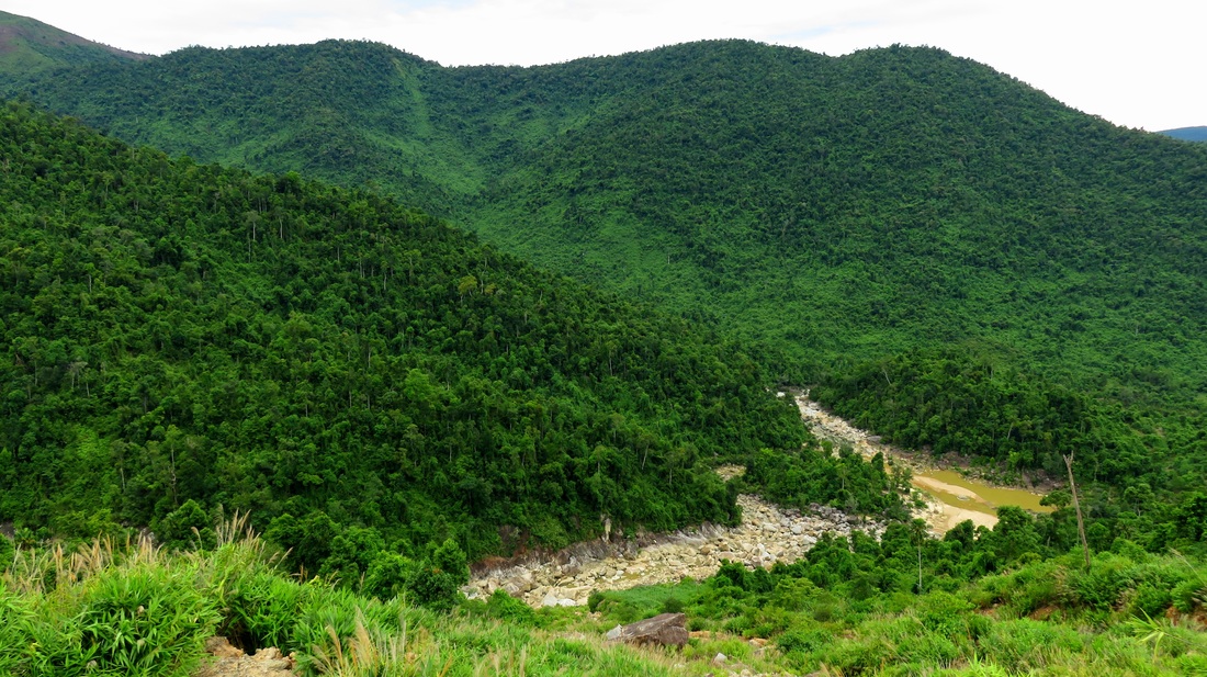
Around a couple more corners and the hydropower project comes into view. The road continues to be messy, as recent landslides have dumped many rocks and boulders and lots of dirt onto the path. You can still get through but ti's slow going. At one point a really good viewpoint comes up on the left; definitely take the time and stop here. To the left is the gorge of the Song Vang; directly across is a large tributary canyon, and to the right is an incredible view over the mountains that separate the valley of An Diem and the Song Kon in the foreground with the valley of the Song Cai and Thanh My behind it. |
|

From here, you've got two options, but you better be sure of yourself and your bike's ability when you make the choice. You can either drop all the way down to the power plant, which is exciting but ultimately doesn't get you much else. From here adventurous explorers with stout and solid bikes can take a rugged single track down the hill, which spits you out at the end of the road in the Lower Song Vang Gorge section. This is a strictly one way track, and should only be attempted by drivers who are sure of themselves, their driving skills, and the sturdiness of their bikes. Once you get down the track, you are still a very long drive on broken cement paths and dirt roads to get back to the nearest civilization.
For everyone else it should just be a matter of turning around and heading back the way you came in. It will take about 30 minutes to get back to the highway, and the slow going can be even more annoying on the way out. However, there are some great views on the way out, especially near the upper end of the canyon, where there is a great shot of Nui Mang rising above the beginnings of the gorge. Thanks for reading and enjoy!
All photos copyright Kit Davidson.
