
Skip to the Interactive Map!
Deep in western Nong Son, a small hydroelectric power plant has been built to service the local area, and the road to reach this power plant hidden in the jungle is a great quick off road adventure for advanced riders, or a long and challenging road for beginners and intermediates. Either way, this is definitely a high-quality rural route into a wild piece of jungle and if approached properly, should be a lot of fun for just about everyone. Whomever drives this road should know they are in for a fun, but semi-serious adventure.

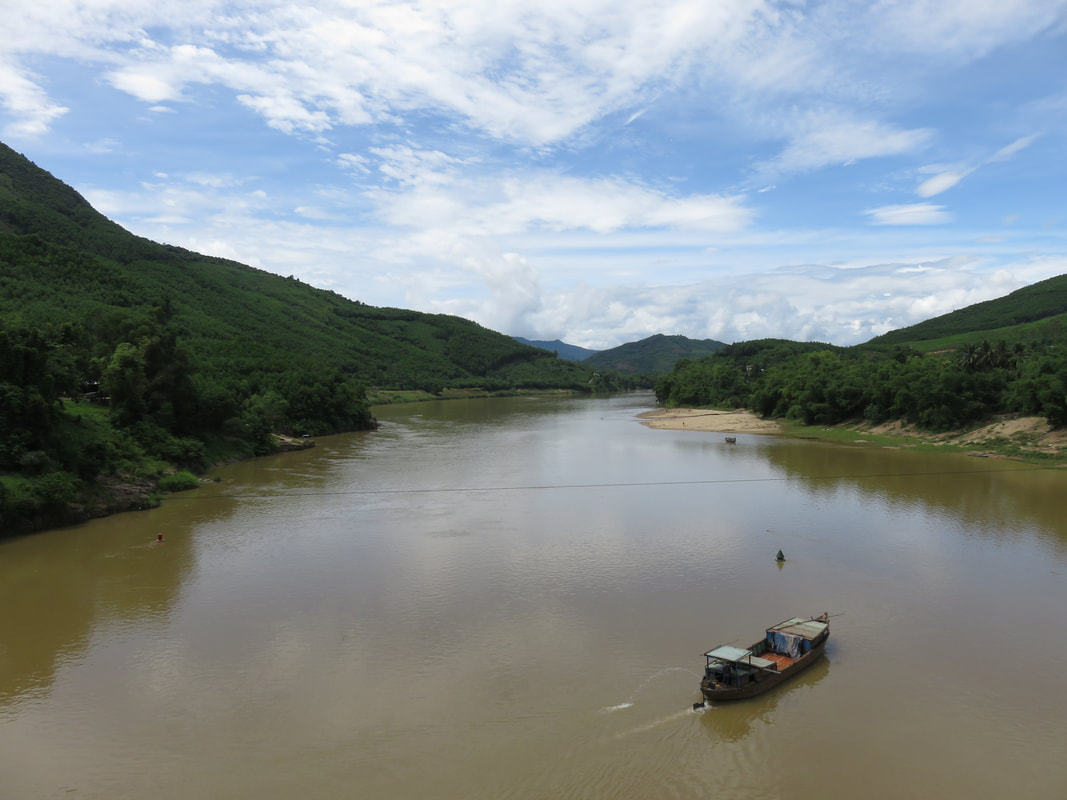
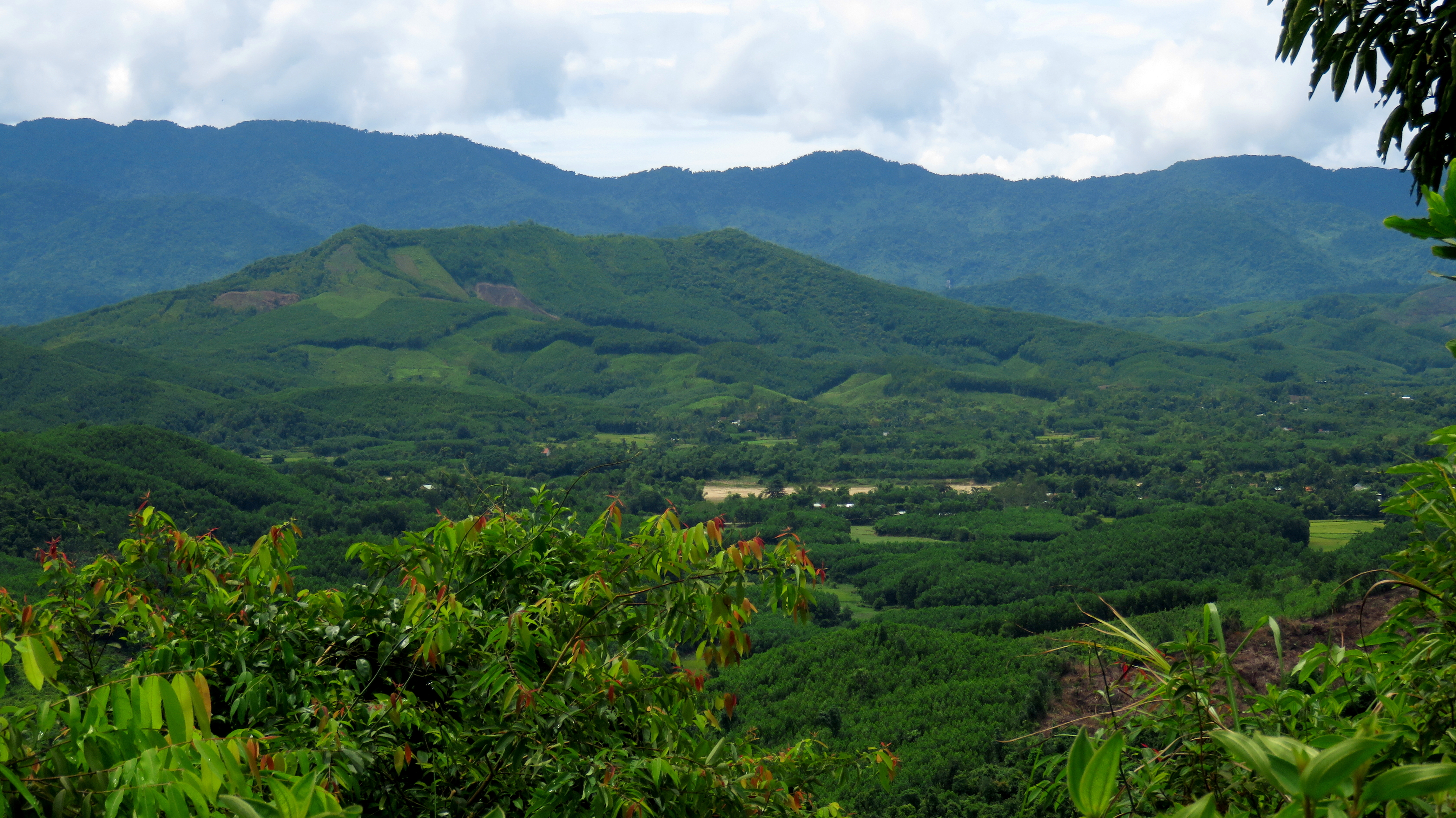
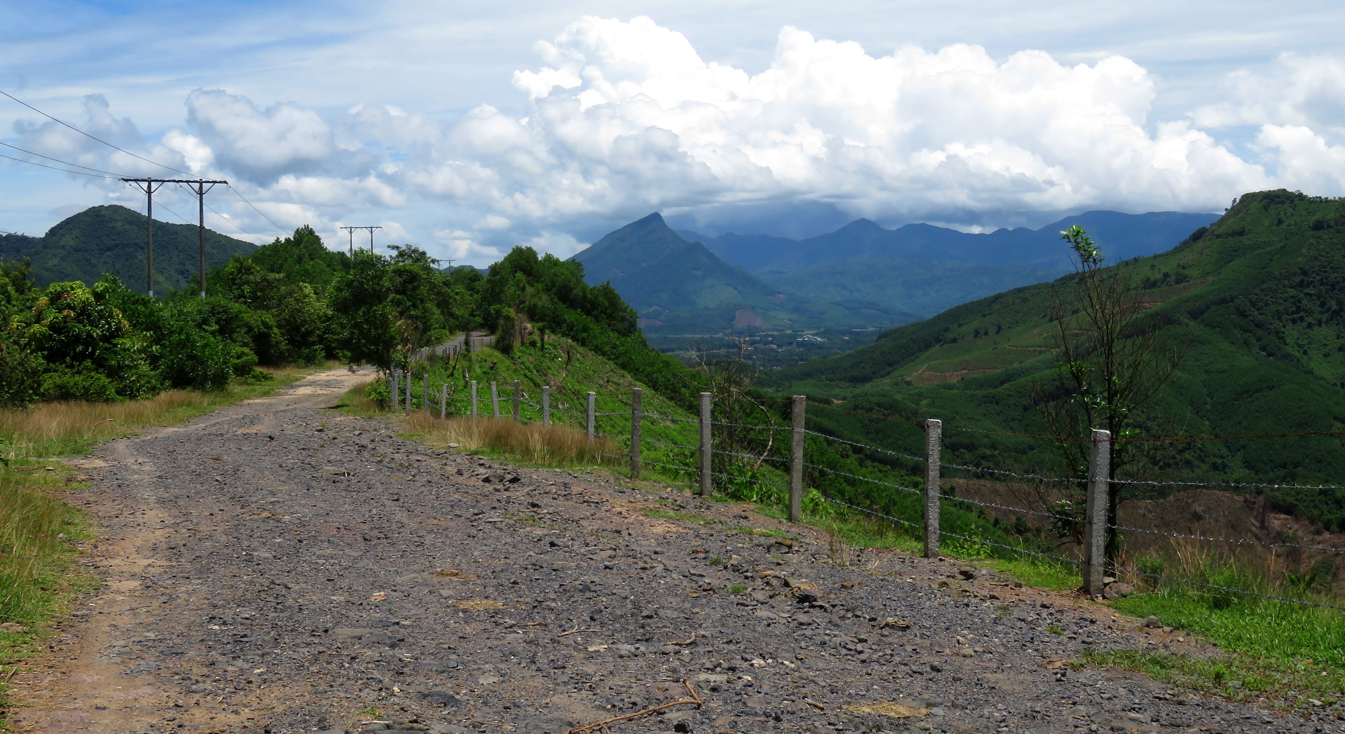
Looking over southern Non Son. Hon Kem Da Dung is on the left, behind the mountain. The peaks of Phuoc Son rise behind in the clouds.
|
The road is really not that far travel time from Da Nang. Thanks to the new Giao Thuy Bridge connecting Dai Loc and Duy Xuyen, and a nice new road from Duy Xuyen to Nong Son, it is possible to make it from Da Nang to Nong Son in under 90 minutes. However, once in Nong Son, things change very quickly and your travel times will lengthen immensely. First you cross the Nong Son Bridge, which is one of only two crossings locally in an otherwise lengthy corridor of the Thu Bon River, and very quickly come to boundaries of the Nong Son Coal Mine. You can read more about this mine and power plant as part of the "Geology of Da Nang" series.
|
|
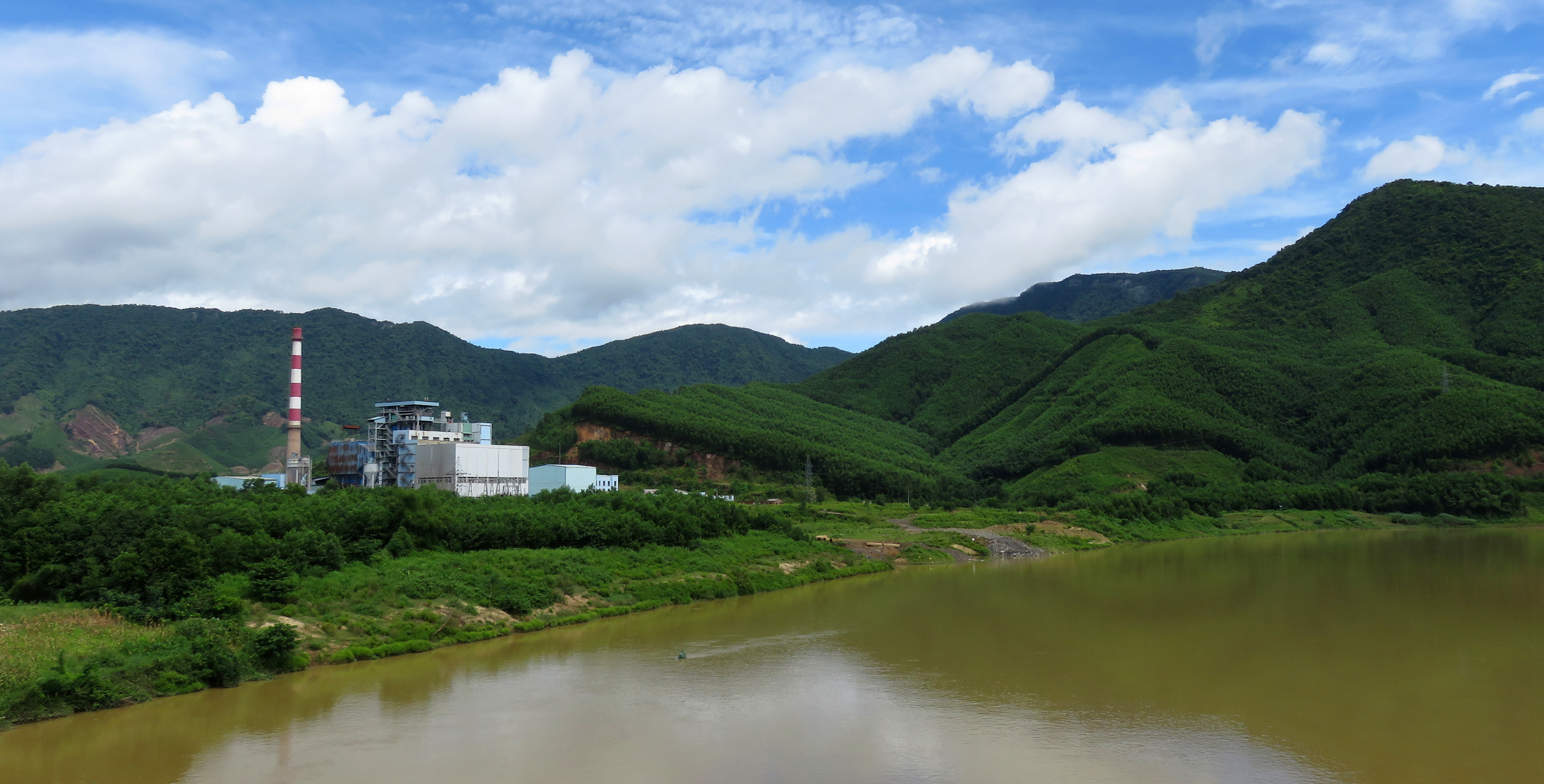
Nong Son coal fire power plant.
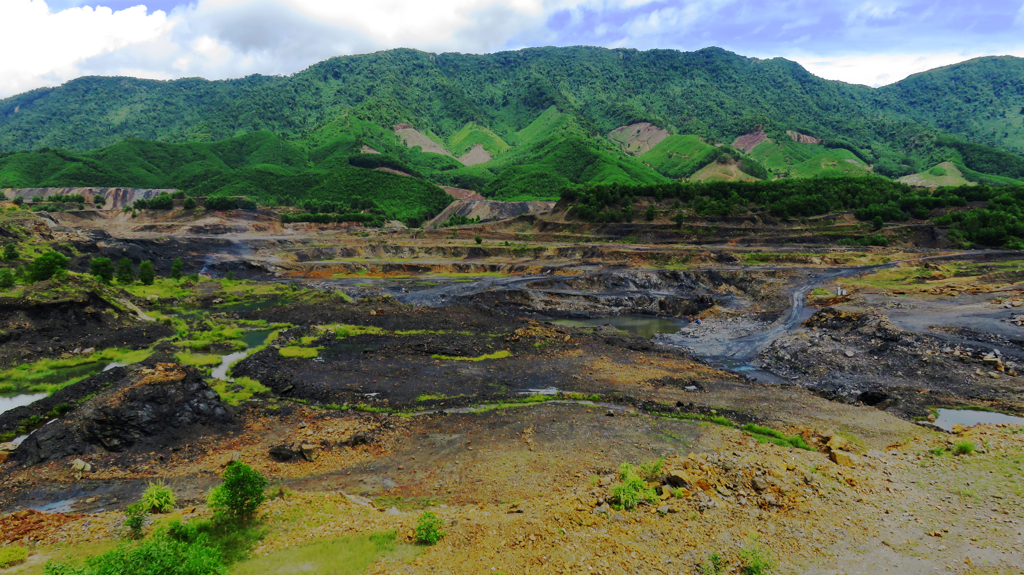
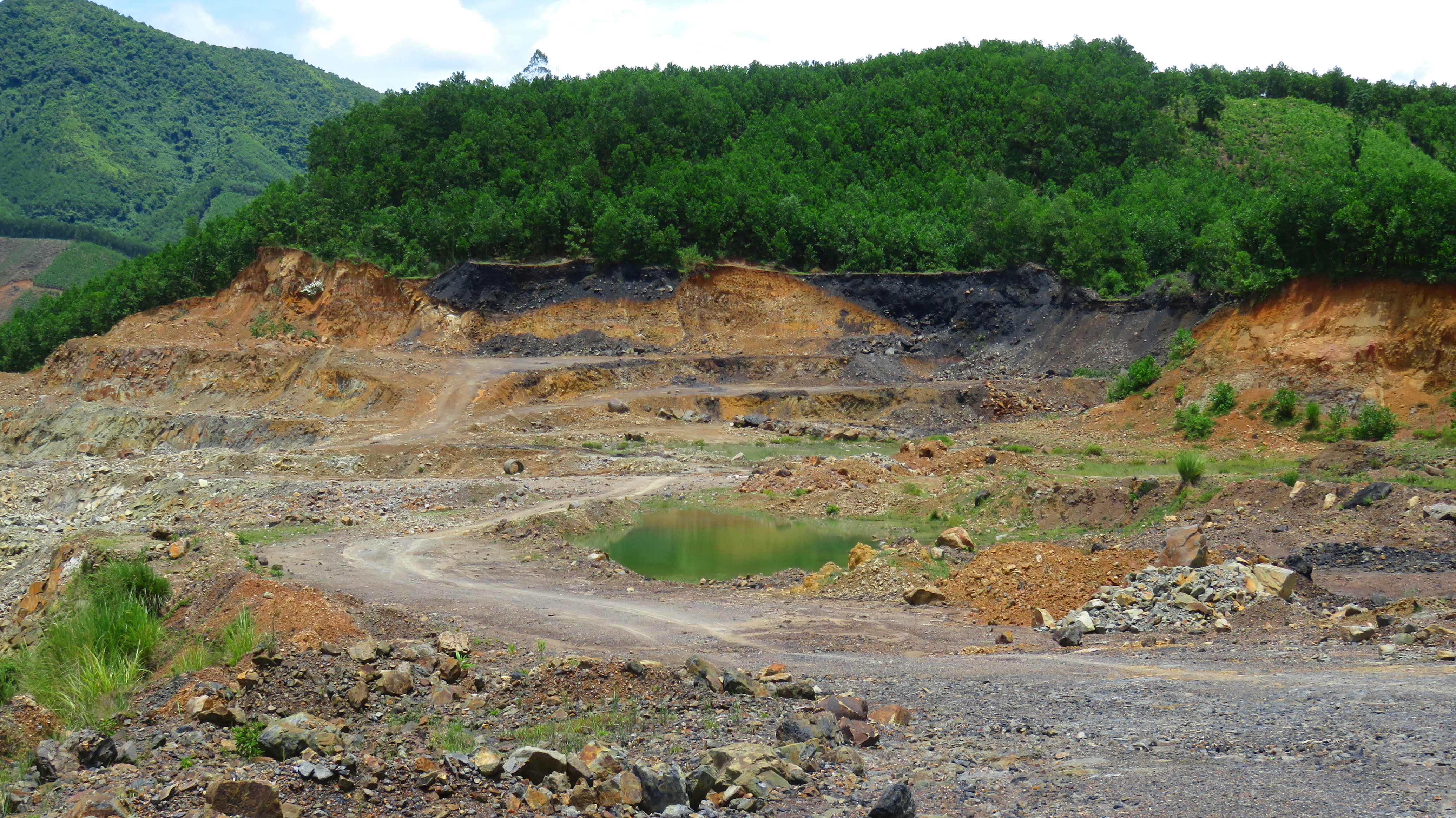
Nong Son Coal Mine.
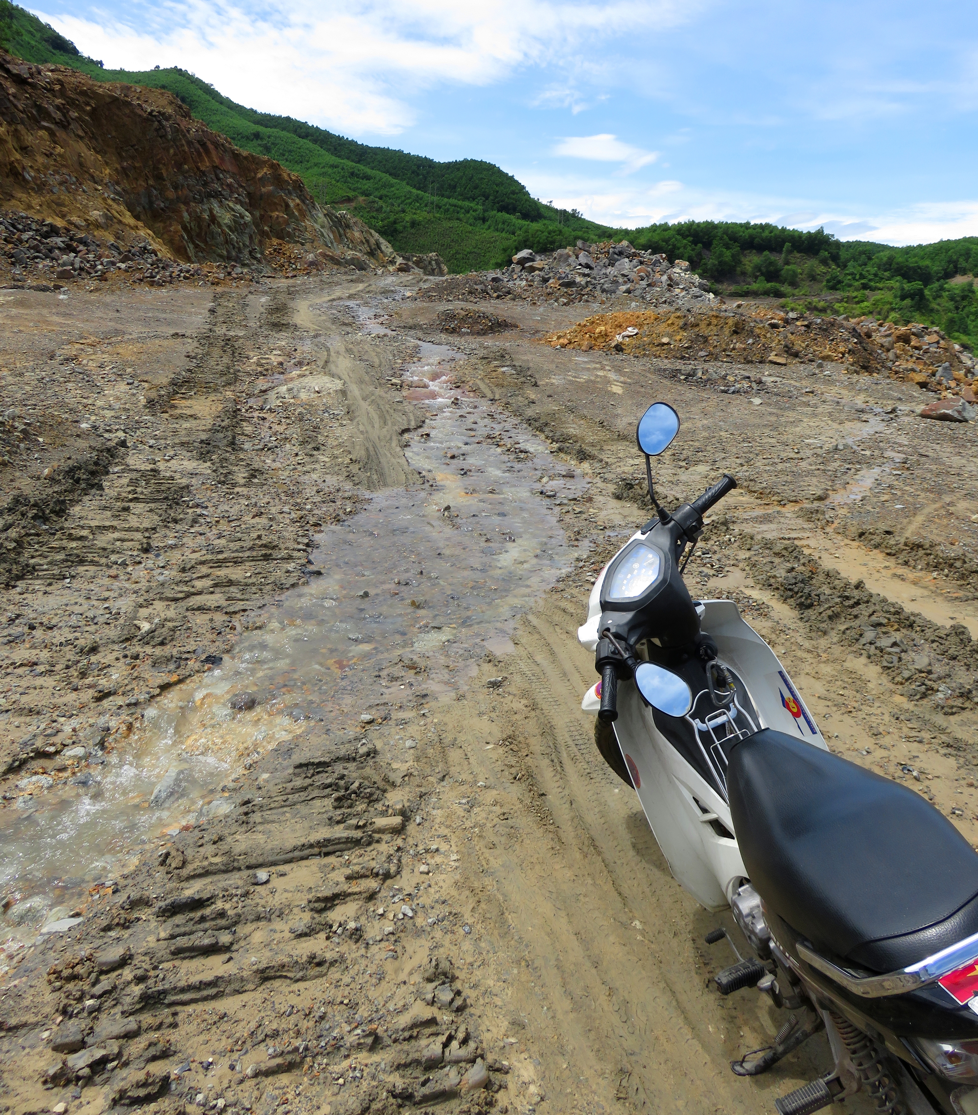
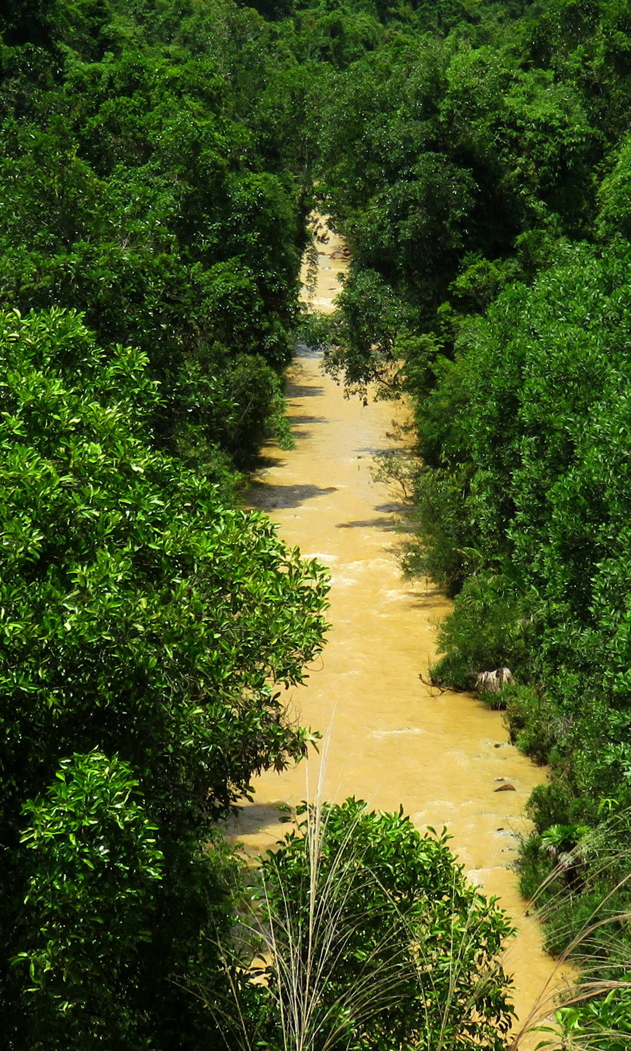
Creek on the road.
|
Once in the coal mine, turn left, and the fun begins right away. The mine ate through the original location of the road, so now the road simply routes through the mine property. The first section of road isn't so bad, but very quickly a creek spills its (surprisingly warm) water down the road, creating a very muddy and wet and exciting ascent. Eventually a small pond is reached, the creek ends, and the end of the road through the pit becomes visible. The size of the pit is surprisingly large- it stretches almost a kilometer across and is fairly deep. It would be interesting to see what the landscape looked like before they took it all down.
Finally, the road ducks into some trees at the edge of the pit. There is a fork in the road, keep right and continue uphill. The road goes up and around some more piles of overburden and slag (waste rock) before finally turning into the trees and beginning it's climb. |
The road through old mined-out sections. Note the coal bearing layers on the top of the section.
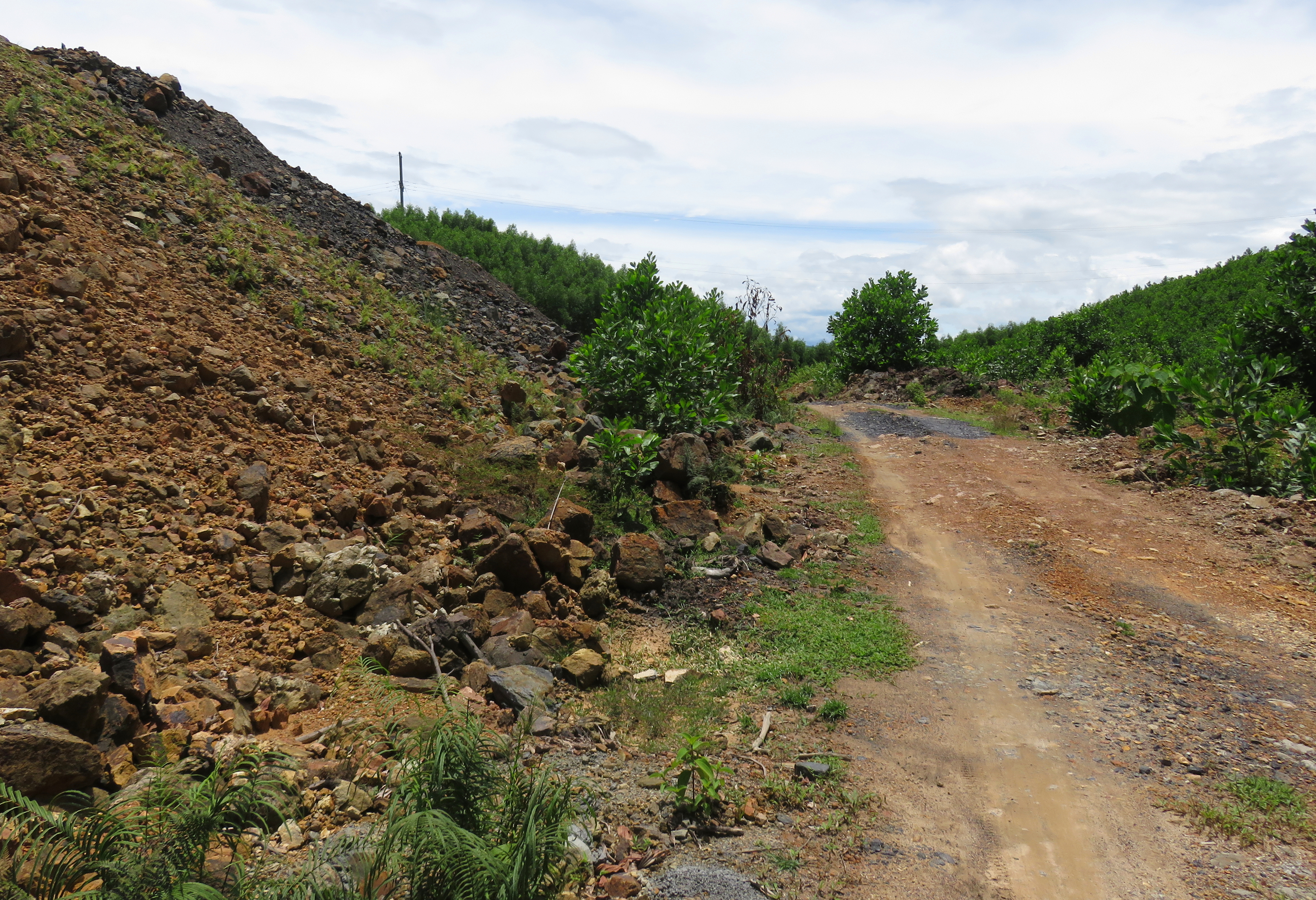
Slag piles on top.
|
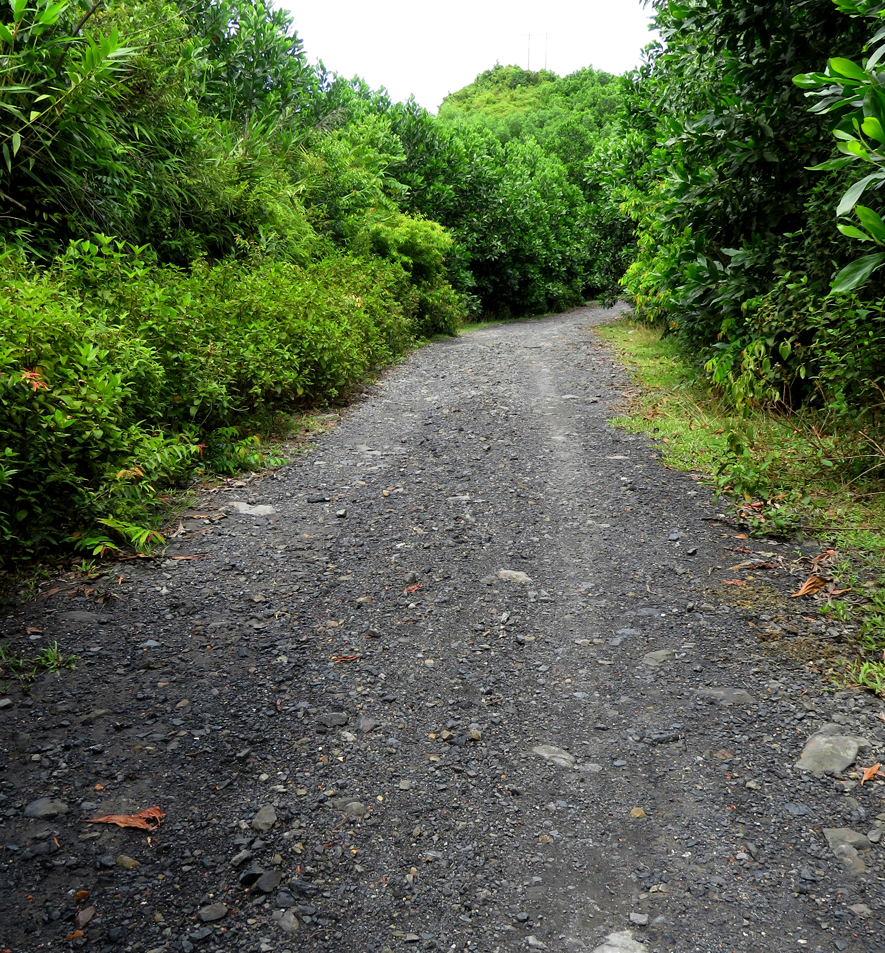
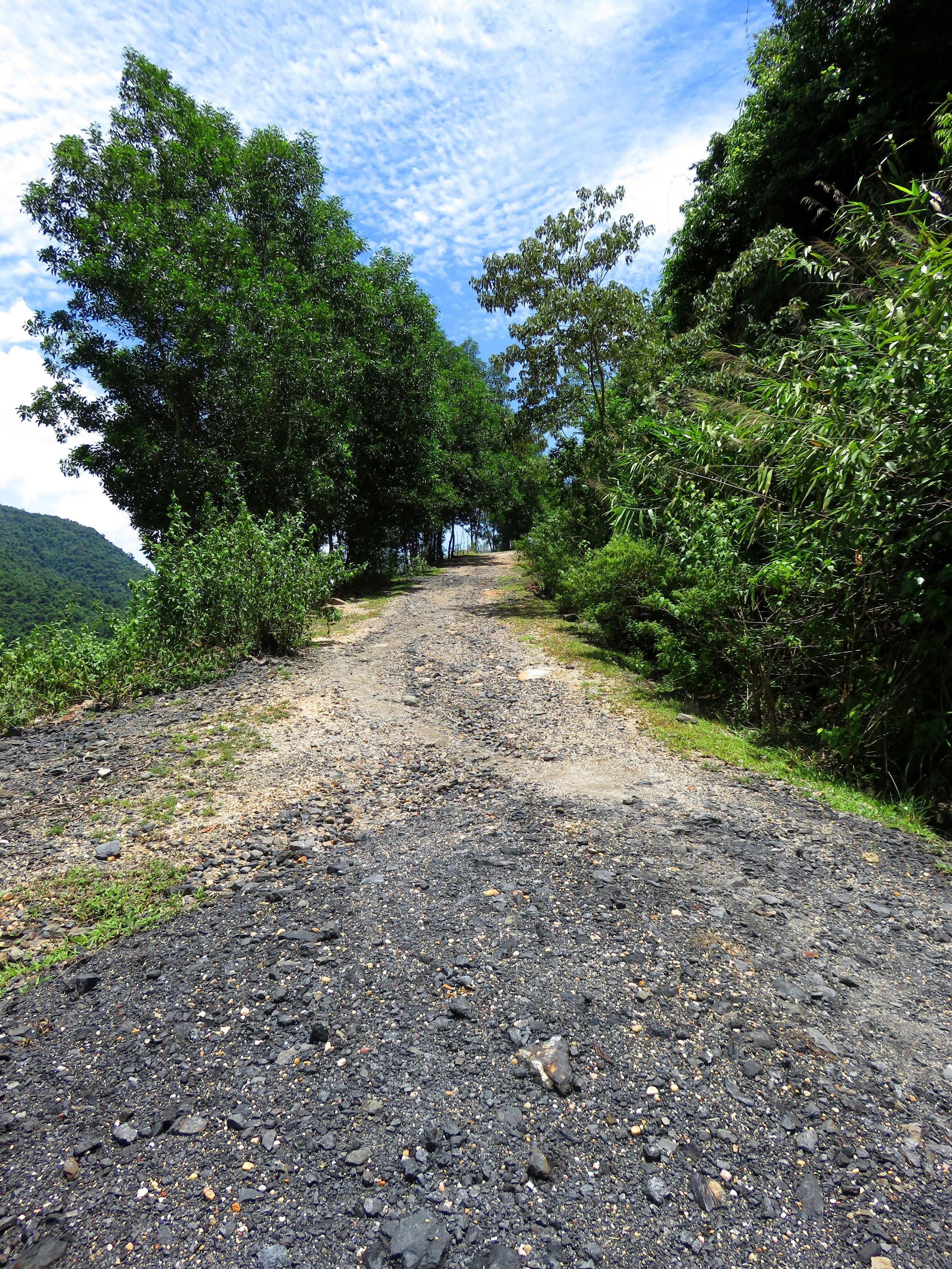
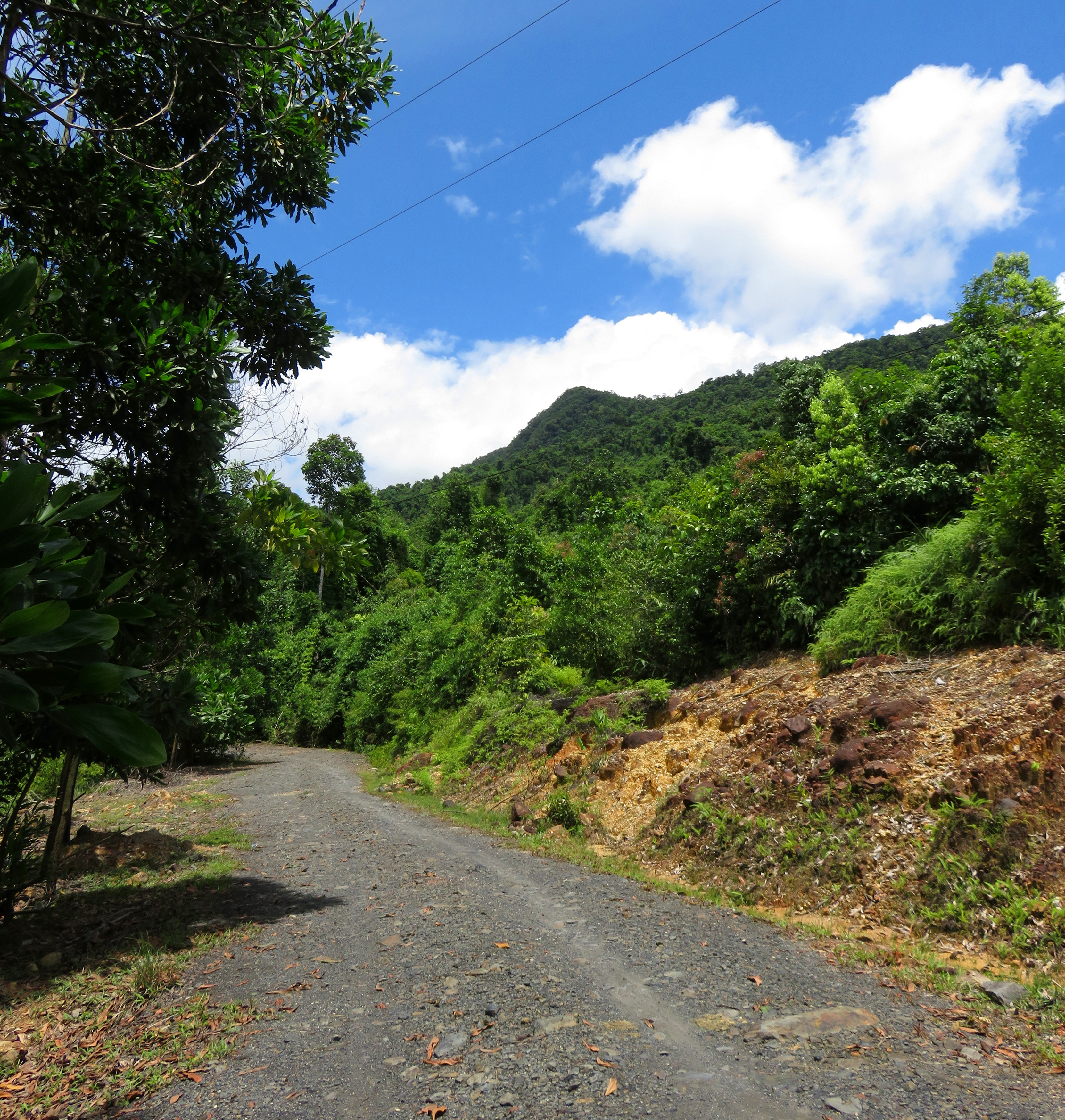
Road on the way up to Vista Point.
|
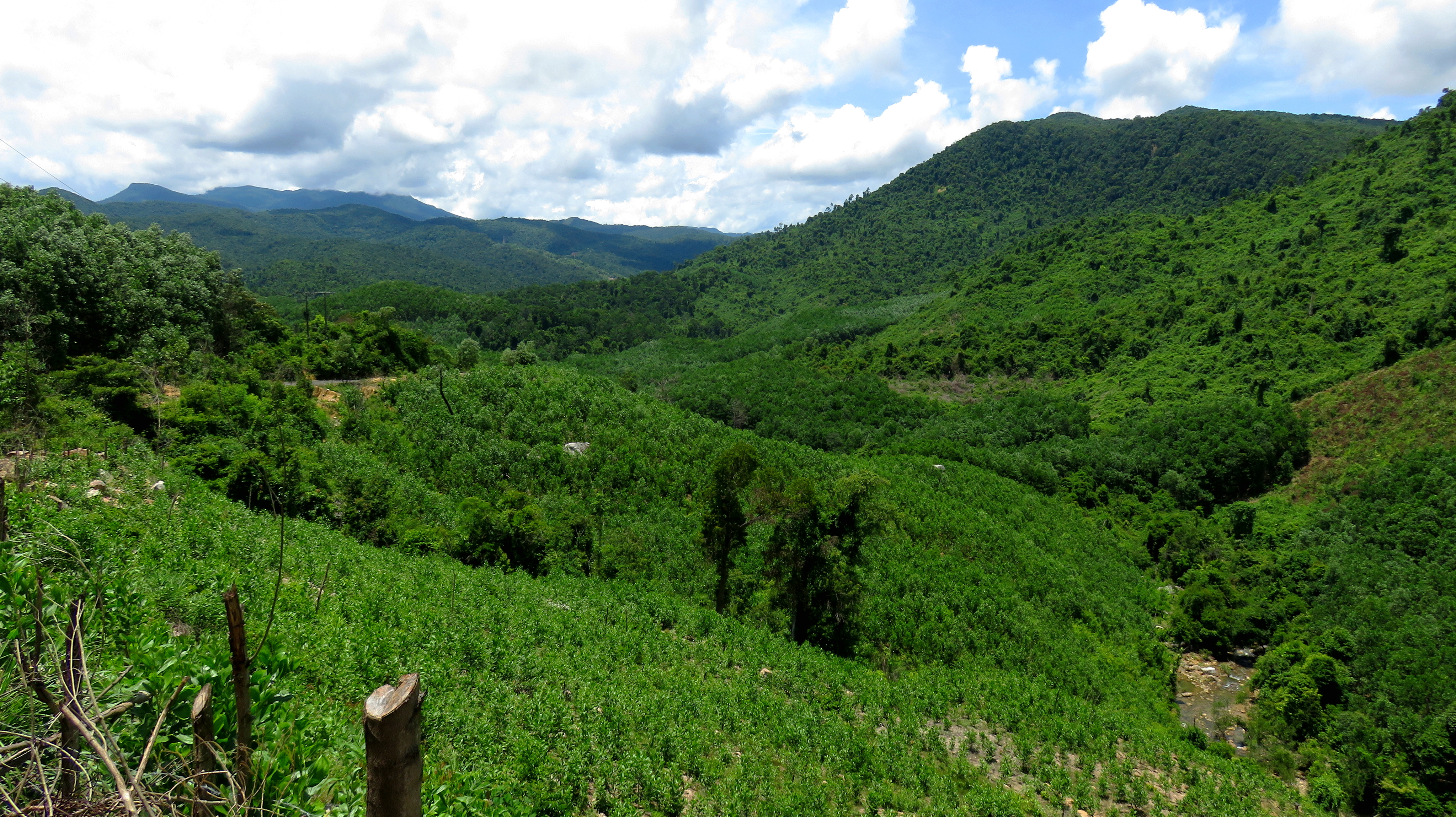
The mine is the first part of the drive. The second part starts at the end of the slag piles, and involves the climb up, and then the descent back down. a decent sized ridge of rock. The road surface doesn't change, but stays the same- lots of fist-sized stones and rocks. A bigger bike (like an XR150 or other similar dirt bike sized bike) will have no problem cruising around on this road, but smaller, scooter sized bikes will need to proceed with caution. I don't know if I would attempt this road on anything smaller than a 110cc. The first section is a long, slow climb up to the ridge top, a dramatic viewpoint I like to call "Vista Point". There is a fantastic view off to the south, including the areas of Que Lam and Que Phuoc in deep southern Nong Son, and off to the backbone of the Hon Kem Da Dung in the background. To the east rise the peaks of Que Son, including the sharply defined fang of Hon Chau.
Looking south to Que Trung and Que Lam.
Vista Point, looking east towards the Que Son Mountains.
First glimpse of Khe Dienne stream.
After a short time on top of the ridge, the road begins to make it's descent into the valley of Khe Dienne. The first part of the descent really isn't too bad, and apart from a couple of short side stream washouts, goes fairly easily. However, about halfway down, the quality takes a turn for the worse and it becomes quite bad for the next two kilometers. Larger rocks, bigger pieces of exposed bedrock, and lots of large stones that have been put down for "road fill" to support the occasional logging truck coming out of here, and for most bikes they are a pain in the ass. However, this descent is worth it as you definitely get the idea you are descending into a tucked away place. The large imposing bulk of the Mo'Ra Mountains rise on the other side of the valley, covered in old growth and with a couple of small waterfalls visible, and a clear mountain stream at the bottom.
Coming down the valley of the side stream towards Khe Dienne.
Part of the rough section.
|
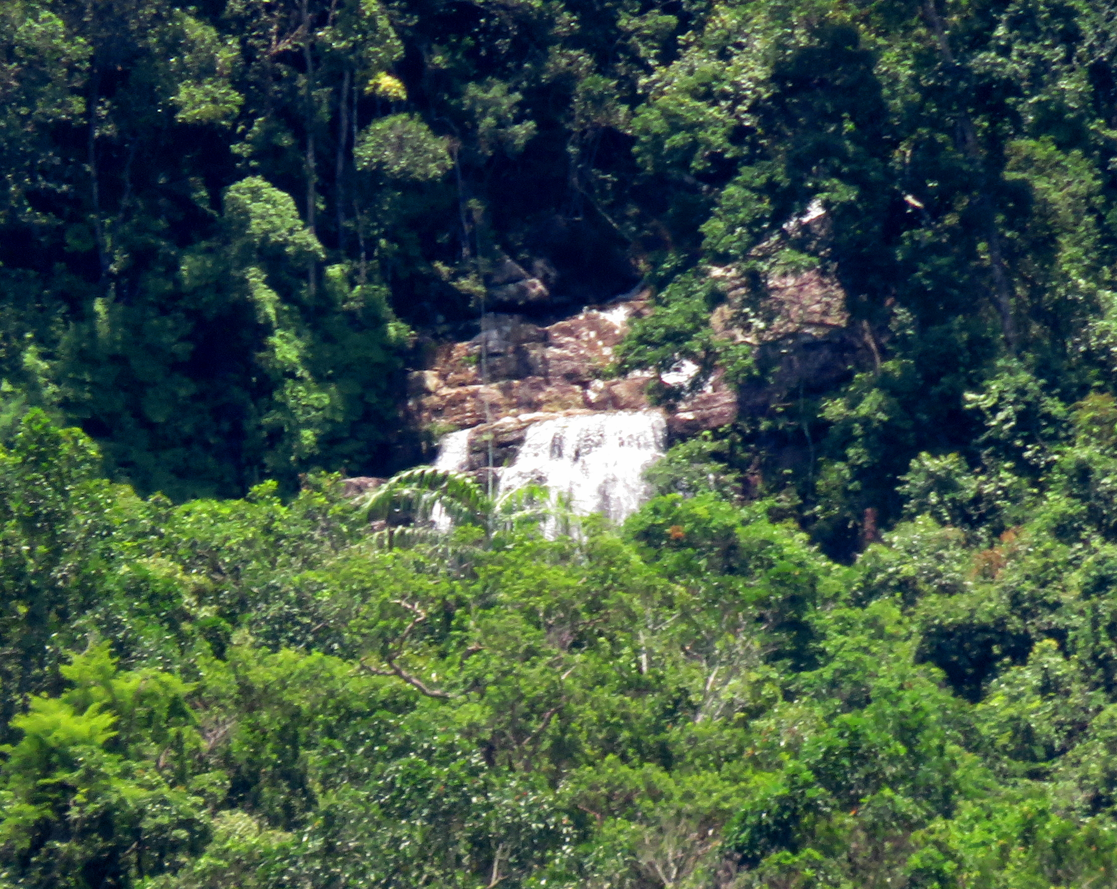
Far off waterfall high above Khe Dienne.
|
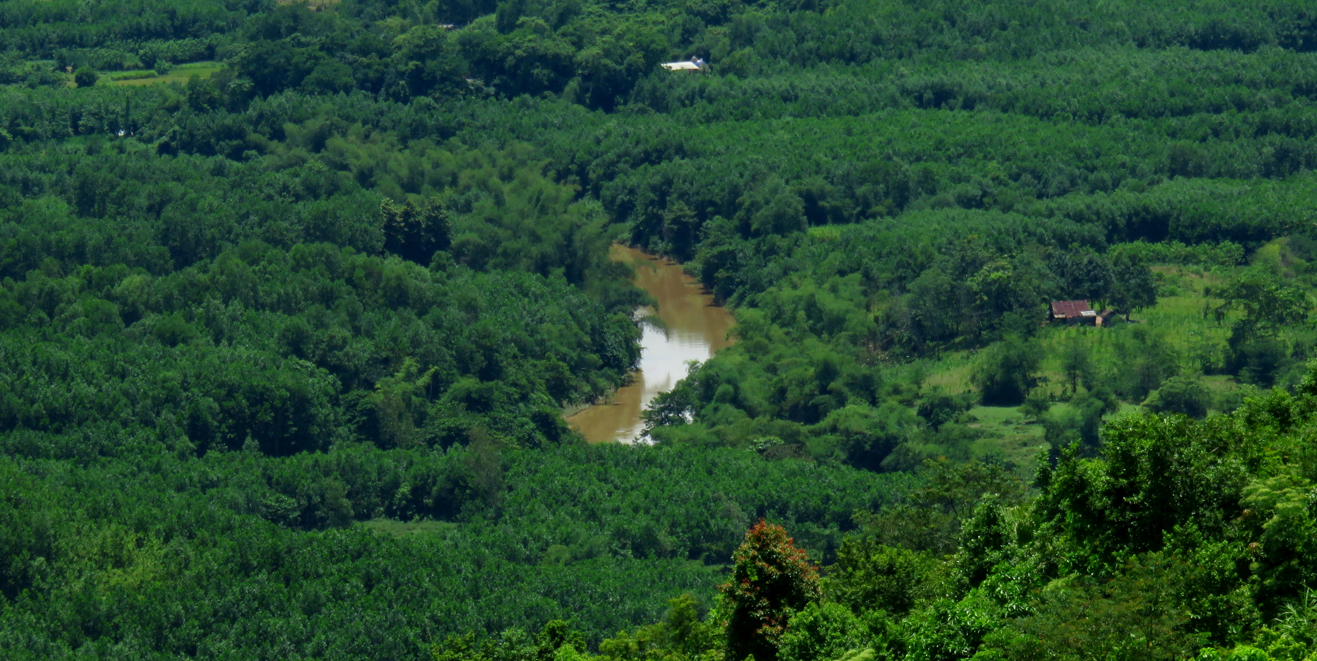
After what seems like quite a while going down, the road will swing around a corner and the remains of a house will appear, and visible through the trees, a decent sized river below. This is the end of the second section, and marks the beginning of the final section of Khe Dienne Road. This section follows along this river (the Song Ba), staying far above it, until the Khe Dienne Power Plant, tucked in the foothills upstream. Few opportunities to view this river are found, but it is a lively gem with some flat sections floating through the jungle and other sections of rapids. The road is more of the same from here, with lots of rocks, fill, bedrock, and wet spots.
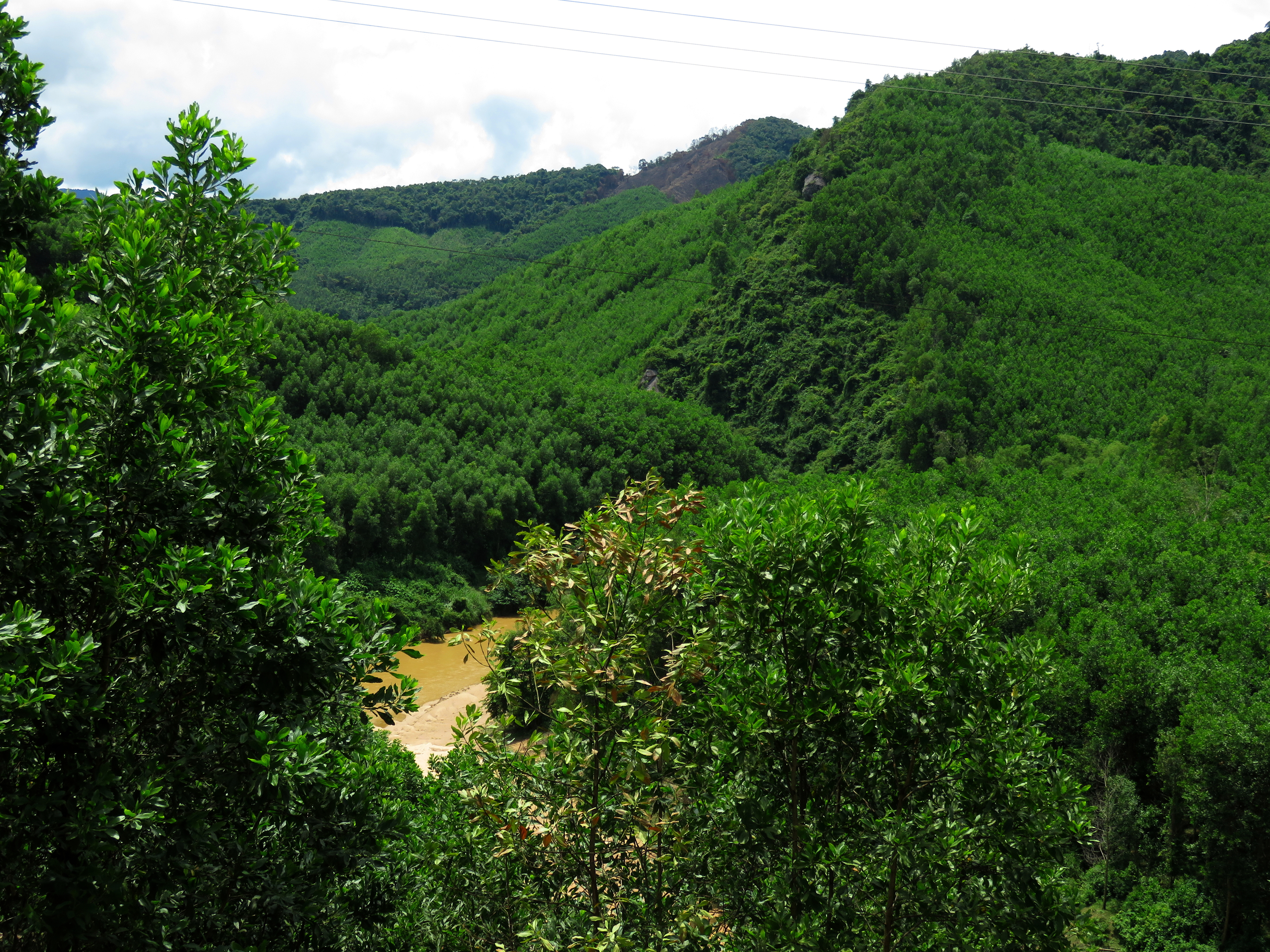
Looking into the final canyon of the Song Ba.
|
|
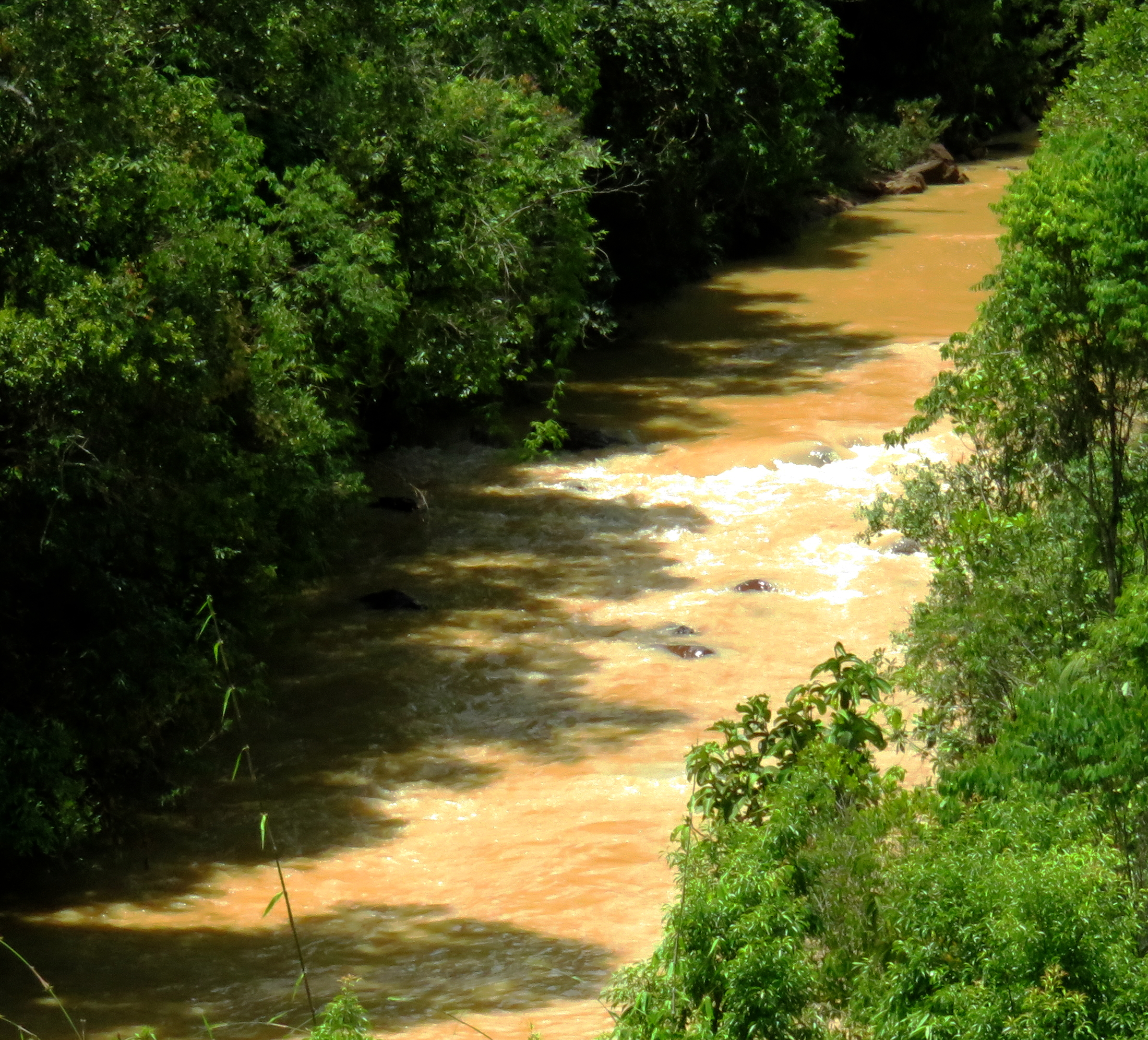
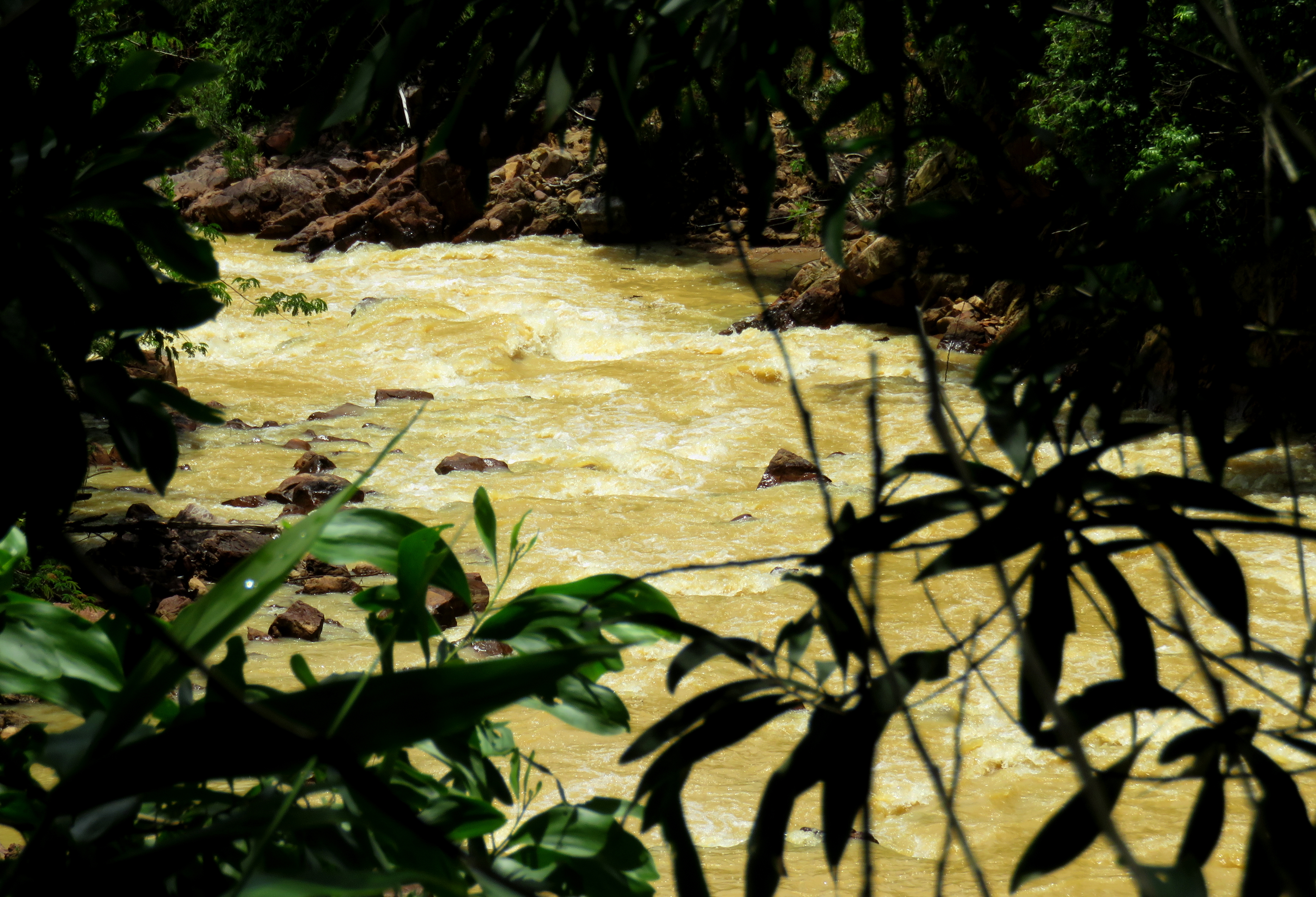
Above & Below Left: Views of the Song Ba. | Below Right: Road alongside the Song Ba gorge.
|
|
Finally, after what seems like a long time, you come around a corner and abruptly, right there is the Khe Dienne Power Plant. This is the powerhouse for a project set high in the mountains between Thanh My and Nong Son. A dam was constructed at the head of Khe Dienne, a river dropping out of the mountains. This created a reservoir known as Ho Phuoc Ninh, which in turn created a series of ghost forests in the flat basins flooded by this reservoir. (The area is known as "Ghost Valley", and is accessible from the Thanh My side of the mountains. One day a road will connect the two but it is not finished yet.) The water is then run down the hill to the power plant, where it spins a turbine and is then released into a smaller river, the Song Ba. This creates and interesting effect of having a riverbed with more water than the course of nature said it should. Supposedly you can't enter, but there is a road here that goes up to the dam, so if you want to try your lock have at it, but don't say I didn't say it's illegal- because it is. So far all intents and purposes, this is the end of the Khe Dienne Road. Now turn around and head back the way you came!
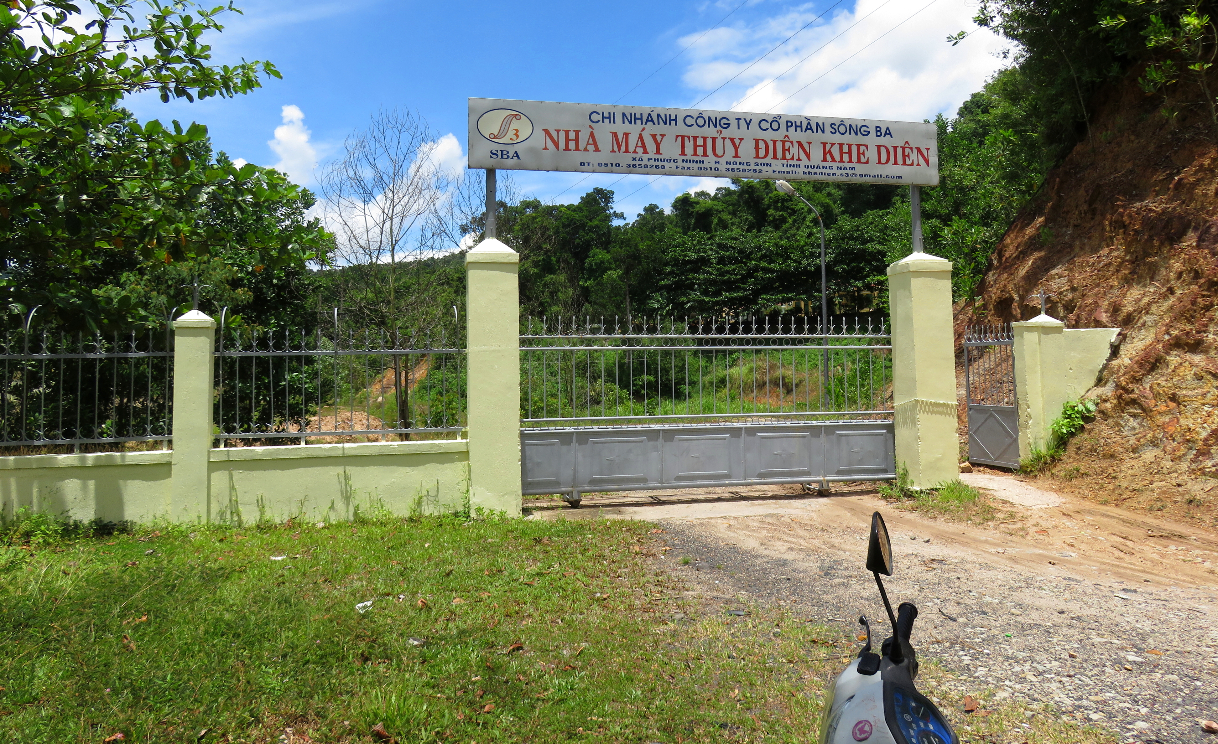
Entrance to the Power Plant.
|
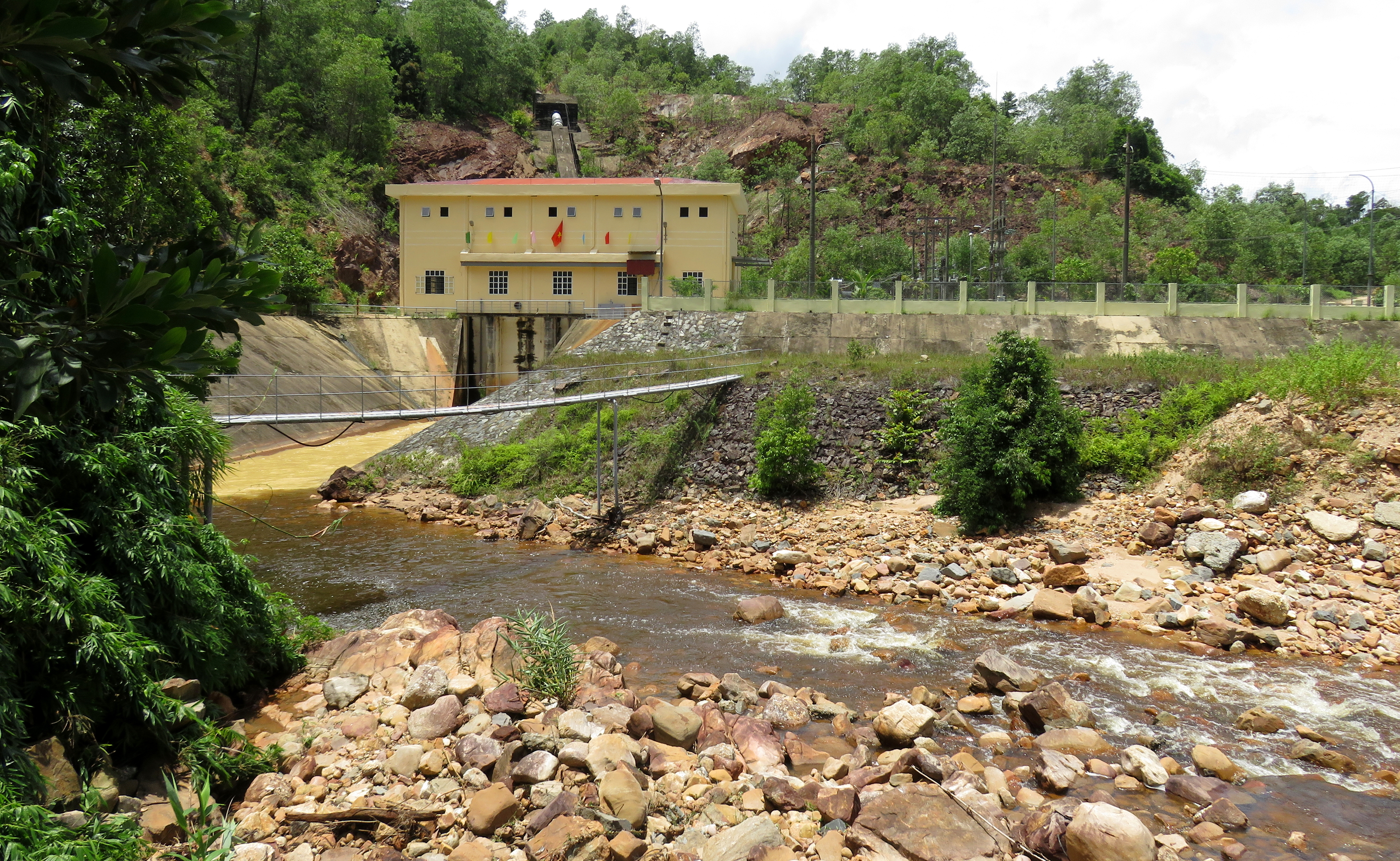
...and the power plant itself.
|
|
Safety Note: Be careful around the mine- they would hopefully close the road if they were to start blasting, but it is Vietnam, so you never know.
|
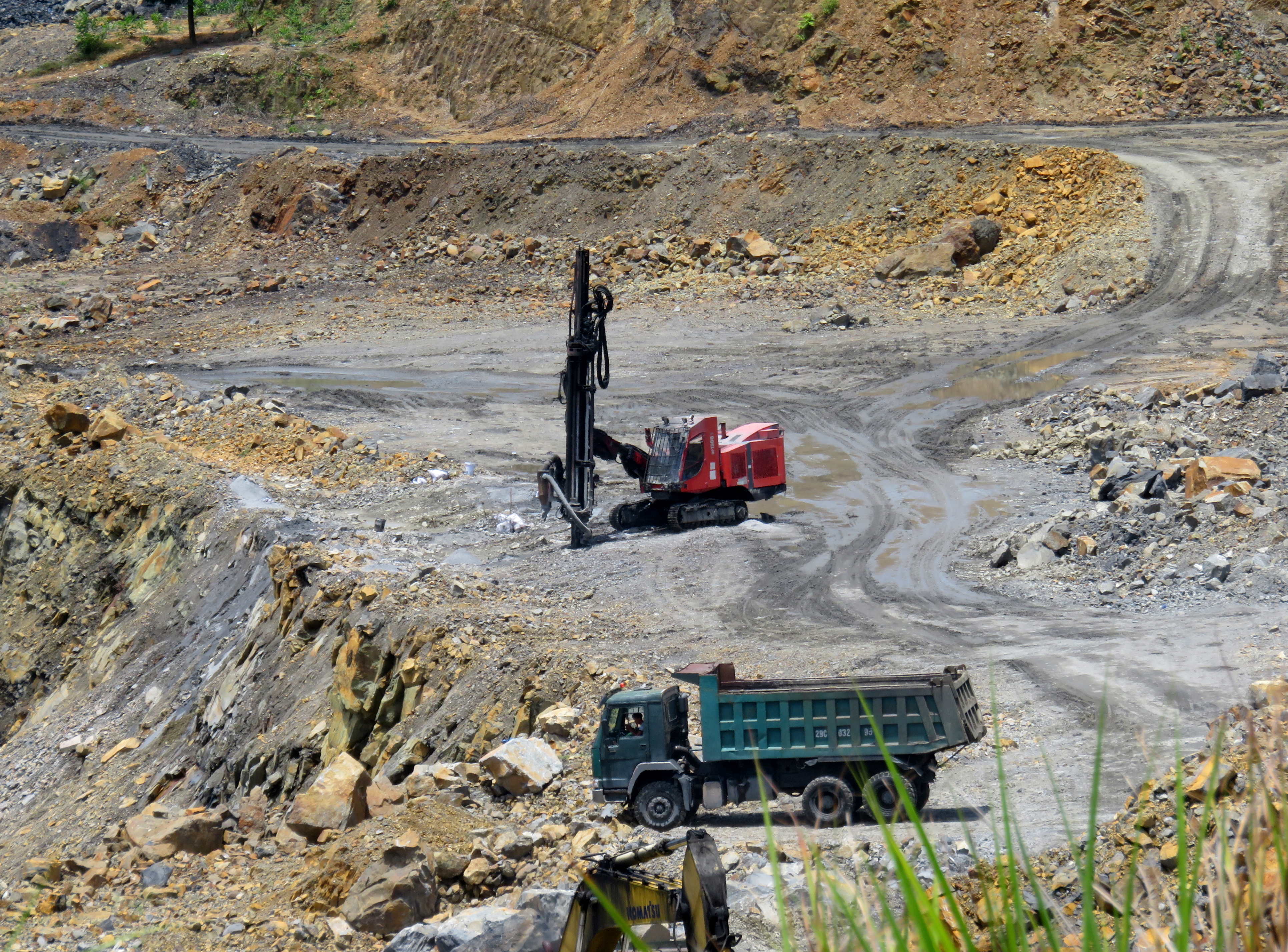
Drill for planting explosives.
|
The Map
Al photos & videos copyright Kit Davidson.
All maps copyright Google MyMaps.
All maps copyright Google MyMaps.
