
Ho Hoi Khe - Ho Dong Trieu - Ho Dong Nghe /Dong Xanh
Skip to the Interactive Map!
This is a great shorter trip that visits three lakes in the foothills southwest of Da Nang. The whole loop can be done in less than 3 hours, and it makes a great way to fill either a morning or an afternoon. Along the way there are numerous local curiosities to see in addition to lakes themselves, and it is a great way to see a rural side of Da Nang, free of development from tourism or industrialization. This is meant to be a travelogue to this nice tour, and will try to point out everything of interest along the way.
Ho Dong Trieu, set in the foothills of Hoa Tho.
The tour starts in the old village of Tuy Loan. This town is one of the "7 Original Villages" that was here before Da Nang, and is an interesting community on it's own because of it's religious importance. Tuy Loan has always been a central area for worship, and to this day the Tuy Loan Temple is one of the more longer-lived and important worship sites anywhere in the area. Today Tuy Loan is a bustling place that straddles it's namesake river. The town benefits from being right next to the Highway 1 - Highway 17 interchange, but ultimately it will one day be swallowed up by ever-expanding Da Nang.
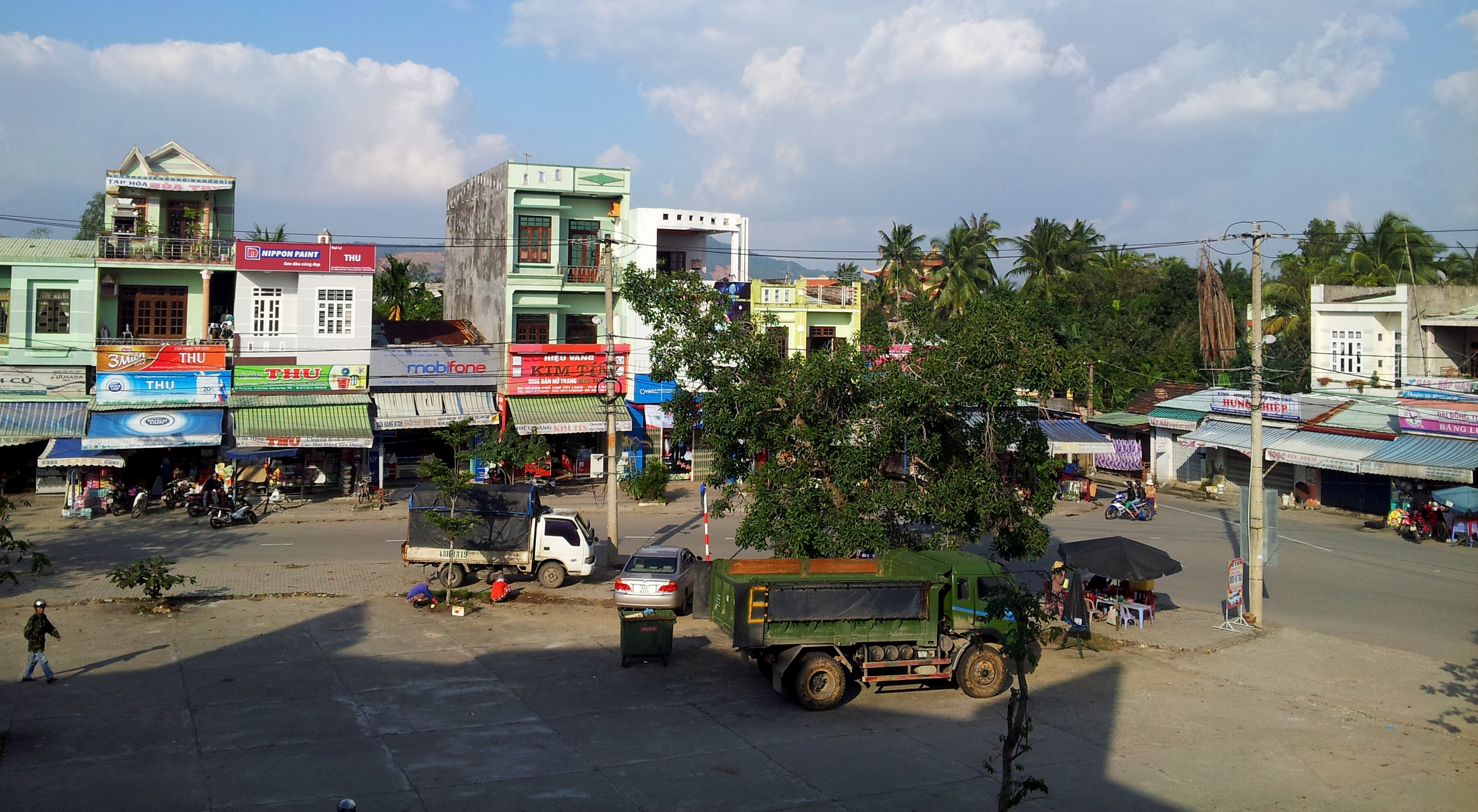
Downtown Tuy Loan, taken from the market.
To start this tour we need to first get to the right road. This can be found by taking AH-17 southwest from Da Nang. Pass through the intersection with Highway 1A. Immediately after this intersection is a turn to the right, with several large signs for Nui Than Tai, Hoa Phu Thanh, and Ngam Doi resorts. Although it's possible to utilize this road, it is in bad shape and is slow going. Instead, continue on for a kilometer or so, past the Hoa Vang Government complex on the right. After a stop light, turn right at the next big intersection. You will be on a concrete path, and should very soon pass a government sports center (left) and a high school (right).
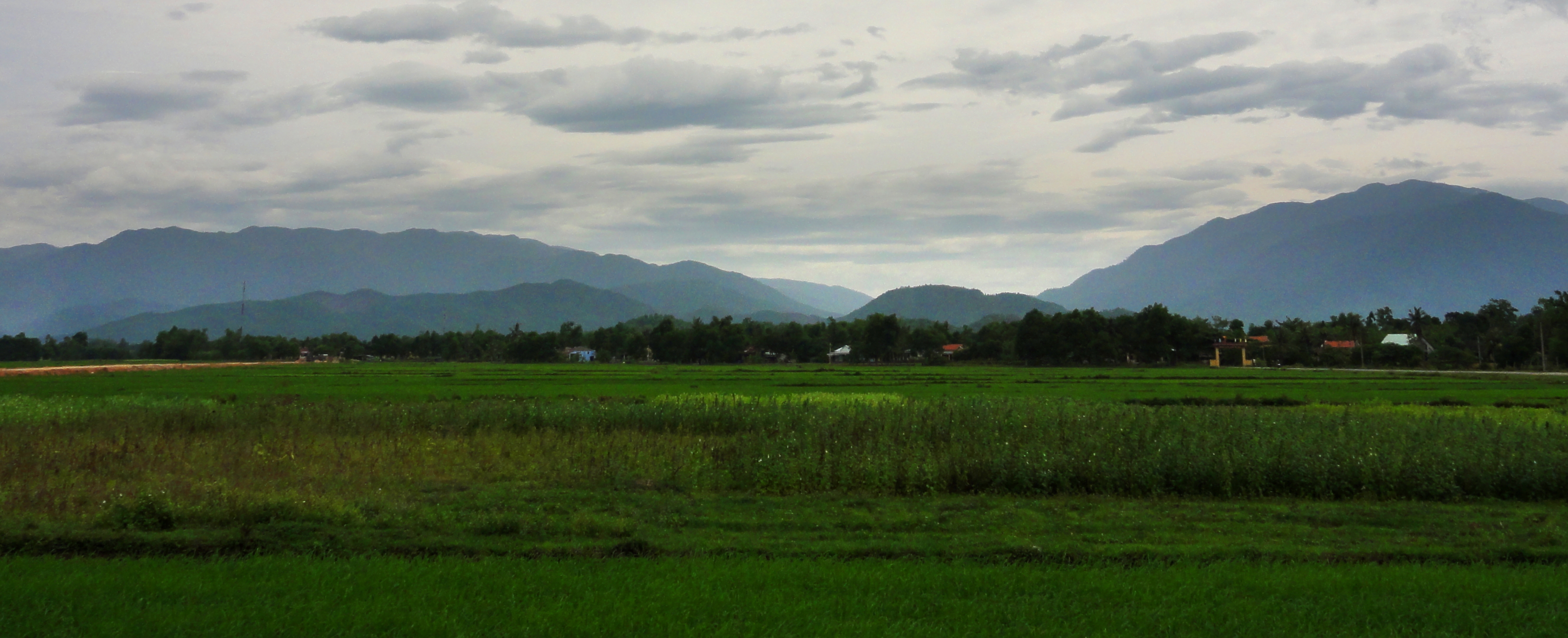
Hoa Phong area, with Nui Tho Thennon, Pine Tree Ridge and Nui Chua in the background.
|
From here continue along this concrete path. You'll wander past some houses, up and over some small hills, before being deposited on a huge open area of rice paddies. This is a good place for photos, especially if there are birds (try to approach quietly), buffaloes, cows, or workers in the fields. Cross these paddies and continue into the village on the other side. Not far along is a 4-way intersection; turn right, down the asphalt path through the forest. This road wanders through the forest, past an old brick factory, and then drops into a very small drainage valley. Cross the tiny stream, and immediately on your left look for a concrete path heading west paralleling the stream. Turn and follow this road all the way to it's end. There is a small farm at the end of the road, so park your bike without impacting them or their property, and if anyone approaches be friendly and point toward the lake.
|
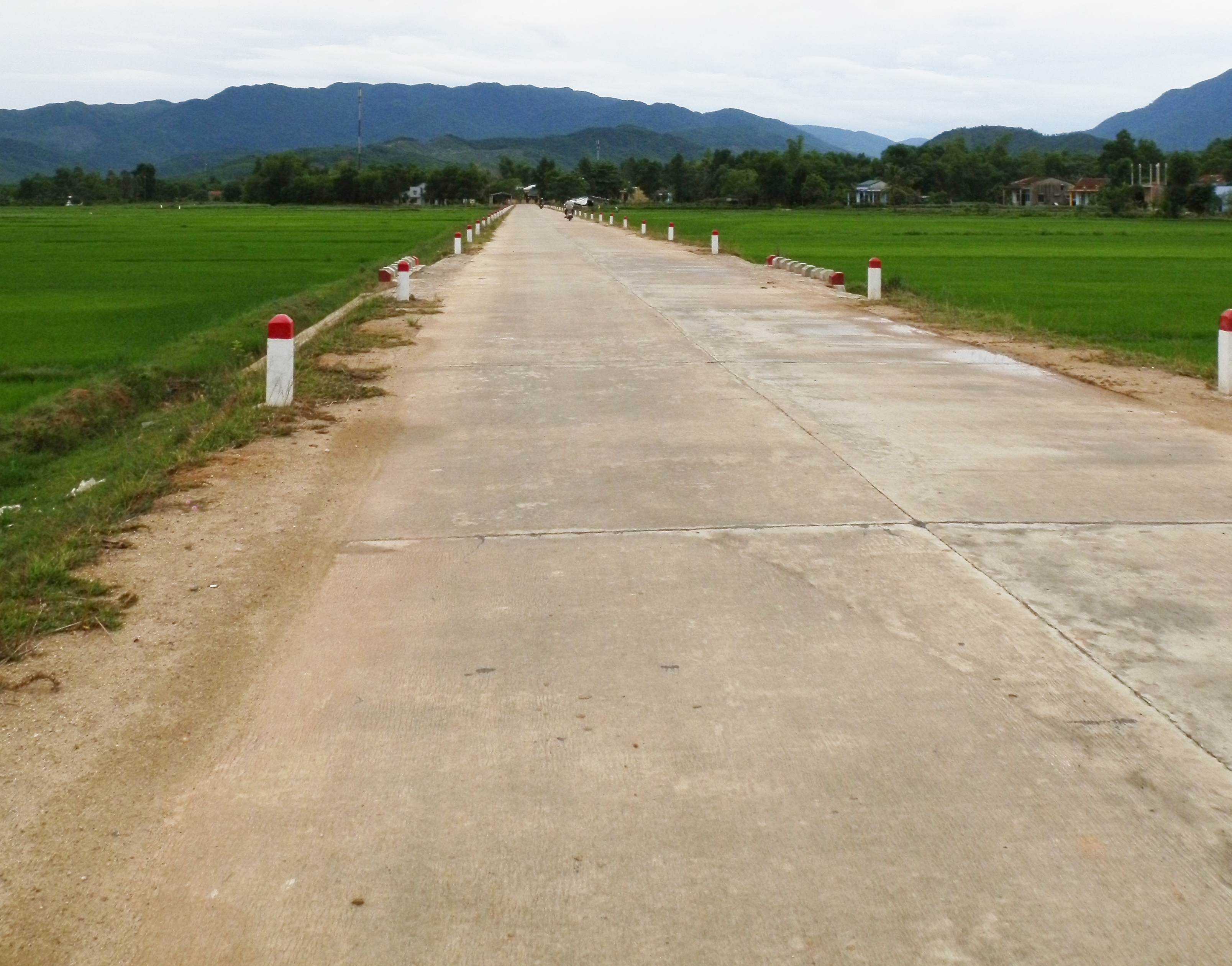
Road across the rice paddies in Hoa Phong.
|
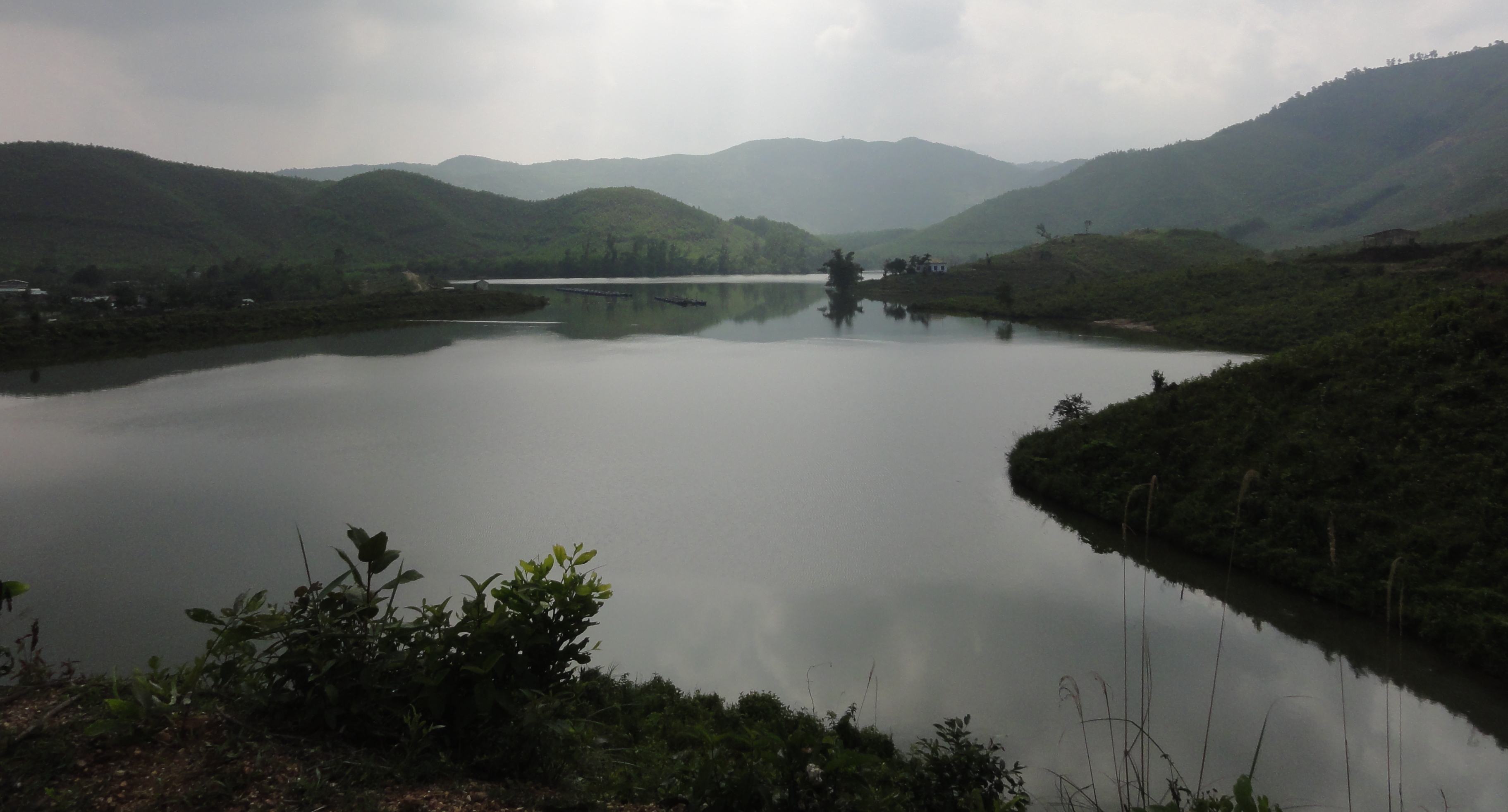
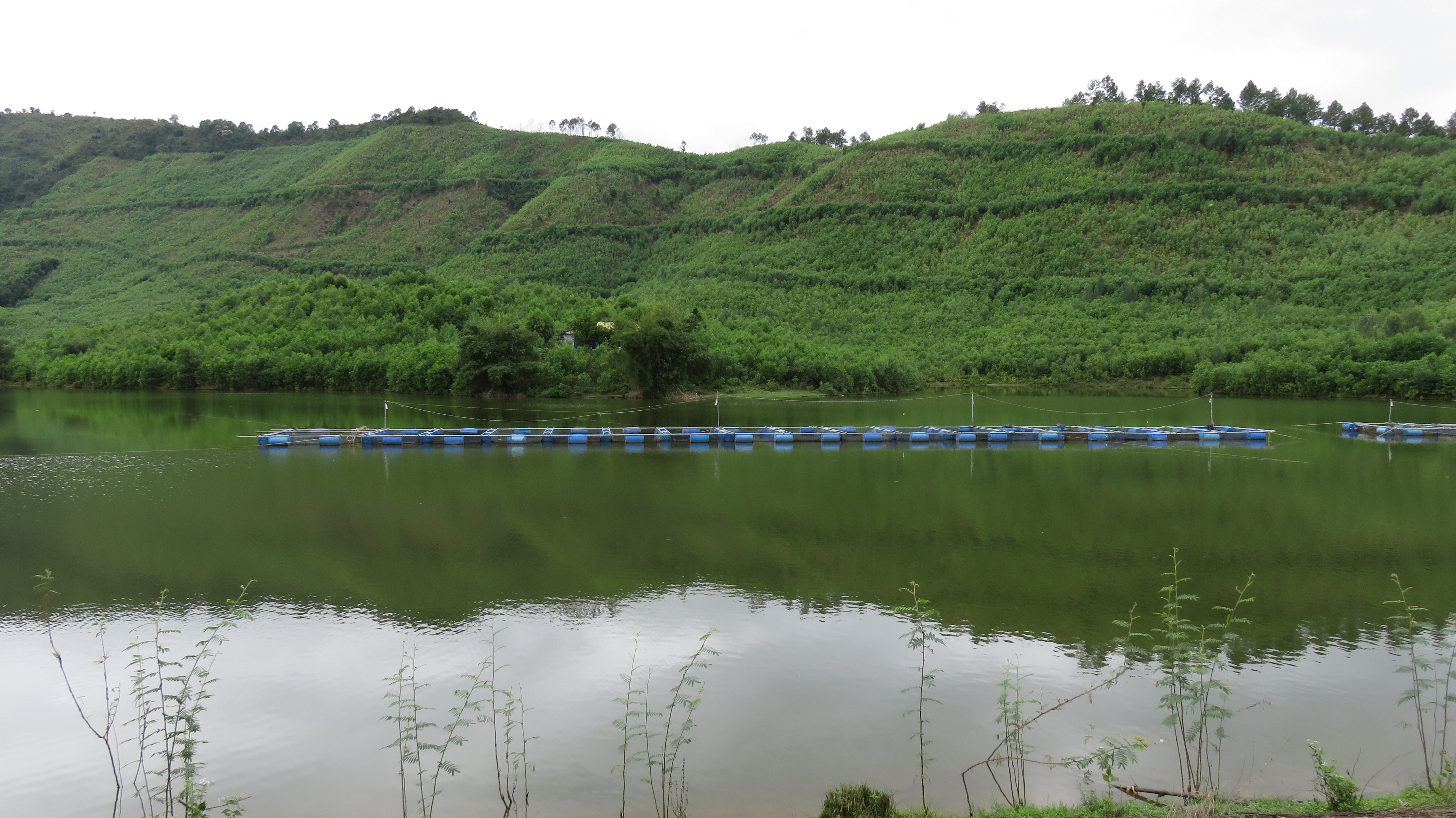
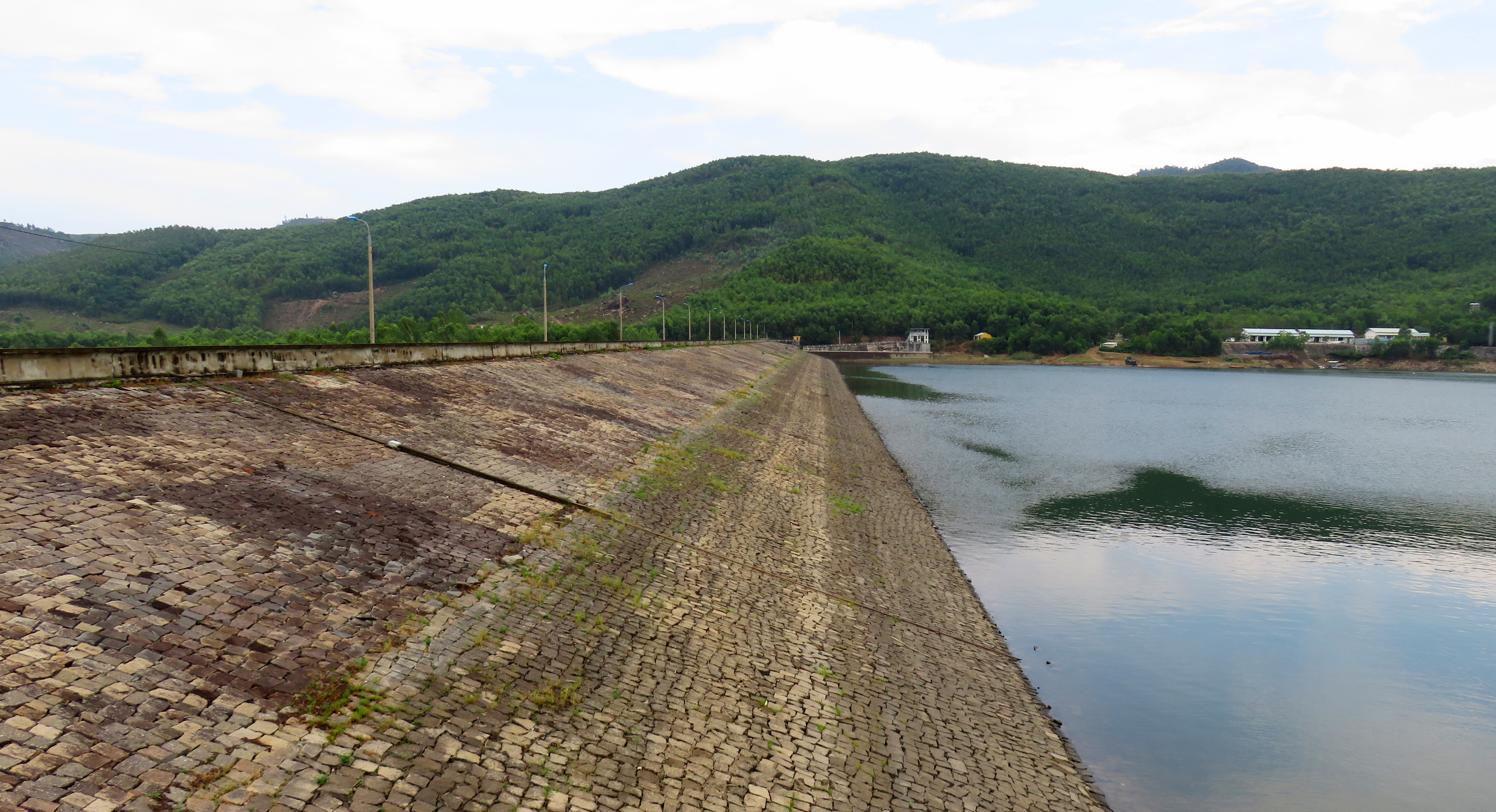
From the end of the road you can see the first dam quite clearly. Walk a short distance through the trees, and up onto the dam. This is the first reservoir, known as Ho Hoi Khe. On a clear day this is one of the better views anywhere in the Da Nang area; the lake itself fills a small basin in the hills of the Hoa Phong area, and thanks to the second growth forests that line it's shores and a perfectly framed view of Nui Chua [Ba Na Hills], the view is actually quite impressive. If you walk along the dam towards the other side some peace and quiet can be found in the trees.
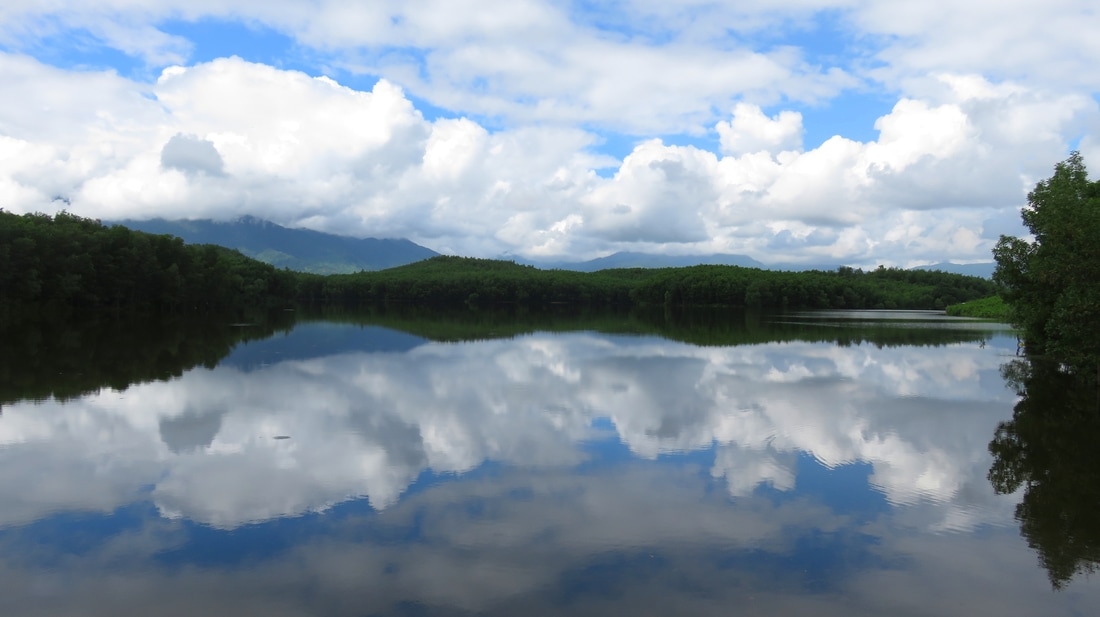
Ho Hoi Khe on a beautiful fall day.
Once finished, head back down to the intersection by the little bridge. Turn left, and begin driving down the road. Keen eyes can spot an interesting tomb a handful of corners past the intersection. It's got a ridge of hardened material- possibly asphalt- in an omega shape around a small concrete tomb. Vietnamese burial traditions prefer a slope or hillside with a view of mountains or water, and sure enough, through the trees you can spot the waters of Ho Hoi Khe. Soon enough the road cruises around a large arm of the lake, with some nice lakefront houses along the way that are lucky to have a great view and location.
Dam at Ho Hoi Khe.
|
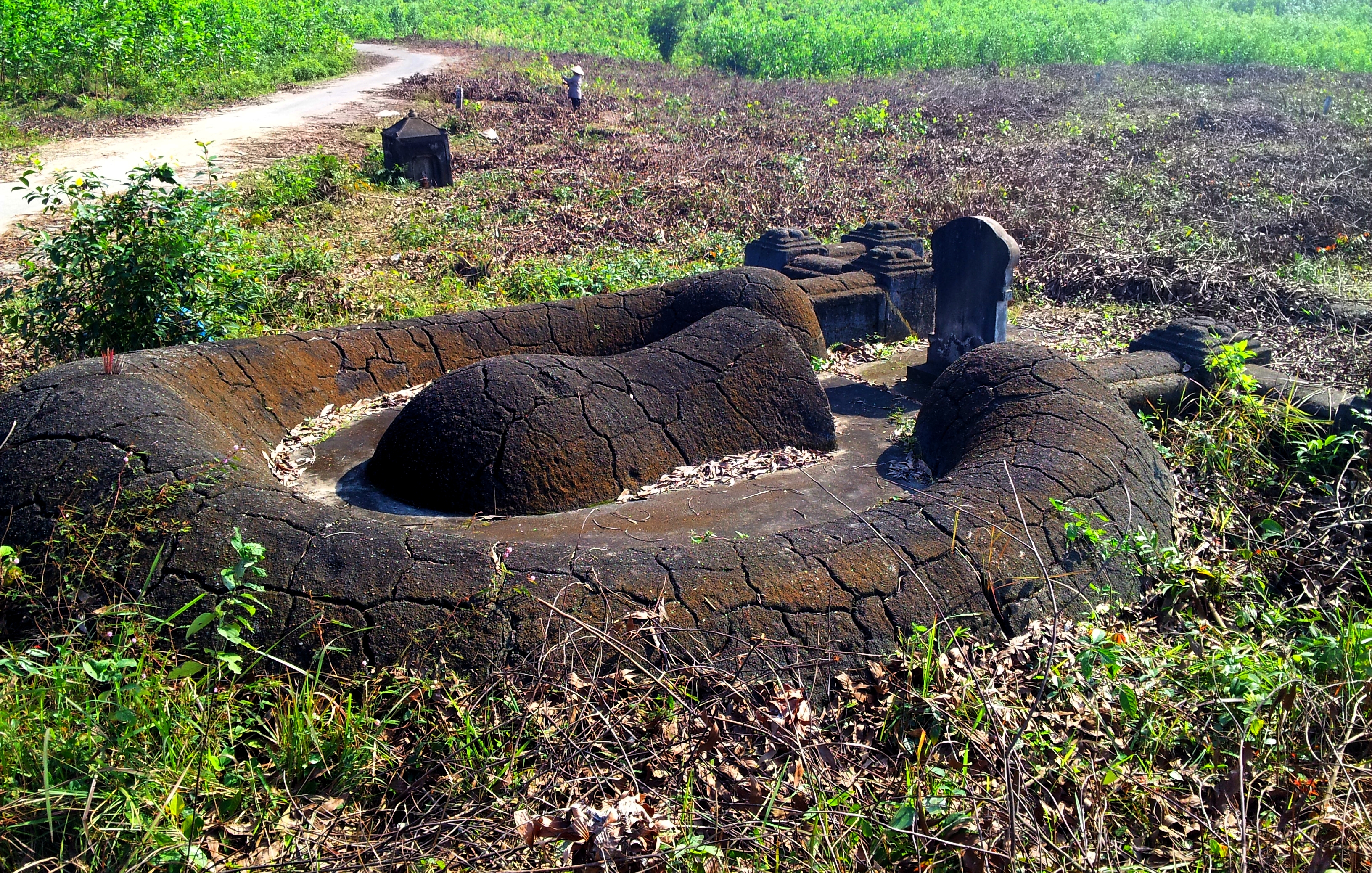
Unusual tomb in near the lake.
|
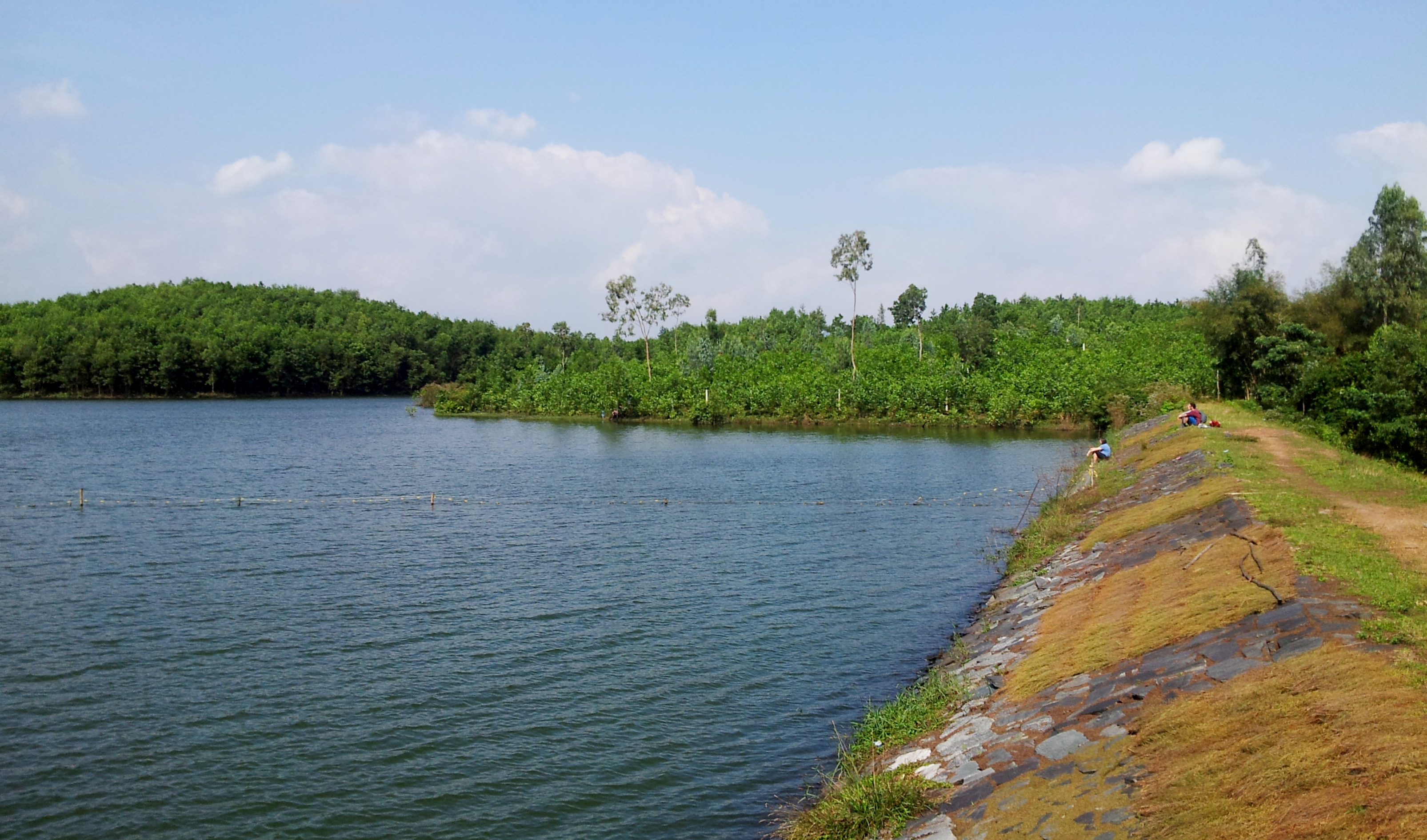
Not far beyond this you will come to a T-junction. This is the road that comes from Tuy Loan that you did NOT take earlier, which you'll soon understand why. Turn left, and follow this bumpy, sketchy road for a short spell. A short distance below is a bridge over a small river and it's arroyo, with a concrete path on the left immediately after. Take this turn. The path first follows the small creek, but then hooks around the toe of a small hill and doubles back the other direction. A short blast through some trees and another dam comes into view. Cross the creek and drive up the small dirt road to the top of this small dam. You are now at the second lake, Ho Dong Trieu.
Ho Dong Trieu on a hazy winter day.
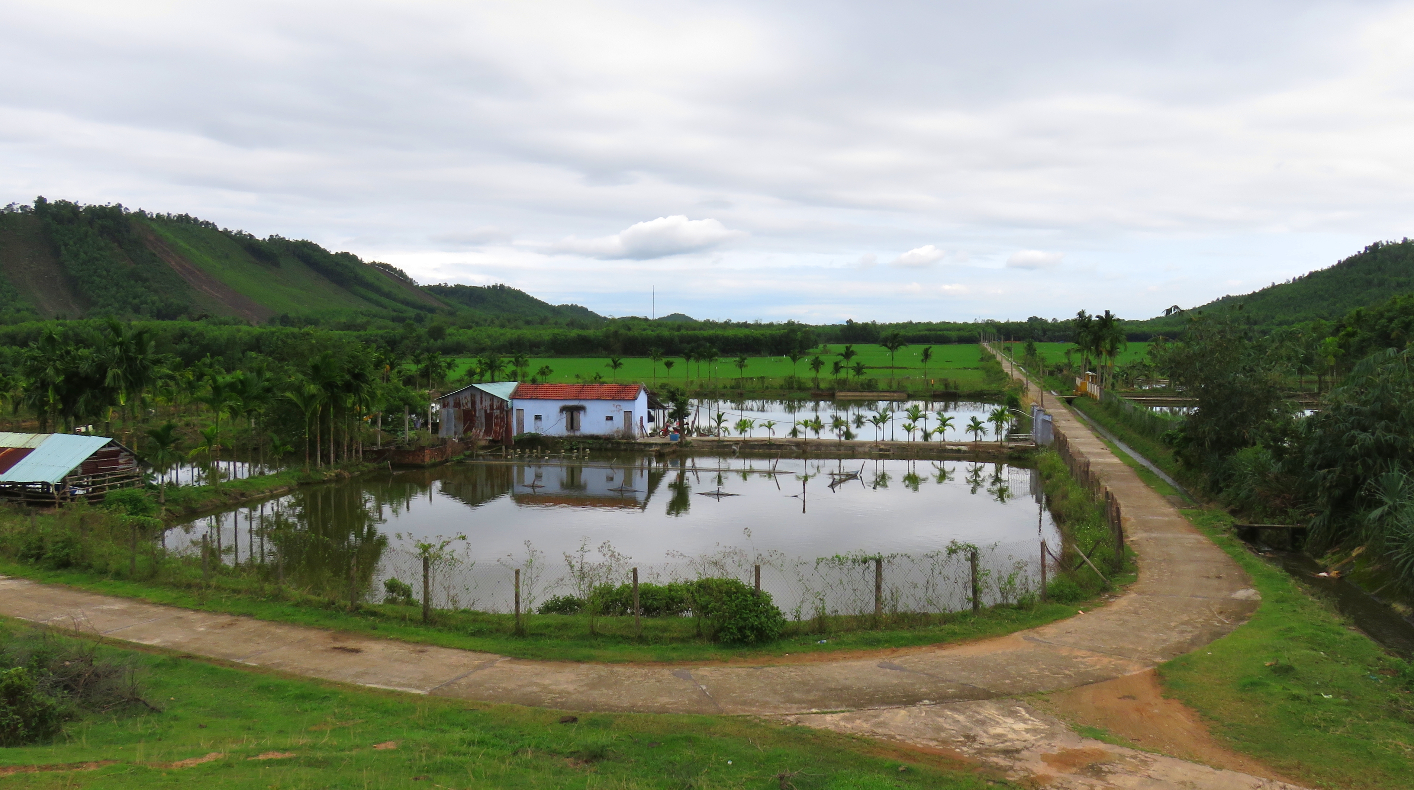
Ho Dong Trieu is an interesting reservoir. It's quite narrow, but wide, stretching out along the bottom of the hill. This hill is interesting in it's own right, for if you look at it's top ridge closely you'll notice some pine trees up there- not the most common tree variety in this part of the Da Nang area. Because of this neat fact, we call this "Pine Tree Hill". Across from the lake is an old house that looks like it was once someone's private villa, but now very little remains except the shell of the house. You can't see it from the lake, but there's actually a small farm hidden in the folds of the hillside behind the lake. A small aquaculture farm sits right at the dam, with some geese that can actually be quite unfriendly- approach with caution. On the other side of the view, a beautiful small valley sits below the dam, with several large rice paddies and a couple of farms in the middle.
|
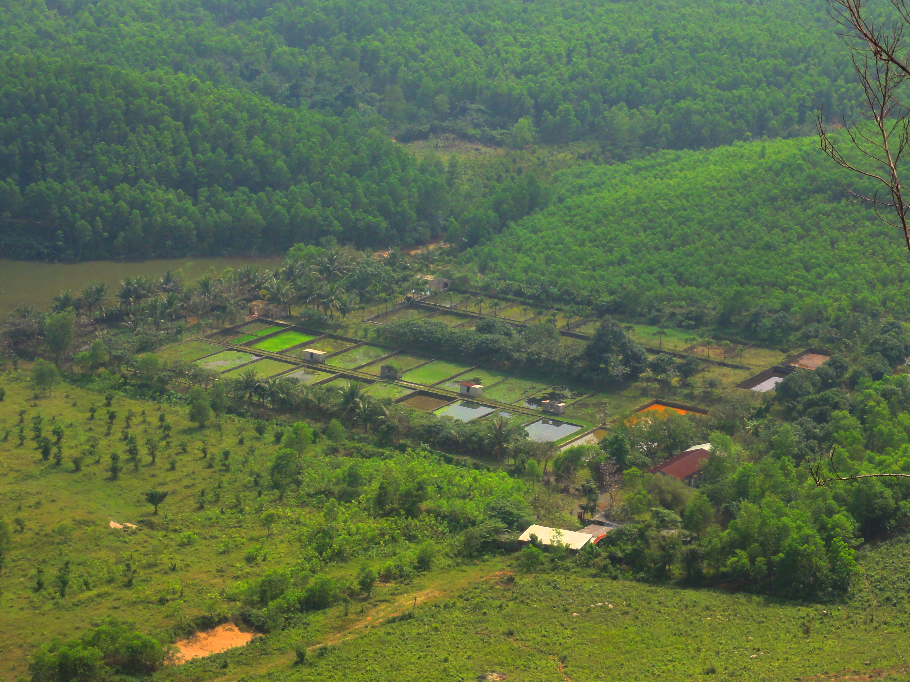
Farm hidden across from the lake.
|
"Hidden Valley" below Ho Dong Trieu.
Once done, drive back down the dirt road, and turn right, and then take a left almost immediately. You will now be on a straight concrete path heading into the rice paddies. There are several small ponds around both farms, and the chances of seeing wildlife in this corridor is high. The road isn't in great shape so take it slow. After a couple of kilometers down the road, the road will enter a small village that holds a curious surprise. This can be seen on the left just past the community house on the left in the form of dragonfruit orchards. The fruits, which are members of the cacti family, are not a common crop in the Da Nang area, so it's intriguing to see this rare crop.
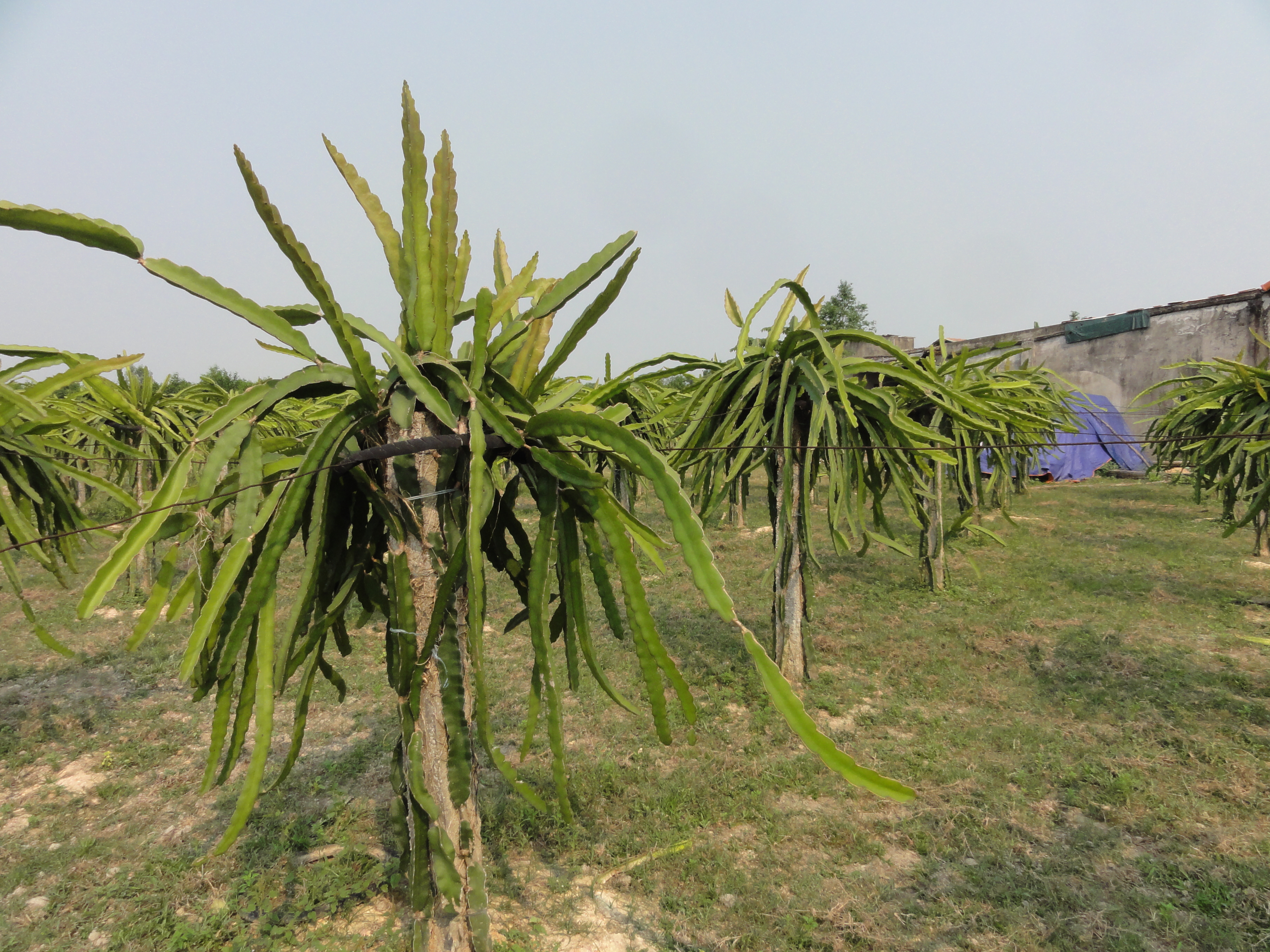
Dragonfruit plants. These are actually members of the cacti family, and are more suited to drier climates, which makes seeing them here somewhat odd.
The road ends at a T-junction; turn left. Follow this road for a short distance, over a bridge and eventually meets up with Highway 14-G at another T-junction. At this turn, turn right and follow this road for a little while. Be aware for a sign on the left, you can't see it coming from this direction but if you slow down you'll see it's a sign for Phuoc Nhon Hot Springs. Turn right and follow this road for several kilometers until you reach a rough 4-way intersection. Turn right and follow this road for three to four kilometers, until you reach one last dam. When you reach the bridge over the spillway, turn and follow this road and out to the dam. You are now at the last lake, Ho Dong Nghe.
Dam at Ho Dong Nghe, looking south towards the road.
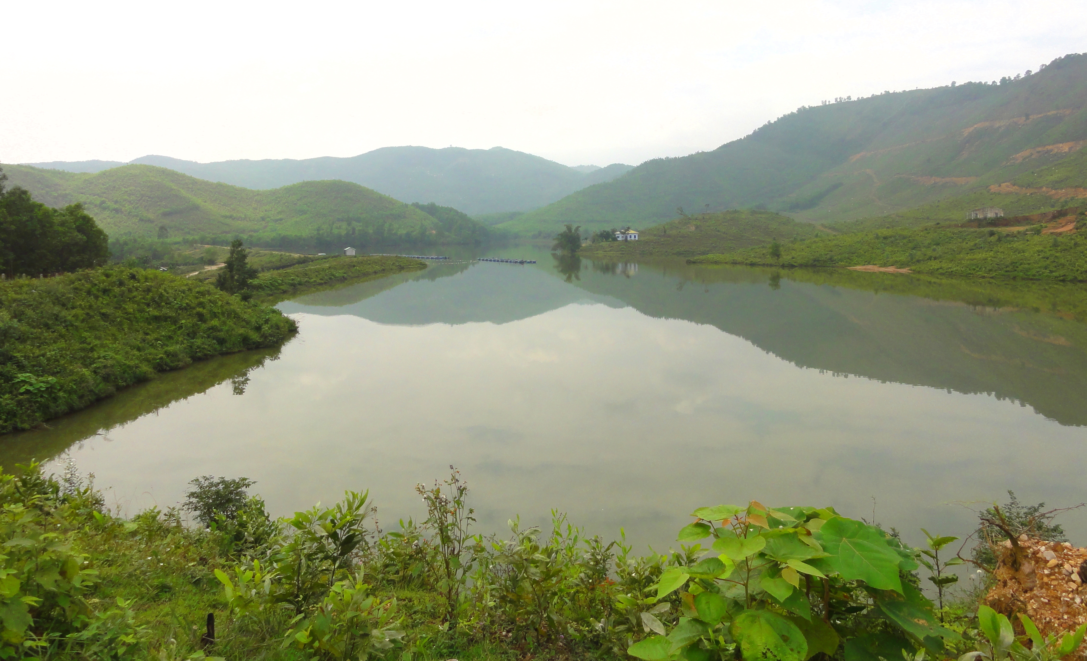
This lake is quite large, and reaches into some of the beautiful ranges of the Tho Thennon behind it. It's also quiet, and is usually kept as full as possible. On the south side of the lake [left if you are facing the lake] is an interesting rowing facility- apparently it's connected to the Vietnamese National Rowing Team, some kind of junior level training grounds- but outside of that there is very little human development. Rumor is there are a couple of small houses in the woods on the far side of the lake, houses that are private retreats for folks from Da Nang who have both time and power, but I've never seen them so I can't comment on that. If you drive across the length of the dam some really nice peace and tranquility can be found at the other end.
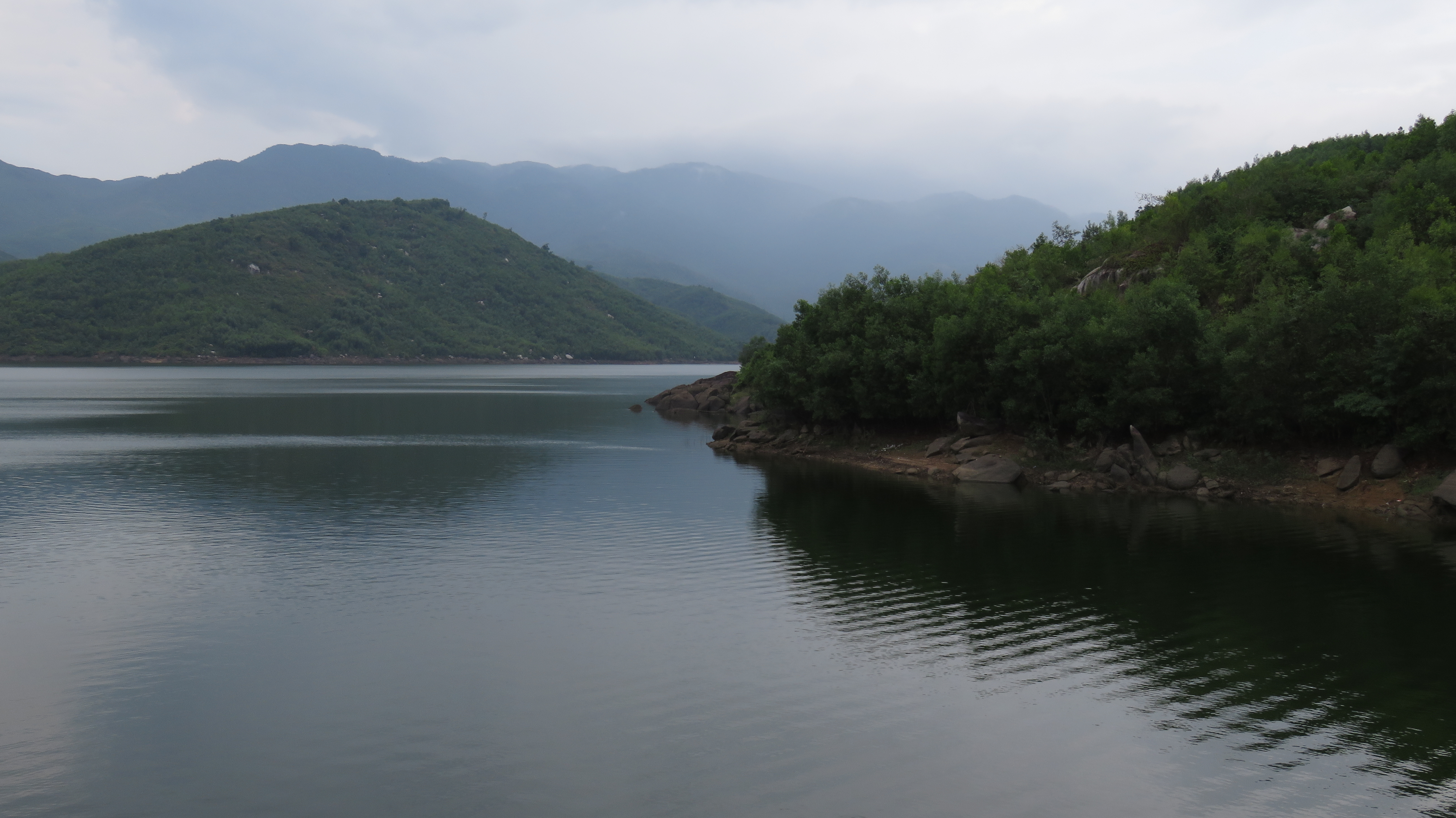
Mountains and water, Ho Dong Nghe.
Once at the other end, there are some trails leading off into the woods. If you choose to wander off, do be cautious; although these paths are likely safe, this small valley has quite the history from the US-Vietnam War era, and it's possible that this may render some of the areas around unsafe. For you see, during that conflict, this valley was nicknamed "Happy Valley" by the US troops, as it was a source of nearly constant RPG (rocket propelled grenade) and mortar fire. Geographically, it isn't that far between this lake and the Marble Mountain Air Base, or Da Nang International Airport, and the Vietnamese guerilla forces kept a steady slow scale attack on these facilities with the limited small arms, and this source of constant irritation for the US troops spurred the nickname. So, despite the beautiful and peaceful nature of the lake today, there is a possibility of UXO (unexploded ordinance) hidden in the trees- since this was indeed a Vietnamese firebase, it is quite likely it was protected by some kind of defenses, and mines cannot be ruled out, and it's also likely to think that if that many RPG's and mortar shells were fired, its also quite likely some of them ended up in the hills around the lake without detonating. In short, if you decide to go hiking around the forests near the lake, please stick to established trails and be cautious!!
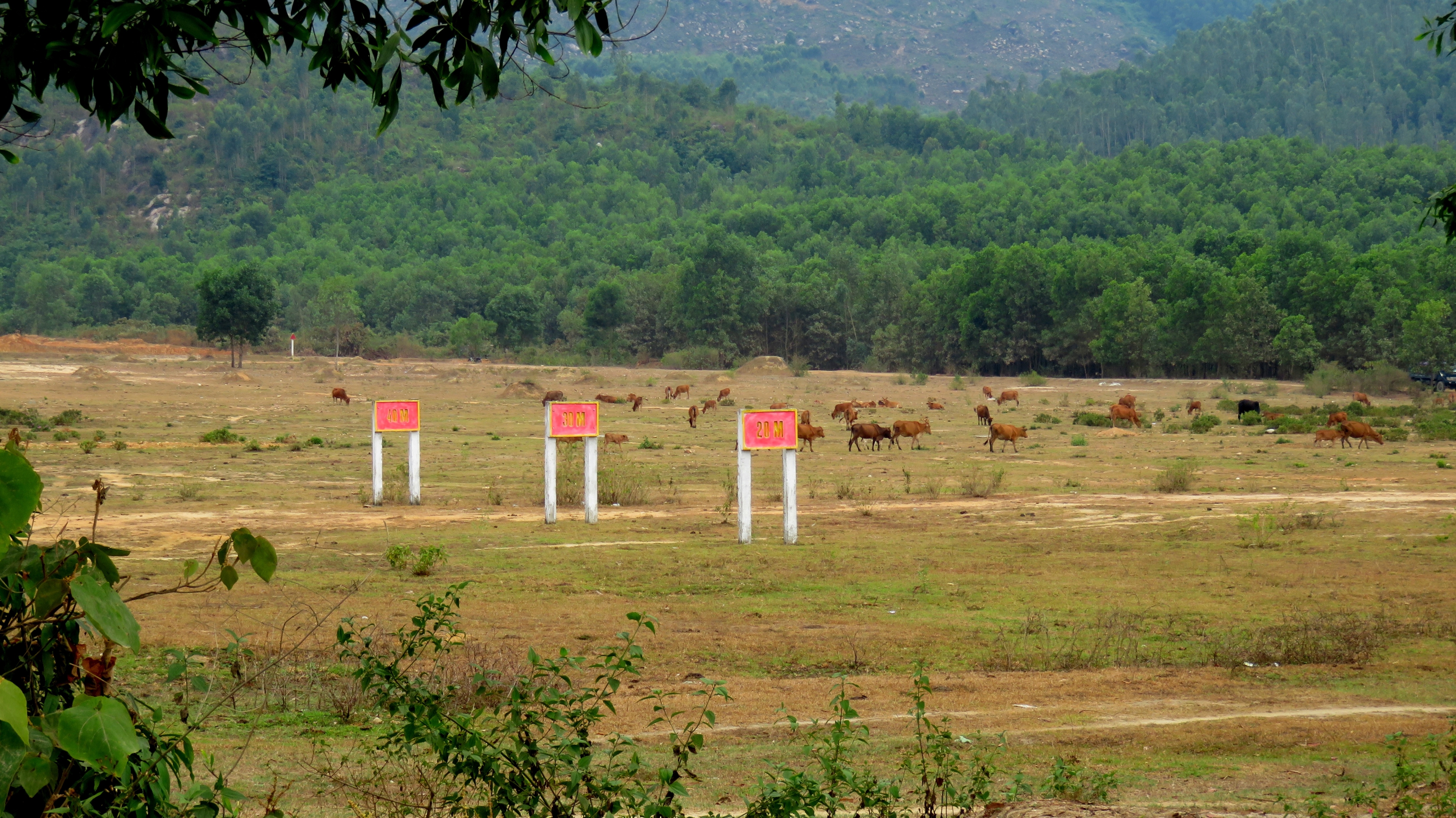
Artillery testing range (the cows aren't there when they bomb....)
Once finished at this lake, drive back across the dam and to the road. Turn left, and head down the road. At the intersection where you joined this road, instead of turning back onto that road, continue straight on the nice newer road. Shortly down this road is a large military base, complete with artillery training, so you can sometimes see and hear live fire exercises in this area. The base is quite large, stretching along the road for several kilometers on both sides. However, after a while you will end up at the AH-17 at a 4-way traffic light in downtown Hoa Khuong village. If you turn left here, you will end up in Tuy Loan where you started just a few short kilometers down the road. This trip can be done in as quickly as two or three hours, and you could easily stretch it into a full day if you want more time. There are several small villages along the way so anything you need (water, snacks, motobike services) is usually not far away. A couple of coffeeshops and small food stalls can be found as well, and there is a decent restaurant at Phuoc Nhon Hot Springs as well (you don't have to buy entrance to the Springs, just tell them you want to eat). The roads, while being a little bumpy in spots, are all non-technical and can be driven by just about anyone, including beginners in most conditions. In fact, getting to the start of this tour from the city is going to be more difficult than any other part of this tour.
The Map
All photos copyright Kit Davidson unless otherwise noted.
All maps copyright Google MyMaps.
All maps copyright Google MyMaps.
