
Ho Chi Minh Road - Da Krong <-> A Luoi
|
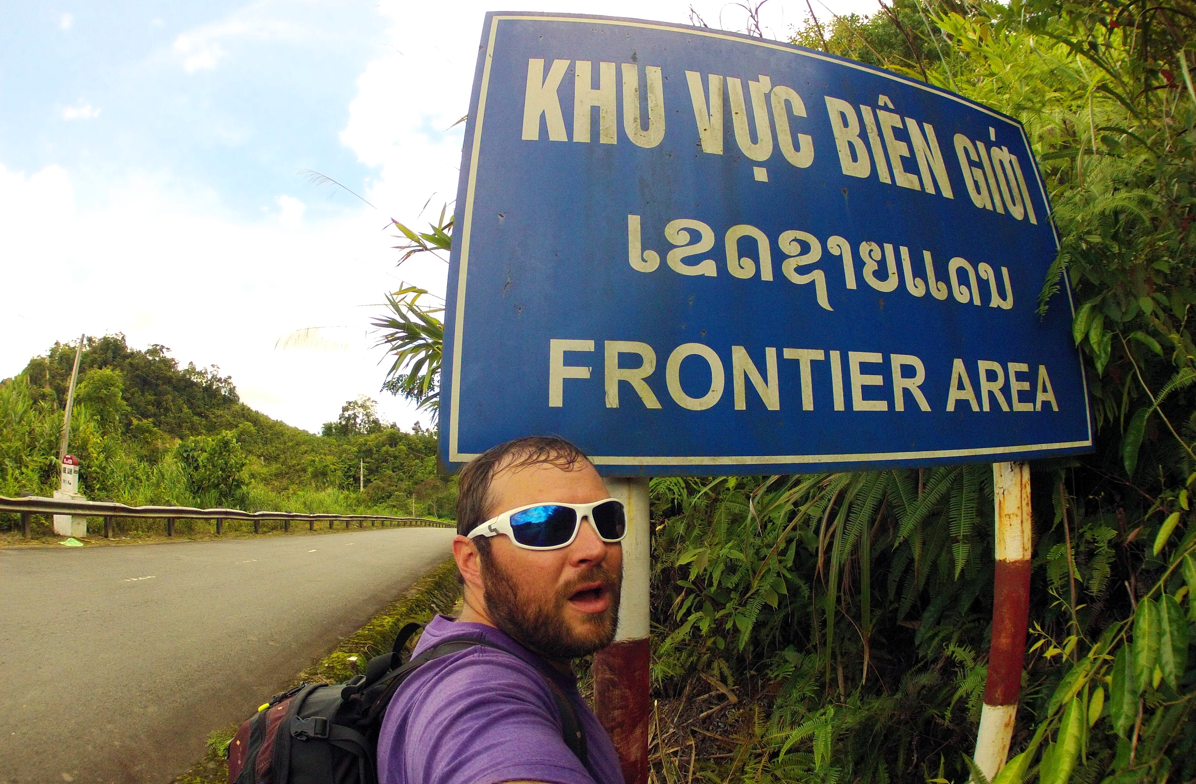
Running up the west side of the country, the Ho Chi Minh Highway is Vietnam's modern version of the famous "Ho Chi Minh Trail", and offers an interior corridor alternative to the coastal Highway 1. Stretching between the Central Highlands provinces of Gia Lai and Dak Nong to the Red River Delta area around Ha Noi, the Ho Chi Minh Road is synonymous in Vietnam with ethnic people, wild jungles, and being on the frontier. Hell, there are even signs along it that read "Khu Vuc Bien Goi" - "Frontier Area". Any trip along this road is great, and the section of it that runs along western Quang Tri is a great piece of that highway.
|
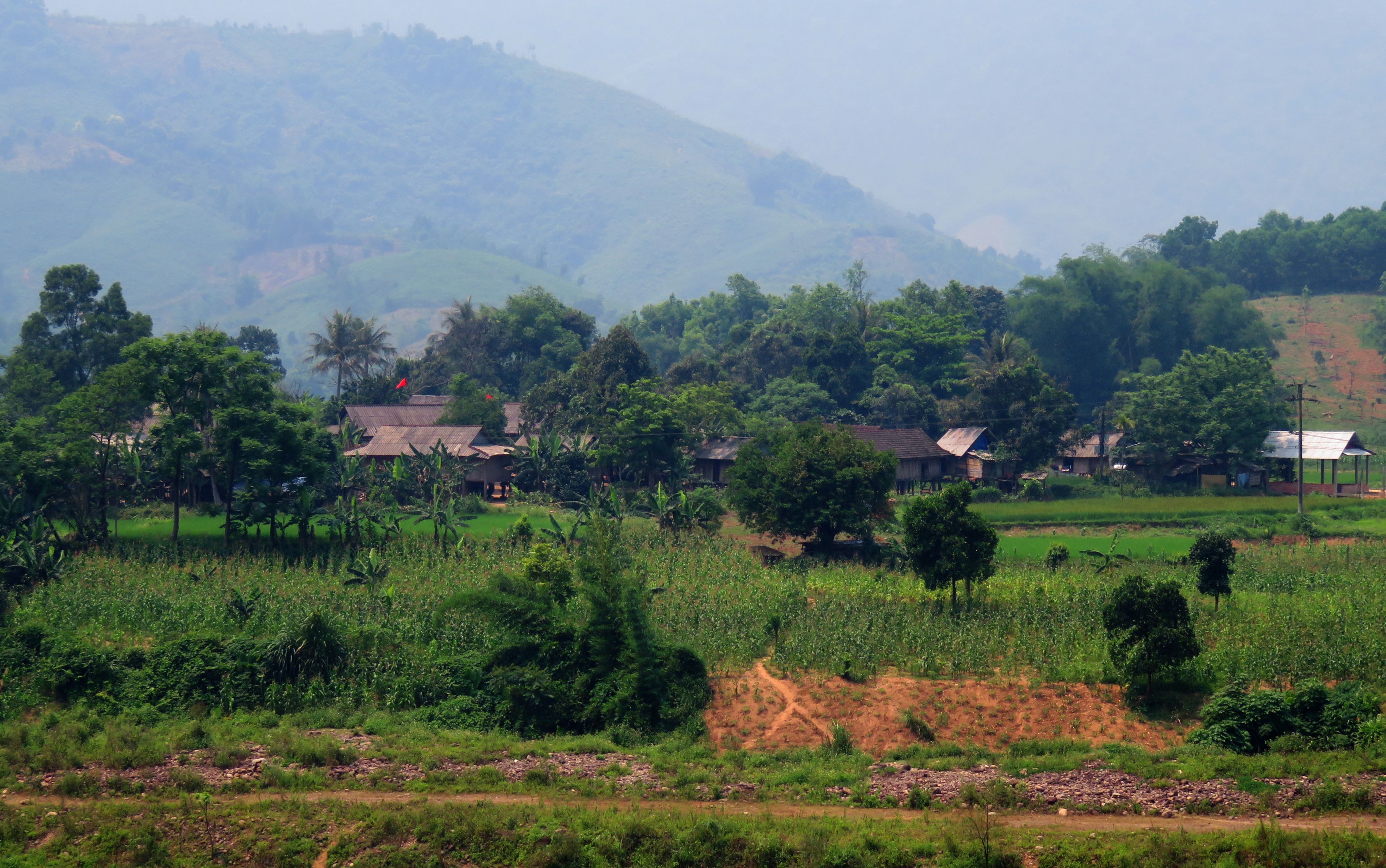
A good example of some of the small farms and houses scattered along the Da Krong River valley.
|
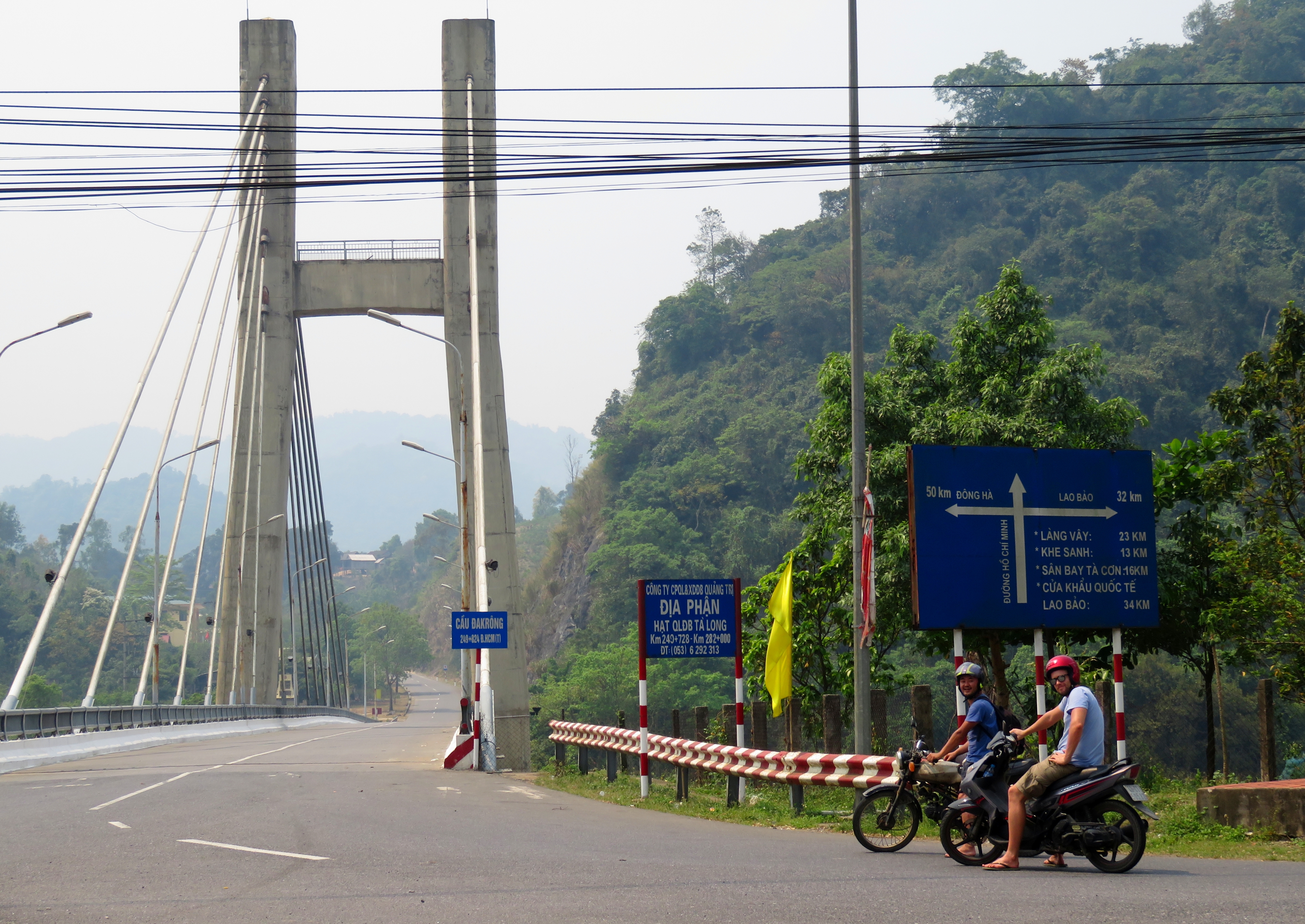
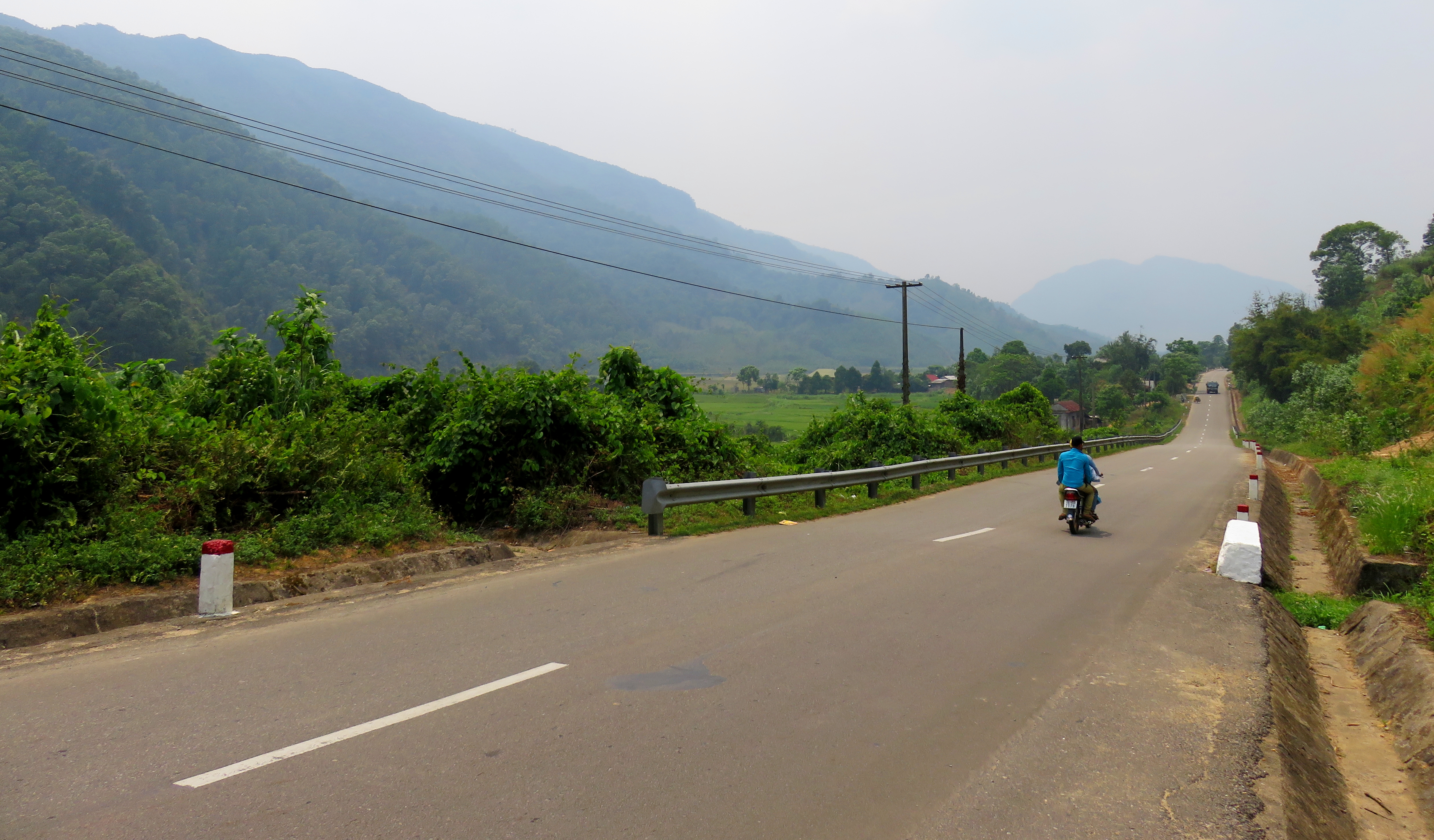
The boys at the bridge over the Song Thach Hanh, ready to start this stretch of the HCM Road!
The Ho Chi Minh Road conveniently breaks down into quite a few nice sections that can be driven independently from the rest of the network. West of Da Nang, many people are familiar with the P'rao to A Luoi section, a gorgeous romp through some virgin mountain jungle, over the crest of the Annamite Range, or it's shorter sibling, the section from P'rao to Thanh My, past all the hydro dams. To come home on our 2016 Hung Vuong Road Trip we decided to come down the Da Krong Section of the HCM Road, as I had never done it before, and Kong was always eager to ride it again. So, on a hot April morning in 2016, we set out from Khe Sanh and turned south onto the Ho Chi Minh Road.
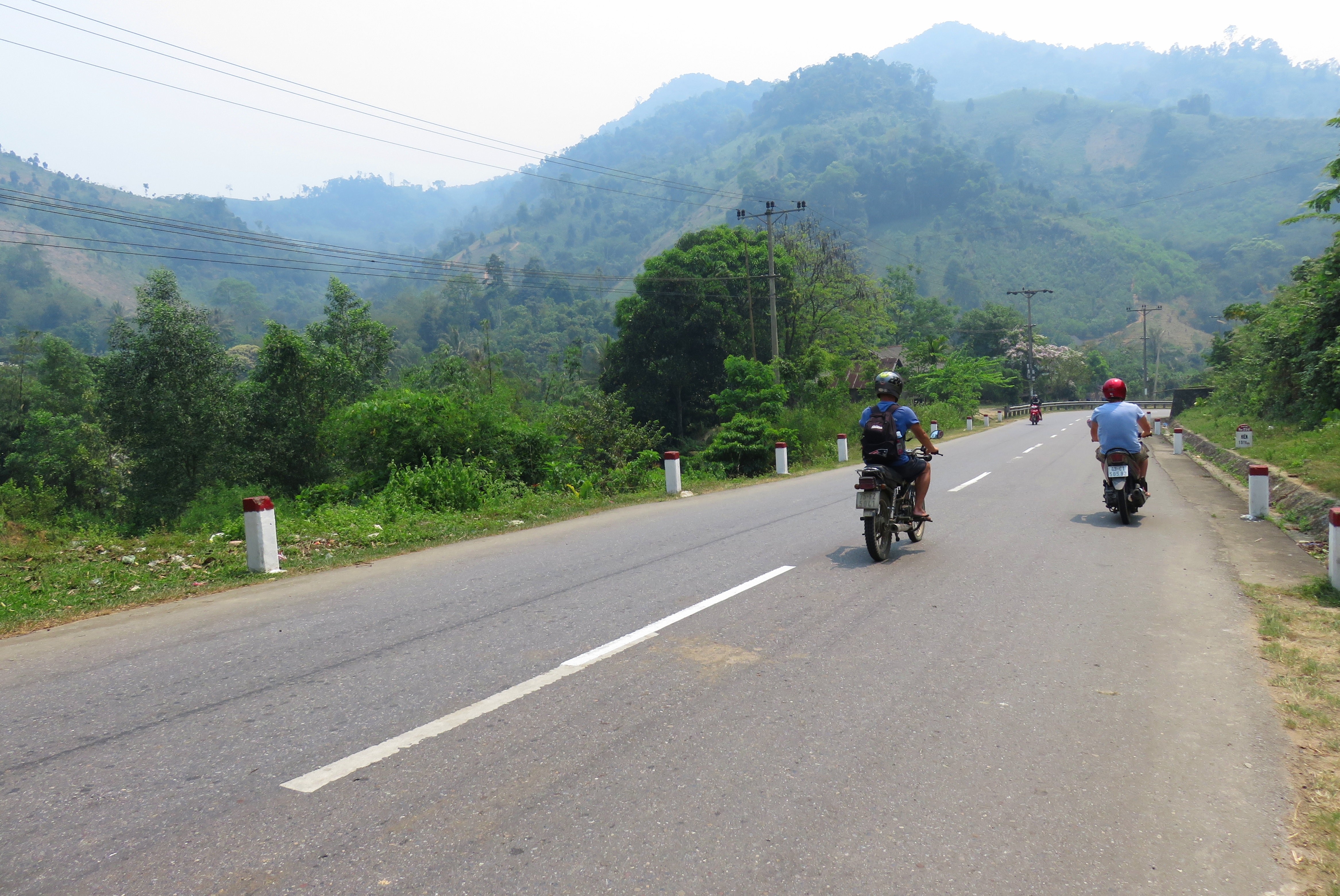
Early on along the road.
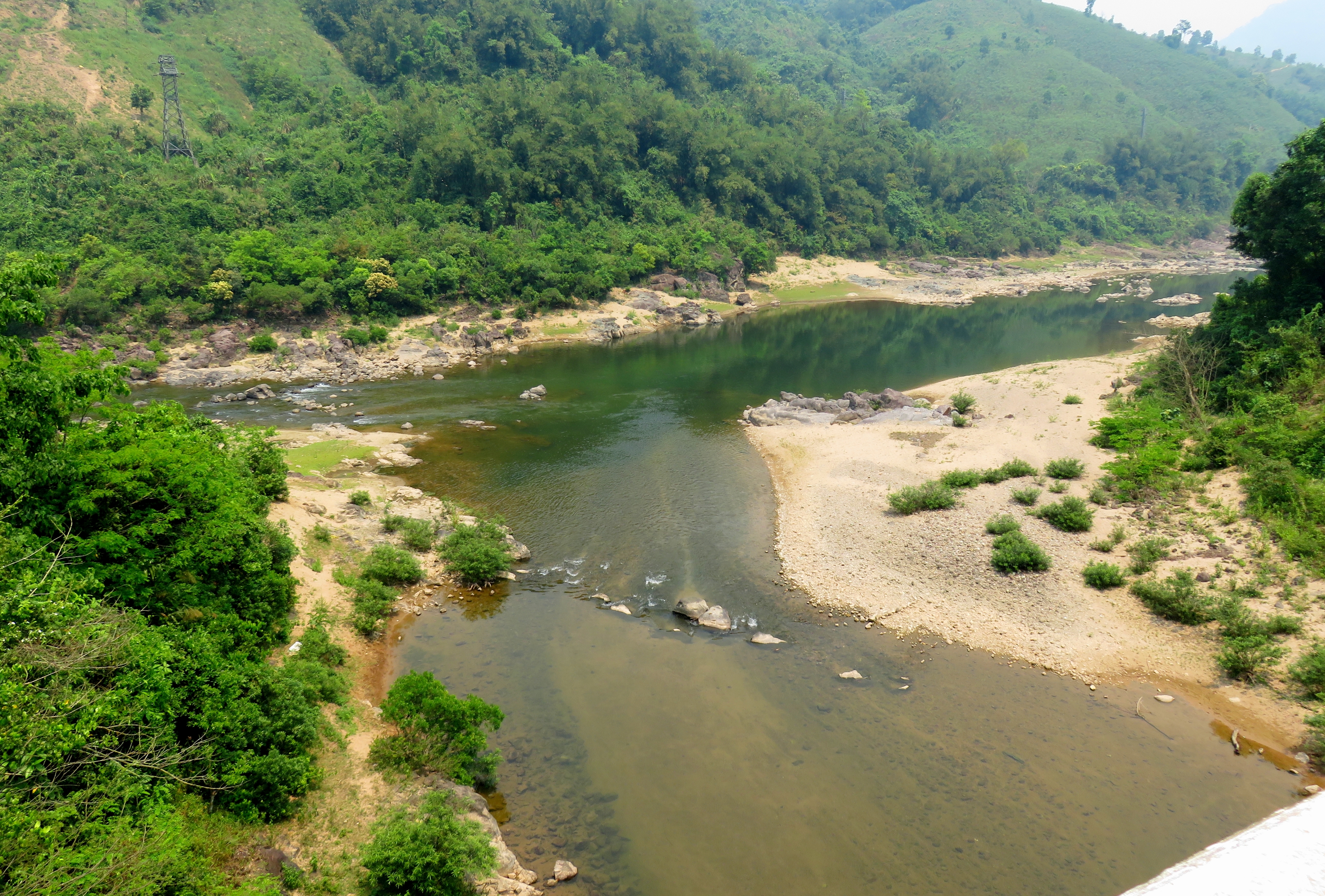
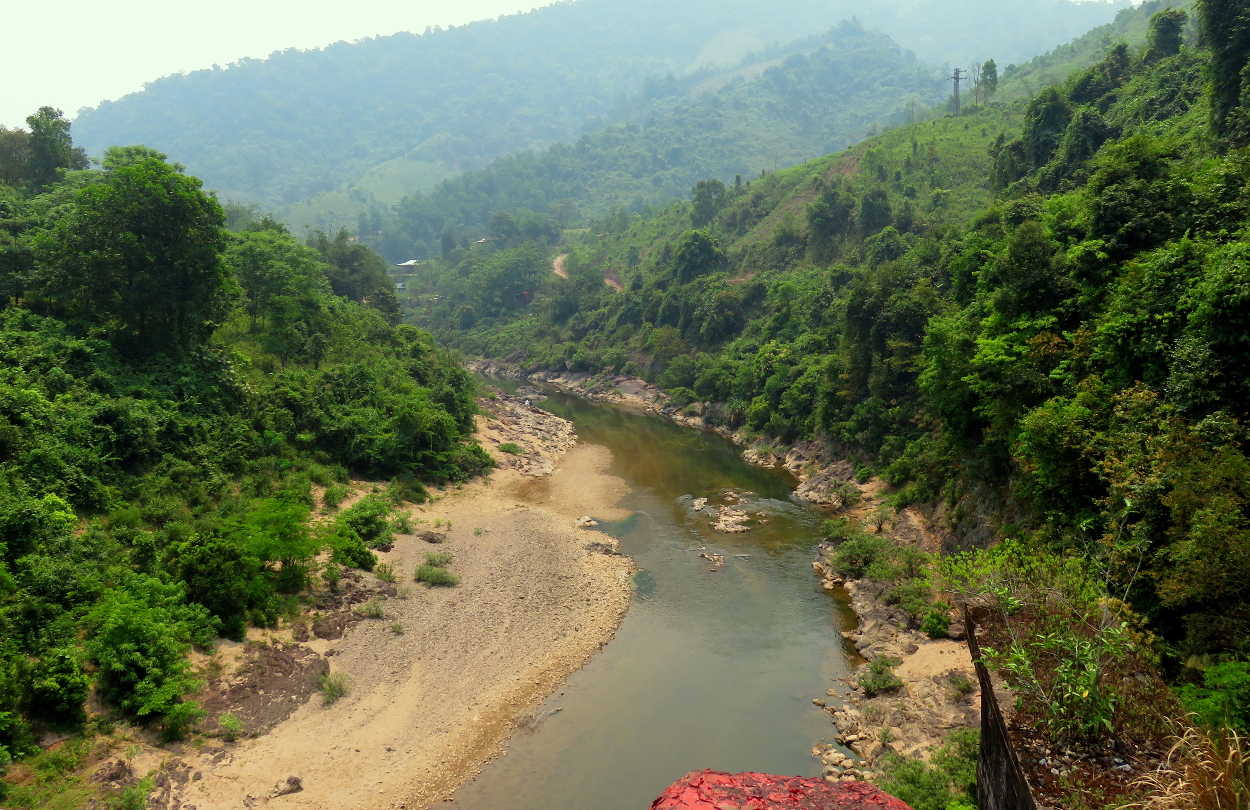
Many of the different sections of the HCM Road all have their own flavor or character that set them apart from the others and gives them their unique identities. P'rao to Thanh My is notable for it's lakes and hydro dams, and beautiful vistas. P'rao to A Luoi is famous for it's big trees and wild jungles. Khe Sanh to Phong Nha is famous for being wonderfully isolated with no services. The two most notable parts of this section are the wide array of ethnic villages, and the Da Krong River valley, both of which dominate the landscape from start to finish. Numerous villages can be seen both close and far from the road, as well as plenty of scattered farms living outside the margins of the villages. The Da Krong River, also remembered as Dewey Canyon, is a fairly major landform in this part of Vietnam, and the road faithfully follows the river all the way from it's confluence with the Song Thach Hanh in Quang Tri to where it's headwaters come out of the wild jungles and coalesce into the Da Krong.
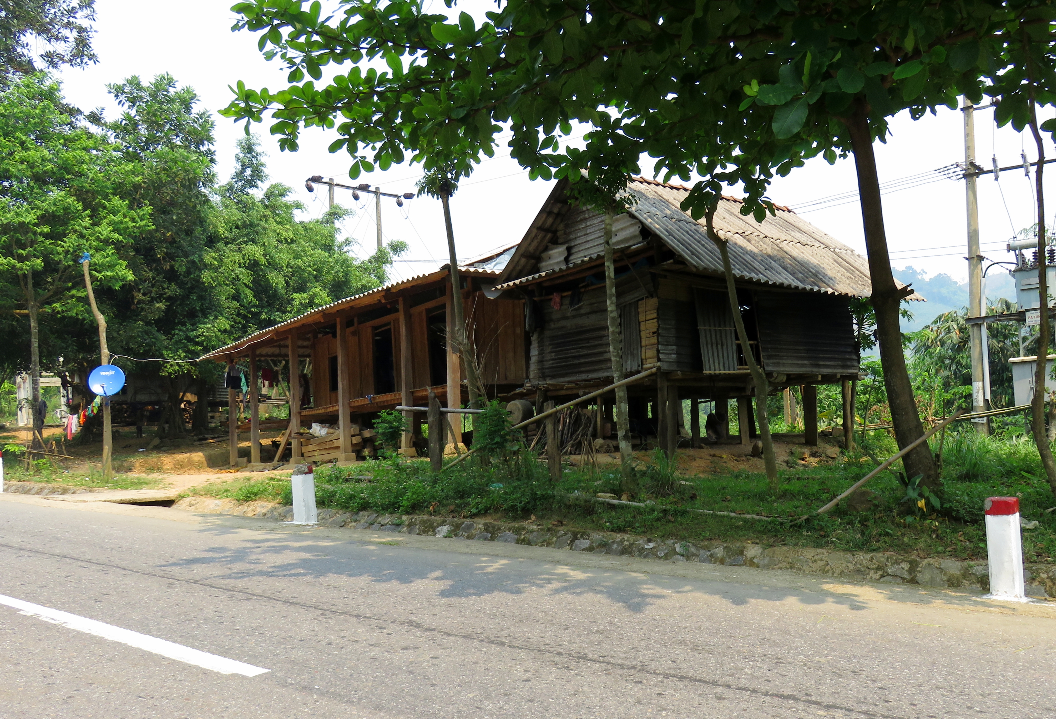
Traditional house on stilts, made out of wood.
The local people in the area come from three main ethnic groups, the Pa Co, Bru - Van Kieu, and Kinh, The Pa Co make up the dominant population in at least a couple areas, notably the commune of Ta Rut, located about halfway between Khe Sanh and A Luoi. According to a GMS-EOC Commune Profile from 2010, Pa Co made up 80% of the village population, while 14% were of the Kinh, and 6% were Bru - Van Kieu. Of course, these numbers differ slightly from village to village, and the further you go north or south the villages are likely more influenced by other tribes, such as the Co Tu around A Luoi. Quang Tri is one of Vietnam's poorest provinces, and some of these villages are the poorest areas of Quang Tri. Most of the local people do not produce handicrafts, and apart from domesticating and owning livestock, most of locals in the area still practice subsistence living. Fishing, hunting, the gathering of supplies and the growing of crops provide the daily necessities. In the same 2010 document, it was reported that almost 50% of the households in the Ta Rut Commune fall under a "poor" classification. Some locals have begun to engage in the direct retail of goods, such as foods, cooking products, and clothing, but this is not that common.
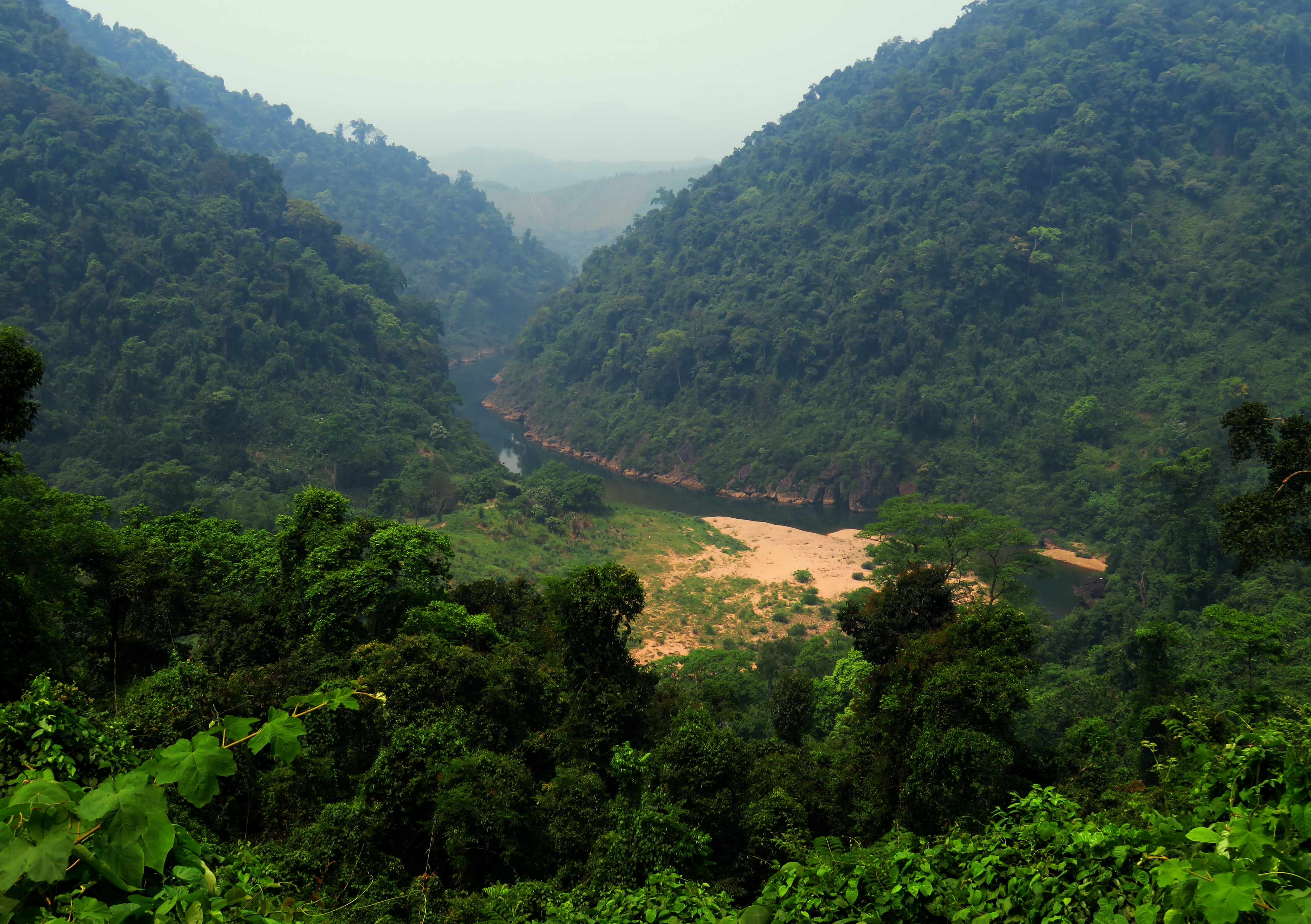
River cutting through a limestone canyon.
|
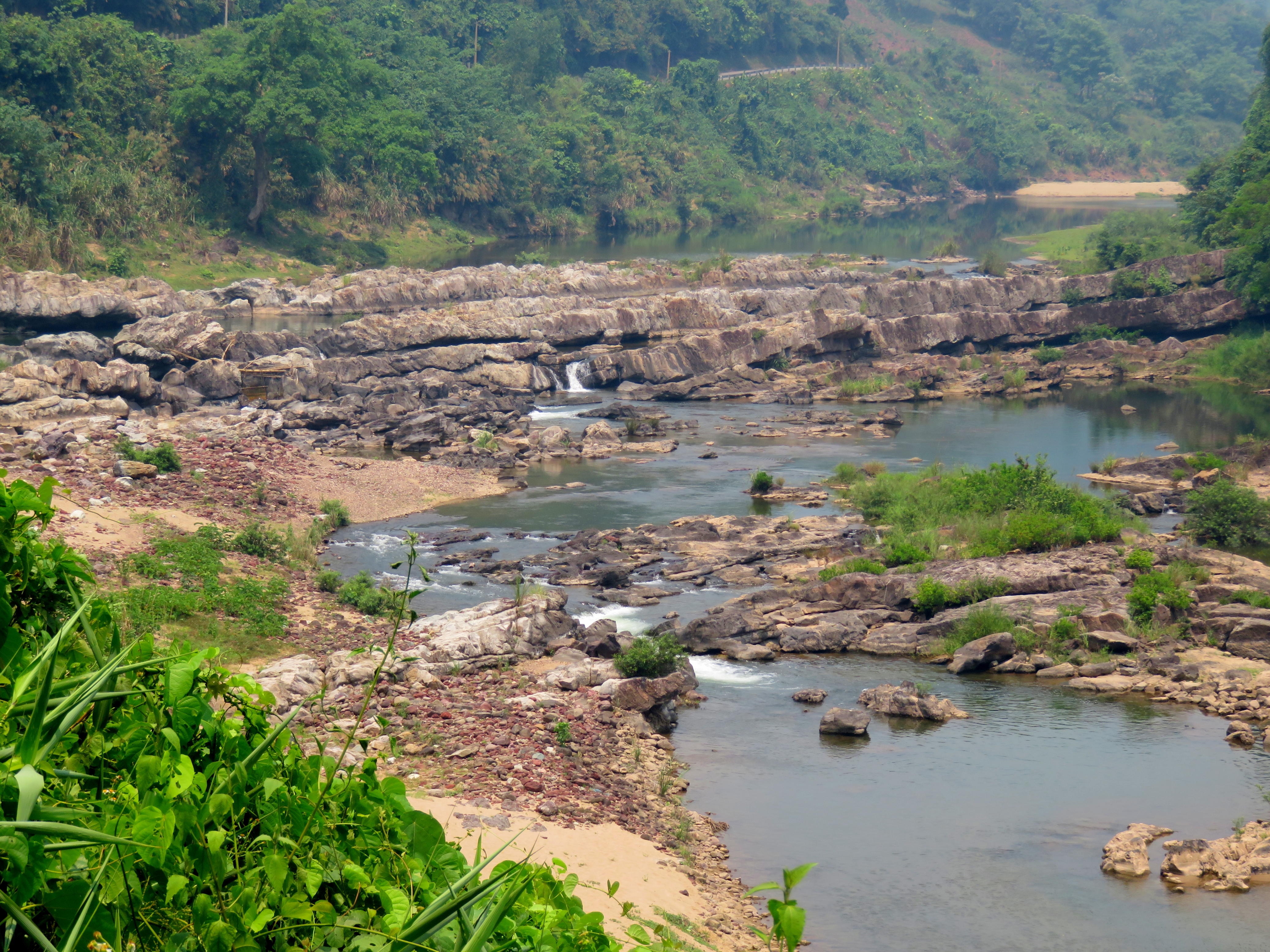
The lower part of the Da Krong River is dominated by small limestone canyons mixed with wider open areas. As with any larger river in Vietnam, there are a handful of dams along the Da Krong, creating small lakes that fill the valley bottom. Swinging around, above, and sometimes away from these reservoirs, the road winds it's way around through small valleys off the main canyon, occasionally offering glimpses down into the lake or river below.
Driving around a corner, I got really excited at one point in here because the road went through a grove of teak trees! Not just pines or dipterocarps, but honest to goodness TEAK trees. We had seen some of these monsters in our trip to Myanmar last summer and they were unmistakable as I was driving along. These logs are incredibly tall and strong, and were used as ships' masts during the golden age of sail-borne trade. They were quite a surprise to see. I was falling behind so I wasn't able to stop a get any good photos though. :-( |
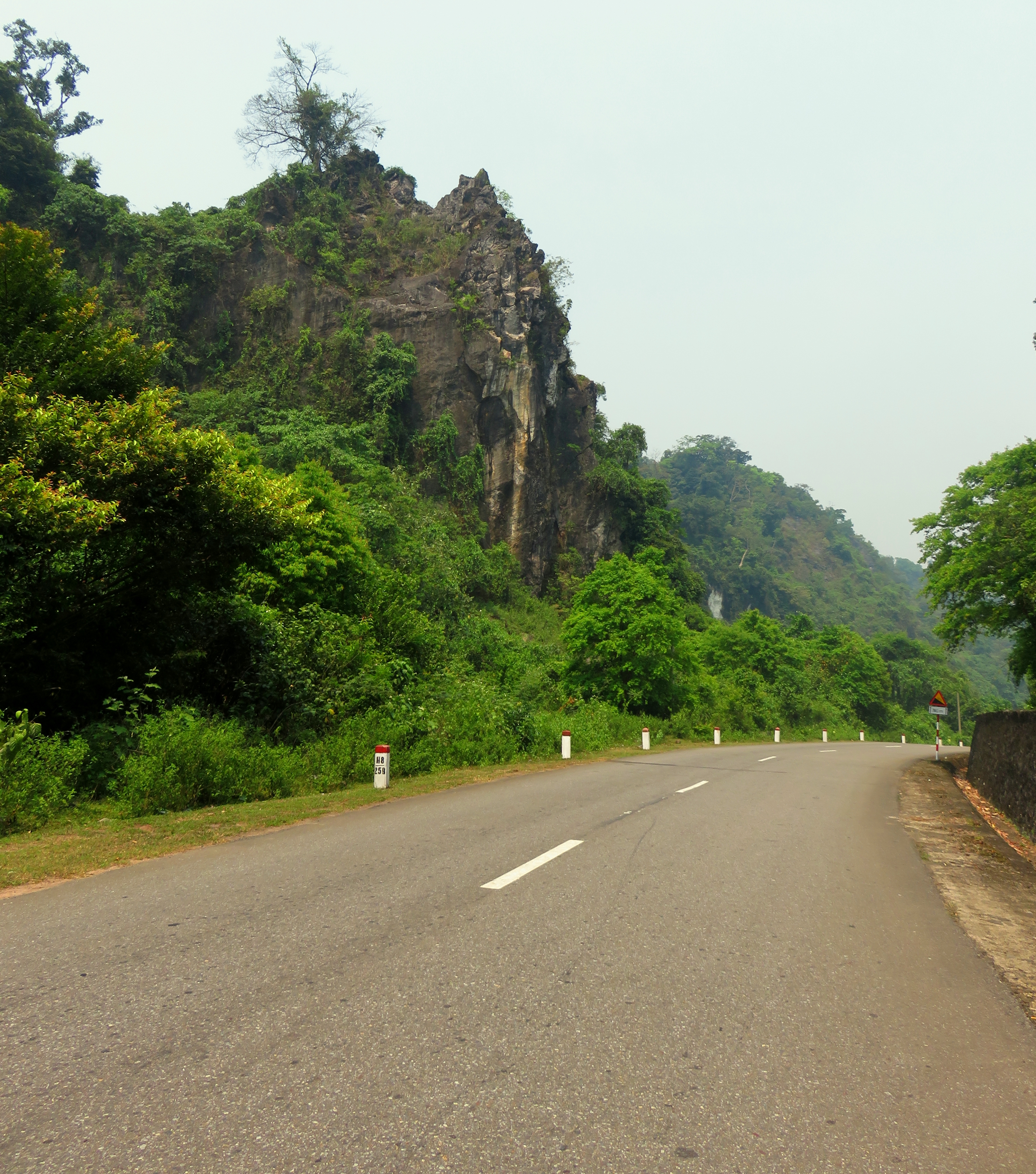
Limestone tower along the drive.
|
Stop along the jungle.
Soon we rounded a couple of bends and found ourselves across the river from Huc Nghi, one of the new government-built villages in the area. This looked like your standard Vietnamese government village, with tin-roofed cabins laid out along a freshly-cleared bottom above the river. Just past this village a river joined from the east that was strikingly beautiful. I would love to come back and check out this canyon further someday.
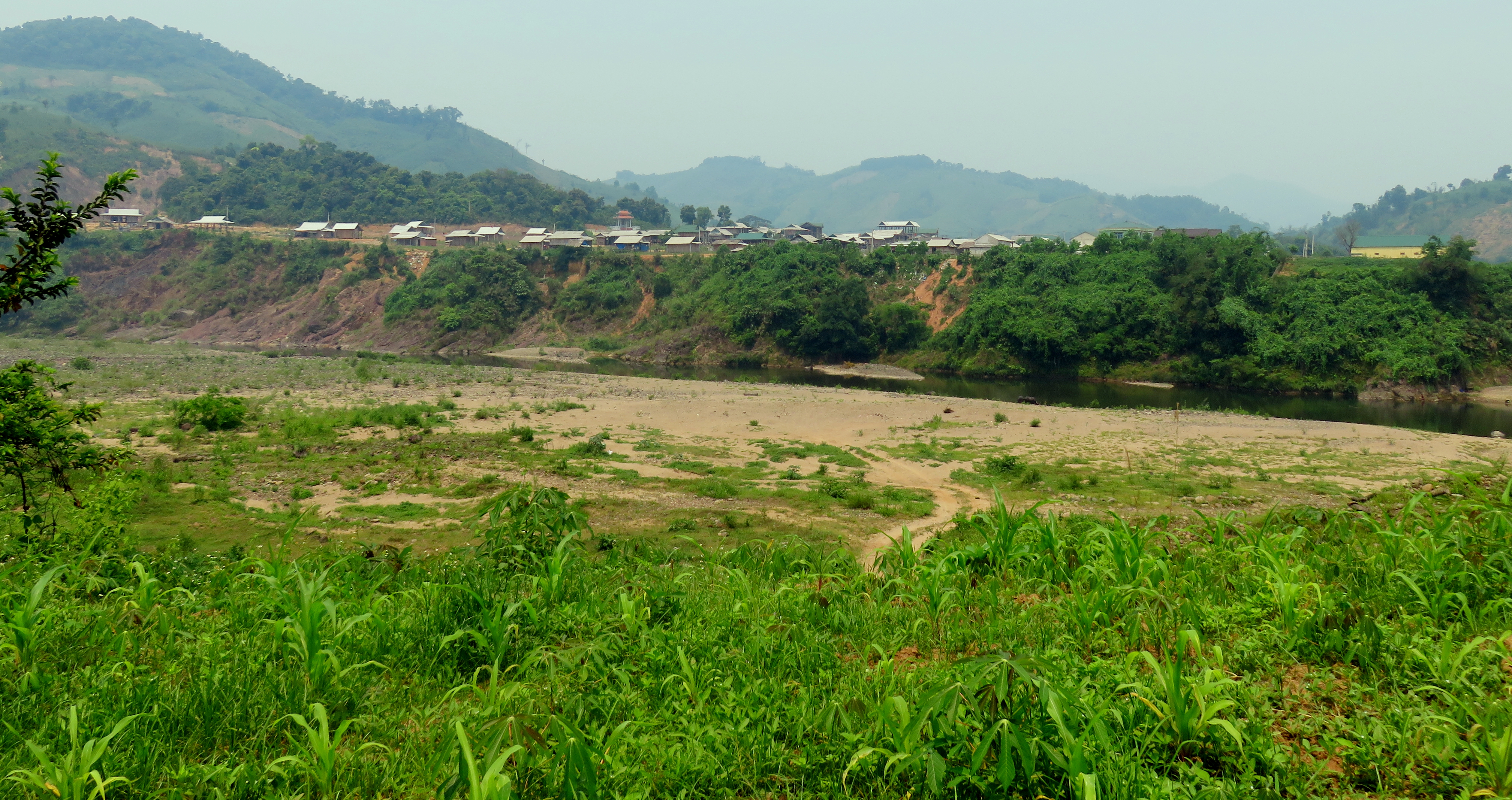
Looking at the village of Huc Nghi, on the other side of the Da Krong River.
"Huc Nghi" & Da Krong Rivers.
|
...and looking up the "Huc Nghi" River.
|
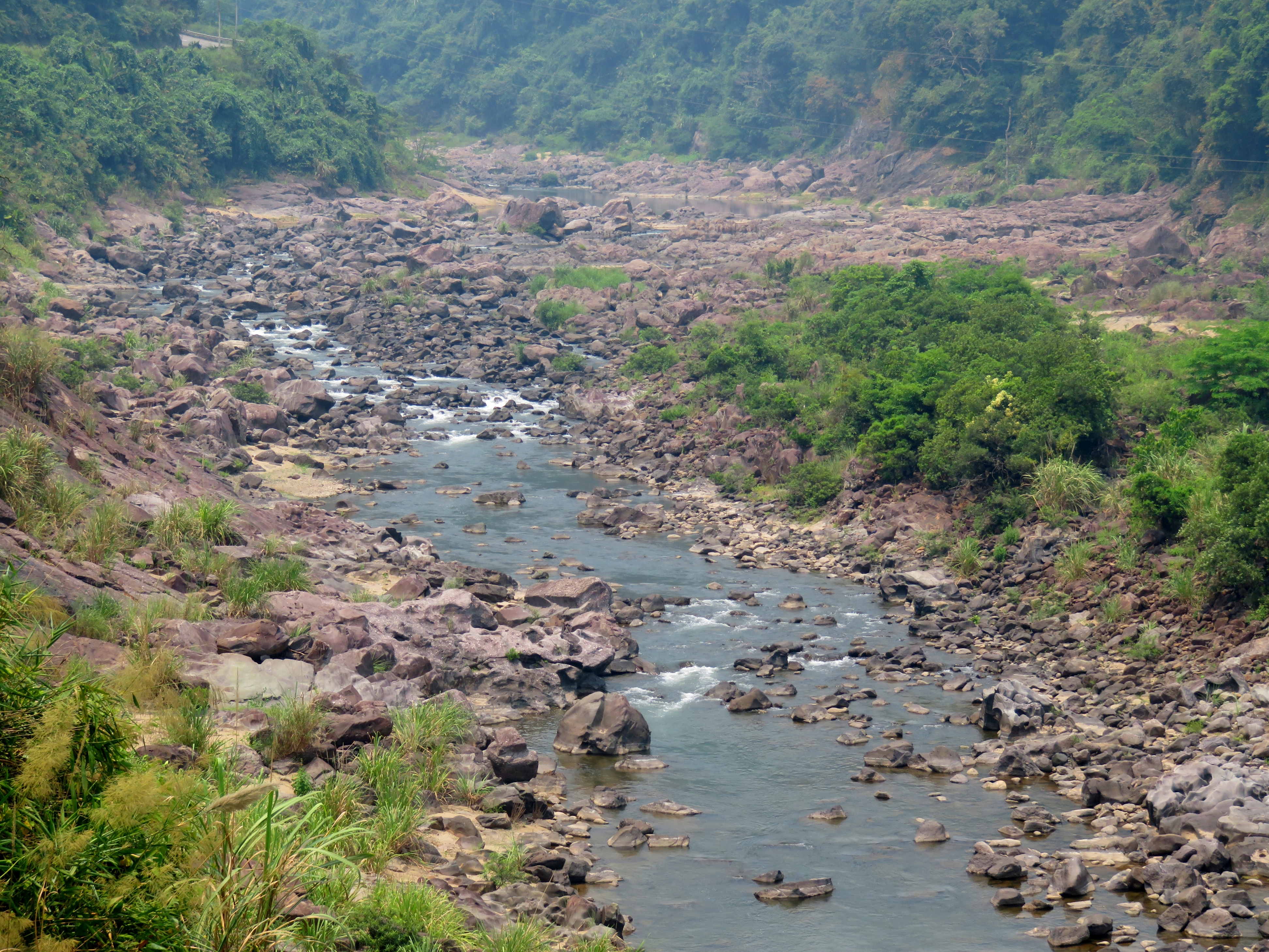
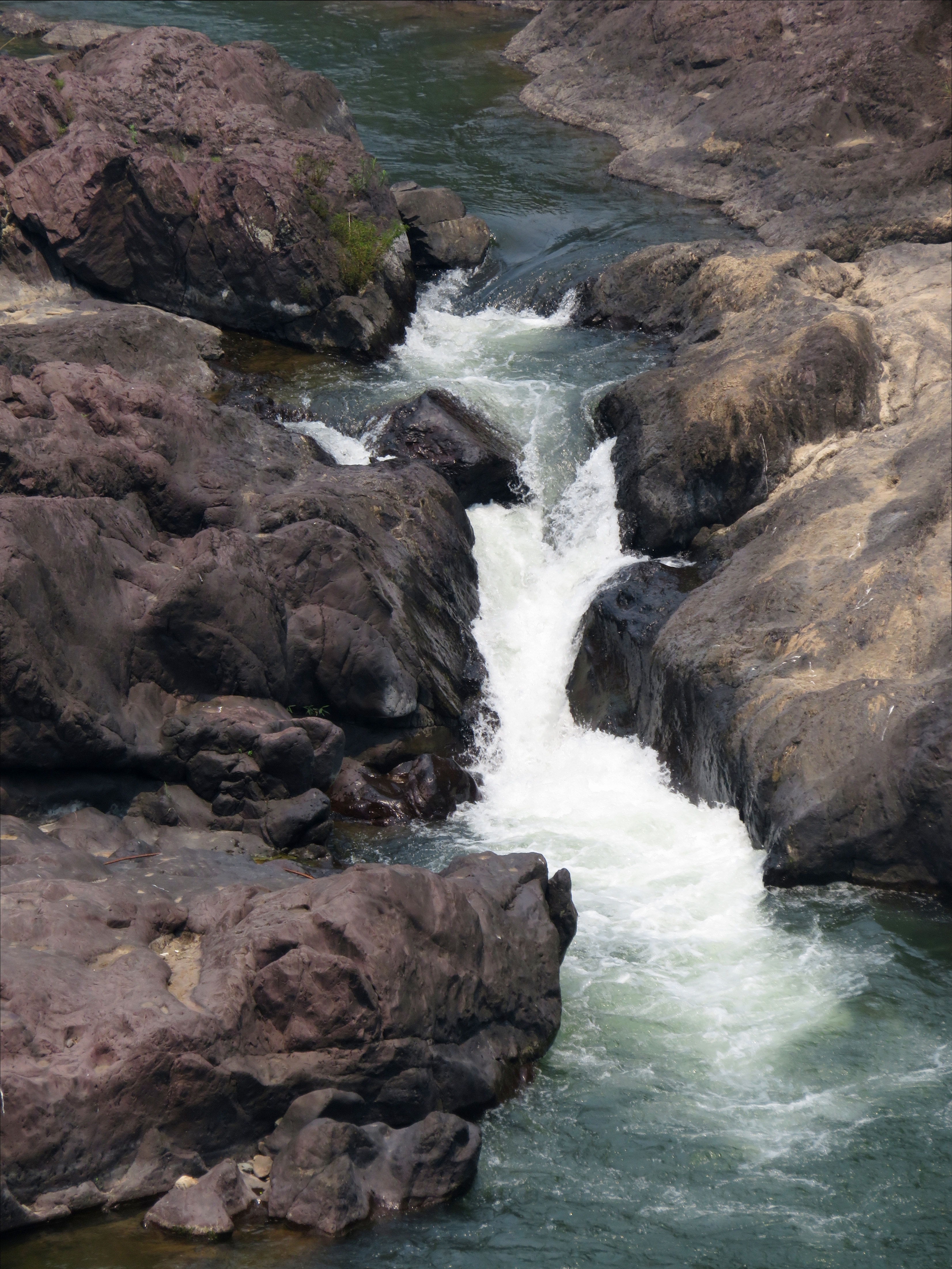
One neat thing about the Da Krong River is it's riverbed. Since the whole area is mostly limestone based sediments, the riverbed itself is often a heavily eroded slab of limestone. This has produced some fascinating features in the rock of the bed, both in intricate designs and textures, as well as river features such as mini-gorges, small waterfalls, crack drops, and slides. Potholes can be found here or there, and in many places it looks like it would be quite fun to go boat down. On one waterfall, several layers of limestone have been folded or faulted to a gentle angle, and the water pouring over them creates several small drops through the gaps in the rock. Very neat!
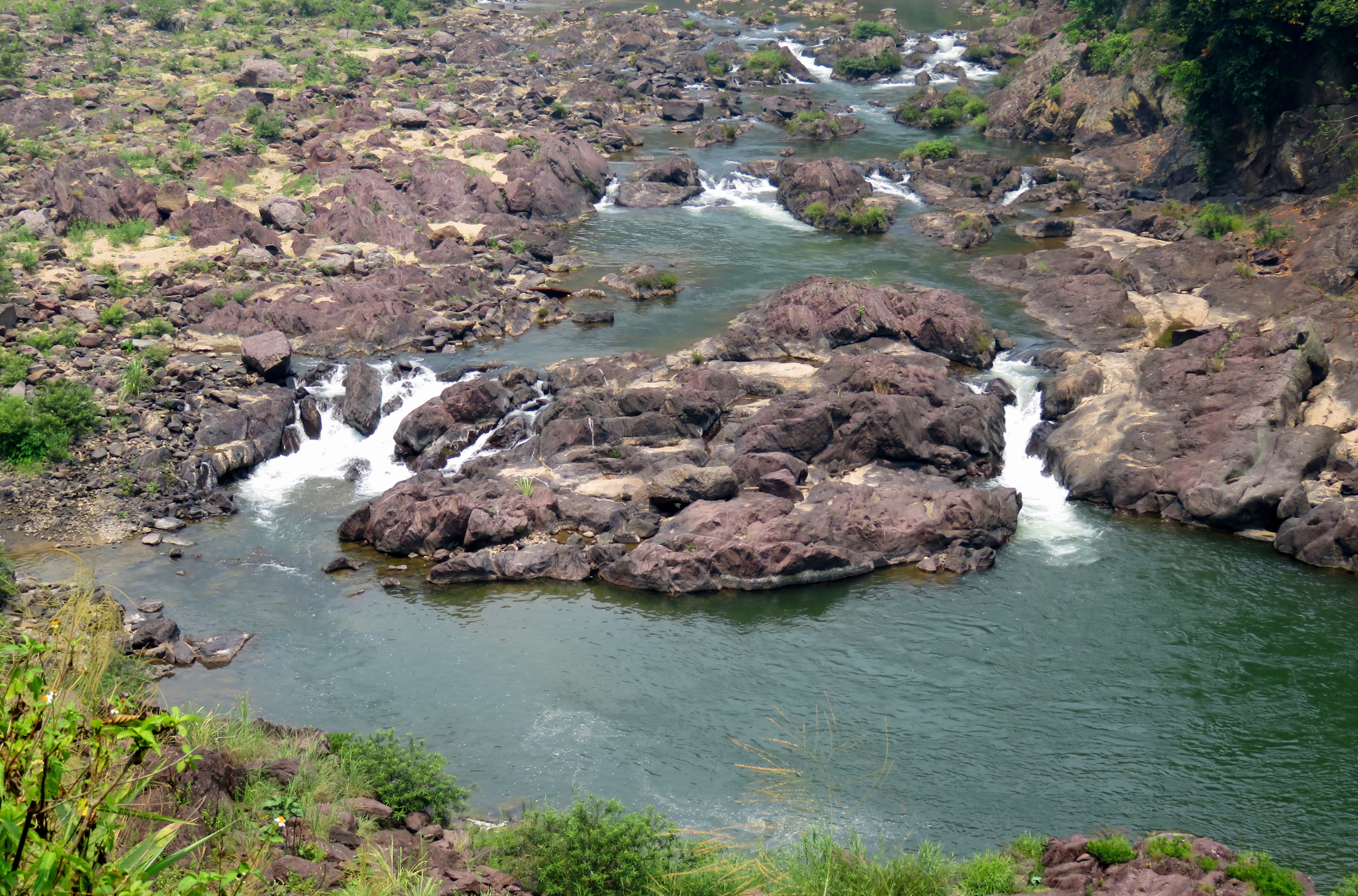
Waterfalls and rapids along the Da Krong River (above and below).
|
|
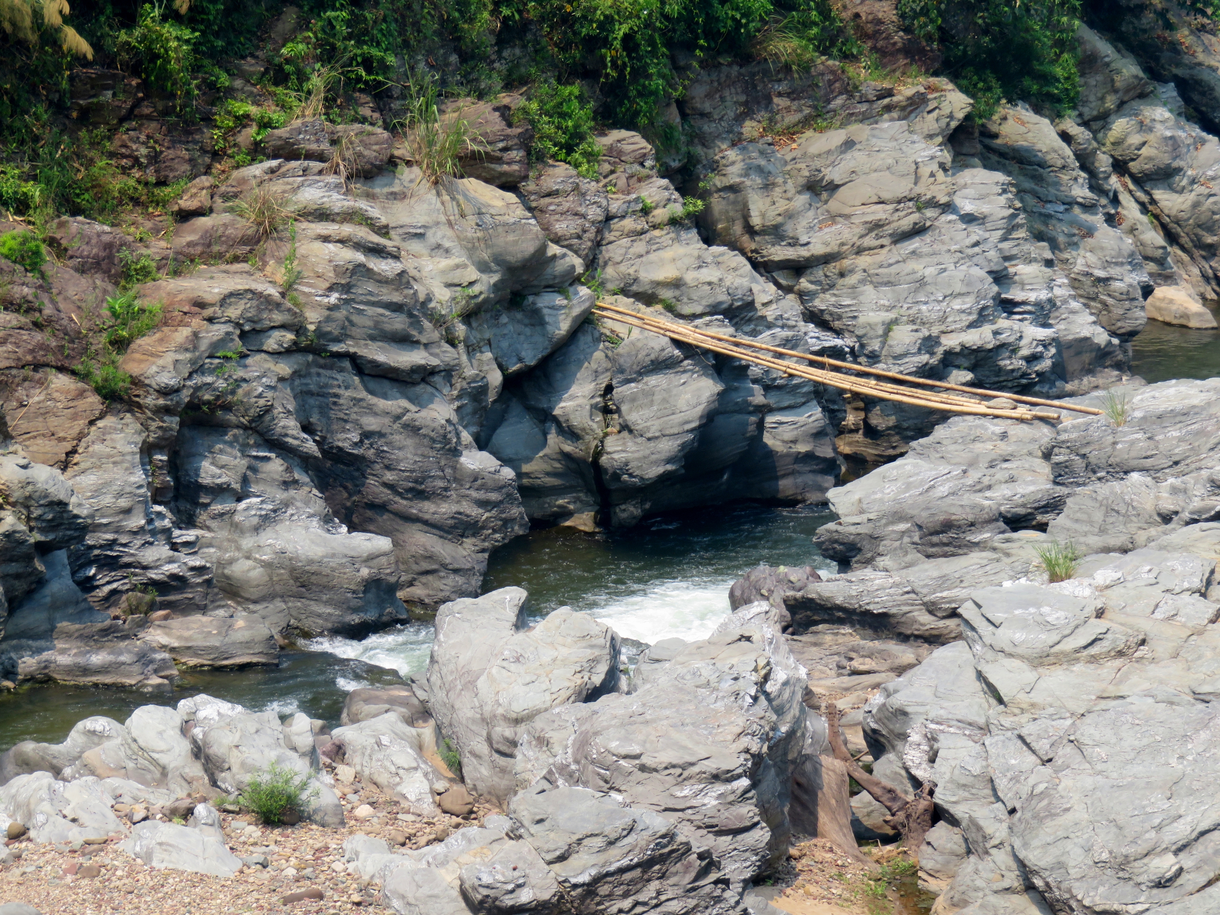
Mini-gorge with a bamboo bridge over it.
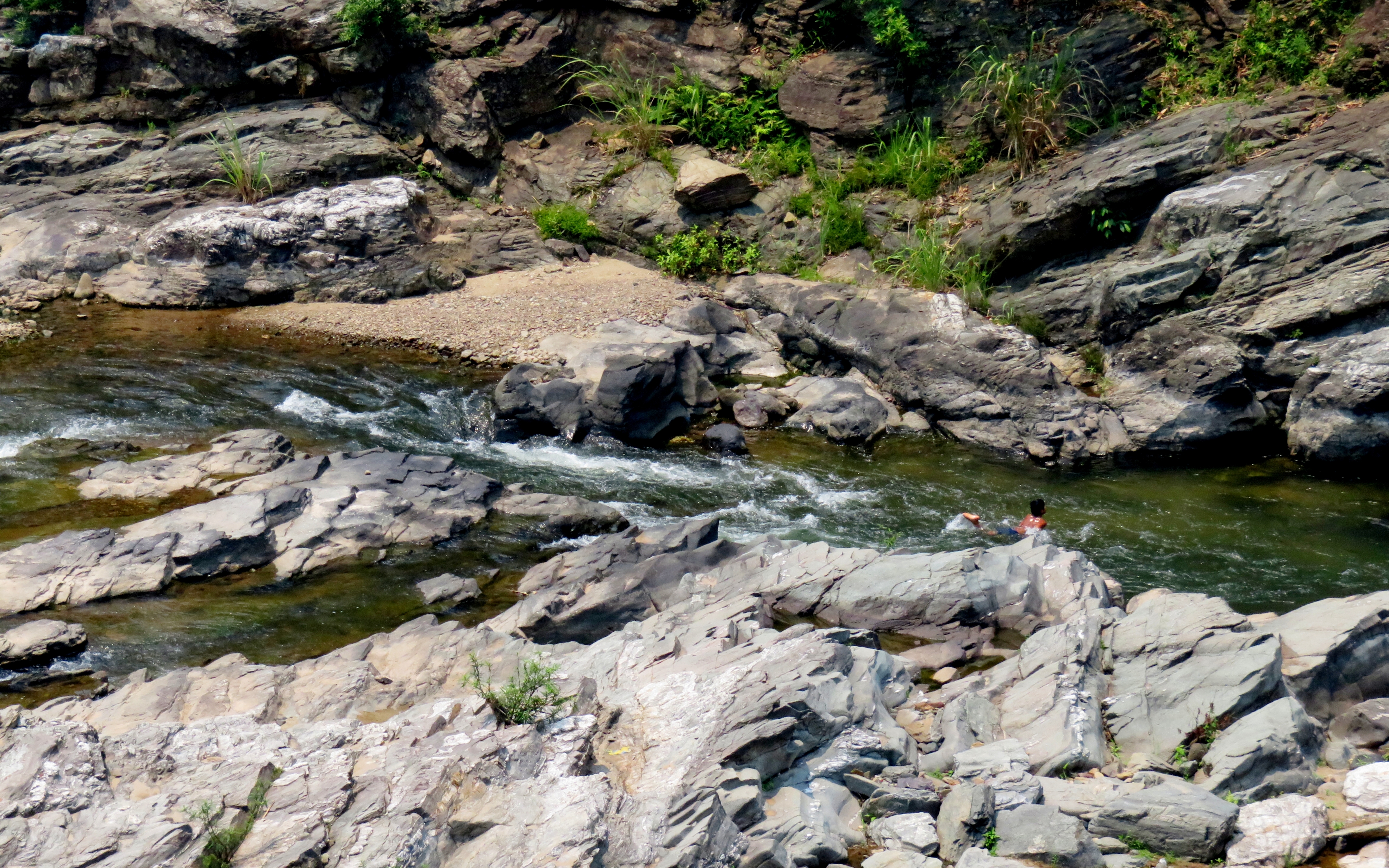
Local boy swimming the channel.
|
Waterfall & ledges.
|
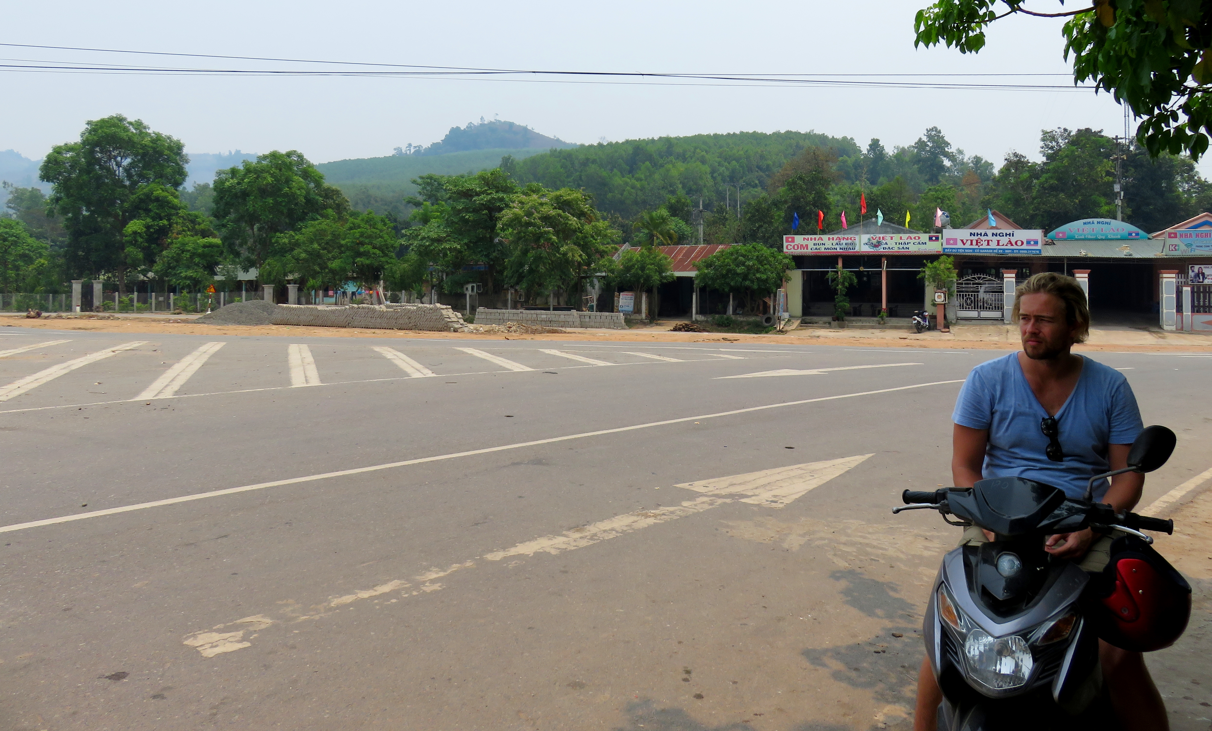
After a while, the river valley changed subtly, on a geologic scale. Up until this point, the river had been mostly confined to a series of narrow canyons, with some open spots here and there, but mostly contained within walls of limestone. However, we soon reached an area where the walls of the canyon receded into the mountains and hills around, and the river was flowing through more of a broad open valley, rather than a narrow canyon. There must have been a syncline in the area, as I saw sediment layers tilted both directions, first down, and then up. This wide open valley continued for quite a few kilometers. Right as we began to climb back into the hills and mountains, and right before the river canyon began to close back in, we stopped at a small, spread out community known as La Lay. Here, there are a handful of small local villages spread out along the road and around a small bend of the river nearby, and you can find a petrol station here, the only one between A Luoi and Khe Sanh. There is a road that runs around 20 kilometers to the Laos border, where there is a border gate, but have visas arranged ahead of time as there are no VOAs here. There are also a couple of small bodegas and restaurants at the big interchange.
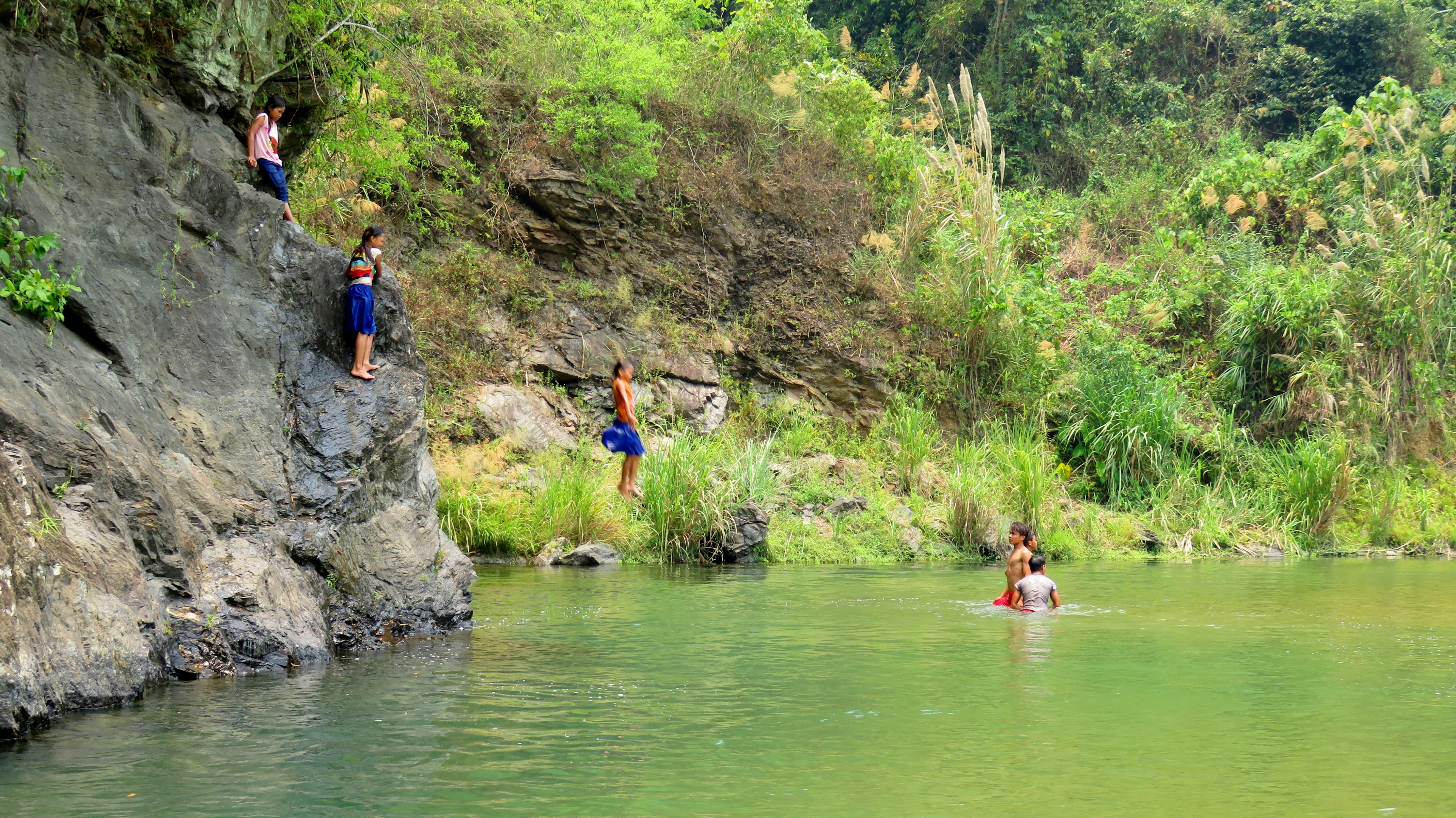
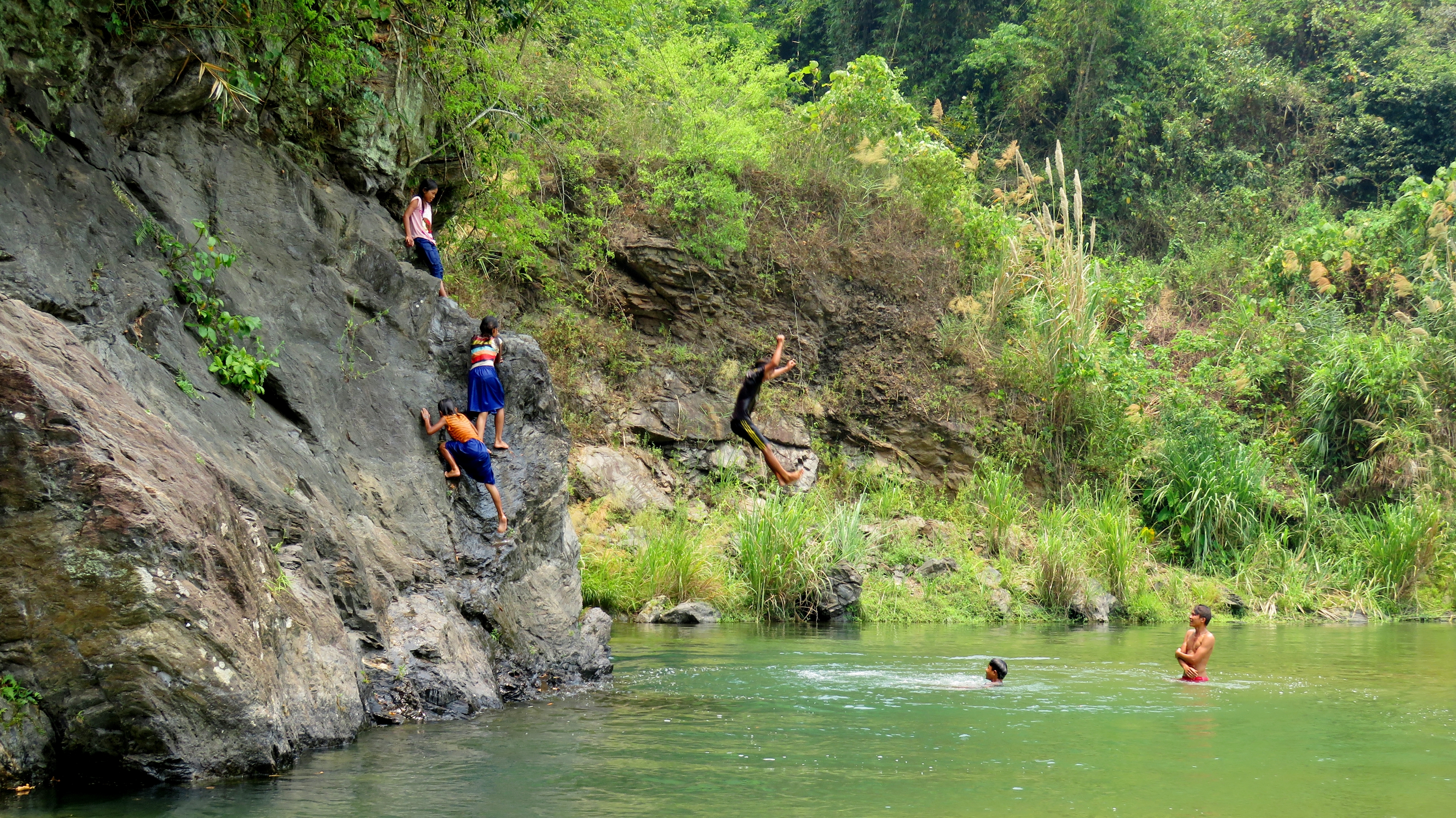
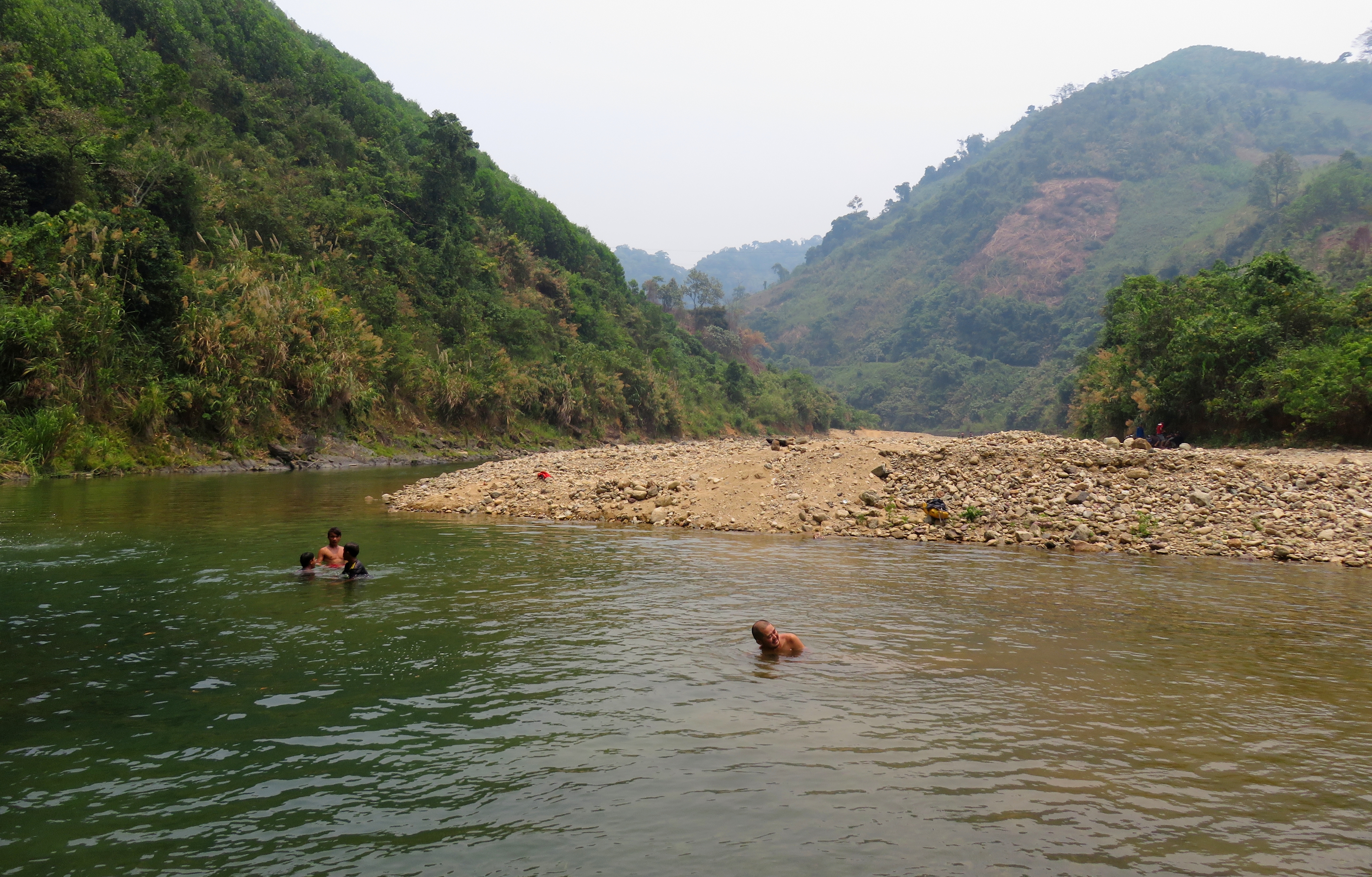
Swimming With Some Local Kids
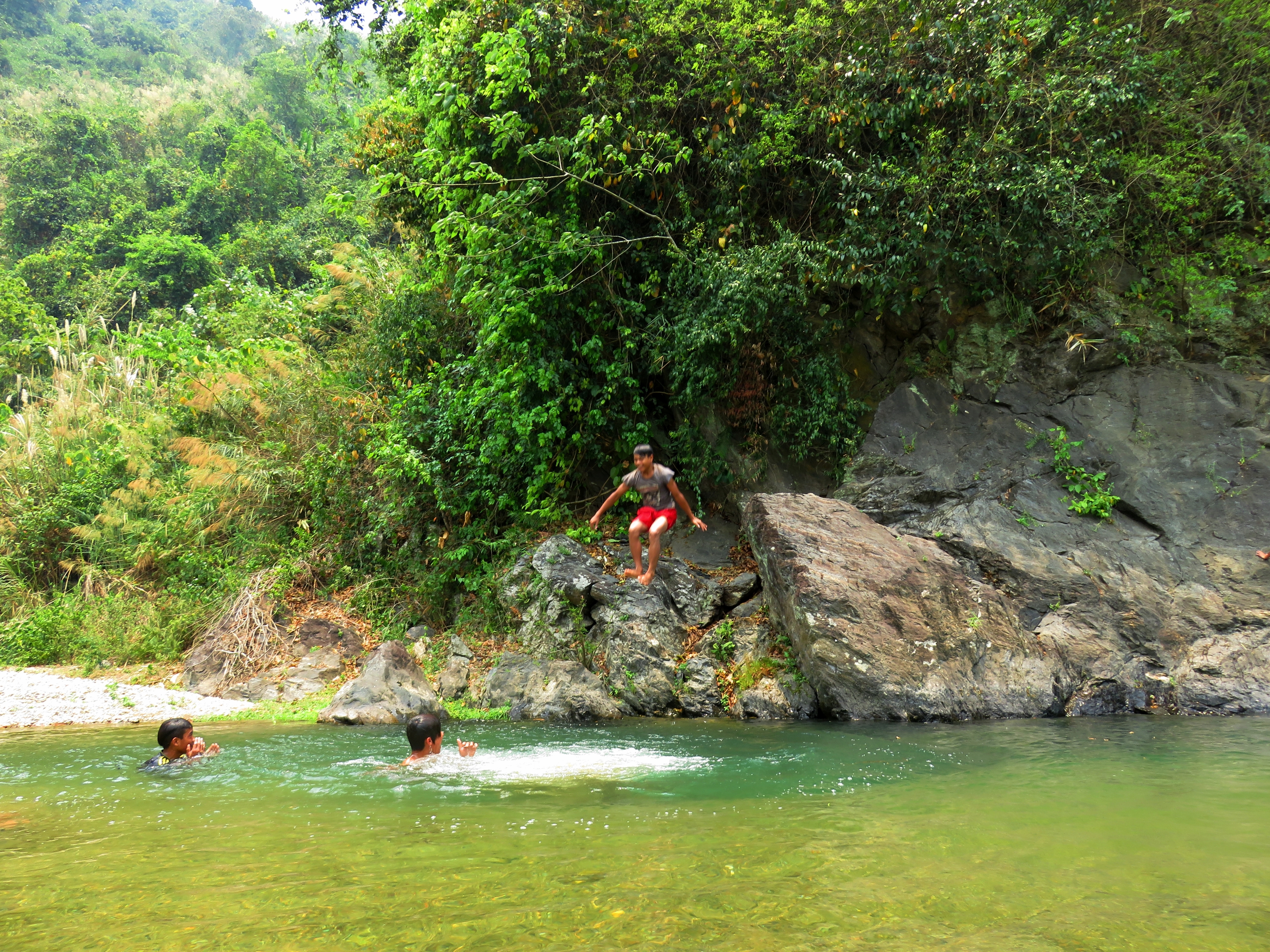
One of the boys jumping in.
The Kong in his natural habitat.
|
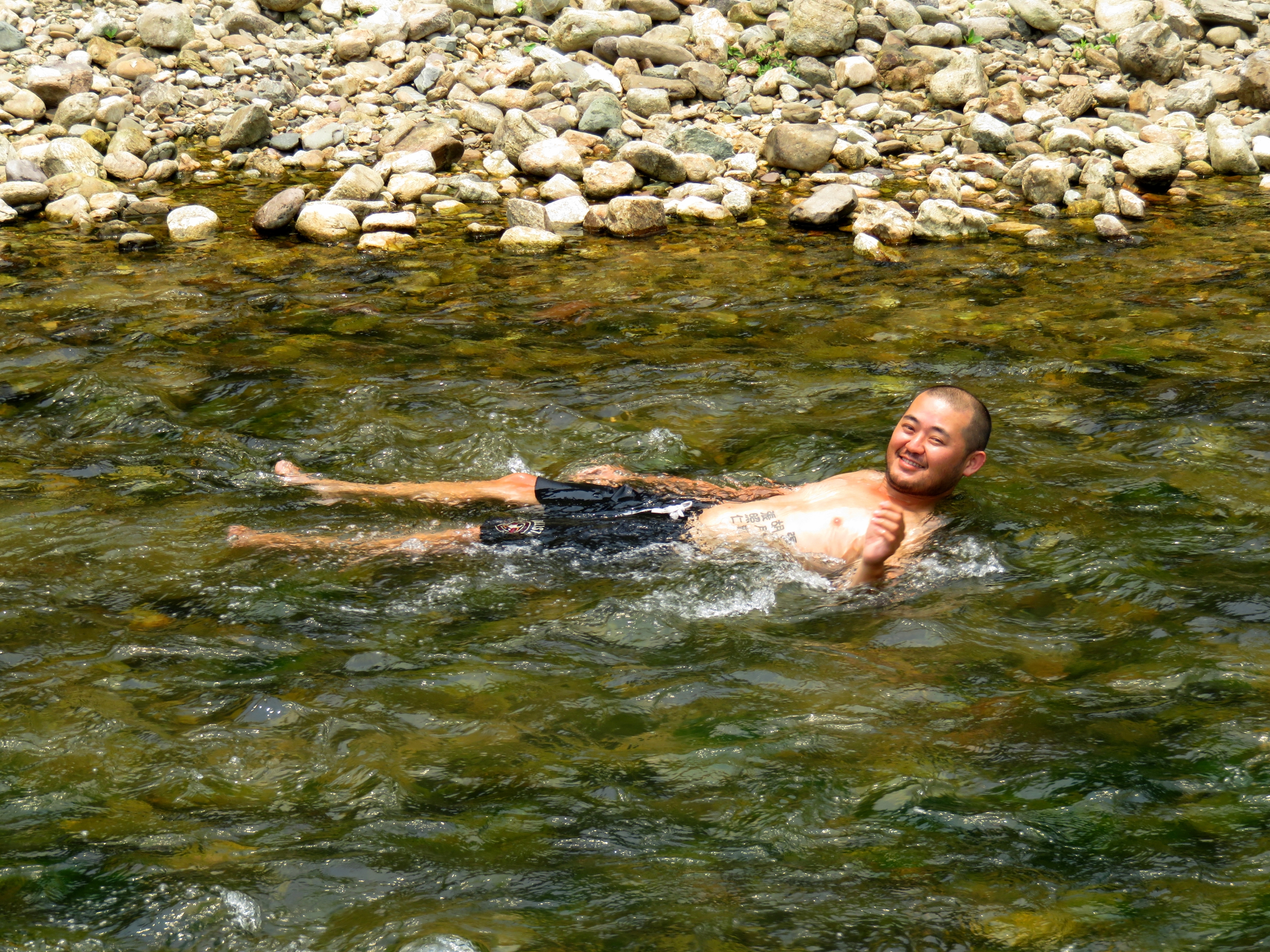
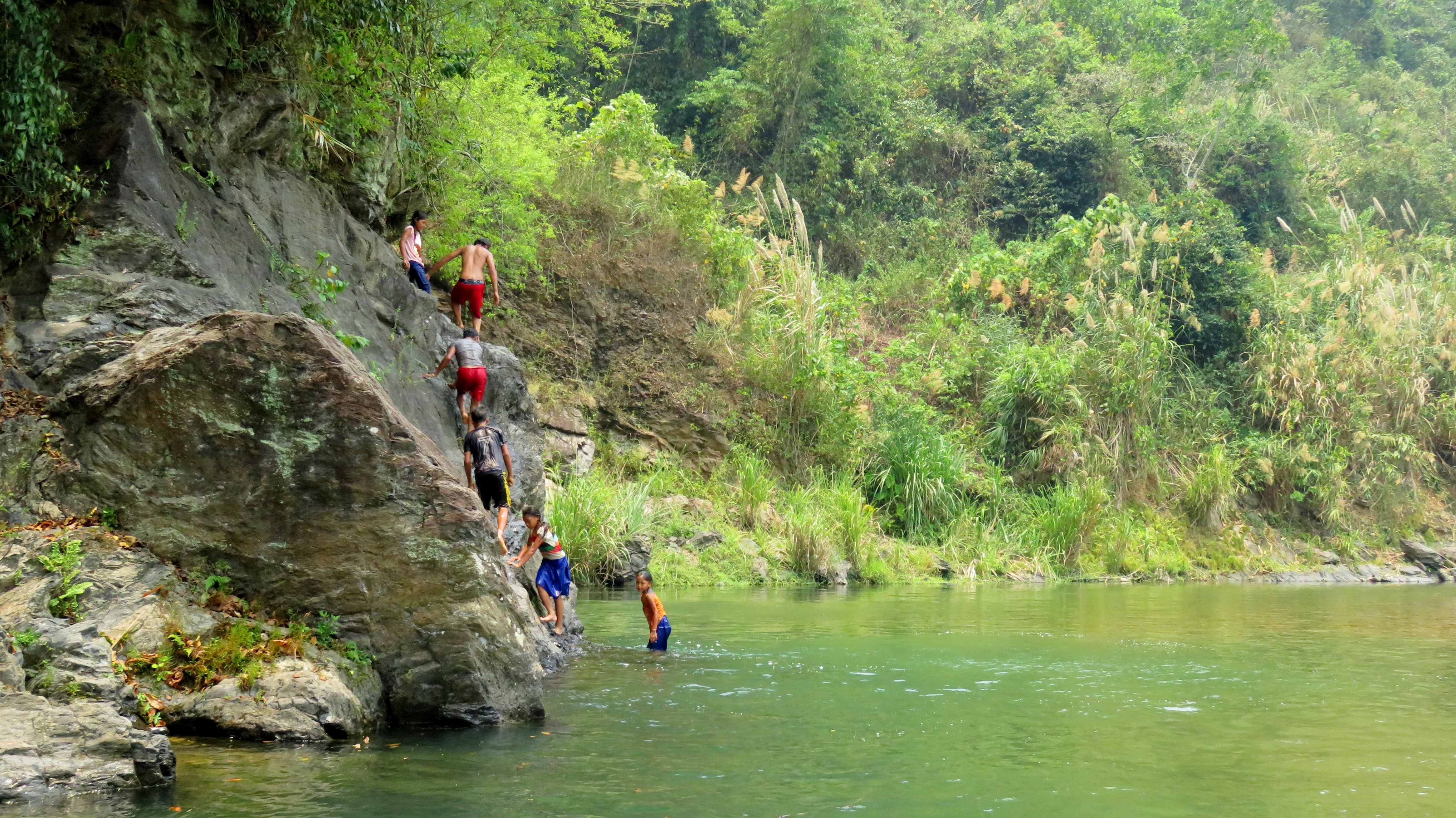
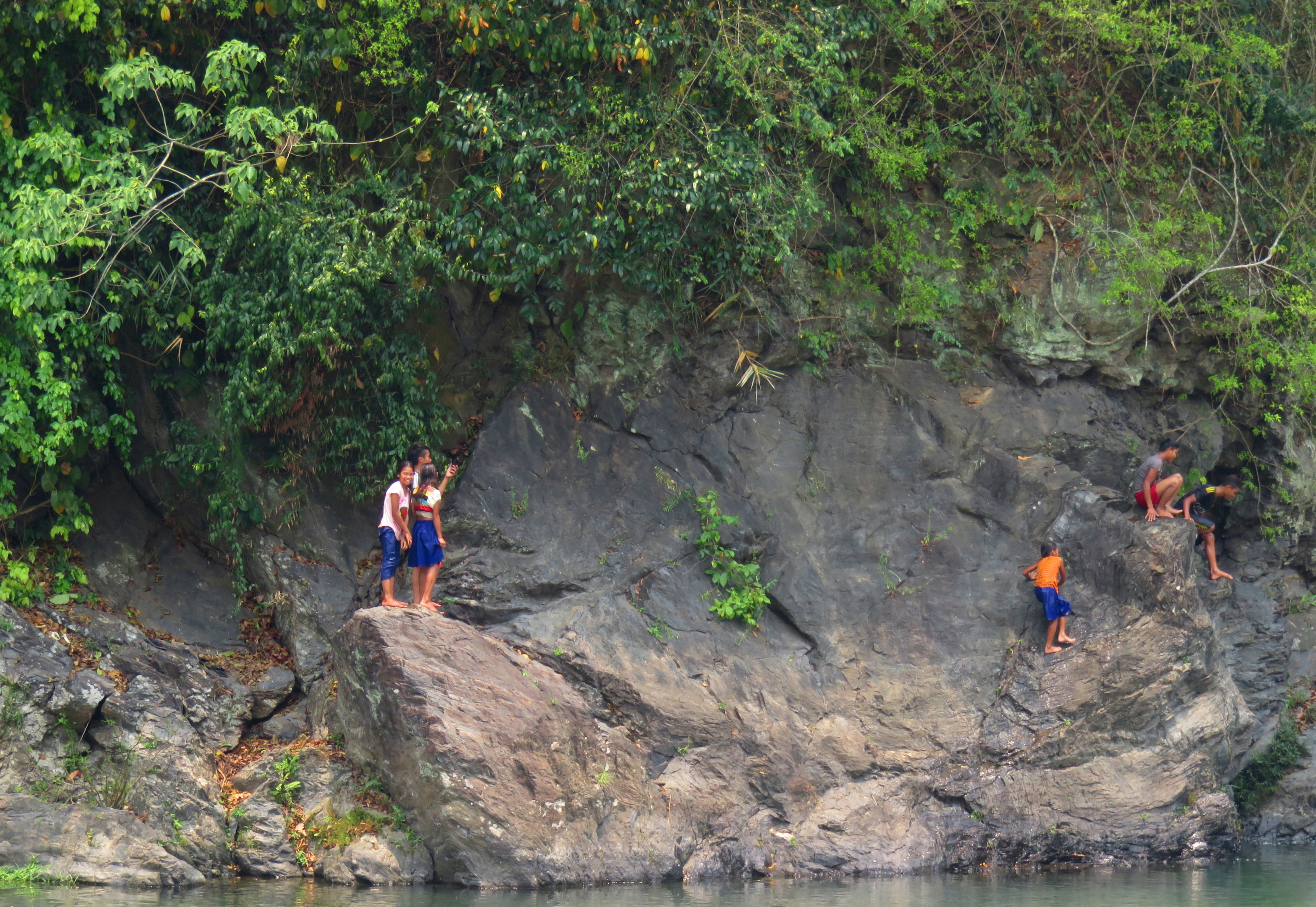
We had been keen to get in the river at some point and cool off, as it was another scorcher of a day. We kept looking at the river as we drove along but we were either too far above the river, or the river didn't look that appealing, for a long ways. Finally, a few kilometers down the road from La Lay, we crossed a bridge, and drove down a small road to the river. Sure enough, there was a beautiful blue green river flowing lazily over the stones, with a great deep pool and small cliff above it to jump off. To add to it, there was a handful of local kids, boys and girls, already there swimming and jumping. So after laying in the river for a few minutes and cooling off, we splashed upstream and started jumping around with our new friends.
|
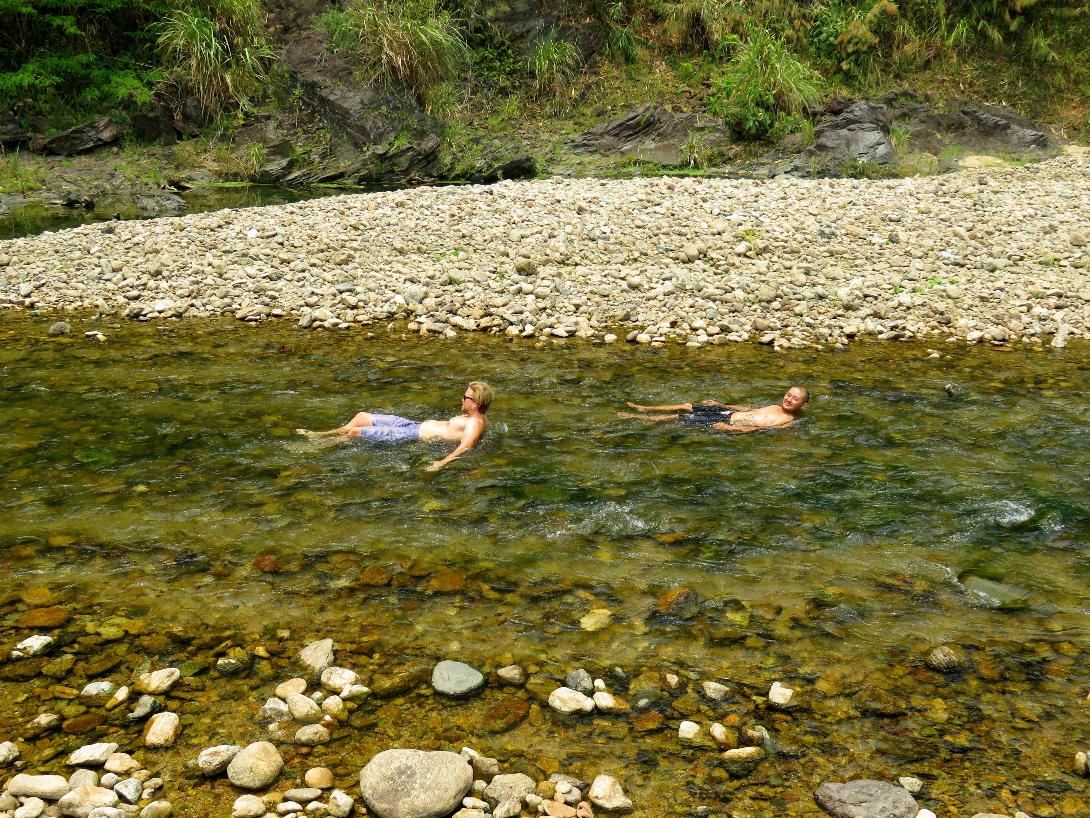
Luke and Kong laying in the Da Krong River.
Jumping from the rocks.
|
|
I was really proud of the girls. There was three of them, between about 7 and 12, and they were jumping off more than the boys, big heavy skirts and all. A couple of the oldest boys spoke a tiny bit of Vietnamese, enough to get a couple of names. We found out the oldest boy (the red shorts) was Trung. It was hard to put a pin on their ethnicity. A name like Trung is Vietnamese, but given the local area, it could be possible they had some ethnic blood in there somewhere. Who knows. All I know is it was sure a lot of fun jumping and splashing with them for about 30 minutes.
|
|
After a great spell of swimming and jumping, it was time to get back on the road. Once we left the river, the road started climbing right away, climbing up and up, out of the river canyon and over the Deo Pe Ke, to the A Shau Valley and the town of A Luoi. Up on top of this pass you finally get a glimpse of the old growth forest in the valley below. However, the road and the canyon part ways here, so the river canyon remains in an undeveloped state, unreachable from the road high above. After a short distance of this old growth, development starts to show itself again, and after a gentle, almost imperceptible divide, the road enters a narrow but flat bottomed valley. This is the northern-most reaches of the A Shau Valley, the major landform that occupies a lot of terrain in Central West Vietnam. This valley stretches for about 6 or 7 kilometers until it narrows briefly, and then you enter the proper A Shau Valley. A Luoi is a scant 4 or 5 kilometers down the road. From here you can either continue south on the HCM Road to P'rao, or you can turn east and head to Hue. Take your pick and enjoy the ride. Thanks for reading!
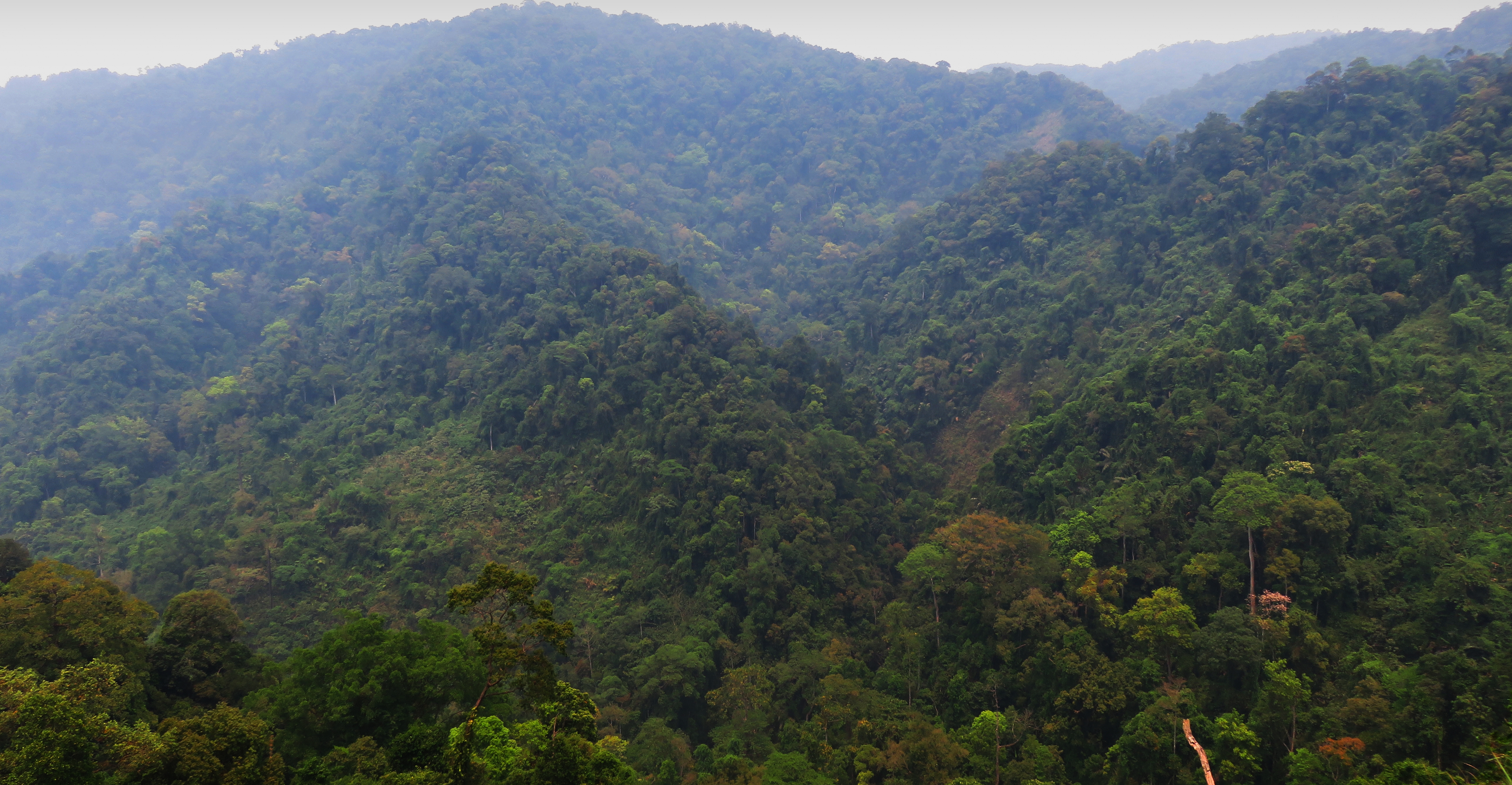
Looking into the old-growth mountain jungle along the headwaters of a Da Krong River tributary.
Many of the villages had these signs, in 3 languages!
|
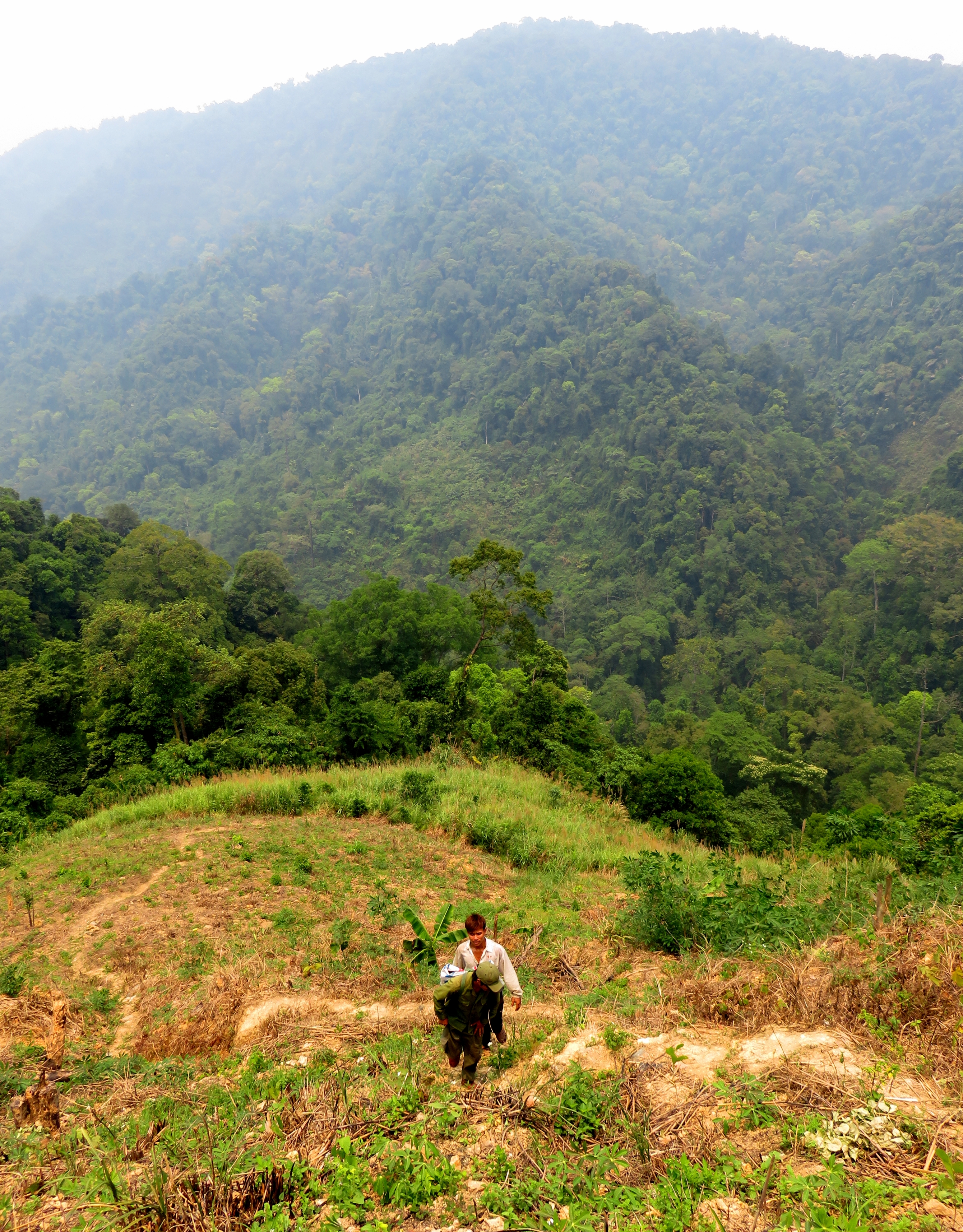
Local coming up the hill out of the jungle.
|
Coming down into the upper end of the A Shau Valley.
The Map
All photos copyright Kit Davidson.
Maps created by and copyright Google MyMaps.
Maps created by and copyright Google MyMaps.
