
I know the name of this page says Ho Chi Minh Road South, and that it's not the southern part of that road. Yes, that is incorrect. However, for those of us living in Da Nang, our access to the Ho Chi Minh Highway is really divided into two nice, neat parts: the segment from P'rao to A Luoi, in Hue, which we call the Ho Chi Minh Road North; and the section from P'rao to Thanh My, in Quang Nam, which we obviously then call the HCM Road South. These names are meant only to be used as references for those who are in the Da Nang area. This is meant to be both a travelogue and a short guide to this latter section, which can make a fine day trip from Da Nang or Hoi An.
Small villages south of P'rao.
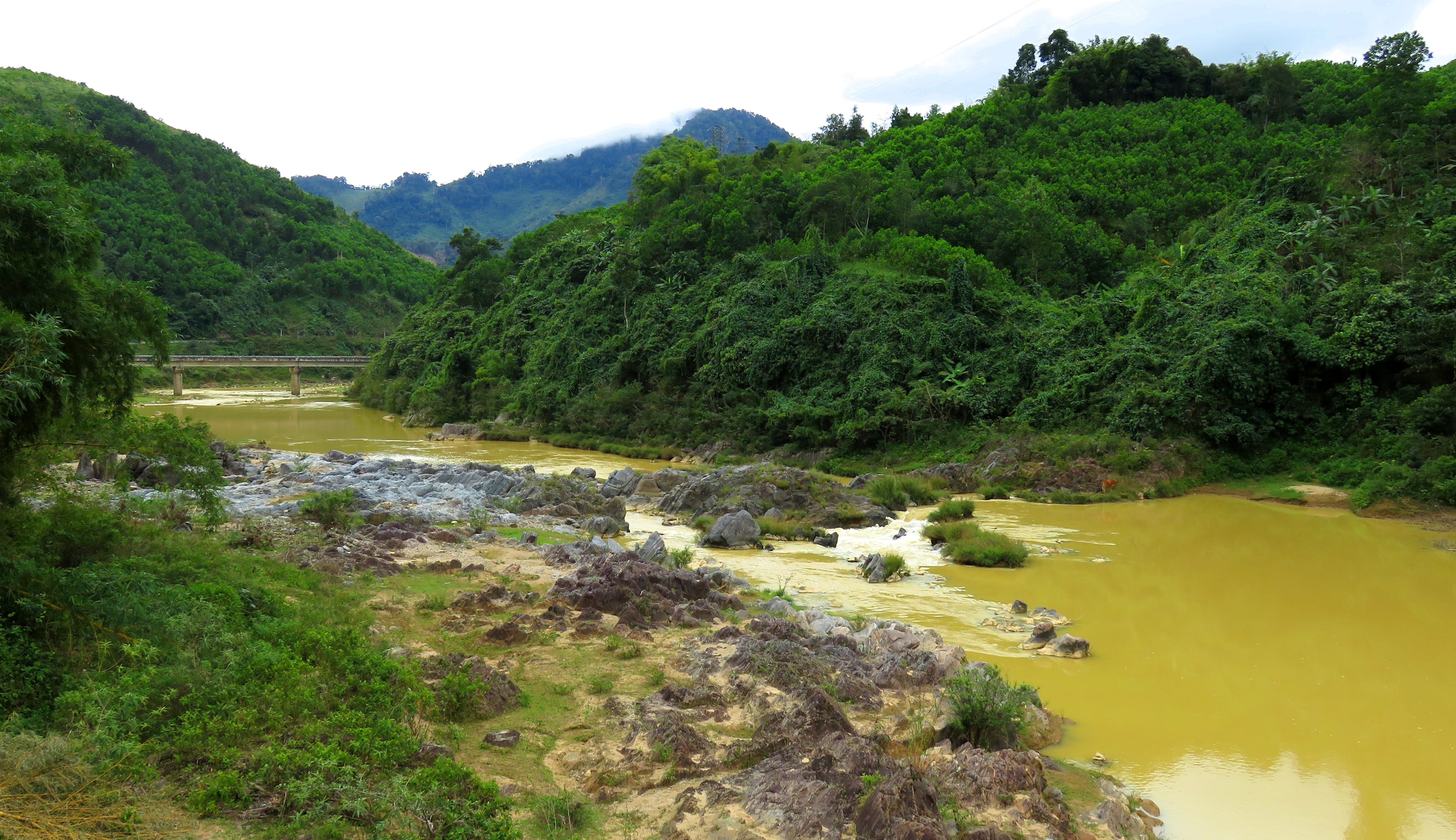
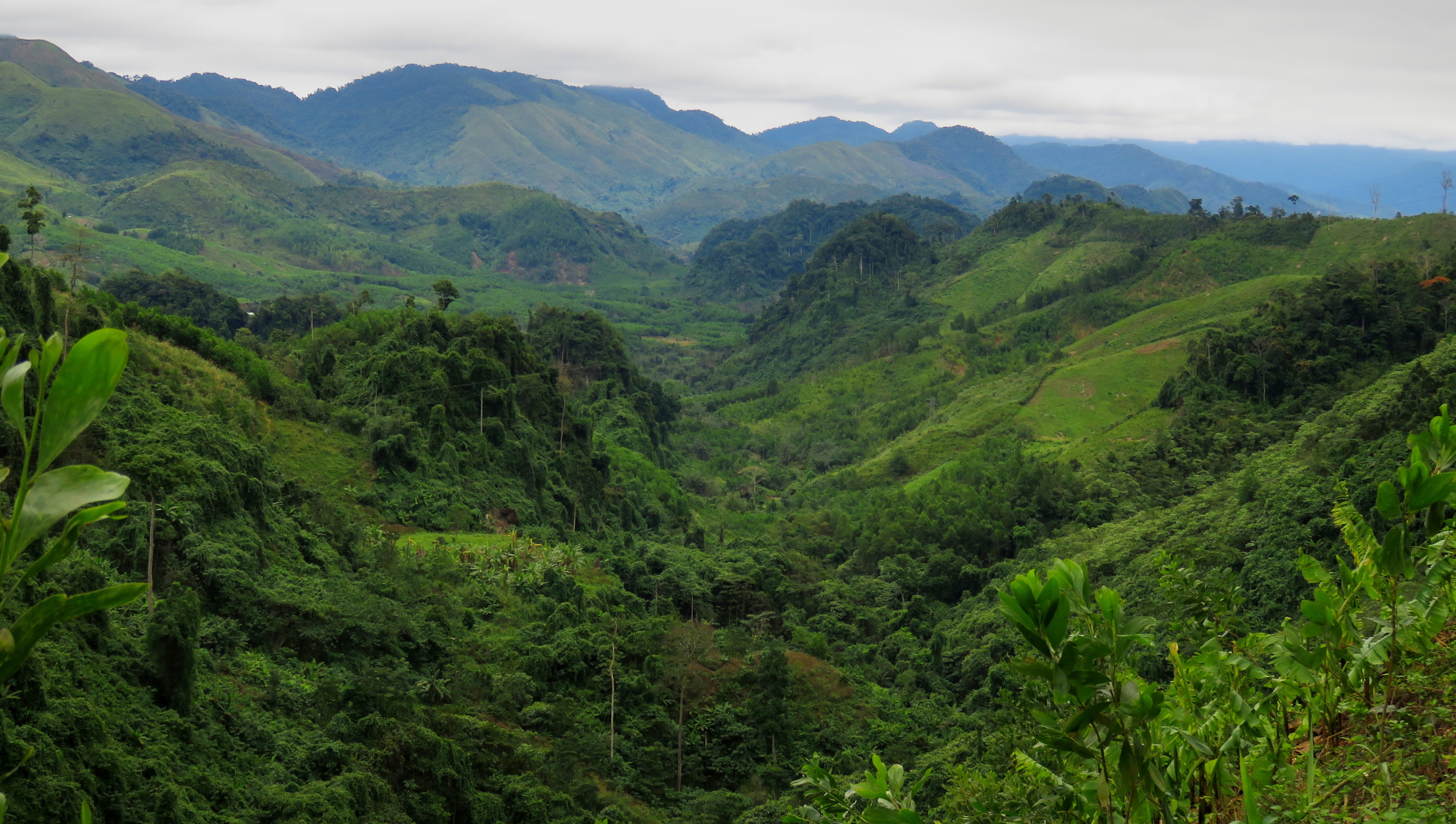
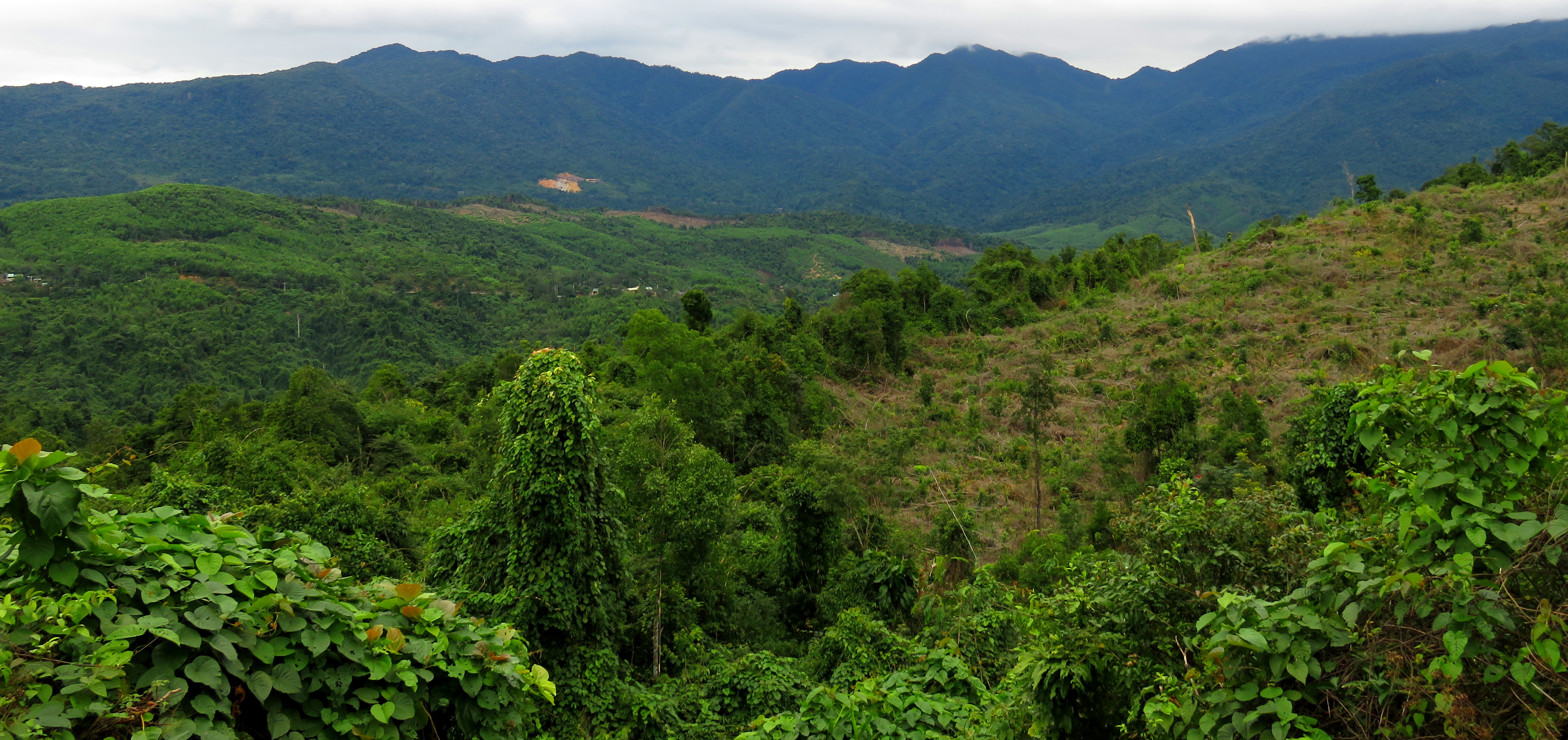
Cutting up the west side of Vietnam, offering an inland parallel to the more coastal Highway 1A, the Ho Chi Minh Road [or Ho Chi Minh Highway] is a modern highway corridor that not only connects cities like Pleiku and Kon Tum, but also traverses through some impressive wild terrain in western Vietnam, and taking a drive along one of it's many segments is usually a great time. In the central part of Vietnam, west of Da Nang and deep in the mountains is the small town of P'rao. The Ho Chi Minh Road cuts right through town, and thanks to the 14-G linking Da Nang and P'rao, it makes for a great access to the HCM Road for those coming from that part of Vietnam. This segment, from P'rao south to Thanh My, stretches almost 50 kms and goes down river canyons and up and over passes and it's amazingly beautiful.
Typical A Vuong River scenery.
|
More A Vuong River Canyon.
|
Although it's possible to go in reverse, to Thanh My, and then up to P'rao, and back, it's a bit better of an idea to go to P'rao first and thence to Thanh My. The reason for this is the 14-G between Da Nang and P'rao is in the worst shape out of any of the roads. So it's best to knock that one off first, while you are fresh, and then you get to enjoy mostly nice, high speed roads all the way back at the end of the day. This guide and report starts in P'rao and finishes in Thanh My.
Nice looking rapid on the A Vuong River.
|
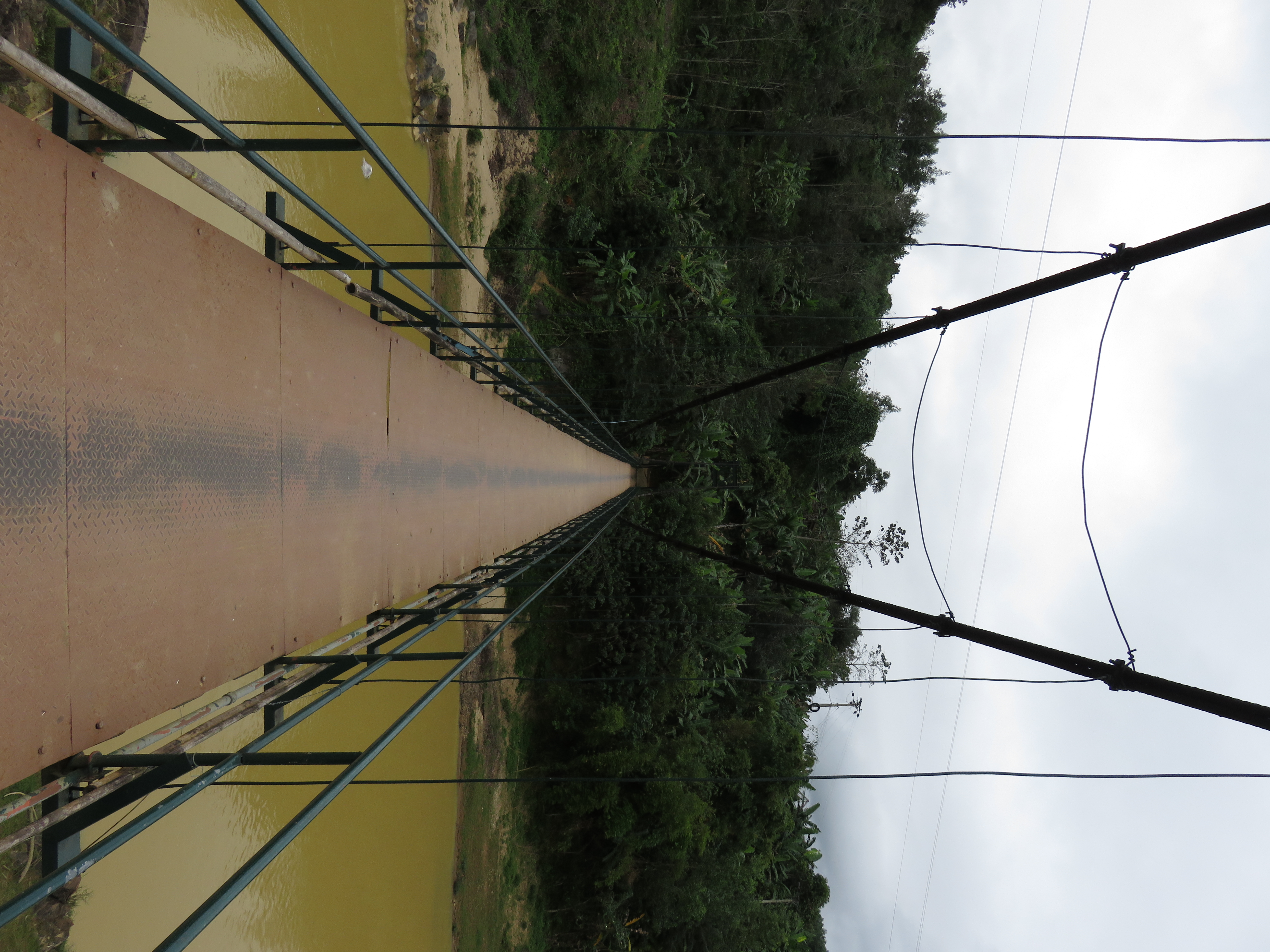
First of two bridges in A Sanh.
|
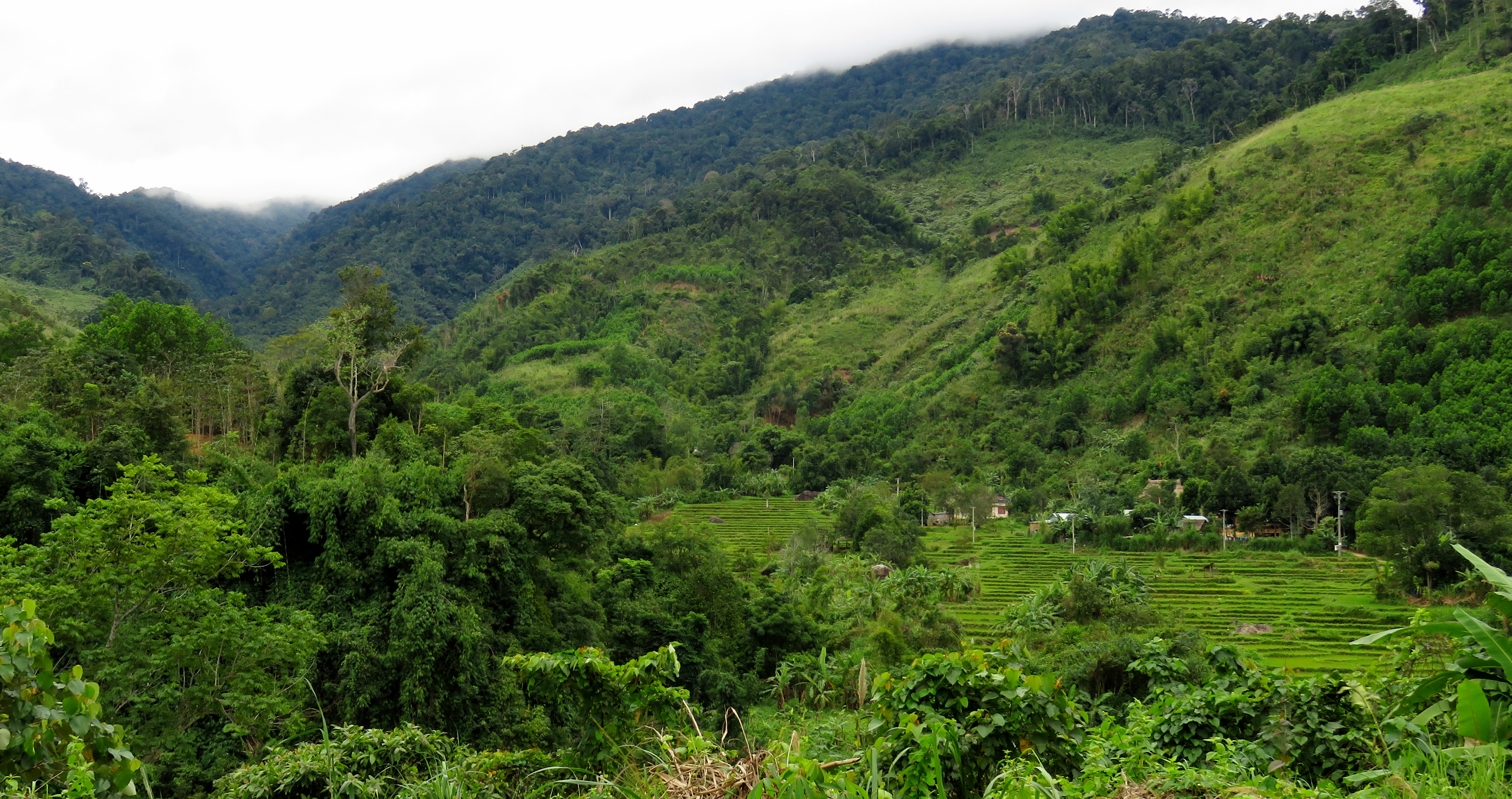
Villages across the river near A Sanh.
The road leaves P'rao and first follows along the A Vuong River through a decent-sized river canyon. The first big bend to the left after leaving P'rao goes through some nice rapids in a mini-gorge, before opening up slightly downstream. Here a series of bridges cross over to access some small villages on the other side, and the general immediate area is known as A Sanh.
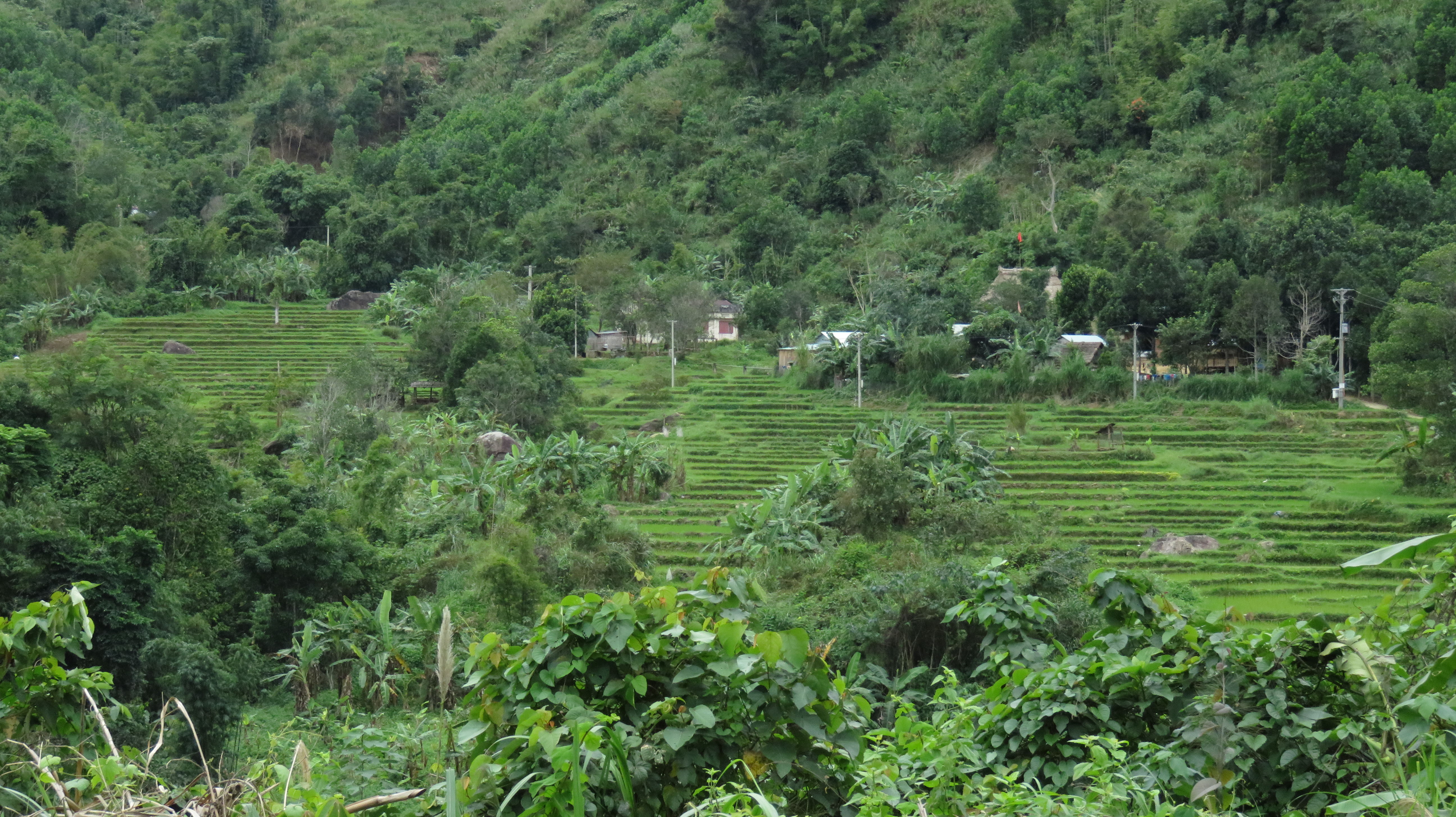
Between the two bridges is a small, boxed-in falls as the river cuts through a chunk of bedrock. There are good views from both bridges. The villages and farms across the river are quite scenic, with one small valley containing a beautiful series of terraced rice paddies.
Between the two bridges is a small, boxed-in falls as the river cuts through a chunk of bedrock. There are good views from both bridges. The villages and farms across the river are quite scenic, with one small valley containing a beautiful series of terraced rice paddies.
Bedrock rapid in A Sanh.
Za Hung Reservoir.
|
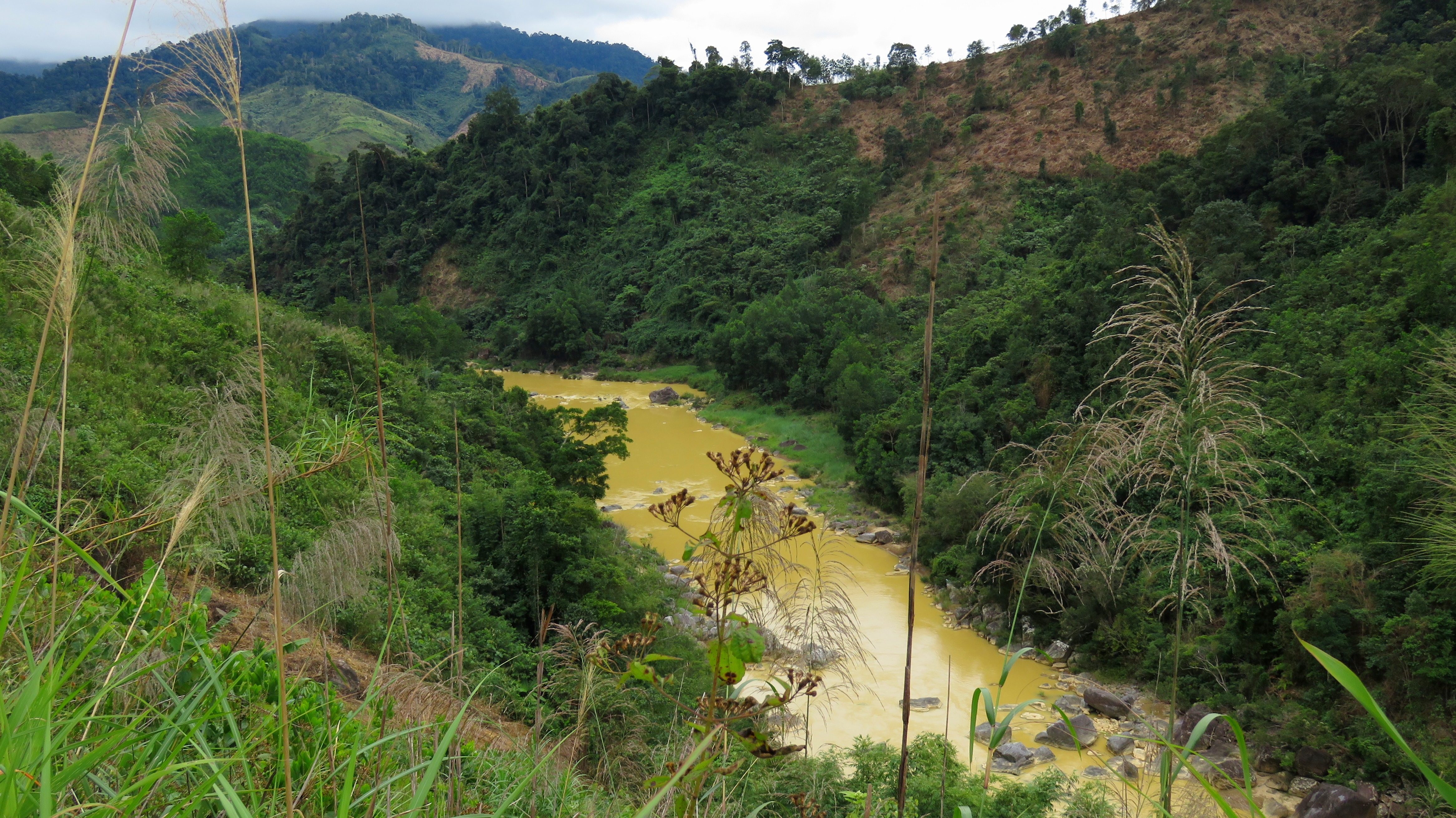
Not too far below this, the waters of the river slow down and pool up, and you realize the river has now become a reservoir. This small lake isn't very long, and it's created by the Za Hung Hydroelectric Dam, and is a large storage basin so they can send the water through a series of tubes through the mountain down to the Za Hung Power Plant downstream. This is a standard "run of the river" system, which is quite useful for power generation. Unfortunately, it requires not only destroying riverine ecosystems and fertile river bottom crop lands with the backed-up reservoirs, but also de-watering sections of riverbeds for all but a handful of days a year where the diversions are located. Often times the best place to build a hydroelectric dam is a place with both A) a narrow gap/start of a canyon at the end of large valley, and B) some gradient to let the water run downstream naturally. As a result, many hydro dams are built at the head of river gorges, so the dam can be small, and the penstocks (tubes) can naturally fall downhill to the waiting powerplant at the bottom of the canyon.
|
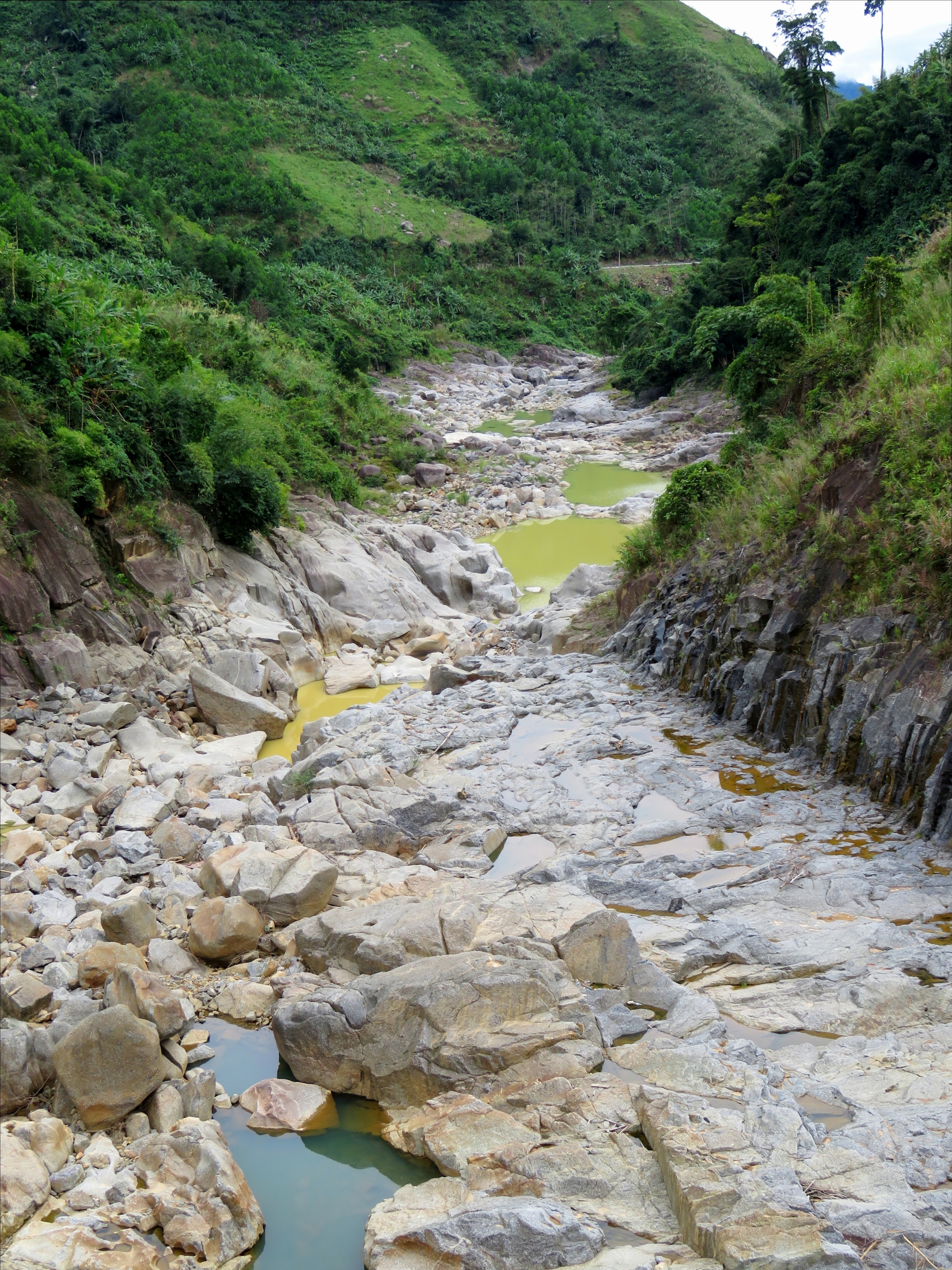
De-watered Za Hung Gorge.
|
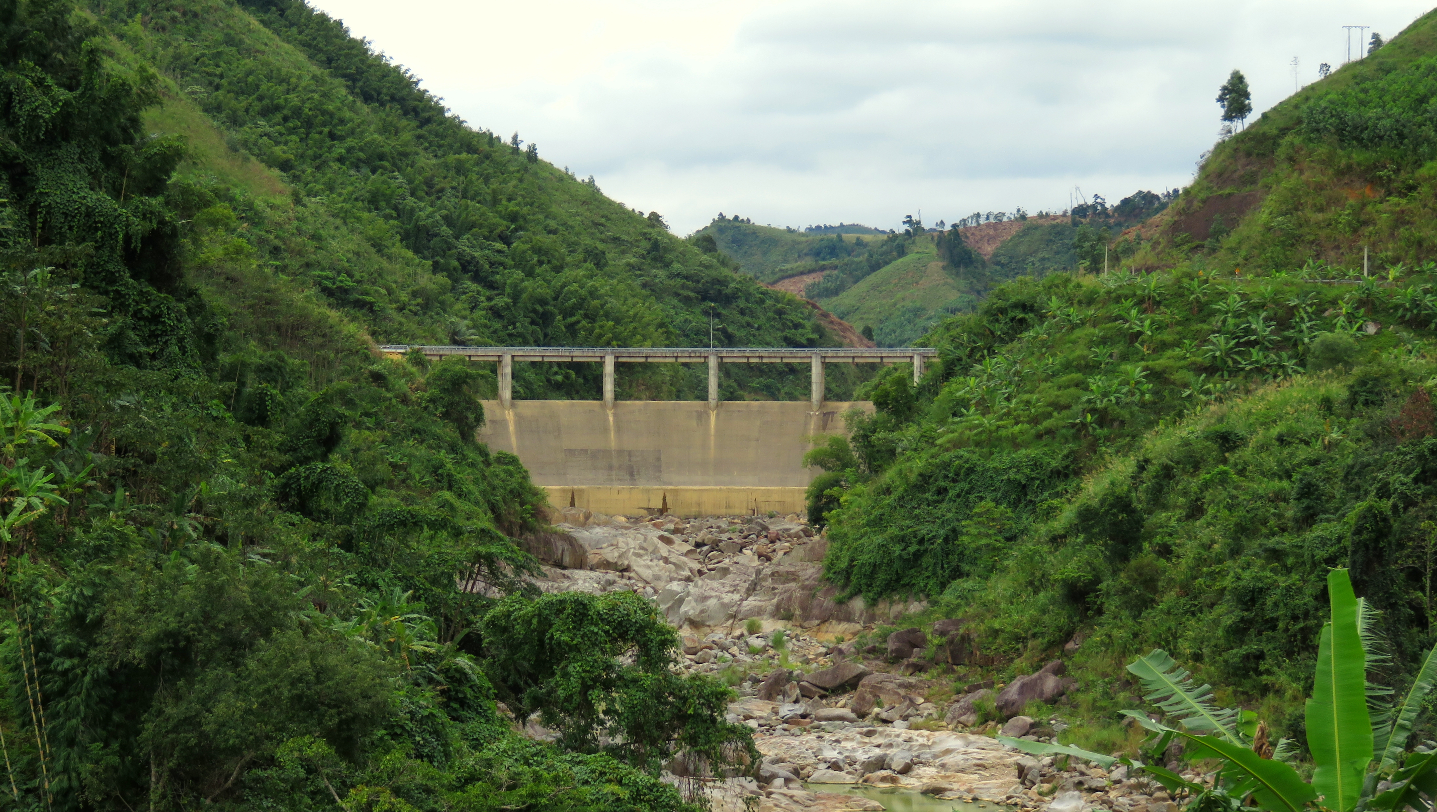
Za Hung Dam.
The Za Hung, while not being built in that exaggerated of a canyon head, is still perched on a section of river that is noticeably steeper, and more walled-in, than the sections above. Even the road goes way above and around it. This beautiful gorge, which probably once flowed with powerful waterfalls and beautiful rapids, now lies dried and barren, a tiny collection of pools linked by a cup's worth of flow. I guess it would make a great canyoning route at this point, rather than a lost whitewater run. The power plant is located at the bottom of this gorge, where there roads comes back to river. Unfortunately, the next reservoir downstream, the massive A Vuong 1, backs all the way up so there is no river between the two.
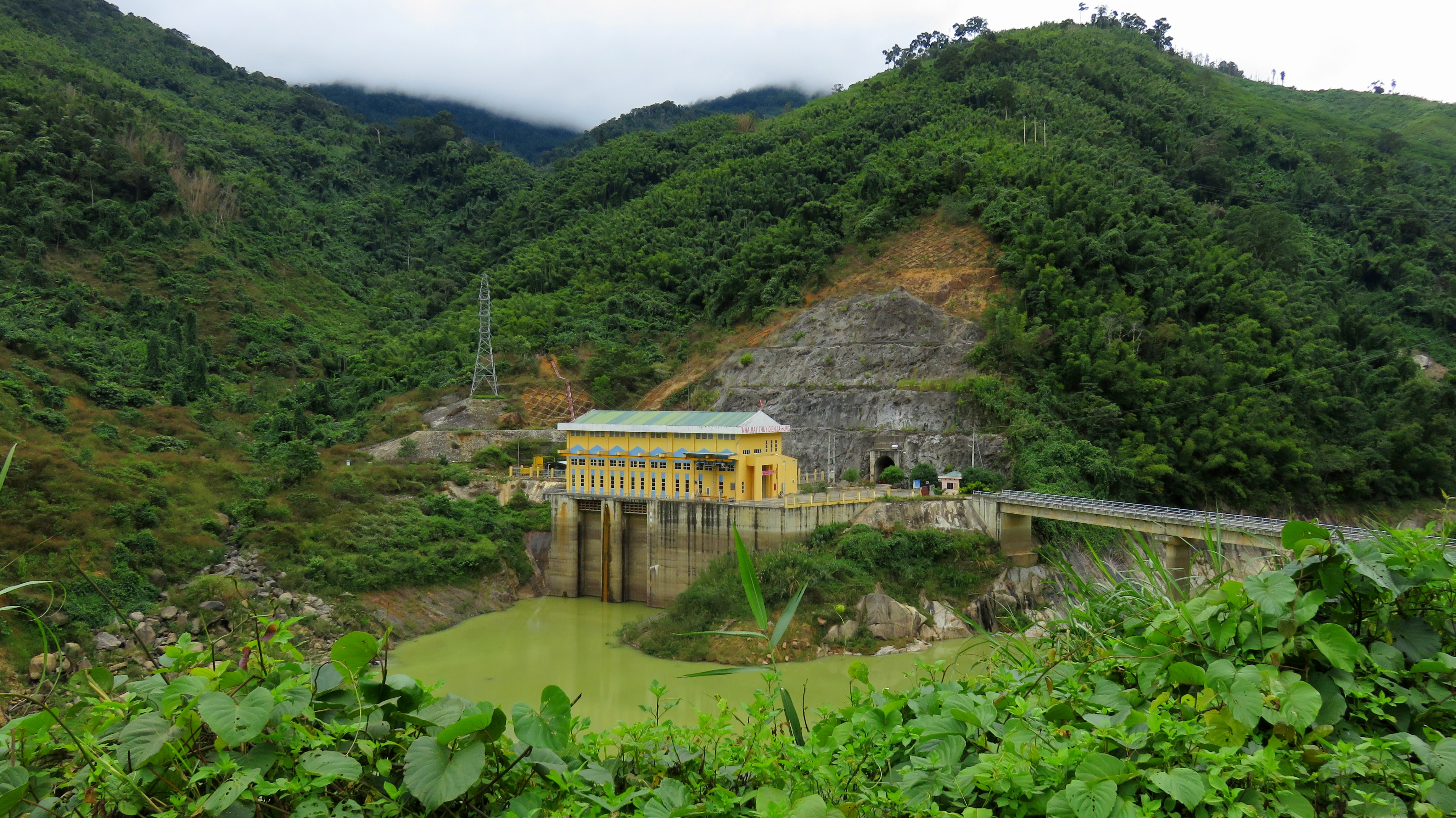
Za Hung Hydroelectric Power Plant.
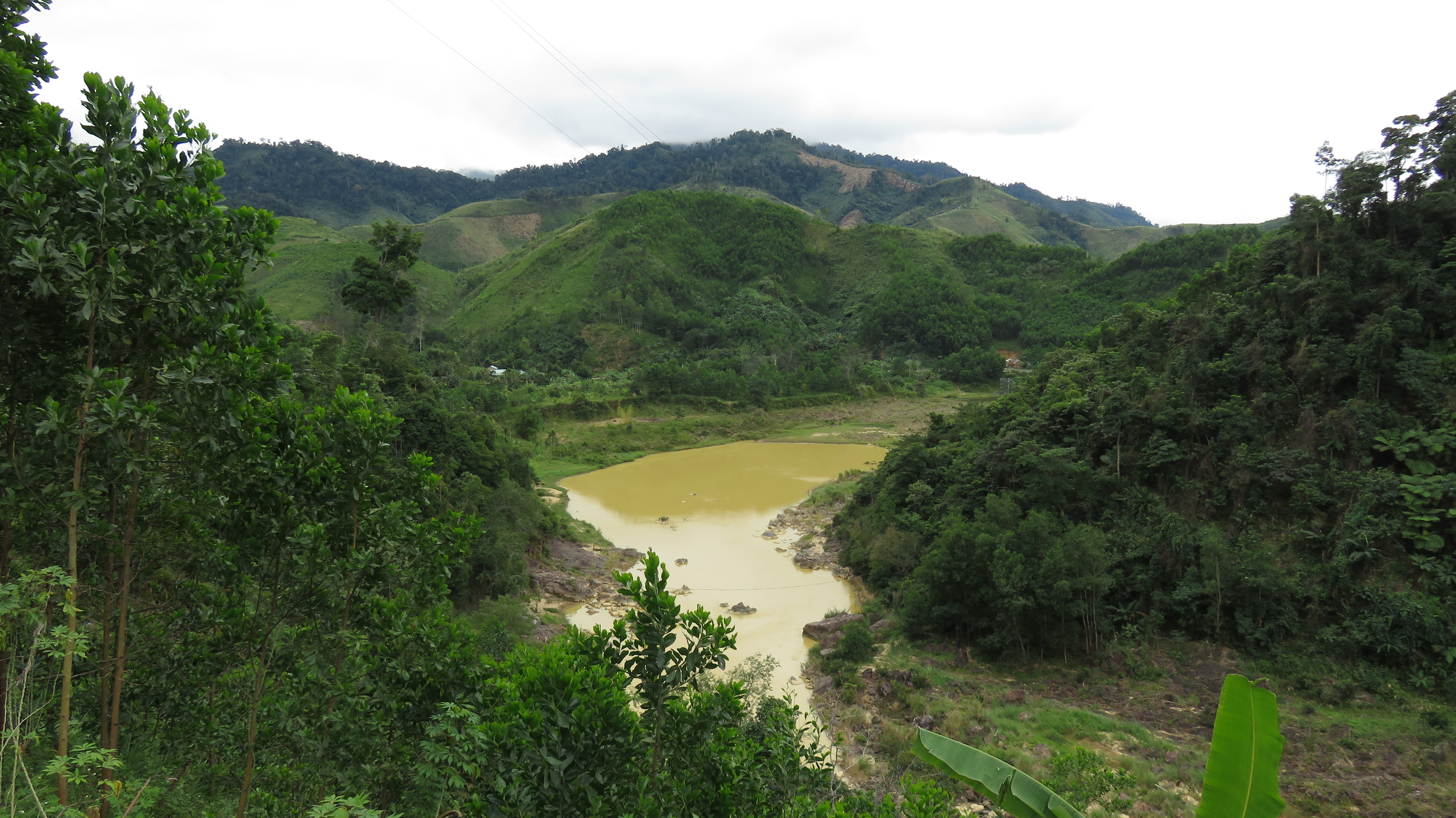
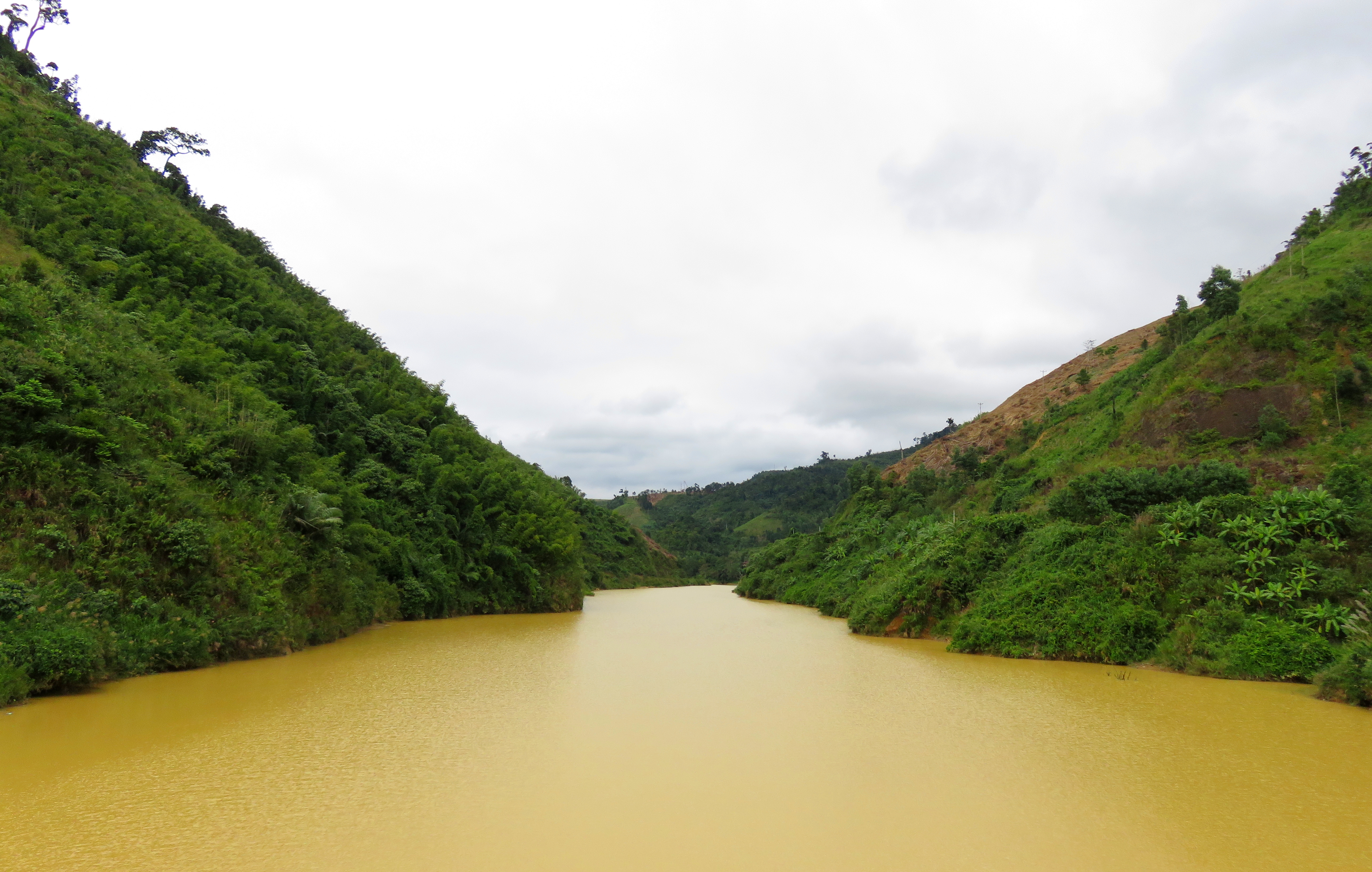
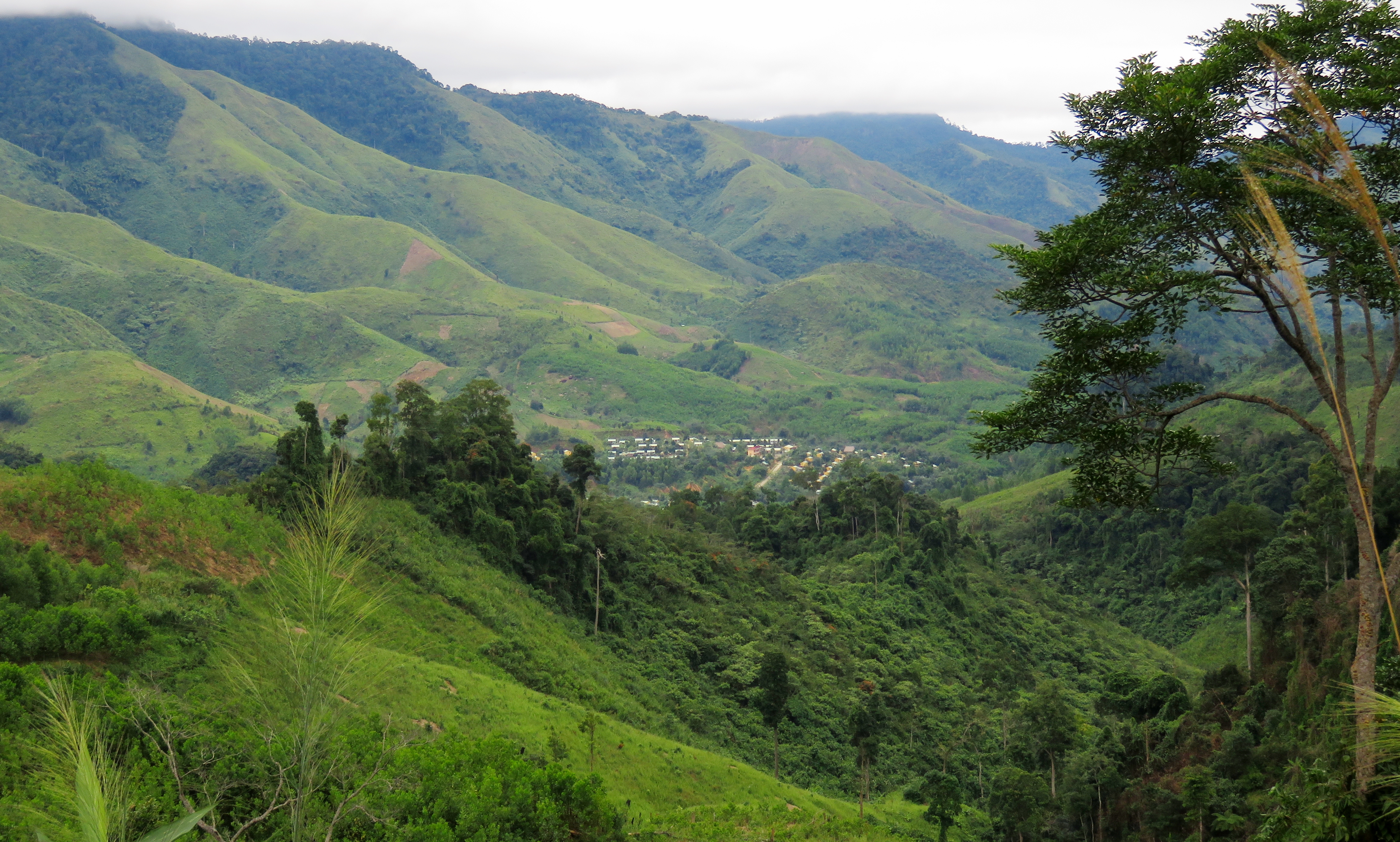
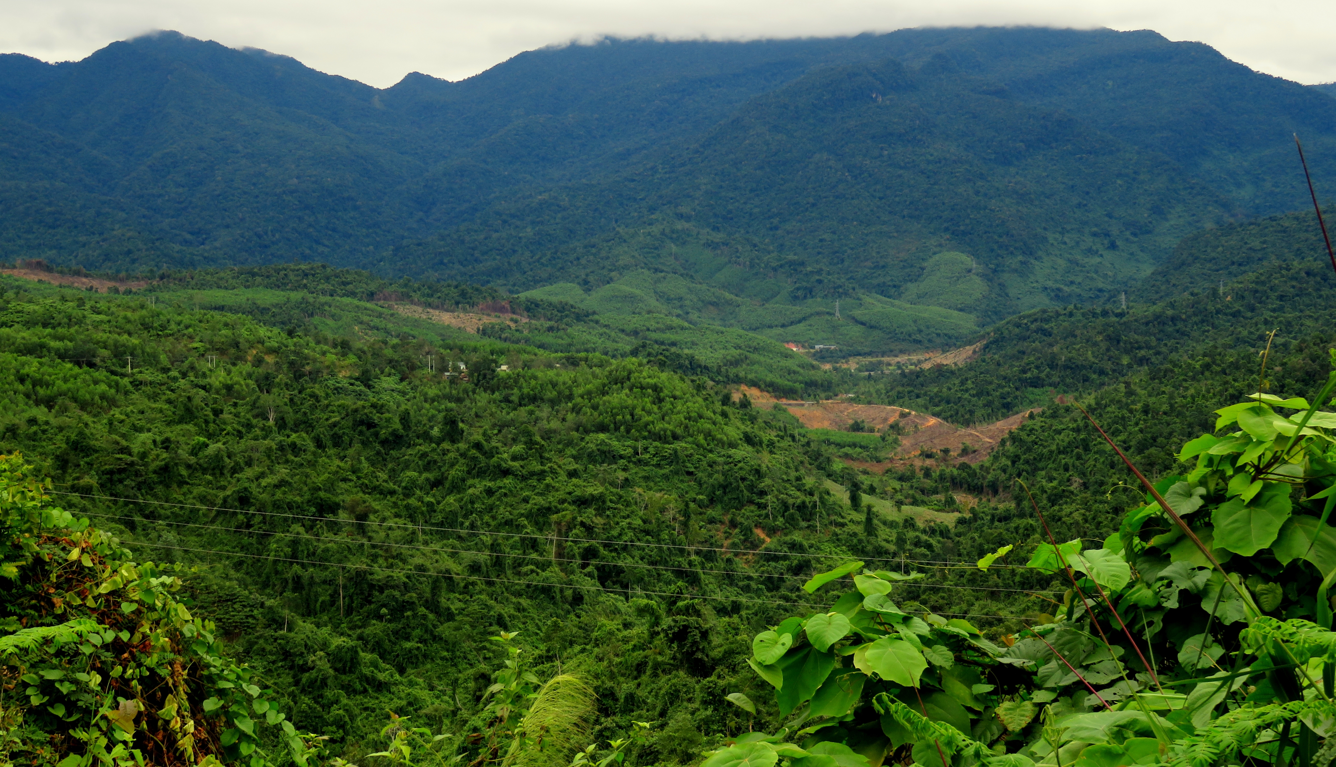
The A Vuong 1 Reservoir dominates the scenery for the next handful of kilometers, all the way down to the villages in the area of Ma Cooih. The lake is quite large, and possesses a beautiful blue-green color, thanks to the high amounts of dissolved limestone in the A Vuong River drainage. Looking at maps of the area before the reservoir was built, one can imagine how beautiful the river bottom must have been before it was flooded. Now the road follows around the shores of the lake, in and out of several flooded side valleys, until it wraps away and into downtown Ma Cooih, land of the limestone towers.
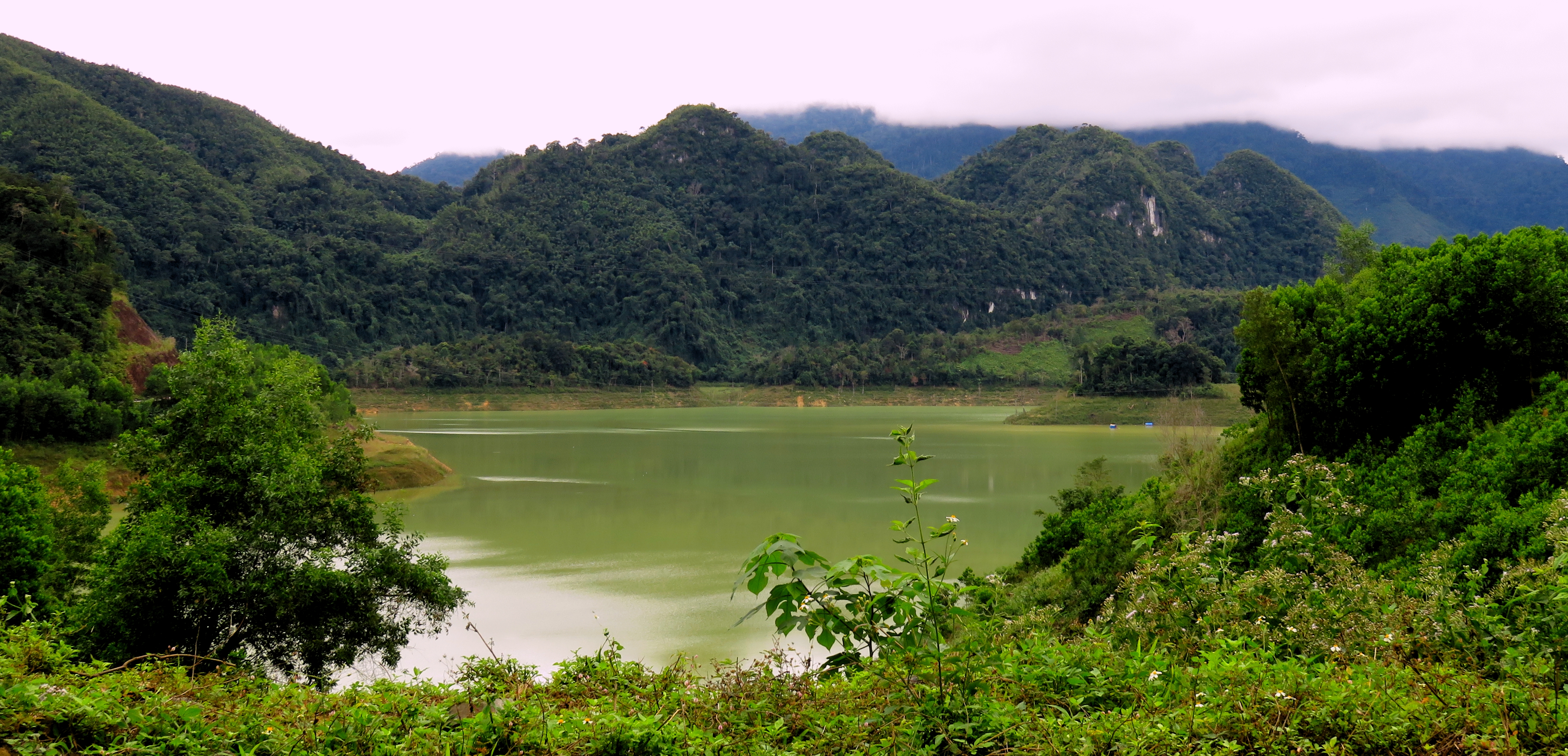
A Vuong 1 Reservoir.
There are a number of small restaurants, a gas station, and a couple of bike repair services in town, and it's the last bit of services before you reach Thanh My. The next stretch of road wraps up and over the mountains, crossing from the A Vuong River Basin into the valley of the Song Bung. It's a pretty impressive climb, and it takes fifteen to twenty minutes to get all the way to the top. Good views are found at many points along the way, including one of the villages of Ta Reng and Azal far below, not far from where you just were in Ma Cooih.
Looking down at the valley of Ma Cooih.
Ta Reng & Azal Villages.
|
Nui Djerone on the left.
|
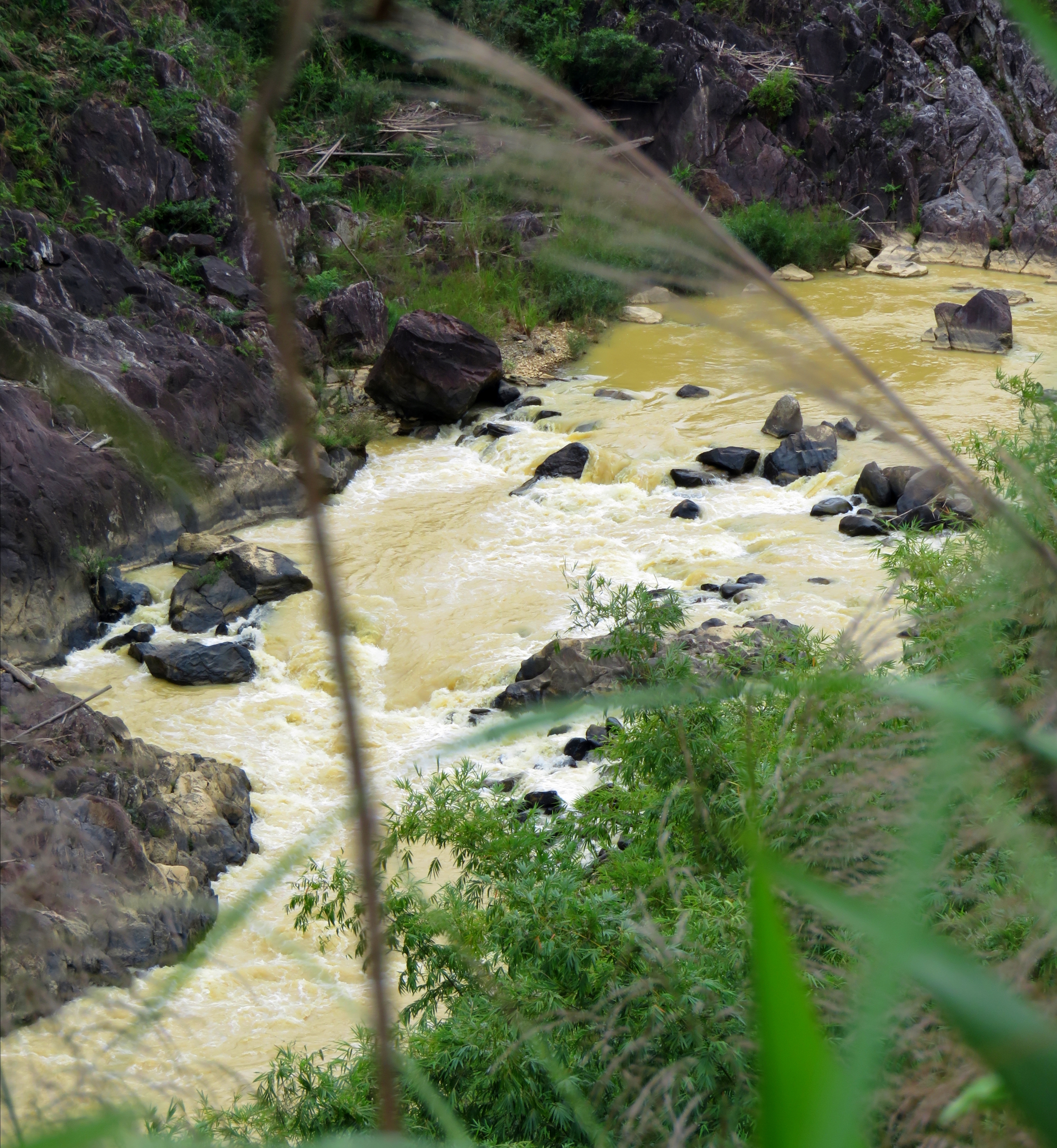
Remember all that elevation you just gained climbing up the mountain and out of the river valley? Well now you get to lose all that elevation as you drop downhill into the valley of the Song Bung, a larger river and the one that the A Vuong eventually joins. Dropping down is quite beautiful, just like coming up, with great views in all directions. At the bottom, the road drops past, and then crosses the river just below, a large hydroelectric dam. This one, known as the Song Bung 5, is part of a massive "waterfall" power project on the Song Bung drainage that includes no less than 20 reservoirs and power plants. The river coming out of the base of the dam is quite large, and it would be impressive to see this dam spilling.
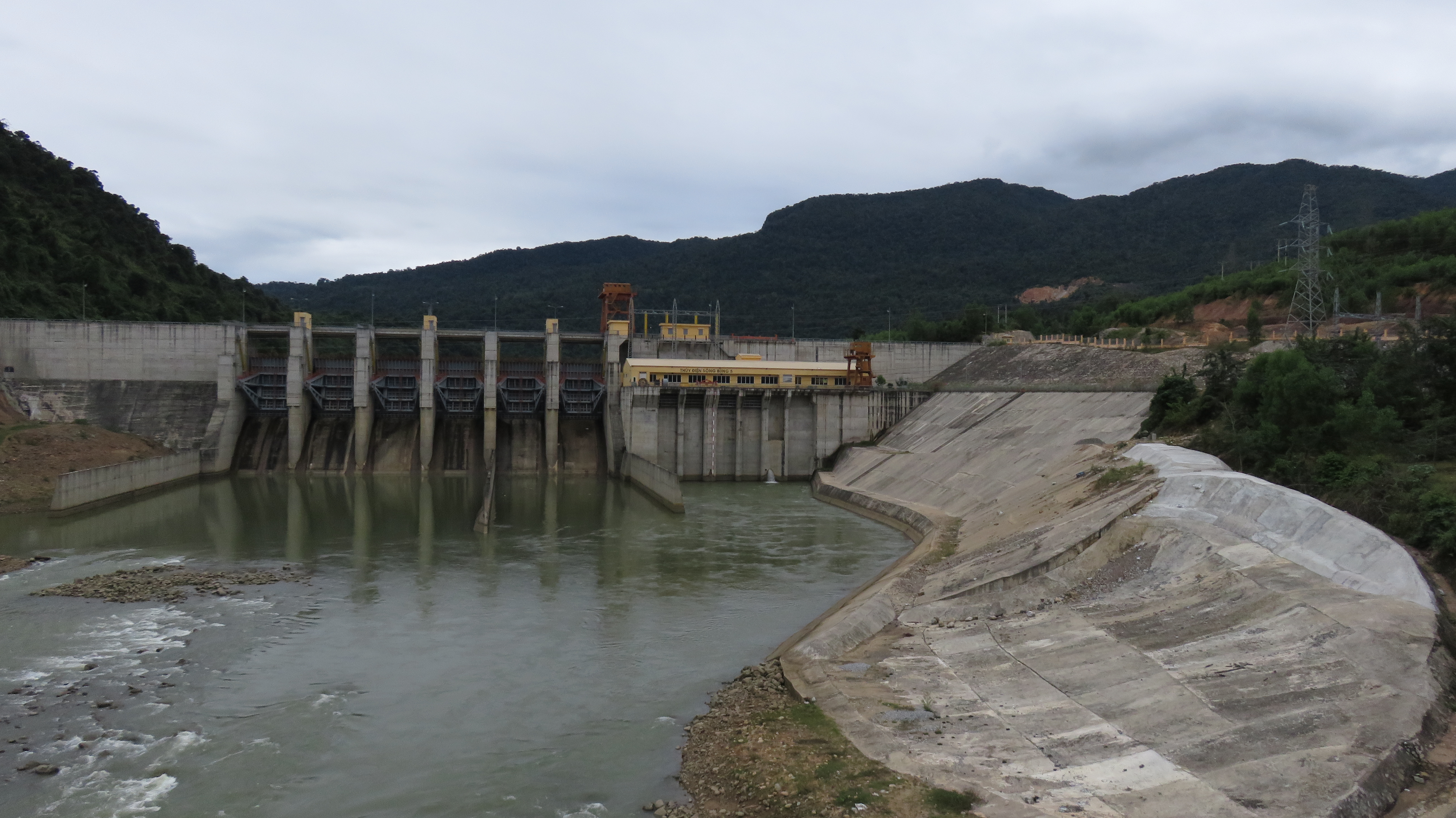
Song Bung 5 Hydroelectric Dam.
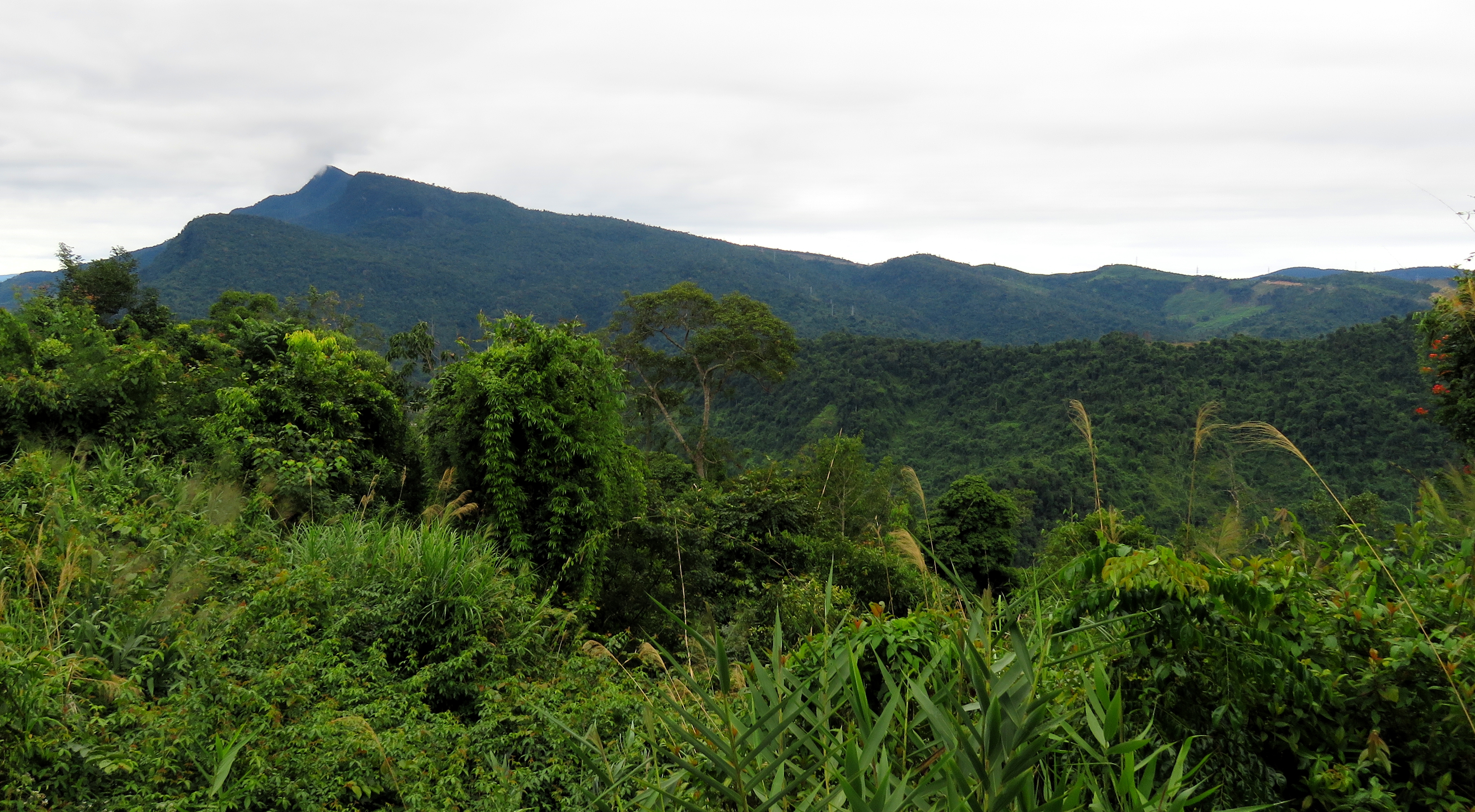
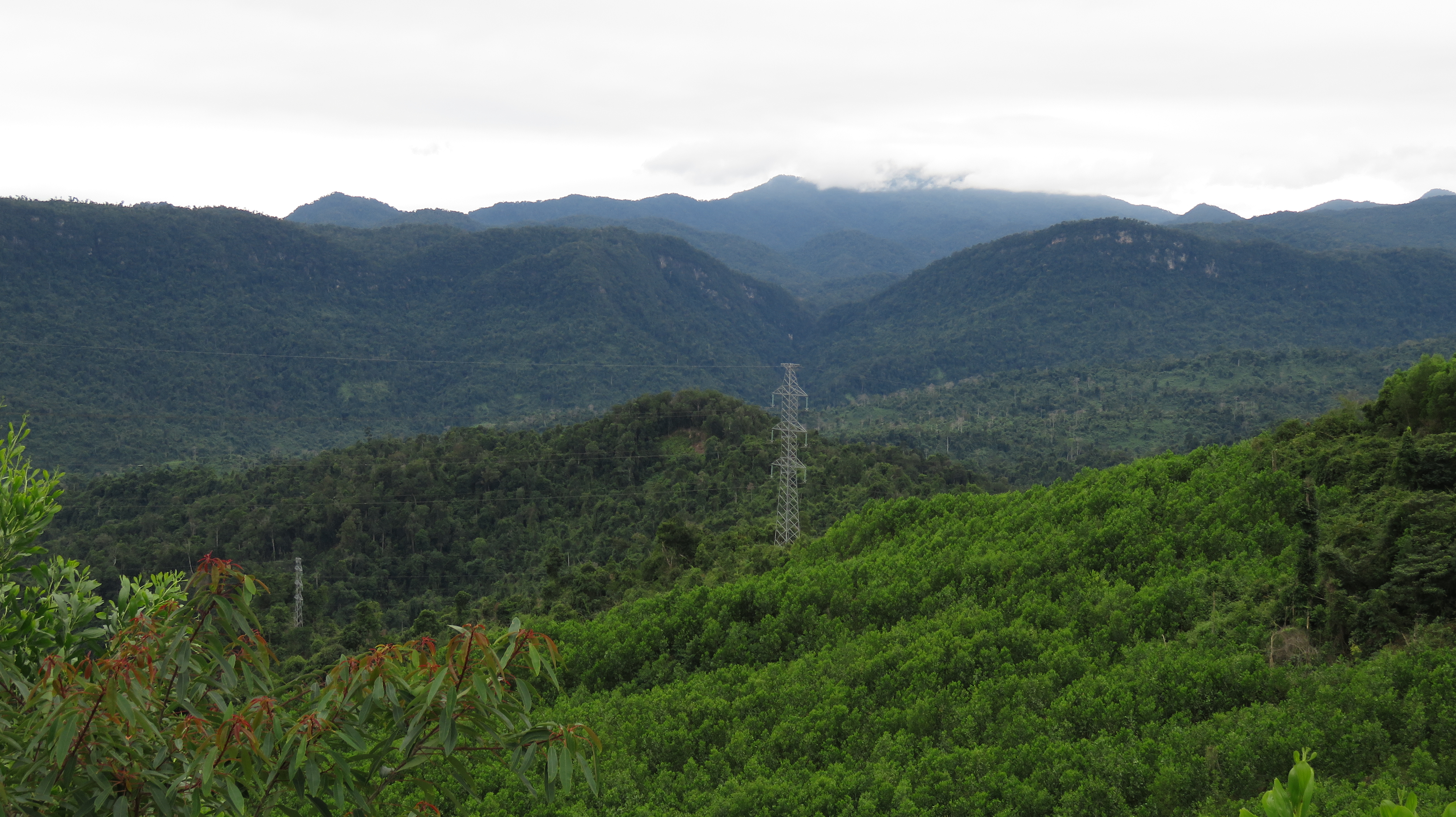
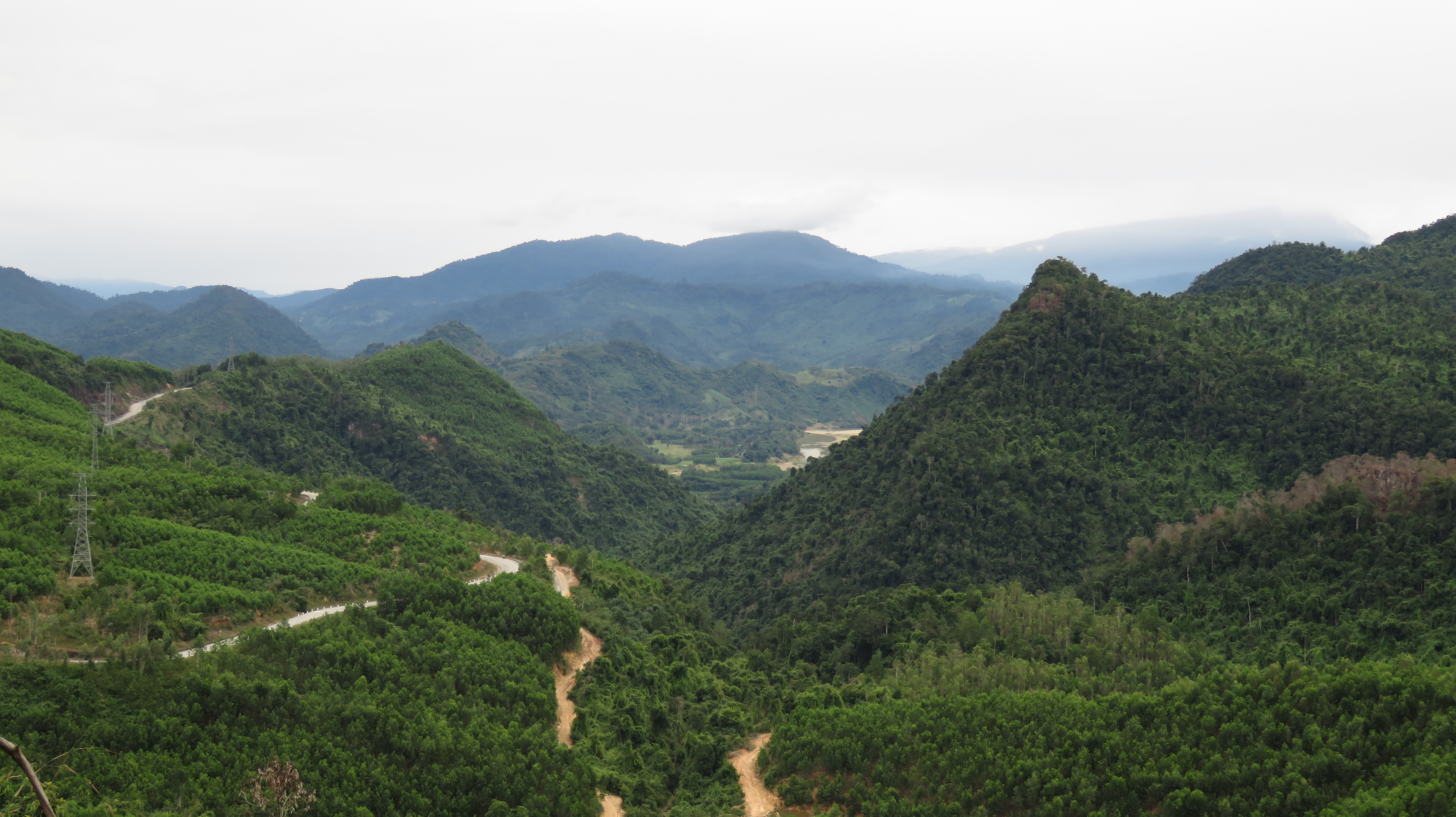
Remember when you drove all the way up, only to then drop all the way back down? Well hope you enjoyed it, because you get to do it again. This time you will climb out of the Song Bung drainage and drop into the Song Cai drainage. Just like before, along the way you will be rewarded with amazing views in all directions. In particular are good views across the canyon of the Song Bung to the backside of the Nui Djerone. The other side of this mountain is "Sentinel Canyon", and is home to the Ma Cooih Road. Also great are views to the west, into the myriad of small valleys and mountains stretching away to the Laos border.
Song Bung Canyon.
|
Looking into Tay Giang.
|
Nui Djerone rising above the river valley of the Song Bung.
Roadside waterfall.
|
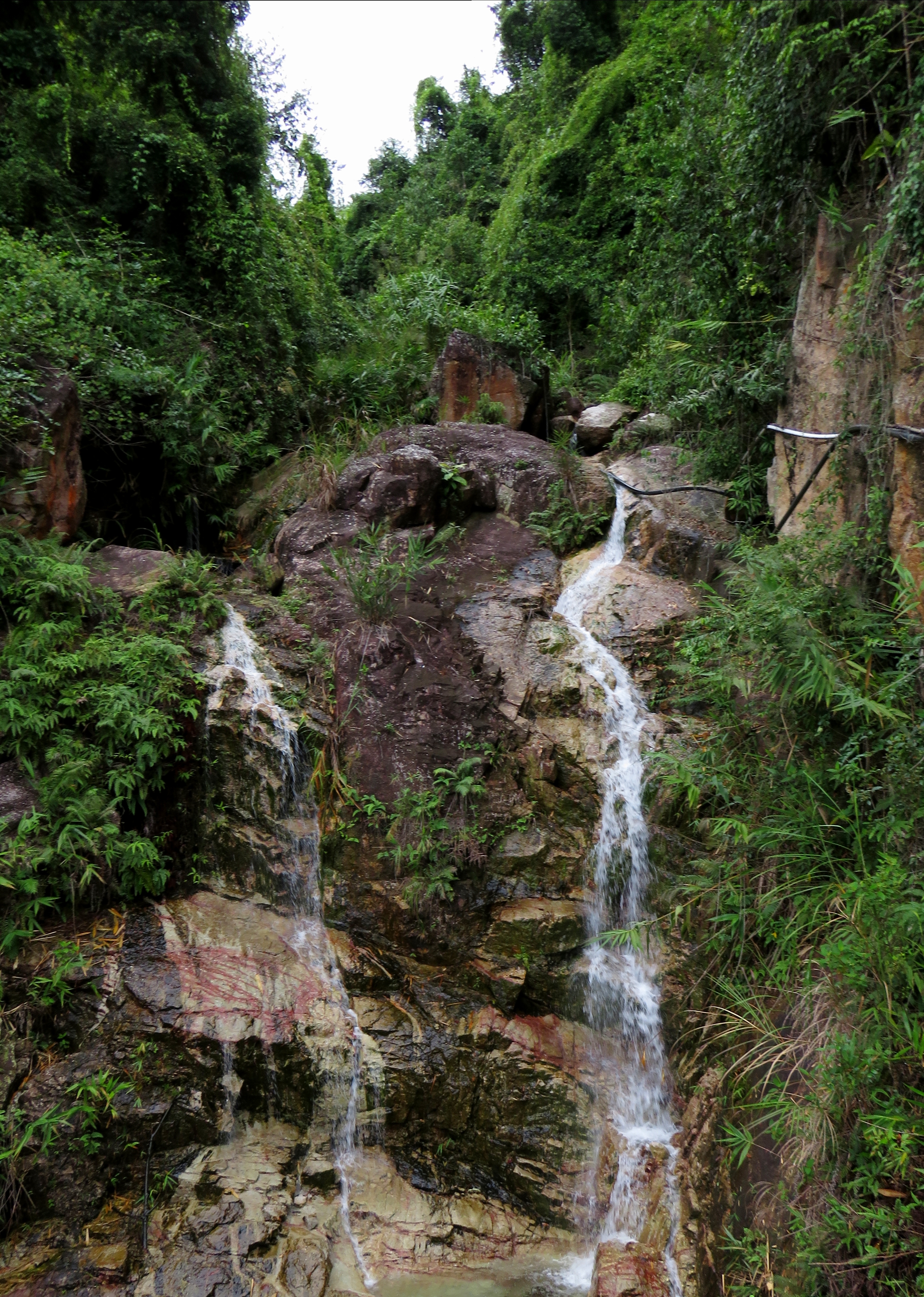
The last bit of the road slowly drops down a large valley created by a surprisingly small creek, and it takes a long time to drop all the way down. At one point on the way down you come to a large corner and can see a portion of the way down, as well as Thanh My, laid out before you, with a great fore- and background of jungle mountains. Along the way down there is a beautiful waterfall the road goes right past, and it makes a great place to stop and catch a breather before you get on the busy highway at the bottom of the hill.
Once in Thanh My, simply turn left and get on the AH-17 / 14-B. Staying on this road will take you all the way back to Da Nang, in anywhere from 1 to 2 hours, depending on your speed. If you are returning to Hoi An, turn off at the turn for Dai Hiep, and take the 609 from Ai Nghia over to Dien An, and then on to Hoi An. Almost all of the Ho Chi Minh Road is in great shape, and the other roads to get to and from this stretch aren't that bad either, so you can really drive this road with just about any kind of bike, provided it has enough power (anything over 100cc should probably be ok) and other than it being a lot of kms, should be possible for just about anyone who's been on a bike for a liitle while. |
Looking down at Thanh My and the Cai River Valley.
All photos copyright Kit Davidson unless otherwise noted.
Maps copyright Google MyMaps.
Maps copyright Google MyMaps.
