
Cai River / Vu Gia River - Flatwater Sections
Section 1- Ben Giang to Thanh My
|
Section Length: ~ __ km
Put In: Hoi Khach Ferry Take Out: Ha Nha town |
Difficulty: I
Est. Flow: too low < 200 < 20,000? < too high Paddlers: Not Finished Yet |
This stretch of river is actually on the Cai River, which is formed by the confluence of the Dak Mi and Thanh Rivers in Ben Giang. The Vu Gia doesn't truly form until the Cai River joins with the Bung River downstream of Thanh My. But, for all river purposes, this stretch is much more like the downstream sections than the upstream sections, in that it is flatwater all the way.
Section 2- Thanh My to Hoi Khach - read about here -> "Confluence Canyon"
Section 3- Hoi Khach to Ha Nha Bridge
|
Section Length: ~ __ km
Put In: Hoi Khach Ferry Take Out: Ha Nha town |
Difficulty: I
Est. Flow: too low < 200 < 20,000? < too high Paddlers: Brian Zottoli |
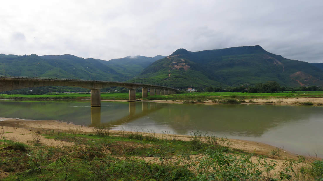
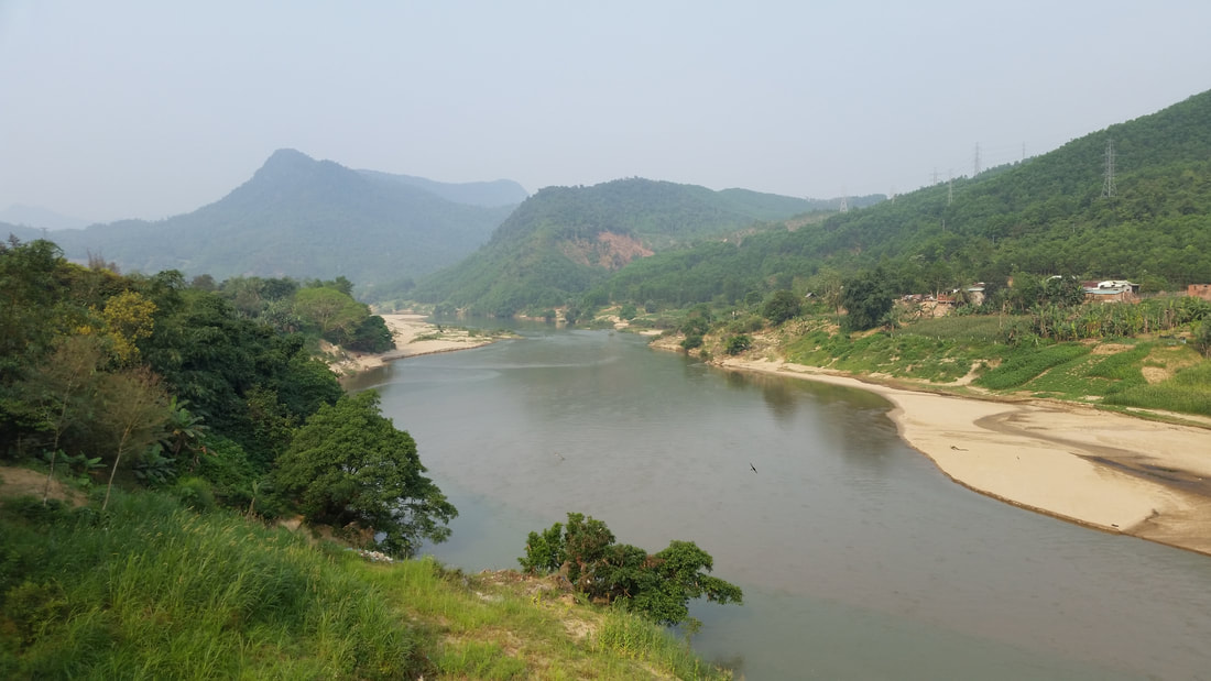
This run, now on the joined Vu Gia River, goes through the transition zone between the canyons upstream and the wide river plains downstream. At the Hoi Khach Ferry, the put in for this stretch, the river is in a fairly decent sized, if wide, canyon. By the time you reach Ha Nha, the walls of the canyon will have receded to form not just a valley, but a wide valley with a flat bottom.
A good portion of this run has some incredible views on river right, as the ever-changing view of the Bang Am Mountain skyline dominates all. If you turn your boat around early on, you may find a glimpse of Nui Djerone, the "Sentinel" peak that guards over the upper A Ran Valley. In addition, the canyons of the Bang Am also hold numerous waterfalls of impressive height. Try to spot them as you float past. Finally, see if you can spot the monument for Thuong Duc, the local site where a long battle was fought during the US War, rising quietly on one of the last riverside hills on river left. Beware of sand mining in a couple of places on this stretch.
A good portion of this run has some incredible views on river right, as the ever-changing view of the Bang Am Mountain skyline dominates all. If you turn your boat around early on, you may find a glimpse of Nui Djerone, the "Sentinel" peak that guards over the upper A Ran Valley. In addition, the canyons of the Bang Am also hold numerous waterfalls of impressive height. Try to spot them as you float past. Finally, see if you can spot the monument for Thuong Duc, the local site where a long battle was fought during the US War, rising quietly on one of the last riverside hills on river left. Beware of sand mining in a couple of places on this stretch.
Section 4- Ha Nha Bridge to Ai Nghia
|
Section Length: ~ __ km
Put In: Ha Nha town Take Out: Ai Nghia town (on the Yen River) |
Difficulty: I
Est. Flow: too low < 200 < 5000? < too high Paddlers: Brian Zottolli |
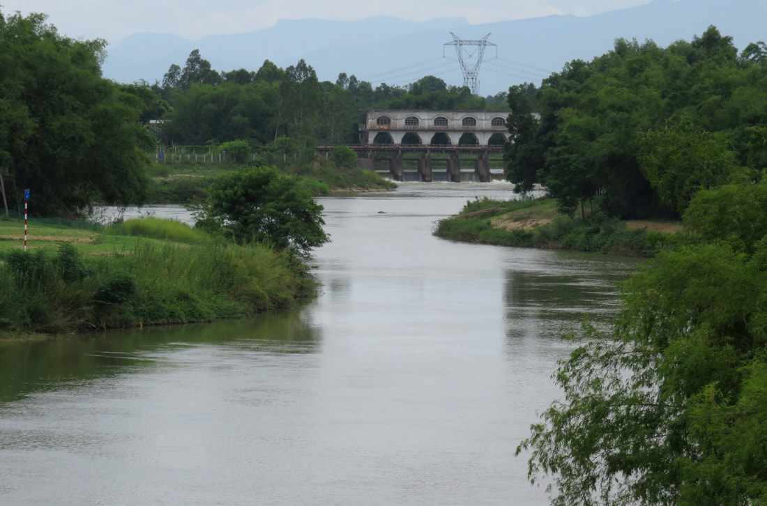
Section 5A- Ai Nghia to Dap An Trach (Upper Song Yen)
|
Section Length: ~ __ km
Put In: access below Ai Nghia- see text Take Out: An Trach Dam |
Difficulty: I
Est. Flow: too low < 200 cfs < 10,000 cfs < too high Paddlers: |
Click to set custom HTML
Section 5B- Dap An Trach to Cam Le (Lower Song Yen)
|
Section Length: ~ __ km
Put In: below An Trach Dam Take Out: fields along Cau Do - Tuy Loan Road |
Difficulty: I
Est. Flow: too low < 200 cfs < 10,000 cfs < too high Paddlers: |
This is the lowest stretch of the Song Yen before it joins with the Tuy Loan to form the Song Cau Do. Entirely flat water, it is still an enjoyable paddle because it is surprisingly quiet and peaceful despite being just outside, and ending at, the edge of the city. With the exception of small occasional small locals fishing vessels, not many other boats ply these waters, so there shouldn't be too much worry of getting caught in a wake or being caught unaware.
The put in is easy to find; go to Hoa Khuong, and in the middle of town turn east and drive 2 kilometers to the An Trach dam. Put in just below it. The takeout is a little more difficult but still not hard. Take the Cau Do - Tuy Loan road and
Information provided by
|
All photos copyright original owners.
All maps copyright Google MyMaps. |
