
Nuoc Lah - Tak Po Gorge - R.I.P
This stretch of stream now sits under a small reservoir and is lost. This page remains as a remembrance to what existed before.
|
Section Length: 2 km
Put In: bridge above gorge Take Out: footbridge below gorge |
Difficulty: IV+ / V-
Est. Flow: too low < 150 < med < 1,000(?) < too high Paddlers: not finished yet |
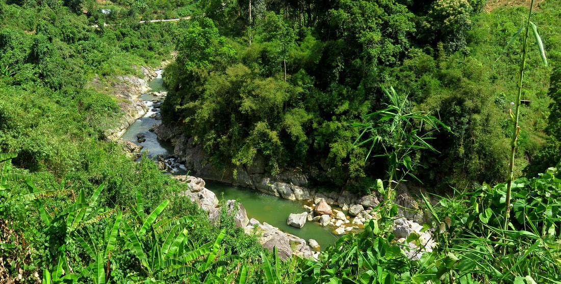
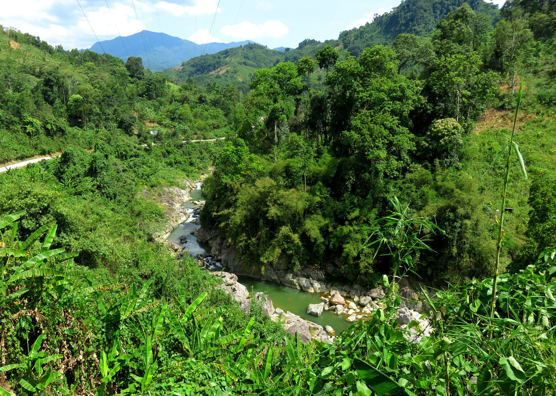
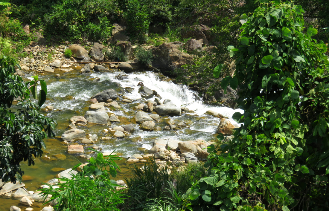
This is an interesting gorge on the Nuoc Lah stream that just happens to be inside Tak Po, the main village of Tra Mai town, which is itself the district seat of Nam Tra My district. With a road on either side of the gorge, and located just meters from farm fields and trails, there is still a boxed-in, vertical walled narrows that can offer an interesting paddling experience depending on the level you find it at. It is novelty boating, and quite short, with only half a dozen drops spaced along the less than 2 kilometers of this gorge, but it is worth writing up for future intrepid paddlers.
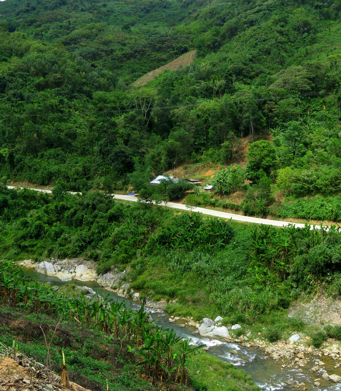
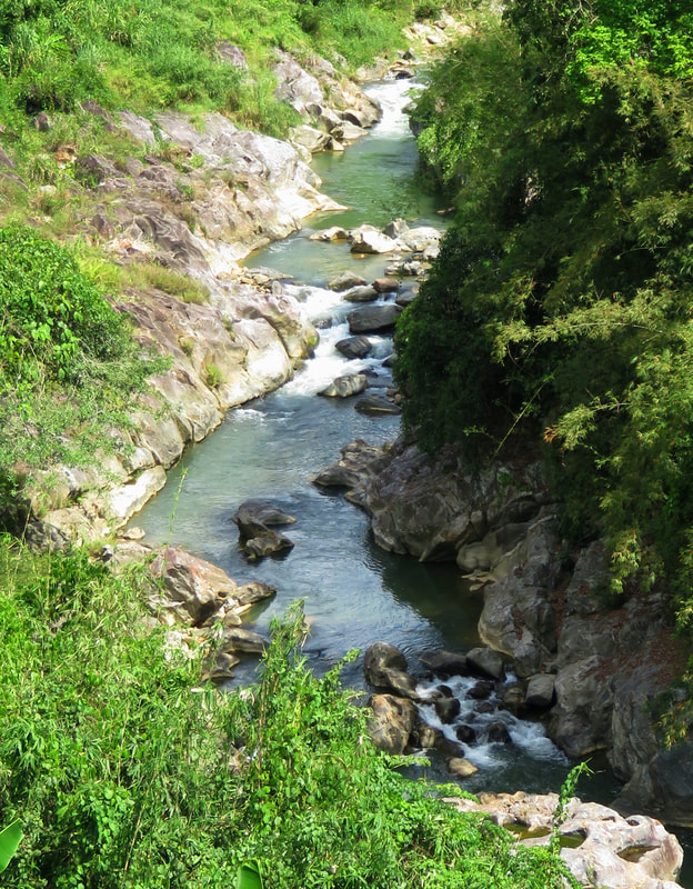
The gorge starts just below the put in bridge, which is itself reached by driving southeast out of Tak Po until you cross the gorge about 2 minutes later. Its that close. There is plenty of parking around, and the bedrock starts right down stream. A couple of shallow and junky rapids quickly give way to the first bedrock rapid just around the corner. The rapids in the gorge are interesting because they are partially bedrock, but also partially boulder gardens, and this creates some interesting lines and features.
|
|
The first rapid of the gorge is a straightforward narrow line between some boulders on the left and a bedrock wall on the right. It looks like a simple line and I am guessing it wouldn't be hard to run. The second one is a bit more complex. A mess of boulders on the left creates a similar line on the right, pressed up against the bedrock, like the one before it. However, this 2nd drop has quite a few more boulders in the main flow, and it will probably result in a lot bumpier time at low water. It looks like a simple portage on the left, and while this will disappear as the water rises, the main line will pad out and become much better.
|
|
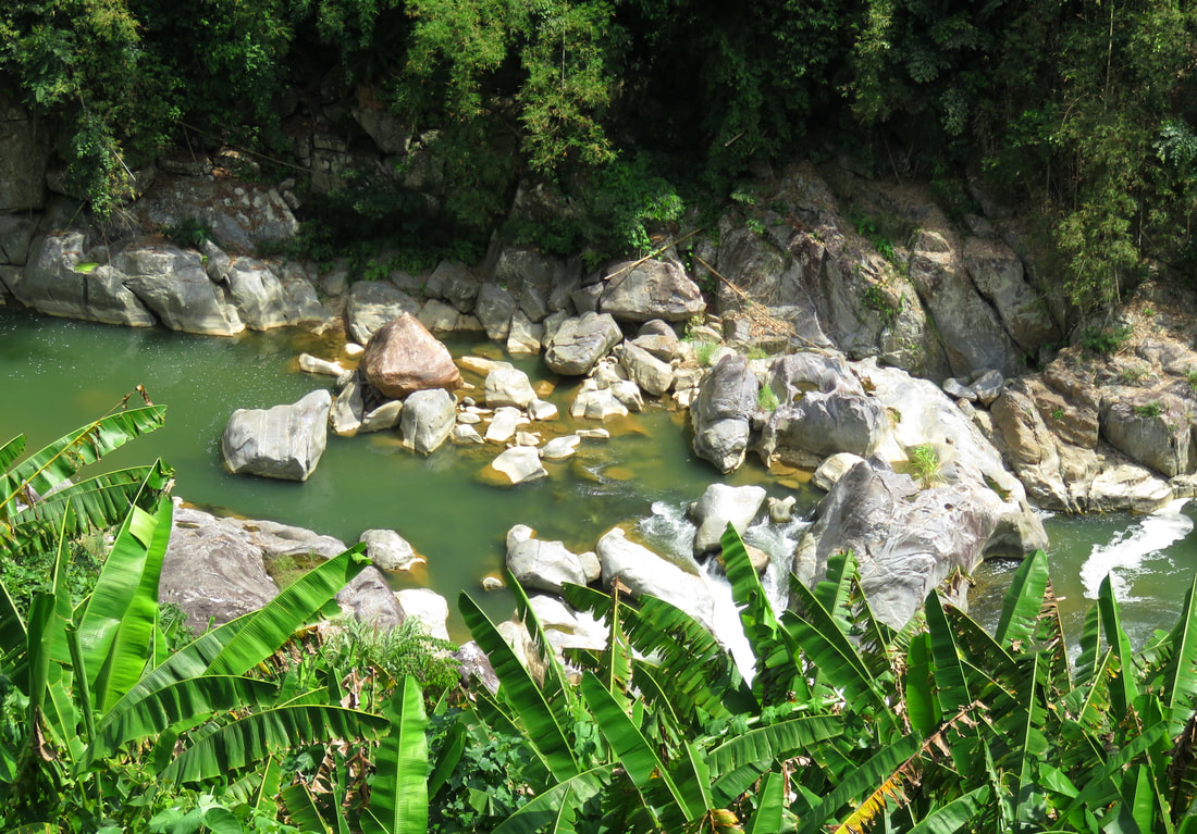
The 3rd and 4th drops are larger and more complex than the first two. The 3rd drop is like the second, with a boulder stack on the left and a cleaner line on the right. However, the main flow on this drop runs perpdendicular to the direction of the river, and the bedrock is undercut, resulting in a somewhat scary line. This, like the 2nd, is portaged on the left. The 4th drop is an interesting falls, with several channels falling through the gaps in the bedrock fins and the boulders caught in between, all meeting in a sticky and awkward hole. This drop needs more water than the three drops above it.
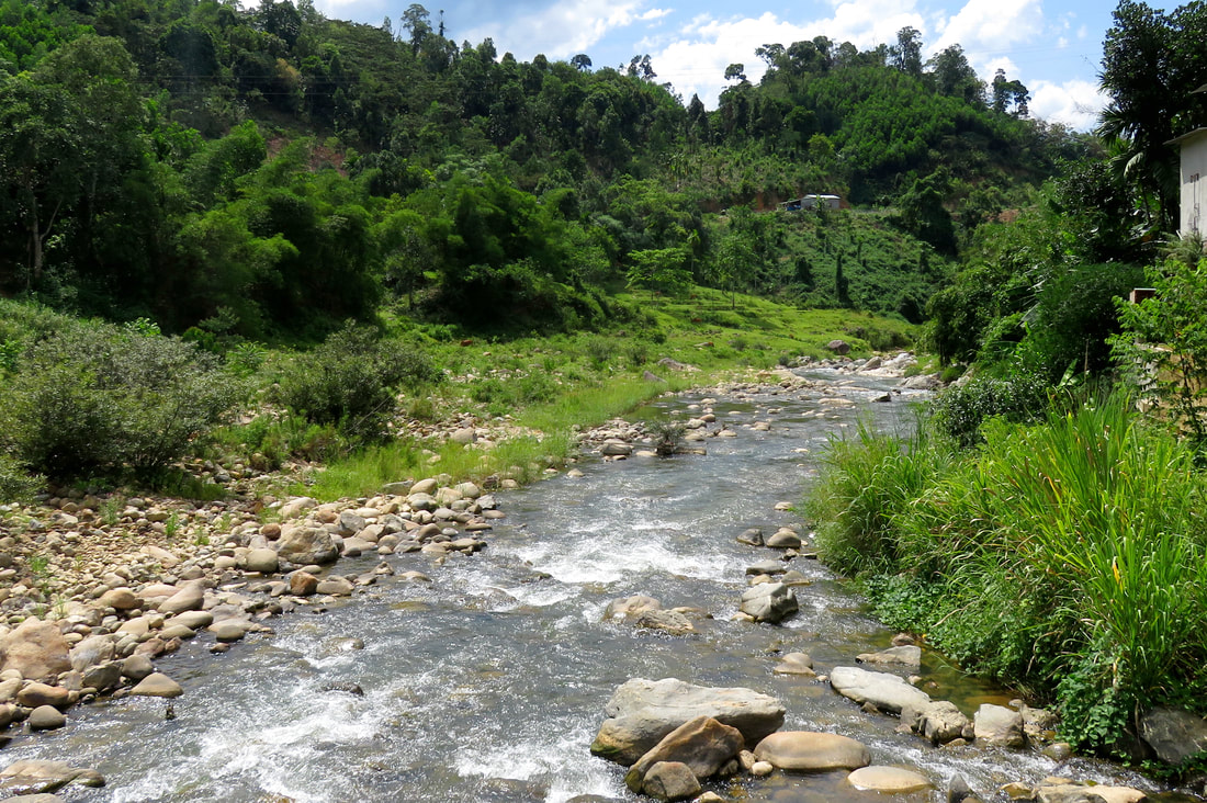
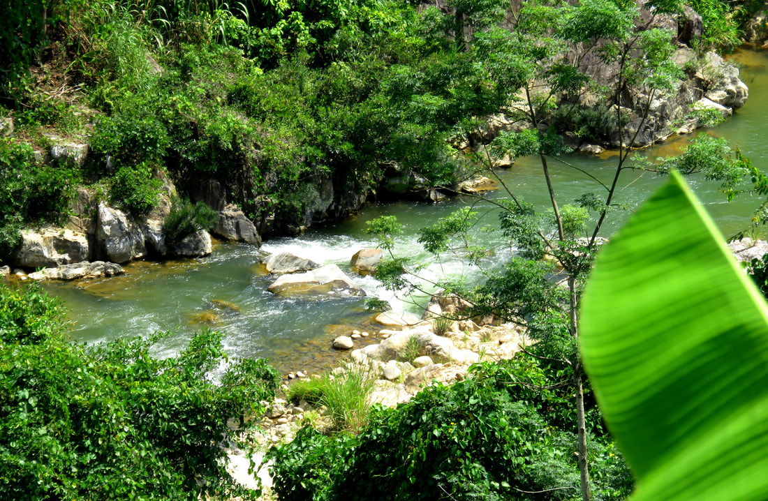
After a short flat spell the 5th rapid comes up, which is a ledge of boulders, but has a fairly clean left line at most most flows. Just below this the last bedrock drop comes up. This drop has a lot of rocks on the shallow right, with a twisting line down the left offering most of the flow at low water. Its not a clean line as there are some rocks in the top part of the falls, and the hole at the bottom looks like it could toss you around in some awkward ways. This drop is not likely runnable without anything below medium flows. Once this drop is finished, the gradient is finished, and the whitewater soon comes to and end. And it is but a super quick float to the footbridge takeout. Hike up the short road on river right and you'll quickly pop out on the road in the middle of Tra Mai town.
|
All photos copyright
All maps copyright Google MyMaps. |
